The best walks and hikes around Vatnvatnet
4.3
(52)
442
hikers
21
hikes
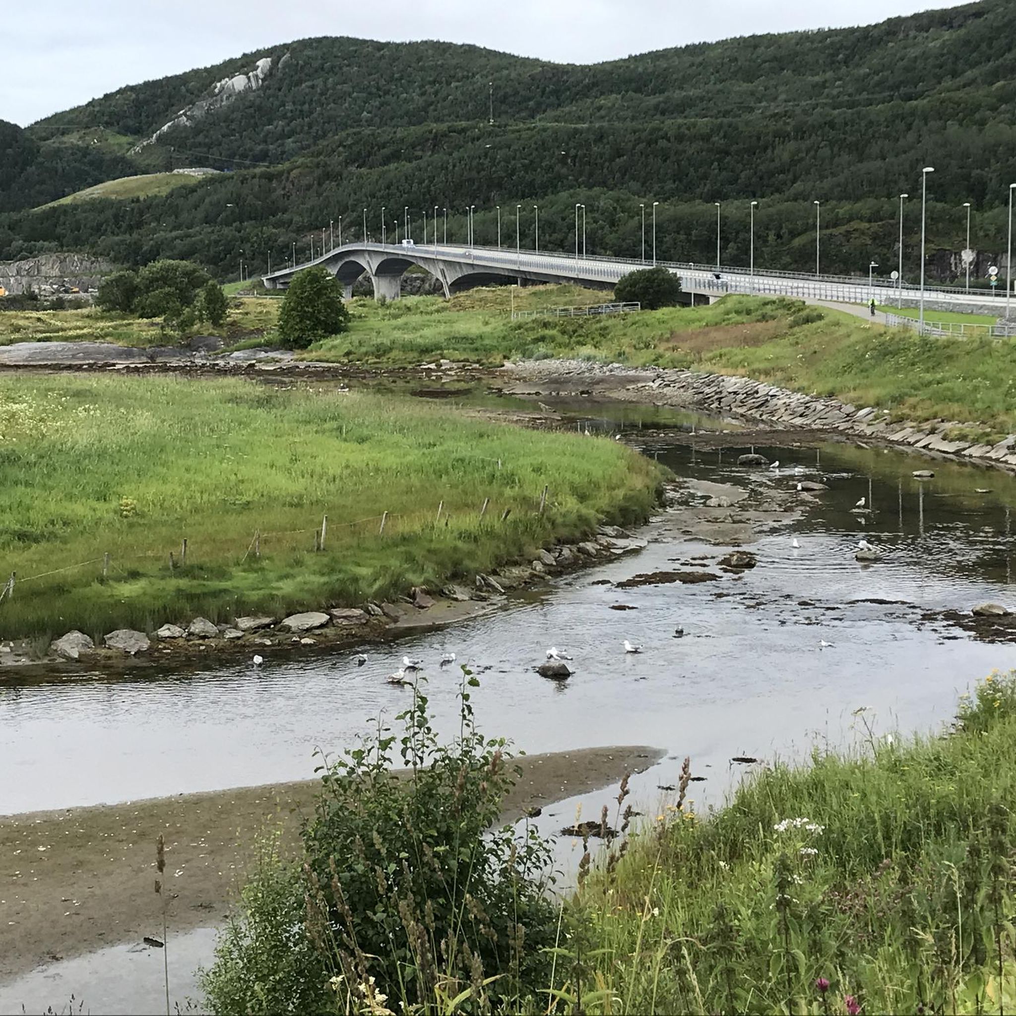
Hiking around Vatnvatnet offers diverse trails set against a backdrop of picturesque landscapes in Nordland, Norway. The region is characterized by the 4.71-square-kilometer Vatnvatnet lake, which is divided into Nervatnet and Innervatnet. Situated near Sjunkhatten National Park, the area features a blend of serene waterscapes and accessible trails, with surrounding terrain hinting at a rugged mountain landscape. The lake's surface elevation is 4 meters above sea level, providing a natural divide on the Bodø peninsula.
Best hiking trails around Vatnvatnet
…Last updated: November 8, 2026
1
hikers
13.9km
04:17
450m
440m
Moderate hike. Good fitness required. Easily walkable paths.
5.0
(2)
39
hikers
7.63km
03:22
700m
700m
Moderate hike. Good fitness required. Easily walkable paths.

5.0
(2)
6
hikers
12.2km
05:06
710m
710m
Hard hike. Very good fitness required. Sure-footedness, sturdy shoes and alpine experience required.
5.0
(9)
31
hikers
8.78km
02:23
130m
130m
Moderate hike. Good fitness required. Easily walkable paths.
4.3
(4)
6
hikers
8.17km
02:19
170m
170m
Moderate hike. Good fitness required. Easily walkable paths.
Get access to more routes and recommendations from other explorers.
Already have an account?
Our route recommendations are based on thousands of hikes, rides, and runs completed by other people on komoot.
Start today with a free account
Your next adventure awaits.
Popular around Vatnvatnet
Tips from the Community

This simple wooden shelter is a great place to take a break and enjoy a snack before continuing your hike.
0
0
Cross the Allmenningselva on this wooden boardwalk. Keep an eye out for the trail just beyond the crossing, then follow the red trail markers across the open mountain landscape.
0
0
A scenic summit with sweeping views across the surrounding mountain landscape. On clear days, the panorama stretches far into the distance.
0
0

Steigtinden is located in Sjunkhatten National Park and is one of the must-see peaks in Bodømarka. At 793 metres above sea level, it is the second highest peak in the region. The climb is challenging, but the view is well worth the effort.
0
0

Here you cross a small bridge over Lakes Kristivatnet and Klubbvatnet. This is the best place to enjoy a view of both lakes at the same time.
0
0
Throughout this section, you walk along a path made of wooden planks to preserve the environment of this sensitive area. The view of the meadow is spectacular, with rocky peaks in the background
0
0
You are at the end of the only road that runs through the area and Sorfjorden. The environment here is very well preserved, far from everything, and the landscape shows no signs of human presence, apart from the Langnesbu small cabin.
0
0

As in northern Norway, surefootedness and some climbing skills are required today
0
0
Frequently Asked Questions
How many hiking trails are available around Vatnvatnet?
There are 19 recorded hiking routes around Vatnvatnet, offering a diverse range of experiences. These include 6 easy trails, 10 moderate routes, and 3 more challenging options, catering to various fitness levels and preferences.
What kind of terrain can I expect on hikes around Vatnvatnet?
The terrain around Vatnvatnet is quite varied. You'll find serene waterscapes along the lake's extensive shoreline, as well as rugged mountain landscapes, especially closer to Sjunkhatten National Park. Some trails are easily accessible, while others, like the Lilletinden – Steigtinden loop from Vatnvatnet, involve significant elevation gain and more challenging, rocky paths.
Are there any easy, family-friendly hikes in the Vatnvatnet area?
Yes, Vatnvatnet offers several easy trails suitable for families. For instance, the View of Vågbakken – Vågnakken loop from Løding is an easy 4.0 km route that can be completed in about 1 hour 19 minutes, offering pleasant views without significant difficulty. Many trails around the lake are accessible and can be completed within two hours with minimal elevation gain.
What are the best viewpoints or landmarks to look out for during a hike?
Hikers often enjoy the stunning views of Vatnvatnet itself, which is divided into Nervatnet and Innervatnet by Storøya. Vantage points like the loop from Heggmoen kraftverk, such as the View of Vatnvatnet loop from Heggmoen kraftverk, offer scenic panoramas. The proximity to Sjunkhatten National Park also provides dramatic mountain backdrops and opportunities to explore areas like Sørfjorden.
Can I find circular hiking routes around Vatnvatnet?
Yes, there are several circular routes available. A popular moderate option is the View of Vatnvatnet loop from Heggmoen kraftverk, which is 7.6 km long. For a more challenging circular experience, consider the Lilletinden – Steigtinden loop from Vatnvatnet, a difficult 12.2 km path.
What do other hikers say about the trails in Vatnvatnet?
The trails in Vatnvatnet are highly rated by the komoot community, with an average score of 4.6 stars from over 30 reviews. Hikers frequently praise the stunning lake scenery, the diverse range of trails for all abilities, and the beautiful natural environment, especially the dramatic backdrop of Sjunkhatten National Park.
Are there opportunities for swimming or other water activities near the hiking trails?
Yes, Vatnvatnet is a popular recreational area for swimming. There are several designated bathing spots, including Forskaia and Hestsundet, which features a sand and gravel beach. Ospenesodden is a 'hidden gem' with fine beaches and smooth rock formations, accessible by canoe or on foot from Hestsundet. Grilling areas are also available near the power station at Heggmoen.
What is the best time of year to go hiking in Vatnvatnet?
While the guide focuses on hiking, the region research suggests that the area is popular for outdoor activities during warmer months, offering opportunities for swimming and camping. Winter also provides options for activities like ski touring, as seen with the 'Hopen - Erlingbu - Maskinisten' route. For general hiking, late spring through early autumn typically offers the most favorable conditions.
Are there any specific permits required for hiking, especially near Sjunkhatten National Park?
The provided information does not specify any general hiking permits required for the Vatnvatnet area or for accessing trails within Sjunkhatten National Park directly from Vatnvatnet. However, it's always advisable to check local regulations for national parks before embarking on a hike, especially for specific activities like camping or fishing.
How can I get to Vatnvatnet using public transport from Bodø?
The provided information does not detail specific public transport routes from Bodø to Vatnvatnet. However, Vatnvatnet is situated approximately 2 kilometers north of Løding village. It is recommended to check local bus schedules or transportation options from Bodø to Løding or nearby areas for the most up-to-date information on public access.
Where can I find parking for hiking trails around Vatnvatnet?
While specific parking locations for every trail are not detailed, the region is known for its accessibility. For routes like the View of Vatnvatnet loop from Heggmoen kraftverk, parking is typically available near the Heggmoen power station. For other trails, look for designated parking areas near trailheads, especially in villages like Løding or Tverlandet.
Are there any moderate hikes that offer a good balance of challenge and scenic views?
Yes, Vatnvatnet has 10 moderate routes that provide a great balance. The Sørfjorden Head trail, for example, is a 8.8 km route that takes about 2 hours 23 minutes and leads through varied landscapes within Sjunkhatten National Park. Another option is the Rypskardet,s – View of Rocky Landscape loop from Tverlandet, an 8.1 km route with scenic rocky landscapes.
Most popular routes around Vatnvatnet

Get inspired with the komoot mobile app


Explore more
Browse the best Hikes in other regions.
