Attractions and Places To See around Area I (Youbou / Meade Creek) - Top 11
Best attractions and places to see around Area I (Youbou / Meade Creek) offer a blend of natural beauty and historical significance. The region is centered around Lake Cowichan, a large freshwater body on Vancouver Island, and features the Cowichan River, along with several mountains providing expansive views. Visitors can explore natural features, engage with cultural sites, and discover the area's heritage, including its connection to the Ts'uubaa-asatx Nation.
Best attractions and places to see around Area I (Youbou /…
Last updated: May 11, 2026
Bald Mountains First Summit
Highlight • Summit
Tip by

Lake Cowichan
Highlight • Lake
- It is one of the largest lakes on Vancouver Island.
Popular for recreational activities such as fishing, kayaking, paddleboarding and …
Translated by Google •
Tip by

Sign up now to discover places like this
Get recommendations on the best single tracks, peaks, & plenty of other exciting outdoor places.
Sign up for free
Swimming Spot and Wild Campsite at the River
Highlight • River
Translated by Google •
Tip by

Pacific Marine Circle Route: Lake Cowichan to Port Renfrew
Highlight (Segment) • Trail
You have to adjust to different things here: There …
Translated by Google •
Tip by

Port Alberni–Bamfield Scenic Road
Highlight (Segment) • Cycleway
Translated by Google •
Tip by
Sign up for free to discover even more attractions around Area I (Youbou / Meade Creek).
Sign up for free
Already have an account?
Start today with a free account
Your next adventure awaits.
Login or Signup
Tips from the Community

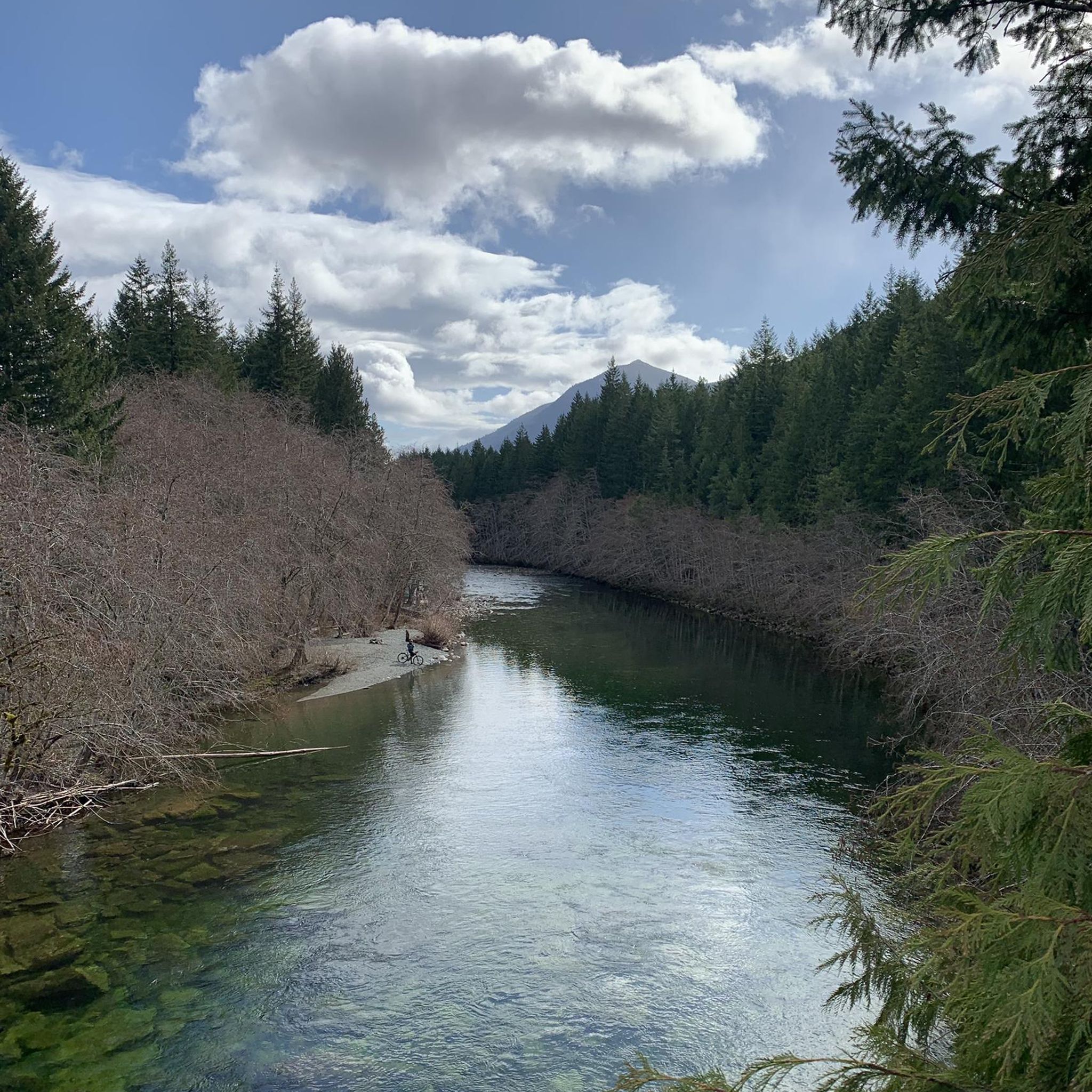
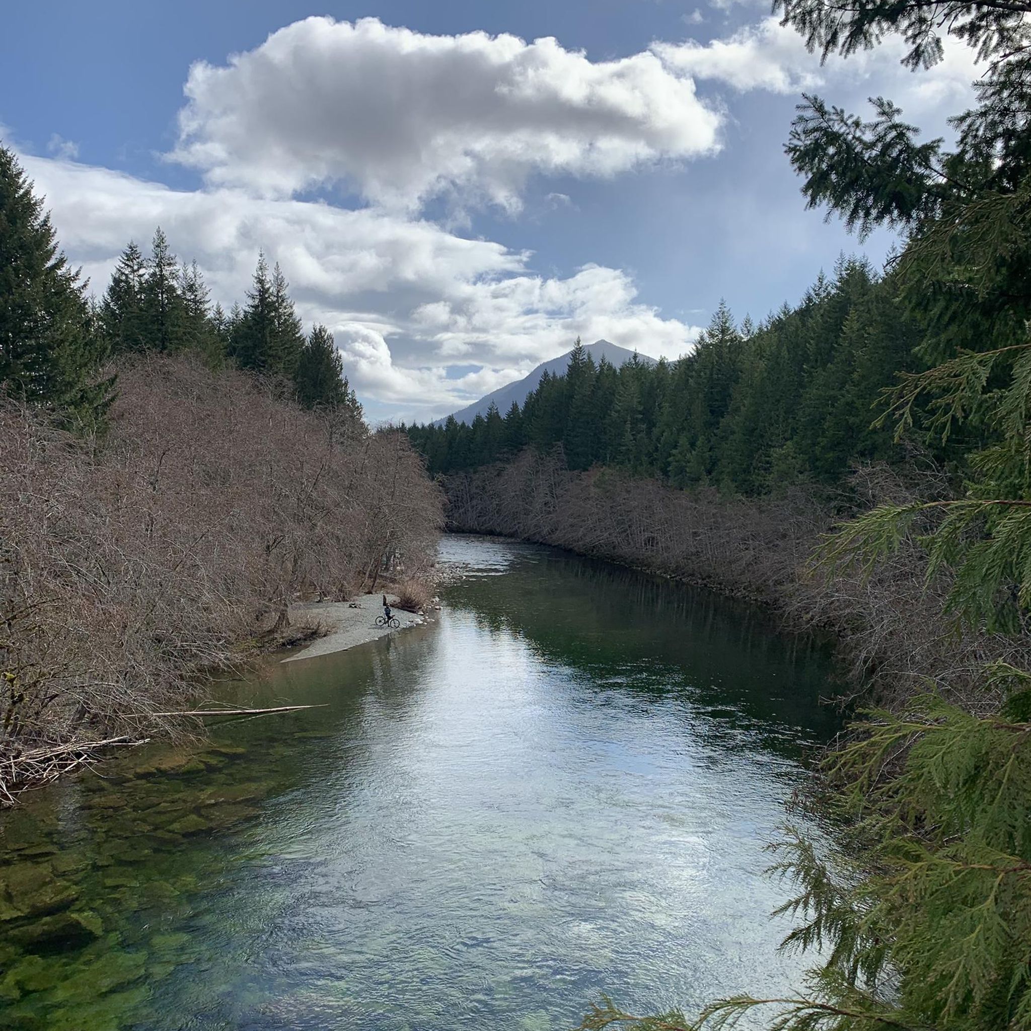
Great for swimming and with the option of wild camping. Directly above the water between bushes and trees. Good privacy and very quiet after 7 p.m. It is also tolerated. There are no no camping signs either.
0
0
The connection from Port Alberni to Bamfield has been paved. This makes it much easier to drive. However, there are some steep sections with a gradient of 10%. The view is very beautiful, though.
0
0

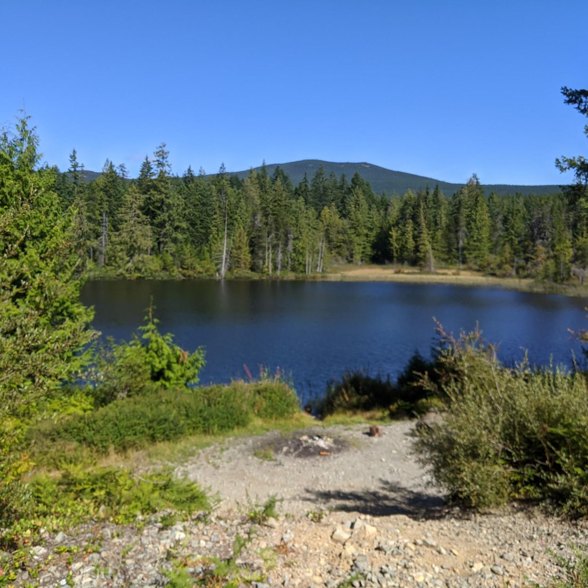
- It has a length of approximately 30 kilometers. - It is one of the largest lakes on Vancouver Island. Popular for recreational activities such as fishing, kayaking, paddleboarding and swimming. - Around the lake there are numerous cabins. - The region has a rich cultural history and is important to local indigenous communities.
2
0

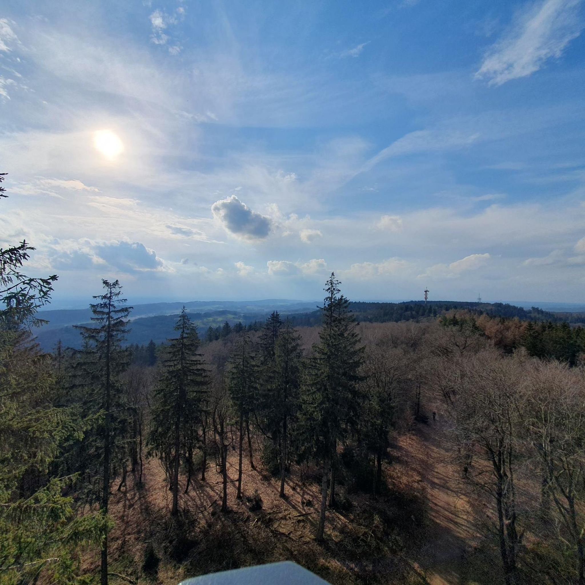
Very nice spot with views on all the parts of Lake Cowichan. Unlike many other trails in Vancouver Island mountains, there is views all the way up as there is little trees. The winding curves make the way up not too demanding and the views allow really to enjoy each curve as you discover a new aspect of the landscape.
3
0

This section of the Pacific Marine Circle Route crosses the island from Lake Cowichan to Port Renfrew and the open ocean. You have to adjust to different things here: There are no real civilian stations for about 50km, so neither (unnatural) refreshments nor other advantages. In addition, the road is always "improved", so that in sections with gravel is expected (for me about 3 km in total). On the way you quickly realize that there is also a lot of timber industry on Vancouver Iceland, the mountains are often bare, shade is rare especially in the direction of Lake Cowichan. The section in front of Port Renfrew is very worthwhile (see further highlights on the route).
0
0
Frequently Asked Questions
What natural features can I explore in Area I (Youbou / Meade Creek)?
The region is rich in natural beauty, centered around Lake Cowichan, one of Vancouver Island's largest freshwater bodies, perfect for swimming, fishing, kayaking, and paddleboarding. The Cowichan River is also a prominent feature, known for tubing and scenic viewpoints. You can also find various parks like Nantree Park and Arbutus Park Beach along the lake.
Are there hiking trails with good views in Area I (Youbou / Meade Creek)?
Yes, the area offers several trails with excellent views. Bald Mountains First Summit provides continuous panoramic views of Lake Cowichan as you ascend. Other notable hikes include the Green Mountain Trail loop, the Log Bridge Over Forest Creek – Robertson River Falls loop, and for more challenging options, Mount Whymper and Mount Moriarty offer expansive vistas over the island ranges and beyond.
Where can I go swimming or enjoy water activities in Area I (Youbou / Meade Creek)?
You have several options for water activities. Lake Cowichan is ideal for swimming, kayaking, paddleboarding, and fishing. The Swimming Spot and Wild Campsite at the River offers a private and quiet location for swimming in the Cowichan River. Additionally, Nantree Park in Meade Creek and Arbutus Park Beach in Youbou both provide public beaches with swimming areas and picnic facilities.
What historical or cultural sites can I visit in Youbou and Meade Creek?
Youbou has several sites reflecting its heritage, including the historic Youbou Community Hall, which has served as a community hub since 1937, and the Youbou Community Church, recognized in the CVRD Community Heritage Register. The Youbou Mill Site, though closed, is a Canada Historic Site acknowledging the region's industrial past. The area is also the traditional territory of the Ts'uubaa-asatx Nation, adding significant cultural depth.
Are there family-friendly attractions or activities in Area I (Youbou / Meade Creek)?
Absolutely. Lake Cowichan is family-friendly for swimming and gentle water sports. The Swimming Spot and Wild Campsite at the River is also suitable for families. Nantree Park and Arbutus Park Beach offer beaches, swimming areas, and picnic facilities. The Youbou Little League Recreation Park provides a playground, baseball facilities, and picnic areas.
What cycling or gravel biking routes are available near Youbou and Meade Creek?
The region offers various cycling and gravel biking opportunities. You can find routes like the Lake Cowichan Bridge – Mayo Lake loop or the Temperate Rainforest Trail – 66 Mile Trestle loop for cycling. For gravel biking, options include the 66 Mile Trestle – Holt Creek Trestle loop. You can explore more routes and their details on the Cycling around Area I (Youbou / Meade Creek) and Gravel biking around Area I (Youbou / Meade Creek) guide pages.
When is the best time to visit Area I (Youbou / Meade Creek) for outdoor activities?
The warmer months, typically from late spring through early autumn (May to September), are ideal for enjoying outdoor activities like swimming, hiking, and boating on Lake Cowichan and the Cowichan River. During August, you might also catch the annual Youbou Regatta.
What unique local experiences can I find in Youbou?
Youbou offers a few unique local experiences. The annual Youbou Regatta, held in August at Arbutus Park, features dances, a sunset cruise, and parades. You can also visit the Youbou Community Bowling Alley, known for its historic charm and hand-set pins, offering a nostalgic recreational activity.
Are there any notable regional landmarks outside of Youbou/Meade Creek but still accessible?
Yes, the Kinsol Trestle, an impressive railway trestle on the Cowichan Valley Trail, is a significant regional landmark and an extraordinary piece of engineering, standing over 140 feet high. While not directly in Youbou/Meade Creek, it's a popular destination in the broader Cowichan Valley. The Vancouver Island Motorsport Circuit is also about 20 minutes away for those interested in driving experiences.
What do visitors enjoy most about the attractions in Area I (Youbou / Meade Creek)?
Visitors particularly appreciate the stunning views from spots like Bald Mountains First Summit, where the winding trails offer continuous scenic discoveries. The recreational opportunities at Lake Cowichan, from swimming to kayaking, are also highly valued. The tranquility and privacy of places like the Swimming Spot and Wild Campsite at the River are also frequently highlighted.
Are there any parks or recreation sites in Youbou and Meade Creek?
Yes, Nantree Park in Meade Creek is a waterfront park on Cowichan Lake with a beach, swimming area, wharf, and picnic facilities. In Youbou, Arbutus Park Beach is a public beach with lifeguards in summer, picnic tables, and shelters. Price Park offers a nature trail and secluded beaches, while Pine Point and Maple Grove Recreation Sites provide camping, fishing, paddling, and hiking opportunities.
Most popular routes around Area I (Youbou / Meade Creek)

Get inspired with the komoot mobile app


Explore more
Still not found the Highlight you’re looking for? See guides of the top attractions in other regions:
