The best running trails around Pitt Meadows
4.7
(16)
1,244
runners
137
runs
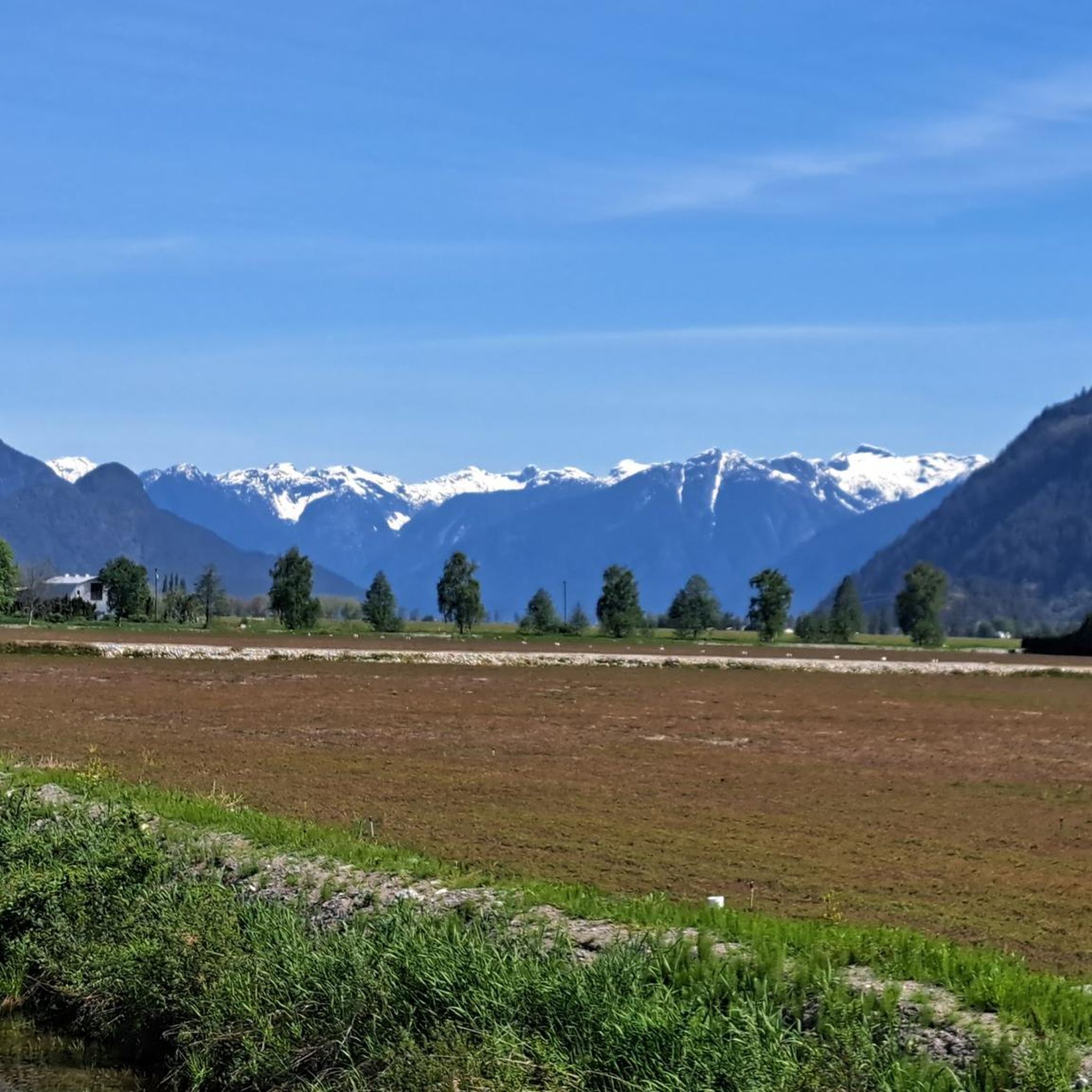
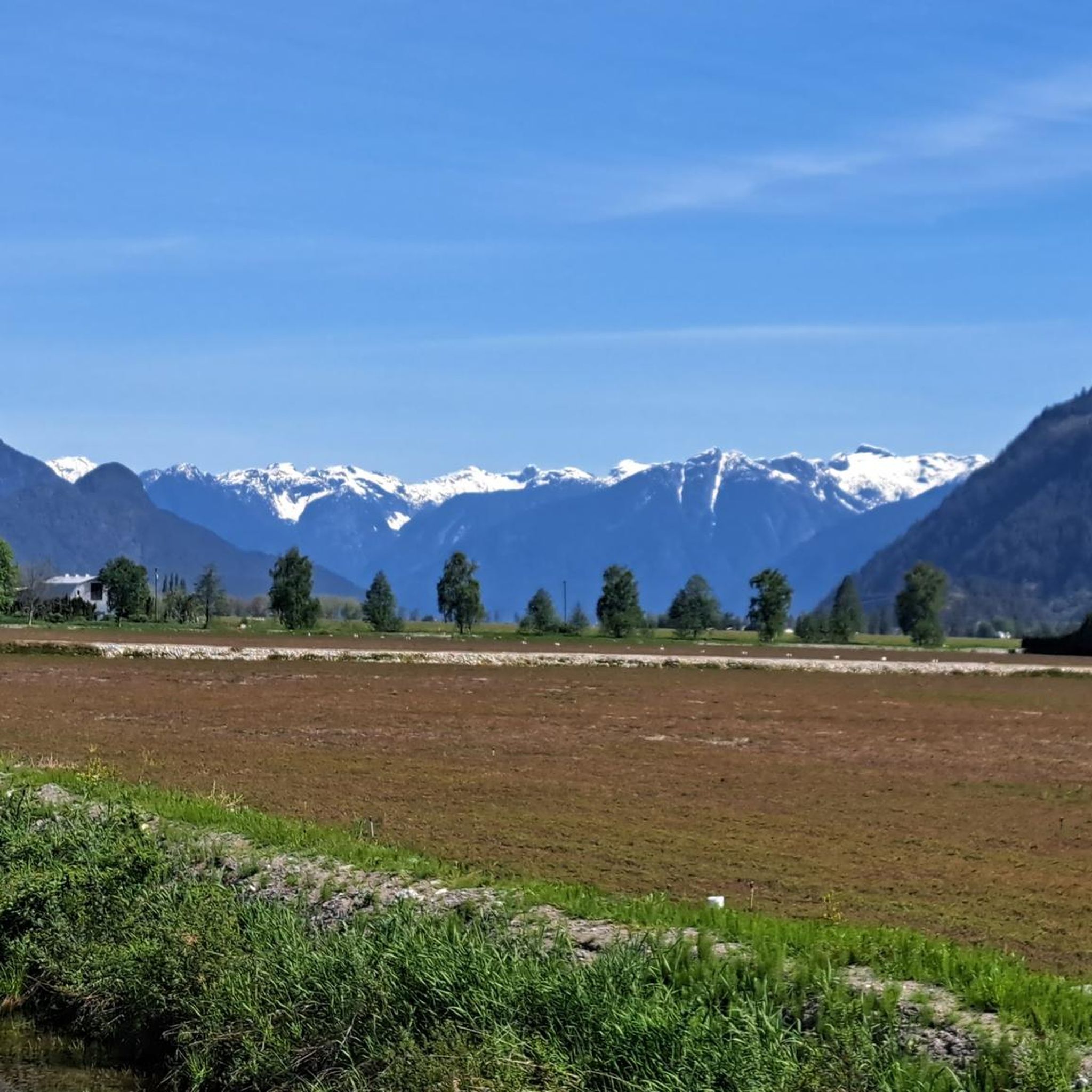
Jogging around Pitt Meadows offers routes through a landscape characterized by extensive river systems, sloughs, and flat, accessible parklands. The region's terrain is generally low-lying, providing numerous opportunities for relatively flat running. Trails often follow waterways, offering open views and a mix of paved and unpaved surfaces. This area is well-suited for runners seeking routes with minimal elevation changes.
Best jogging routes around Pitt Meadows
- The most popular jogging route is Deboville Slough loop from Port Coquitlam, a 5.3 miles…
Last updated: August 15, 2026
5.0
(1)
29
runners
Hard run. Very good fitness required. Mostly paved surfaces. Suitable for all skill levels.
15
runners
Hard run. Very good fitness required. Mostly paved surfaces. Suitable for all skill levels.

Sign up for free
4.5
(2)
15
runners
10.7km
01:14
20m
20m
Moderate run. Good fitness required. Mostly paved surfaces. Suitable for all skill levels.
11
runners
6.57km
00:43
20m
20m
Moderate run. Good fitness required. Mostly paved surfaces. Suitable for all skill levels.
8
runners
6.19km
00:40
70m
70m
Moderate run. Good fitness required. Mostly paved surfaces. Suitable for all skill levels.
Get access to more routes and recommendations from other explorers.
Sign up for free
Already have an account?
Our route recommendations are based on thousands of hikes, rides, and runs completed by other people on komoot.
Start today with a free account
Your next adventure awaits.
Login or Signup



Tips from the Community

This section of the Trans Canada Trail follows the wooded banks of the Coquitlam River through Coquitlam. The mostly gravel path runs through forested river habitat, offering a quiet stretch of trail where the sound of the river accompanies much of the walk. It’s a multi-use route popular with hikers, runners, and cyclists, and several bridges and viewpoints along the way provide good views over the river as it flows through the valley.
0
0
From the Eleanor Ward Bridge, you will be suspended high above the flowing waters of the Coquitlam River. The bridge provides a clear view down into the forested river corridor as the river winds through the valley below. It’s a striking vantage point along the route and a great place to pause and watch the river moving through this green stretch of Coquitlam.
0
0

This beautiful river is a major tributary of the Fraser River that flows south from the Garibaldi Ranges, through Pitt Lake, before joining the Fraser River near Port Coquitlam. The lower stretches of the river are tidal, and the surrounding wetlands are home to a rich diversity of wildlife. The river also holds cultural significance for the Kwantlen First Nation, serving as a natural corridor that connects the coastal region with the interior of the province.
0
0

Dedicated in 2019 by the City of Port Coquitlam in recognition of Michael Forrest's contributions to the community and his service on City Council from 2000 to 2018 A third generation Fort Coquitlam resident, Michael has "cherished this view of the Fraser River his whole life, The rivers that were his playground as a child became his workplace as an -lt. Michael continues to be active in the community and can be seen regularly on the water,
0
0

Lively river running through a suburb of Vancouver.
0
0
Frequently Asked Questions
How many running routes are available in Pitt Meadows?
Pitt Meadows offers a wide variety of running experiences, with over 150 routes available. These include 12 easy routes, 111 moderate routes, and 31 more challenging options, ensuring there's something for every runner.
Are there many loop trails for jogging in Pitt Meadows?
Yes, many of the running trails in Pitt Meadows are loops, which are popular for their convenience. Examples include the Deboville Slough loop from Port Coquitlam, the Pitt River Viewpoint loop from Douglas Island, and the Osprey Basin loop from Widgeon Marsh Regional Park.
What are the best running trails for beginners in Pitt Meadows?
For beginners, routes with minimal elevation changes are ideal. Pitt Meadows is generally low-lying, offering many flat paths. Look for routes categorized as 'easy' on komoot, which typically follow river paths and slough trails, providing a gentle introduction to running in the area.
Are the jogging routes in Pitt Meadows dog-friendly?
Many trails in Pitt Meadows are dog-friendly, but it's always best to check specific route details and local regulations regarding leashes and waste disposal. Generally, paths along the sloughs and in regional parks welcome well-behaved dogs.
Can I access running trails in Pitt Meadows using public transport?
Public transport access to some trailheads in Pitt Meadows is possible, though it varies by location. It's advisable to check TransLink routes and schedules to plan your journey to specific starting points. Many routes are also accessible by car with nearby parking.
What kind of wildlife can I expect to see while running in Pitt Meadows?
Pitt Meadows is rich in natural habitats, especially along its river systems and marshlands. Runners often spot various bird species, including waterfowl and raptors. Keep an eye out for beavers, otters, and other small mammals, particularly in quieter areas like the Osprey Basin loop.
Are there any waterfalls or scenic viewpoints along the running routes?
While Pitt Meadows itself is relatively flat, the broader region offers stunning natural features. You can find scenic viewpoints along routes like the Pitt River Viewpoint loop. For waterfalls, you'd need to venture slightly further, with highlights like Crystal Falls and Lower Falls in Golden Ears Provincial Park being popular destinations nearby.
What do other runners enjoy most about jogging in Pitt Meadows?
The running routes in Pitt Meadows are highly rated by the komoot community, with an average score of 4.7 stars from over 10 reviews. Runners frequently praise the flat, accessible paths, the scenic river and slough views, and the peaceful natural environment that makes for an enjoyable outdoor experience.
Are there any family-friendly running trails in Pitt Meadows?
Yes, many of the flatter, well-maintained paths are suitable for families. Routes that follow the sloughs and are within regional parks often provide safe and enjoyable environments for all ages. The minimal elevation changes make them ideal for a family outing.
What are the typical trail lengths for jogging in Pitt Meadows?
Trail lengths vary, offering options for different fitness levels. For example, the Deboville Slough loop is about 8.4 km (5.3 miles), while the Michael Forrest River Walkway loop extends to approximately 13.9 km (8.6 miles). You'll find a range from shorter, easy runs to longer, moderate distances.
Are there any hidden gems or less-known running routes in Pitt Meadows?
While popular routes like the Deboville Slough are well-loved, exploring the network of trails around areas like the Codd Wetland Ecological Conservancy Area can reveal quieter, less-trafficked paths. These often offer unique perspectives of the local marshland and wildlife.
Is Pitt Meadows a good place for winter jogging?
Pitt Meadows can be suitable for winter jogging, especially on paved or well-maintained gravel paths. The low elevation means less snow accumulation compared to mountainous areas. However, always check local weather conditions for ice or heavy rainfall, and wear appropriate gear for colder, potentially wet conditions.
Most popular attractions around Pitt Meadows

Get inspired with the komoot mobile app


Explore more
Browse the best Running Trails & Routes in other regions.
