The best cycling routes around Surrey
4.4
(53)
346
riders
33
rides
Touring cycling around Surrey is characterized by its diverse landscapes, including rolling hills, extensive woodlands, and chalk escarpments. The region features the Surrey Hills National Landscape, offering a network of bridleways and quiet country lanes. Key natural features like Box Hill and Leith Hill provide challenging climbs and panoramic views. The North Downs, a prominent chalk ridge, further defines the varied terrain suitable for different cycling experiences.
Best touring cycling routes around Surrey
- The most popular touring cycling route is Delta Heritage Air Park – Beharrel Ditch Wetlands loop from Panorama Ridge Secondary, a 27.5 miles (44.2 km) trail that takes 3 hours 30 minutes to complete. This route explores wetlands and natural areas.
- Another top favourite among local touring cyclists is Derby Reach Regional Park – Fort-to-Fort Trail loop from King George, a moderate 37.7 miles (60.7 km) path. It follows scenic riverfront trails and connects historical sites.
- Local touring cyclists also love the Port Mann Bridge – Pitt River Bridge loop from Fleetwood Park Secondary School, a 30.4 miles (48.9 km) trail leading through urban and riverside landscapes, often completed in about 2 hours 58 minutes.
- Touring cycling around Surrey is defined by rolling hills, dense woodlands, and river valleys, with routes catering to various skill levels from easy countryside rides to more challenging ascents.
- The routes in Surrey are highly rated by the komoot community with an average score of 4.5 stars from over 60 reviews. More than 500 touring cyclists have used komoot to explore Surrey's varied terrain.
Last updated: October 26, 2026
4.0
(24)
55
riders
60.1km
03:42
340m
340m
Moderate bike ride. Good fitness required. Mostly paved surfaces.
4.6
(7)
33
riders
Moderate bike ride. Good fitness required. Mostly paved surfaces.

3.0
(1)
32
riders
Moderate bike ride. Good fitness required. Mostly paved surfaces.
5.0
(2)
28
riders
94.4km
05:50
440m
440m
Hard bike ride. Very good fitness required. Mostly paved surfaces.
4.0
(1)
14
riders
Moderate bike ride. Good fitness required. Mostly paved surfaces.
Get access to more routes and recommendations from other explorers.
Already have an account?
Our route recommendations are based on thousands of hikes, rides, and runs completed by other people on komoot.
Start today with a free account
Your next adventure awaits.

Tips from the Community

Must go through the tunnel now as the pass under Hwy 99 near Ladner is essentially closed unless you want to walk your bike
0
0

So need to use a gravel bike ? Would it be too challenge with road bike?
0
0

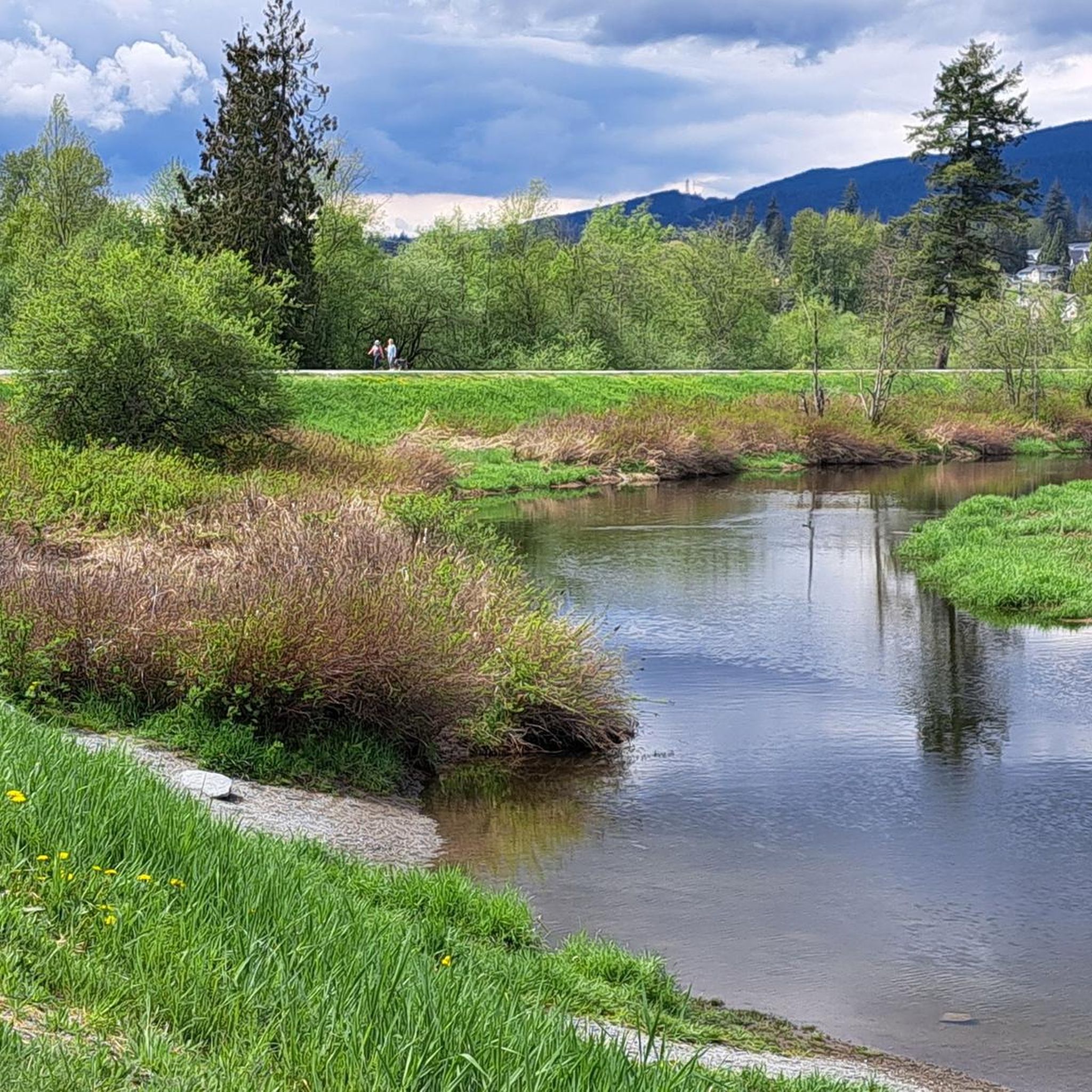
Green Timbers Lake is a small freshwater lake at the centre of the park, surrounded by forest, walking paths, and fishing platforms that make it one of the area’s main gathering spots. Stocked with rainbow trout and bordered by wetlands, the lake attracts ducks, turtles, and other wildlife, while calm water and tree reflections give it a lovely, peaceful atmosphere.
0
0

There are some shaded benches here along the Willow Trail with a tranquil view across the water. You can enjoy a nice picnic by the lake.
0
0
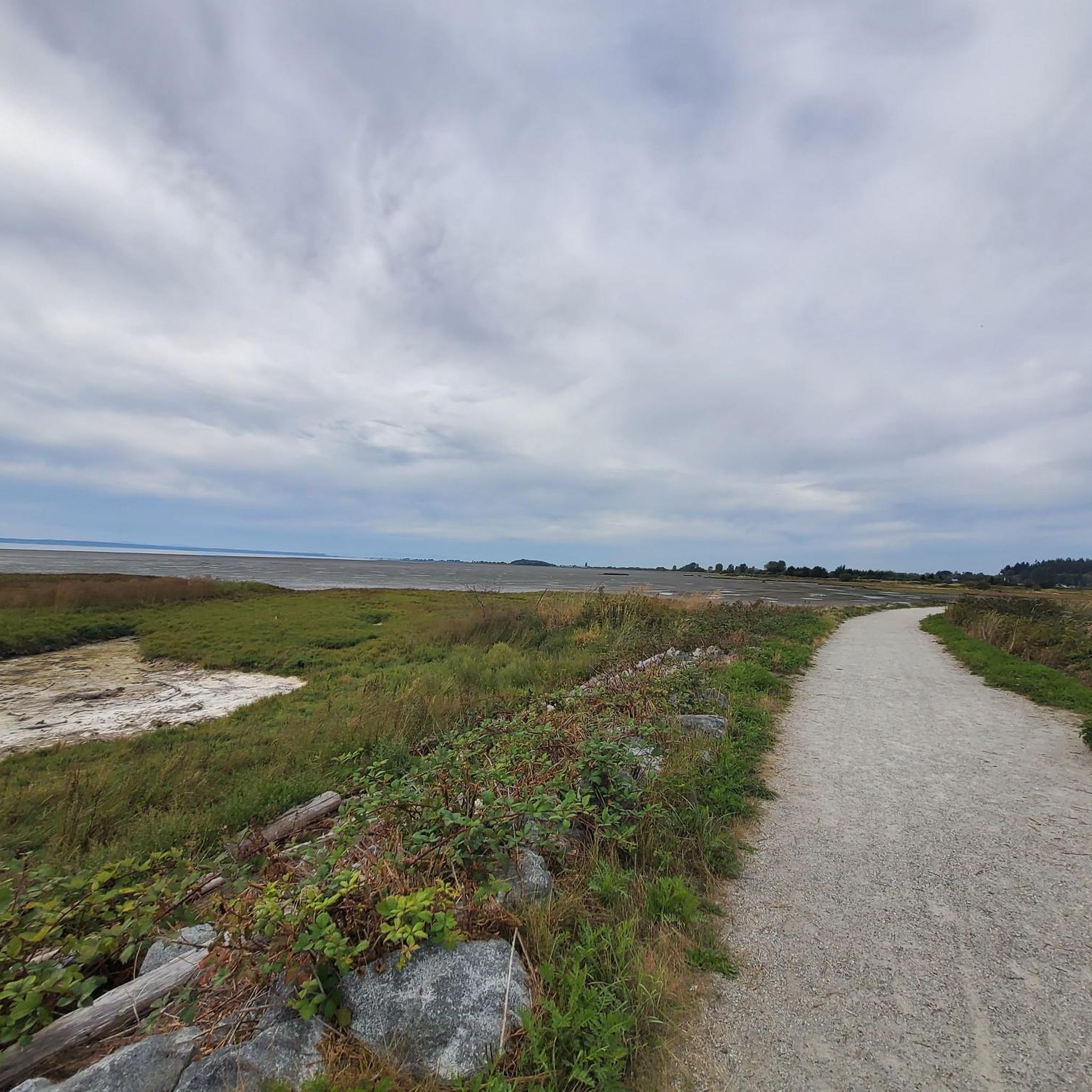
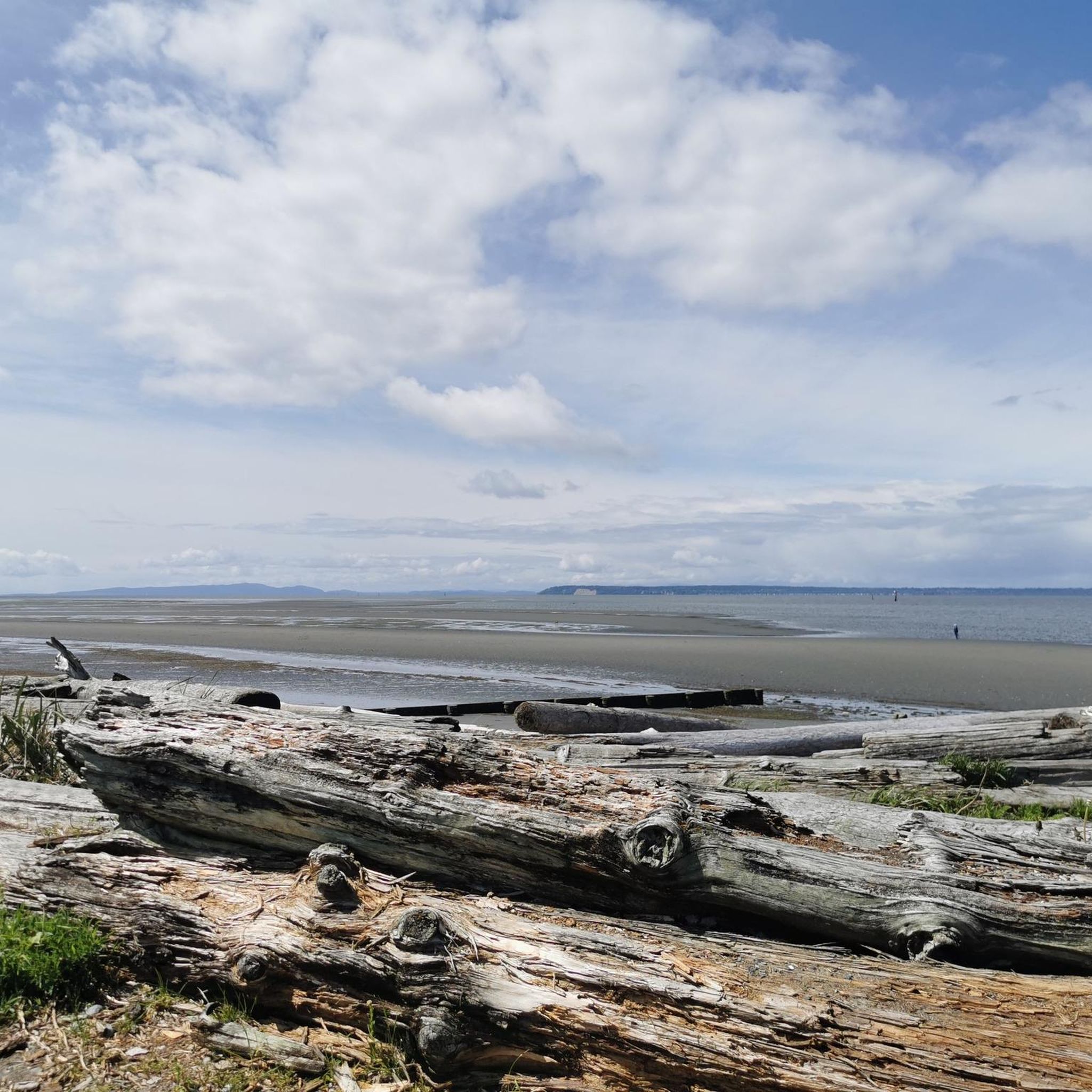
Boundary Bay Wildlife Management Area protects a vast stretch of intertidal mudflats, salt marsh, and eelgrass habitat along Boundary Bay. The area supports large numbers of migratory shorebirds and waterfowl, making it one of the most important bird habitats on Canada’s Pacific coast. Its accessible trails, consistent bird activity, and ever-changing tidal scenery make it an especially rewarding place to explore on foot or by bike.
0
0
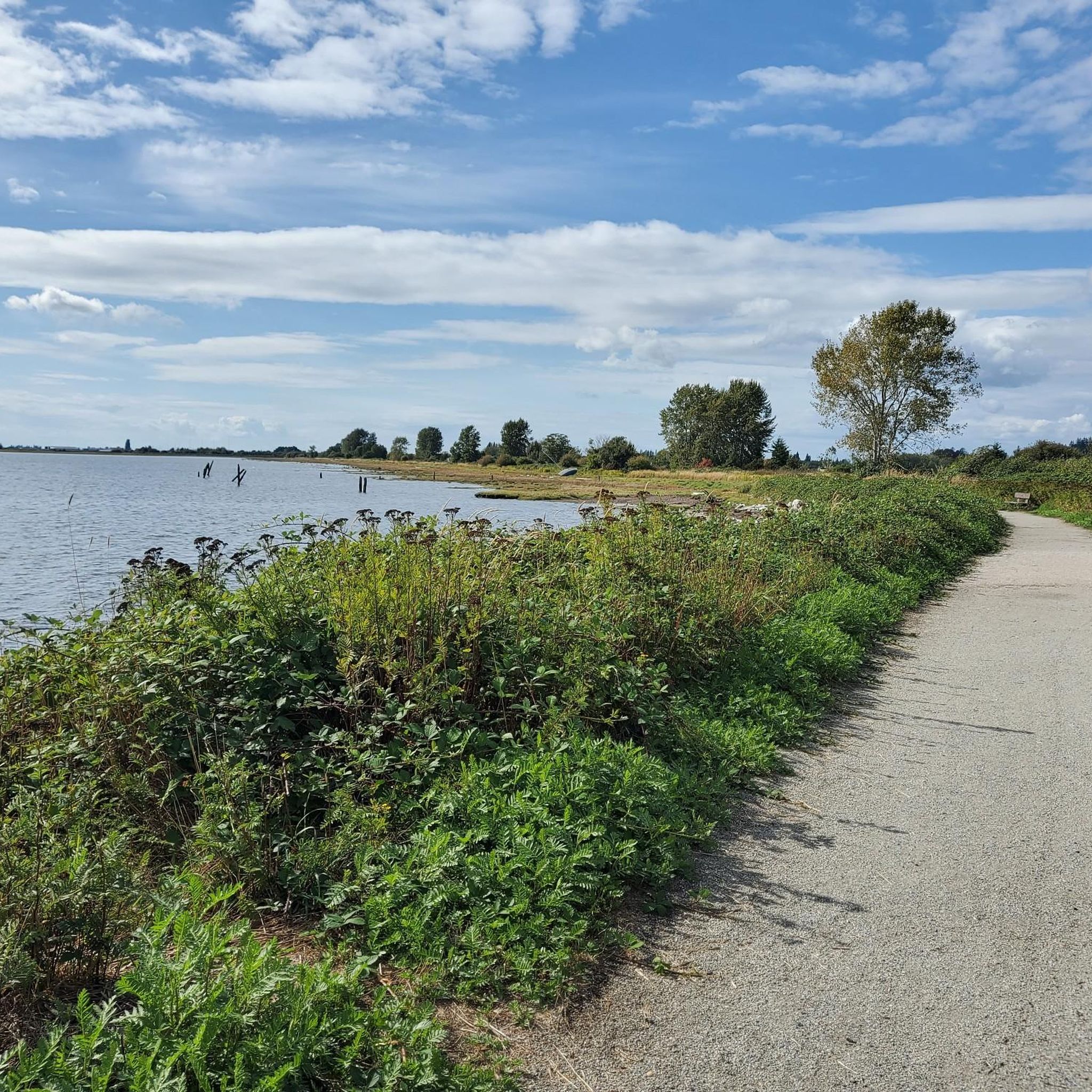
Boundary Bay Dyke Trail is a long, flat route along the shoreline, with uninterrupted views across mudflats and the open water. Its wide gravel surface is ideal for walking and cycling, with plenty of benches and access points along the way. Set along a major migratory route, the trail is especially known for birdlife and beautiful, expansive coastal scenery.
1
0

This paved, multi-use trail traces thee edges of Tynehead Regional Park in a four kilometer loop. You'll find interpretive signage placed along the loop as you make your way around.
0
0
Watershed Park is a beautiful, forested park with an extensive trail system that beckons hikers, trail runners, and mountain bikers to explore its inner realms. There's also nice viewpoints over Mud Bay and an open meadow with a picnic area.
0
0
Frequently Asked Questions
How many touring cycling routes are available in Surrey?
Surrey offers a wide variety of touring cycling routes, with over 40 routes documented on komoot. These range from easy rides through picturesque villages to challenging ascents in the Surrey Hills.
What kind of terrain can I expect when touring cycling in Surrey?
Surrey's diverse geology provides a range of terrain. You'll find chalk downs, sandy soils, and woodlands, suitable for various bike types. The region is characterized by rolling hills, dense woodlands, and river valleys, offering both gentle countryside rides and more challenging climbs, particularly in areas like Box Hill and Leith Hill.
Are there any easy touring cycling routes suitable for beginners or families in Surrey?
Yes, Surrey has several easy routes perfect for beginners or family outings. For instance, the Watershed Park loop from Joe Brown Park Equestrian Trailhead is a moderate 15.2 km ride that offers a pleasant experience without excessive difficulty. The region also features the Cycle Surrey Hills network, providing over 50 miles of largely traffic-free off-road trails.
What are some challenging touring cycling routes in Surrey?
For those seeking a challenge, Surrey's landscape includes demanding climbs and longer distances. The Pitt River Bridge – Fort-to-Fort Trail loop from King George is a difficult 95.1 km route with significant elevation gain, offering a strenuous yet rewarding experience. Iconic climbs like Box Hill and Leith Hill also provide excellent challenges.
What natural features or landmarks can I see along touring cycling routes in Surrey?
Surrey's routes pass through stunning natural landscapes and near interesting landmarks. You can explore the Fort-to-Fort Trail, enjoy views from the White Rock Pier and Waterfront, or discover the Kamui Mintara (Playground of the Gods) Sculpture. The region is also home to the Surrey Hills National Landscape, Box Hill, Leith Hill, and the North Downs, offering breathtaking panoramic views and diverse ecosystems.
Are there any circular touring cycling routes in Surrey?
Many touring cycling routes in Surrey are designed as loops, allowing you to start and end at the same point. Examples include the Delta Heritage Air Park – Beharrel Ditch Wetlands loop from Panorama Ridge Secondary and the Derby Reach Regional Park – Fort-to-Fort Trail loop from King George. The Surrey Cycleway is also a 94-mile circular tour predominantly on quiet country roads and lanes.
What do other touring cyclists say about the routes in Surrey?
The touring cycling routes in Surrey are highly regarded by the komoot community, with an average rating of 4.5 stars from over 60 reviews. Cyclists often praise the diverse landscapes, from rolling hills and woodlands to scenic riverfront trails, and the variety of routes catering to different skill levels.
Are there any routes that explore wetlands or natural areas in Surrey?
Yes, several routes offer opportunities to explore Surrey's natural wetlands and protected areas. The Delta Heritage Air Park – Beharrel Ditch Wetlands loop from Panorama Ridge Secondary specifically explores wetlands and natural areas, providing a serene cycling experience. You can also find highlights like the Burnaby Lake Wetlands nearby.
Can I find routes that connect historical sites in Surrey?
Absolutely. Surrey's rich history is accessible via its cycling routes. The Derby Reach Regional Park – Fort-to-Fort Trail loop from King George follows scenic riverfront trails and connects historical sites, offering a blend of natural beauty and cultural exploration. The North Downs Way also passes by various historic sites.
What are some scenic riverfront routes in Surrey?
For picturesque riverfront cycling, the Port Mann Bridge – Pitt River Bridge loop from Fleetwood Park Secondary School leads through urban and riverside landscapes, offering pleasant views. The Derby Reach Regional Park route also features scenic riverfront trails.
Are there any lakes or viewpoints accessible from touring cycling routes in Surrey?
Yes, Surrey's routes often provide access to beautiful lakes and stunning viewpoints. You can find highlights like Burnaby Lake Wetlands, Mundy Lake, and Brydon Park Nature Lagoon. For panoramic vistas, the View of Indian Arm and Burrard Inlet is a notable viewpoint.
What is the best time of year to go touring cycling in Surrey?
Surrey offers enjoyable cycling throughout much of the year. Spring and autumn provide pleasant temperatures and beautiful scenery with changing foliage. Summer is also popular, though routes can be busier. Even in winter, many routes remain accessible, especially those on paved surfaces, though some off-road trails might be muddy.
Most popular routes around Surrey
Most popular attractions around Surrey

Get inspired with the komoot mobile app


Explore more
Browse the best Cycling routes in other regions.
