The best walks and hikes around Capital G
4.8
(81)
1,262
hikers
29
hikes
Hiking around Capital G offers a diverse range of landscapes, from the mountainous terrain of the Blue Ridge Mountains in the north to the unique geological formations of its canyons and the expansive coastal areas. The region is characterized by extensive forests, numerous waterfalls, and significant river systems, providing varied environments for outdoor activities. Hikers can explore deep gorges, granite domes, and wetlands, with elevations ranging from coastal plains to peaks over 4,700 feet.
Best hiking trails around Capital G
…Last updated: August 8, 2026
6
hikers
7.96km
02:17
190m
190m
Moderate hike. Good fitness required. Easily-accessible paths. Suitable for all skill levels.
6
hikers
6.51km
01:48
120m
120m
Easy hike. Great for any fitness level. Easily-accessible paths. Suitable for all skill levels.

Sign up for free
3
hikers
1.20km
00:19
10m
10m
Easy hike. Great for any fitness level. Easily-accessible paths. Suitable for all skill levels.
1
hikers
3.13km
00:59
120m
120m
Easy hike. Great for any fitness level. Easily-accessible paths. Suitable for all skill levels.
1
hikers
2.50km
00:48
110m
110m
Easy hike. Great for any fitness level. Easily-accessible paths. Suitable for all skill levels.
Get access to more routes and recommendations from other explorers.
Sign up for free
Already have an account?
Our route recommendations are based on thousands of hikes, rides, and runs completed by other people on komoot.
Start today with a free account
Your next adventure awaits.
Login or Signup
Tips from the Community

This forest is shaped by the Mediterranean-like climate of Gulf Islands National Park Reserve. Although seaside cliffs are nearby, the trails in this section of the park take you rambling through the forest near the relatively tiny postage stamp of Mount Menzies Park. Every though you can't access the water from here, the park's protective boundaries extend some 200 meters into it.
0
0
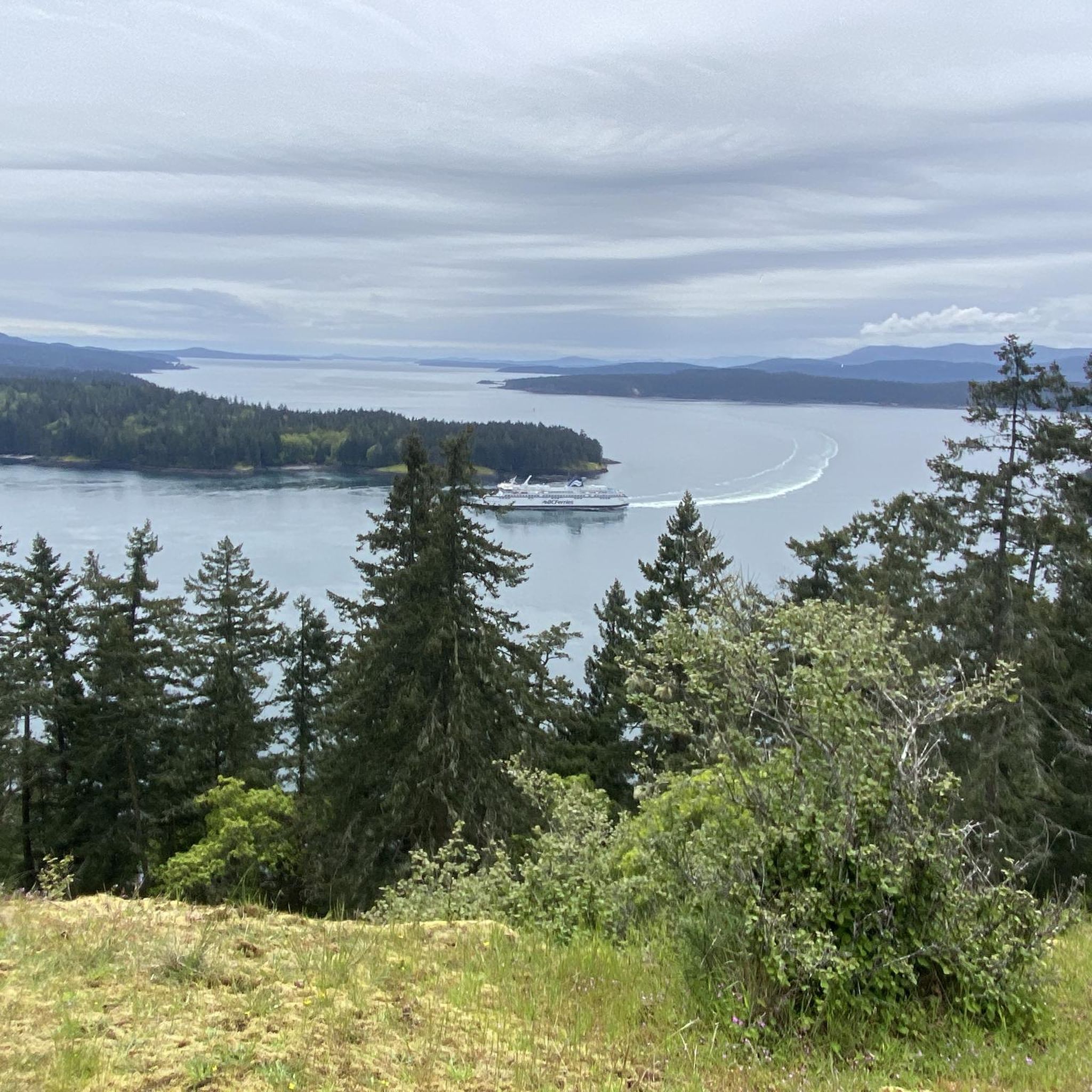
Named for the crooked tree that serves as a guidepost (the right tree will have a sign on it for Crooked Tree Lookout Trail), this viewpoint is the stunning reward for a singletrack hike that is, otherwise, entirely cloaked in trees.
0
0
It's a little counterintuitive, but the recommended loop trail through Mount Menzies Park uses this signpost as the ending point, not the start. Although the trail rambles along the skirts of Mount Menzies, it does not go all the way to the top. Instead, the figurative high point is the expansive views you'll get from Crooked Tree Lookout.
0
0

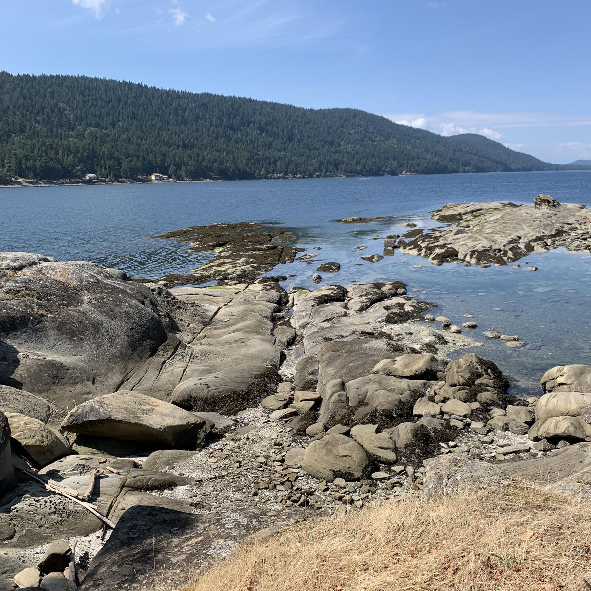
This short, easy loop trail follows a narrow wooden boardwalk through forest and wetland before opening up onto the rocky shoreline. From there, you can explore the beach at low tide, walk out along the point for beautiful views of Drummond Bay, Boundary Pass, and the San Juan Islands. The whole loop takes less than an hour, but there are plenty of picturesque places to stop and take it all in along the way.
0
0
From this spot, you can see a small automated lighthouse on the shoreline, and from here the views across Boundary Pass to Washington State's San Juan Islands are well worth the walk. You can see the surrounding Southern Gulf Islands, and on a clear day, the snow-capped peak of Mount Baker in the distance.
0
0
Gowlland Point sits at the western end of Brooks Point Regional Park, where the trail opens onto rocky bluffs with beautiful views of Drummond Bay. It is a popular spot to watch for seals, sea lions, orca pods, and the occasional bald eagle flying overhead, all from right here along the shoreline. On a clear day, you can also see across to Saturna Island and the surrounding Gulf Islands, making it one of several unforgettable viewpoints on South Pender Island.
0
0
Brooks Point Regional Park sits at the southern tip of South Pender Island and is one of the last undeveloped headlands in the Southern Gulf Islands. Covering just under 5 hectares of rocky bluffs, coastal forest, a rare Garry Oak ecosystem, grassy meadows, and a sheltered pebble beach, it is home to over 100 species of birds, the endangered sharp-tailed snake. In the spring, the meadows are filled with beautiful native chocolate lilies and camas. It is also one of the best spots on the island to watch for seals, orca, and other marine life passing through the channel.
0
0

Set along the eastern side of Galiano Island, Bodega Ridge Provincial Park protects a rugged stretch of coastal bluff, Douglas fir forest and rocky ridgeline overlooking the Salish Sea. The park is best known for its elevated viewpoints across the Gulf Islands, with sections of exposed rock and Garry oak ecosystem rare within British Columbia. Bald eagles are commonly seen soaring along the ridge, especially on windy days.
0
0
Frequently Asked Questions
How many hiking trails are available in Capital G?
Capital G offers a diverse network of over 25 hiking trails, catering to various preferences and skill levels. The majority, 18 routes, are considered easy, while 7 are moderate. The komoot community has highly rated these trails, with an average score of 4.8 stars from over 55 reviews.
Are there any family-friendly hiking options in Capital G?
Yes, Capital G is home to many family-friendly trails, particularly in its state parks. Many areas offer paved or hard-surfaced paths suitable for leisurely walks with children. For an easy and accessible option, consider the Ridge Trail, which is 1.9 miles (3.1 km) long and takes about an hour to complete through natural surroundings.
What kind of natural landmarks or attractions can I see while hiking in Capital G?
Capital G boasts a remarkable diversity of natural landmarks. You can explore dramatic canyons like Tallulah Gorge and Providence Canyon, or witness impressive waterfalls such as Amicalola Falls. The region also features unique geological formations like Stone Mountain. For specific points of interest, consider visiting Butchart Gardens or enjoying the views from Mount Douglas Summit Observation Deck.
Are there any circular hiking routes in Capital G?
Yes, Capital G offers several circular hiking routes that allow you to start and end at the same point, providing convenient exploration. A popular choice is the Mount Galiano loop from Collinson Point Provincial Park, an easy 3.4-mile (5.4 km) path with scenic views. Another option is the Hiking loop from Montague Harbour Marine Provincial Park, which is 3.2 miles (5.2 km) long.
What are some challenging hikes in Capital G?
While many trails in Capital G are easy to moderate, the region's diverse landscape, particularly in the Blue Ridge Mountains, offers opportunities for more challenging hikes. Backcountry trails can be found in areas like Amicalola Falls (providing access to the Appalachian Trail), Black Rock Mountain, and Cloudland Canyon. For a moderate option, the Mount Norman – Ainslie Point loop from Skull Islet covers 4.0 miles (6.5 km) through varied terrain.
What is the best time of year to go hiking in Capital G?
The best time to hike in Capital G largely depends on the specific region and desired experience. Spring and fall generally offer pleasant temperatures and vibrant scenery, with blooming wildflowers in spring and colorful foliage in autumn, especially in the Blue Ridge Mountains. Summer can be warm, but higher elevations provide cooler conditions. Winter hiking is possible, particularly in lower elevations, though some mountain trails may experience snow or ice.
Are there any dog-friendly hiking trails in Capital G?
Many state parks and natural areas in Capital G welcome dogs on trails, provided they are kept on a leash. It's always best to check specific park regulations before heading out. Generally, the numerous forest trails and less strenuous paths are suitable for hiking with your canine companion. Remember to bring water for both yourself and your dog.
Can I find hikes with waterfalls in Capital G?
Absolutely! Capital G is renowned for its numerous impressive waterfalls. Amicalola Falls, the tallest cascading waterfall in the Southeast, is a major draw for hikers. Other parks like Cloudland Canyon, Fort Mountain, and Vogel State Park also feature scenic waterfalls along their trails, offering beautiful natural rewards for your hike.
What do other hikers enjoy most about hiking in Capital G?
The area is highly rated by the komoot community, with an average score of 4.8 stars. Reviewers often praise the diverse landscapes, from mountain trails and canyon views to coastal paths. Hikers appreciate the variety of options for different ability levels and the well-maintained routes that allow for exploration of Capital G's unique natural beauty.
Are there any lakes or water features to explore near the hiking trails?
Yes, Capital G offers several beautiful lakes and water features that complement its hiking trails. You can find opportunities for water activities or simply enjoy the serene views. Elk/Beaver Lake Regional Park is a notable area with trails around the water, and Elk Lake itself provides a scenic backdrop for outdoor recreation.
Are there any trails that offer historical insights in Capital G?
Yes, Capital G offers trails that combine hiking with historical exploration. Sites like the Etowah Indian Mounds and Hofwyl-Broadfield Plantation feature trails that allow you to immerse yourself in the region's rich history while enjoying the outdoors. These trails provide a unique blend of natural beauty and cultural heritage.
Are there opportunities for wild swimming or cooling off during a hike?
While specific designated wild swimming spots directly on hiking trails might be limited, the region's numerous rivers and lakes, such as those found in the Blue Ridge Mountains or around Lake Lanier, offer opportunities for cooling off. Always check local regulations and safety guidelines before entering any natural water body.
Most popular attractions around Capital G

Get inspired with the komoot mobile app


Explore more
Browse the best Hikes in other regions.
