The best walks and hikes around Area C (Sasquatch Country)
4.6
(120)
1,281
hikers
33
hikes
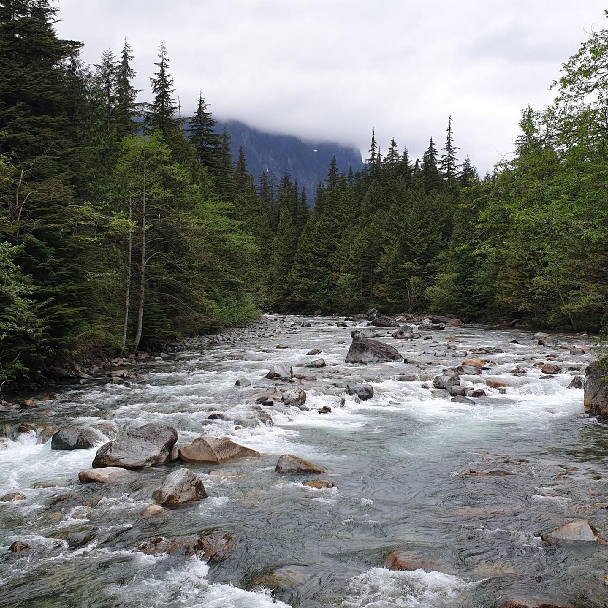
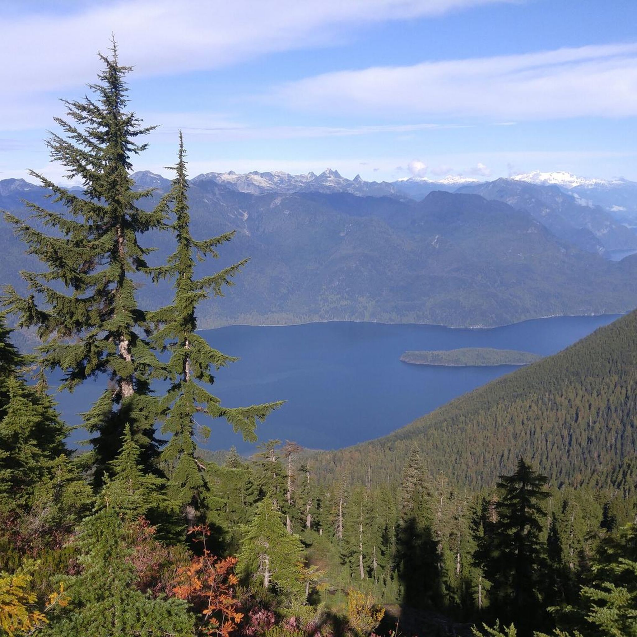
Hiking around Area C (Sasquatch Country) offers diverse landscapes, including second-growth and birch forests, scenic mountain ridges, and picturesque pocket lakes. The region features the expansive Harrison Lake, providing mountain backdrops and views. Higher elevation trails offer panoramic vistas of the Fraser Valley and surrounding ranges, with numerous streams adding to the forest experience.
Best hiking trails around Area C (Sasquatch Country)
- The most popular hiking route is Ultimate Lookout via Campbell Lake Trail — Harrison Hot Springs, a difficult 7.3 miles (11.7 km) trail that takes 5 hours 25 minutes to complete. This route features significant elevation gain leading to expansive views.
- Another top favourite among local hikers is Bear Mountain — Harrison Hot Springs, a difficult 11.4 miles (18.4 km) path. This trail involves a substantial ascent through varied terrain, offering rewarding mountain vistas.
- Local hikers also love the Harrison Lookout Trail — Fraser Valley C, a 2.1 miles (3.4 km) trail leading through forested slopes, often completed in about 1 hour 50 minutes.
- Hiking around Area C (Sasquatch Country) is defined by diverse forests, scenic mountain ridges, and picturesque lakes. The network offers options for various ability levels, from easy walks to strenuous ascents.
- The routes in Area C (Sasquatch Country) are highly rated by the komoot community with an average score of 4.5 stars from over 100 reviews. More than 1000 hikers have used komoot to explore Area C (Sasquatch Country)'s varied terrain.
Last updated: August 6, 2026
13
hikers
18.4km
06:22
990m
990m
Hard hike. Very good fitness required. Sure-footedness, sturdy shoes and alpine experience required.
4
hikers
3.36km
01:53
320m
320m
Moderate hike. Good fitness required. Mostly accessible paths. Sure-footedness required.

Sign up for free
5.0
(1)
2
hikers
12.3km
04:43
430m
430m
Moderate hike. Good fitness required. Mostly accessible paths. Sure-footedness required.
1
hikers
733m
00:16
50m
50m
Easy hike. Great for any fitness level. Easily-accessible paths. Suitable for all skill levels.
5.15km
01:36
190m
190m
Easy hike. Great for any fitness level. Easily-accessible paths. Suitable for all skill levels.
Get access to more routes and recommendations from other explorers.
Sign up for free
Already have an account?
Our route recommendations are based on thousands of hikes, rides, and runs completed by other people on komoot.
Start today with a free account
Your next adventure awaits.
Login or Signup
Popular around Area C (Sasquatch Country)
Tips from the Community

Forest Road BR814, also known as the Elbow Lake lookout trail, is a 4WD accessible off-road path leading up to a very nice lookout of Elbow Lake. If you access it by car, you can park along side the road and hike from there, or you can park along the Chehalis Forest Service Road near "Gianna Point", where there is access to elbow Lake. The path is a steady climb along rocky terrain until the lookout point at the end of the trail. Since this is a 4WD accessible road, keep an eye out for vehicles along the path.
0
0
At the end of the climb up Forest Road BR814, you'll reach a lovely lookout point where you can take in some wonderful views over the surrounding forest and Elbow Lake.
0
0

The trail follows the series of pools down to the final pool along the Sloquet River. It’s a short walk to reach the last pool, but the area can get very busy on weekends.
0
0
Sloquet Hot Springs is a series of shallow, man-made pools fed by a hot waterfall. The pools extend from the waterfall down to the banks of the Sloquet River. One thing to keep in mind is the $10 cash day-use fee if you’re visiting the hot springs without camping. Camping costs $20 per night and includes access to the hot springs.
0
0
The Harrison Lookout Trail begins from the LK10 logging road. There is no official parking lot; hikers should find a suitable pull-off spot along the side of the road. The route starts steeply but eases after a few hundred meters. Just over 500 meters into the hike, look for a wooden sign marked "Trail" on your left. From there, the path winds in and out of clear-cut areas until you reach the white fire lookout tower at the summit. Be aware that the trail is not maintained, but you can follow the orange metal markers to stay on the correct path.
0
0
The Harrison Lookout sits on the summit of the unofficial names Hale Peak. The summit has stunning panoramic views of Harrison Lake and the surrounding mountain ranges, including glimpses of peaks like Mount Cheam and Mount Baker on a clear day.
0
0
The trail is mostly rugged single track, passing by waterfalls and small creeks. There are a few log crossings, with the first crossing being the most challenging. You will cross an old log bridge that spans the water about 2–3 m off the ground. The bridge is more stable than it looks, and there is a wire handrail to help with your balance.
0
0
Surrounded by towering old-growth forest and snow-capped peaks, Statlu Lake is a picturesque lake situated at 635 m in elevation.
0
0
Frequently Asked Questions
How many hiking trails are available in Area C (Sasquatch Country)?
Area C (Sasquatch Country) offers a diverse network of over 25 hiking trails. These routes cater to various skill levels, from easy walks through lush forests to challenging ascents with significant elevation gain, ensuring there's something for every hiker.
What types of landscapes can I expect to see while hiking in Sasquatch Country?
Hikers in Sasquatch Country will encounter a rich variety of landscapes. The region features unique second-growth and birch forests, scenic mountain ridges, and picturesque 'pocket lakes' like Hicks Lake. You'll also find stunning views of the vast Harrison Lake, numerous burbling streams, and panoramic vistas of the Fraser Valley and surrounding ranges from higher elevations.
Are there any easy, family-friendly hikes in Area C (Sasquatch Country)?
Yes, Sasquatch Country offers several easy, family-friendly options. In Sasquatch Provincial Park, the Hicks Lake Trail (around 4 km return) and Deer Lake Trail (around 2 km return) are accessible choices. The Beaver Pond Interpretive Trail is another short, easy loop. For a relaxed stroll, the Village Loop (3 km) at Sasquatch Mountain is also suitable.
What are some challenging hikes for experienced adventurers in this region?
For experienced hikers seeking a challenge, Area C provides several strenuous trails. The Ultimate Lookout via Campbell Lake Trail is a difficult 11.7 km route with significant elevation gain. Another demanding option is Bear Mountain, an 18.4 km path offering rewarding mountain vistas. Additionally, Mount Claudt Summit (8 km) and the Cartmell Peak Loop (10 km) involve substantial ascents and ridge-line exposure.
Are there any circular hiking routes in Area C (Sasquatch Country)?
Yes, the region includes several circular routes. For instance, the Cartmell Peak Loop offers a longer circuit with ridge-line exposure and seasonal wildflowers. Shorter, easier loops like the Beaver Pond Interpretive Trail are also available, providing a complete experience without retracing your steps.
What is the best time of year to go hiking in Sasquatch Country?
The best time to hike in Sasquatch Country is generally from spring through fall. During these seasons, the weather is milder, trails are typically clear of snow, and you can enjoy wildflowers and lush greenery. Higher elevation trails might be accessible later in the season, while lower trails are enjoyable earlier.
Can I bring my dog on the hiking trails in Area C?
While many trails in British Columbia are dog-friendly, it's always best to check specific regulations for Sasquatch Provincial Park and other managed areas. Generally, dogs are welcome on leash in many outdoor spaces, but some sensitive ecological areas or wildlife protection zones may have restrictions. Always practice Leave No Trace principles and clean up after your pet.
Are there any notable viewpoints or landmarks along the trails?
Absolutely. Higher elevation trails like Eagleview Trail and Mount Claudt Summit offer sweeping vistas of the Fraser Valley, peak views, and the Douglas Ranges. From Mount Cartmel, you can even enjoy views of Harrison Lake, Mount Baker, and the Cascade Range. The area also embraces its namesake with the "Sasquatch Trail" in Harrison River Valley, where you can follow clues to find Sasquatch sculptures and learn about local legends. For more information on the Sasquatch legend, you can visit Tourism Harrison's website.
What do other hikers enjoy most about hiking in Area C (Sasquatch Country)?
The hiking routes in Area C (Sasquatch Country) are highly rated by the komoot community, with an average score of 4.5 stars from over 100 reviews. Hikers often praise the diverse forests, scenic mountain ridges, and picturesque lakes. Many appreciate the variety of options available, from easy walks to strenuous ascents, and the rewarding panoramic views from higher points.
Is public transport available to reach hiking trailheads in Area C?
Public transport options directly to many remote trailheads in Area C (Sasquatch Country) are limited. Most visitors typically rely on personal vehicles to access the various hiking areas, especially those within Sasquatch Provincial Park or higher up Sasquatch Mountain. It's advisable to plan for car access or carpooling.
Are there any permits required for hiking in Sasquatch Country?
For general day hiking in most areas of Sasquatch Country, including Sasquatch Provincial Park, permits are typically not required. However, it's always recommended to check the official BC Parks website or local tourism resources for any specific regulations, especially for backcountry camping or during peak seasons, as rules can change.
What is the significance of the 'Sasquatch' name in this region?
The name 'Sasquatch' is deeply rooted in the oral traditions of the Sts'ailes First Nations people of the Harrison Lake and River communities. The word 'Sasq'ets' means 'hairy man' and refers to a legendary figure. The region embraces this heritage, offering unique cultural connections and even a dedicated Sasquatch Trail where visitors can explore the legend.
Most popular routes around Area C (Sasquatch Country)
Most popular attractions around Area C (Sasquatch Country)

Get inspired with the komoot mobile app


Explore more
Browse the best Hikes in other regions.
