The best cycling routes around North Saanich
4.6
(76)
1,111
riders
16
rides
Touring cycling routes around North Saanich traverse a diverse landscape on the Saanich Peninsula of Vancouver Island. The region features a blend of serene rural roads, picturesque waterfronts, and numerous parks with established trail systems. Terrain is characterized by mostly paved surfaces and gentle rolling hills, though some routes include more significant elevation gains. Old-growth forests, Garry oak ecosystems, and farmland contribute to the varied scenery.
Best touring cycling routes around North Saanich
- The most popular touring cycling route is Lochside Regional Trail – Johnson Street Bridge loop from Saanich Peninsula, a 33.8 miles (54.5 km) trail that takes 3 hours 25 minutes to complete. This moderate route follows a former railway line, winding through beaches, farmland, and wetlands.
- Another top favourite among local touring cyclists is Lochside Regional Trail – Inner Harbour, Victoria loop from Swartz Bay, a difficult 53.7 miles (86.4 km) path. This longer route extends the scenic Lochside Trail experience towards Victoria's Inner Harbour.
- Local touring cyclists also love the Lochside Pigs – Lochside Regional Trail loop from John Dean Park, a 16.3 miles (26.3 km) trail leading through areas with old-growth Douglas fir and Garry oak, often completed in about 1 hour 40 minutes.
- Touring cycling around North Saanich is defined by rural roads, waterfront access, and diverse parks with old-growth forests. The network offers options for various ability levels, from easy coastal rides to more challenging loops.
- The routes in North Saanich are highly rated by the komoot community with an average score of 4.7 stars from over 50 reviews. More than 800 touring cyclists have used komoot to explore North Saanich's varied terrain.
Last updated: October 29, 2026
4.8
(37)
453
riders
Moderate bike ride. Good fitness required. Mostly paved surfaces.
4.0
(1)
56
riders
26.3km
01:40
190m
190m
Moderate bike ride. Good fitness required. Mostly paved surfaces.

4.0
(1)
50
riders
13.8km
00:53
160m
160m
Moderate bike ride. Good fitness required. Mostly paved surfaces.
5.0
(1)
50
riders
16.3km
00:57
80m
80m
Easy bike ride. Mostly paved surfaces.
3.0
(1)
25
riders
Hard bike ride. Very good fitness required. Mostly paved surfaces.
Get access to more routes and recommendations from other explorers.
Already have an account?
Our route recommendations are based on thousands of hikes, rides, and runs completed by other people on komoot.
Start today with a free account
Your next adventure awaits.
Tips from the Community


This trail offers stunning ocean views along the way. While the shoreline of Sooke Basin is mostly rocky, its northern edge features stretches of sandy beach.
0
0

Triangle Park is a small local park just west of the Johnson Street Bridge. It has a mix of public art, tupelo trees, benches, and simple lighting that gives it a relaxed, neighborhood feel. The park sits along the Vancouver Island Trail, so it’s a nice spot to pause if you’re walking or biking through the area.
0
0

Patricia Bay Park is a quiet waterfront spot in North Saanich with open views of the Saanich Inlet and easy access to the paved Scoter Trail. There are picnic tables, restrooms, and a small beach area, making it a lovely place to stop for lunch or take a break. It’s low-key and family-friendly, perfect for birdwatching, a short walk, or just sitting by the water.
2
0

Enjoy the trails! Easy and the view is spectacular.
0
0

The Johnson Street Bridge spans the waters of Victoria Harbour at a narrow point. The single-leaf bascule bridge opened in March 2018. At night, the bridge is illuminated in blue. This commemorates the original bridge from 1924, which was also called the 'Blue Bridge' because of its light blue color.
3
1
Market Square in Victoria's old town was created as part of an urban renewal project in the 1970s, during which numerous buildings from the late 19th century were renovated. https://www.historicplaces.ca/en/rep-reg/place-lieu.aspx?id=6060&pid=0
4
1

Let's you stay off the roads and bypass downtown Sidney if you are just travelling through though Sidney does have some great bakeries and coffee stops
0
0
Frequently Asked Questions
How many touring cycling routes are available in North Saanich?
North Saanich offers over 20 touring cycling routes, catering to various skill levels. These routes traverse diverse landscapes, including serene rural roads, picturesque waterfronts, and established trail systems.
Are there easy touring cycling routes suitable for beginners or families?
Yes, North Saanich has 8 easy touring cycling routes. Many of these feature mostly paved surfaces and gentle elevation gains, making them accessible for beginners or families. The region's extensive network of trails, like sections of the Lochside Regional Trail, provides smooth and scenic options.
What are some longer touring cycling routes in North Saanich?
For those seeking longer rides, North Saanich offers several options. A notable difficult route is the Lochside Regional Trail – Inner Harbour, Victoria loop from Swartz Bay, which spans 86.4 km and extends the scenic Lochside Trail experience towards Victoria's Inner Harbour.
Are there any circular touring cycling routes in North Saanich?
Yes, many of the touring cycling routes in North Saanich are designed as loops. For instance, the Lochside Regional Trail – Johnson Street Bridge loop from Saanich Peninsula is a popular 54.5 km moderate route that follows a former railway line, winding through beaches, farmland, and wetlands.
What kind of viewpoints can I expect along the touring cycling routes?
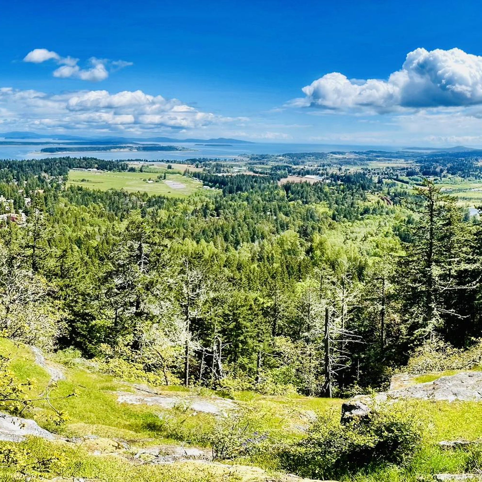
North Saanich's routes offer diverse viewpoints. You can enjoy panoramic vistas from parks like Horth Hill Regional Park, which provides views of Satellite Channel, the Saanich Peninsula, and the Gulf Islands. Waterfront parks such as Patricia Bay Park offer serene coastal views of the Saanich Inlet. Many routes also pass through farmland, providing lush rural scenery.
Are there any challenging touring cycling routes in the area?
While many routes feature gentle terrain, North Saanich does offer more challenging options. There are 3 difficult routes available, with some segments requiring good to very good fitness for more significant climbs. The 'Saanich Peninsula loop ride' can offer up to 1,000 meters of elevation gain over 100 km, showcasing varied terrain where roads are rarely flat or straight.
What kind of natural attractions can I see along the touring cycling routes?
Along the touring cycling routes, you can explore a variety of natural attractions. Highlights include Butchart Gardens, the serene Patricia Bay Park, and the scenic Jocelyn Hill. The region is also home to parks with old-growth Douglas fir and Garry oak trees, such as ȽÁU,WELṈEW̱/John Dean Provincial Park, and waterfront areas like Reay Creek Park with its unique freshwater stream.
What do other touring cyclists enjoy most about cycling in North Saanich?
The touring cycling experience in North Saanich is highly rated by the komoot community, with an average score of 4.7 stars from over 50 reviews. Cyclists often praise the blend of serene rural roads, picturesque waterfronts, and diverse parks. The well-maintained trails and varied terrain, from easy coastal rides to more challenging loops, are frequently highlighted as enjoyable aspects.
Are there touring cycling routes that pass by local cafes or bakeries?
Yes, some routes are designed to include stops at local establishments. For example, The Fickle Fig Bakery loop from John Dean Park is a 13.7 km route that specifically features a popular local bakery, offering a pleasant break during your ride. Another option is the Patricia Bay Park – The Fickle Fig Bakery loop from Sidney, an easy 16.2 km route.
Can I access touring cycling routes in North Saanich using public transport?
The Lochside Regional Trail, a major cycling artery in North Saanich, has several entry points, including Lochside Park, Cy Hampson Park, and Tulista Park. These locations, and others along the trail, are often accessible via local public transport routes, making it possible to reach the cycling network without a car.
Are there any touring cycling routes that go through old-growth forests?
Yes, North Saanich is home to several parks that preserve old-growth forests. The Lochside Pigs – Lochside Regional Trail loop from John Dean Park, for instance, leads through areas with old-growth Douglas fir and Garry oak trees. Other parks like R.O. Bull Park also feature preserved stands of ancient Douglas firs, offering peaceful gravel trails.
What is the best season for touring cycling in North Saanich?
North Saanich offers enjoyable touring cycling experiences throughout much of the year due to its mild climate. Spring and fall provide pleasant temperatures and vibrant scenery, while summer is ideal for longer rides and exploring coastal areas. Even in winter, many paved routes remain accessible, though some unpaved sections might be less suitable depending on weather conditions.
Most popular attractions around North Saanich

Get inspired with the komoot mobile app


Explore more
Browse the best Cycling routes in other regions.
