The best cycling routes in Channel Islands National Park
4.9
(42)
723
riders
31
rides
Touring cycling in Channel Islands National Park primarily involves routes on the mainland, offering coastal views of the islands rather than trails on the islands themselves. The terrain along the mainland coast is characterized by flat to gently rolling paths, often following the Pacific coastline. These routes provide ocean vistas and access to beaches and piers. The area features a mix of paved paths and urban sections suitable for touring bicycles.
Best touring cycling routes in Channel Islands National Park
…Last updated: October 2, 2026
4.9
(10)
98
riders
50.8km
02:59
290m
290m
Moderate bike ride. Good fitness required. Mostly paved surfaces. Suitable for all skill levels.
5
riders
29.5km
01:45
110m
110m
Easy bike ride. Great for any fitness level. Mostly paved surfaces. Suitable for all skill levels.

5.0
(1)
25
riders
23.3km
01:20
60m
60m
Easy bike ride. Great for any fitness level. Mostly paved surfaces. Suitable for all skill levels.
4.8
(5)
86
riders
69.8km
04:03
250m
250m
Moderate bike ride. Good fitness required. Mostly paved surfaces. Suitable for all skill levels.
27
riders
66.5km
04:12
650m
650m
Hard bike ride. Very good fitness required. Mostly paved surfaces. Suitable for all skill levels.
Get access to more routes and recommendations from other explorers.
Already have an account?
Our route recommendations are based on thousands of hikes, rides, and runs completed by other people on komoot.
Start today with a free account
Your next adventure awaits.
Tips from the Community

This museum is one of four branches in Ventura and nearby Santa Paula; it's very community- and experience-focused, with virtual exhibits available if you don't want to stop your bike ride to go in. Admission currently costs $10 for adults, free for those under 18, and half-price admission for seniors and students.
0
0

Early morning or near sunset are great times to run. It can get windy during the day so prepare for a nasty headwind if traveling west.
0
0

Enjoy the relaxed, retro atmosphere at San Buenaventura State Beach, where you can swim, surf, picnic, play beach volleyball, bike, or toss a frisbee. The two-mile beach features a lagoon, views of sealife, and year-round lifeguards. Explore sand dunes and unwind at picnic areas equipped with tables, grills, and privacy screens. Grab a bite at The Jolly Oyster or Good to Go Juice Truck, and rent bikes from Wheel Fun Rentals to explore nearby beaches and Ventura Pier.
0
0

The Sacred Space is a treasure trove of spiritual and cultural items from around the world, with a focus on East Asian traditions.
0
0

The center of town has a lot of cafes and breweries, and many of the streets have designated bike lanes. Carpinteria is a surfing destination, and the town's record shops and bistros complement its seaside aesthetic.
0
0


Really nice beach with surfers and families
1
0
Frequently Asked Questions
How many touring cycling routes are available in the Channel Islands National Park area?
There are approximately 29 touring cycling routes available in the Channel Islands National Park area, primarily located on the mainland. These routes offer diverse experiences, from easy coastal rides to more moderate loops.
What kind of terrain can I expect on touring cycling routes near Channel Islands National Park?
The touring cycling routes in this area are predominantly on the mainland, featuring flat to gently rolling paved paths. They often follow the Pacific coastline, offering ocean views and passing through urban sections. You'll find a mix of dedicated bike paths and shared urban roads suitable for touring bicycles.
Are there any family-friendly touring cycling routes?
Yes, many routes are suitable for families. About half of the available routes are rated as easy, featuring flat terrain and paved surfaces. For example, the Surfers Point Beach – Omer Rains Coastal Bike Path loop from Ventura is an easy option that offers scenic coastal views without significant elevation changes.
Can I bring my dog on touring cycling routes in the Channel Islands National Park area?
While dogs are generally not permitted on the Channel Islands themselves (except service animals), the mainland cycling routes often follow public paths and urban areas where dogs on leashes are typically allowed. Always check local regulations for specific sections of the path you plan to ride.
What are some scenic points or landmarks I can see while cycling?
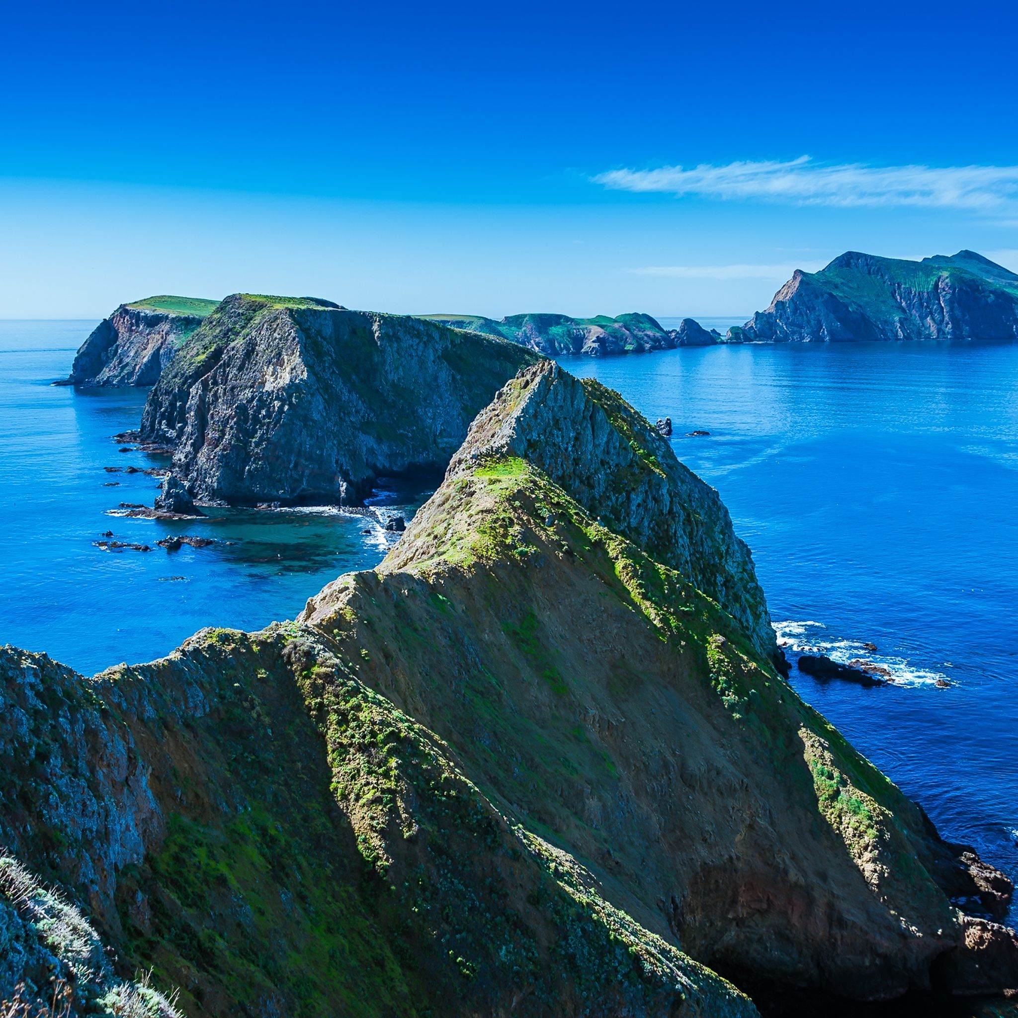
The mainland cycling routes offer continuous views of the Pacific Ocean and, on clear days, the Channel Islands themselves. You can also pass by landmarks such as the Ventura Pier, and access various beaches. For specific points of interest, consider routes that pass near highlights like Scorpion Anchorage Pier (visible from the mainland coast) or areas with views towards Cavern Point on Santa Cruz Island.
Are there circular touring cycling routes available?
Yes, many of the touring cycling routes in the area are loops, allowing you to start and end at the same point. Examples include the popular San Buenaventura State Beach – Ventura Pier loop from Ventura and the longer Ventura Loop, which covers coastal and urban sections.
What is the best time of year to go touring cycling in the Channel Islands National Park area?
The Channel Islands National Park area, including its mainland cycling routes, generally enjoys a mild Mediterranean climate year-round. Spring (March-May) and Fall (September-November) often offer the most pleasant temperatures and fewer crowds. Summer can be warm, and winter might bring occasional rain, but cycling is possible in all seasons.
What are the parking and public transport options for accessing these cycling routes?
For mainland cycling routes, parking is typically available at various points along the coast, such as near beaches and parks in Ventura and Oxnard. Public transport options, including local bus services, may also provide access to areas near the cycling paths. For specific island access, ferry services depart from Ventura Harbor, but remember that cycling is not permitted on the islands themselves.
Do I need any permits or pay access fees for touring cycling?
Generally, no specific permits or access fees are required for touring cycling on the mainland paths and urban routes in the Channel Islands National Park area. However, standard parking fees may apply in some public lots or state parks along the coast.
What do other cyclists say about the touring cycling experience here?
The touring cycling routes in the Channel Islands National Park area are highly rated by the komoot community, with an average score of 4.9 stars from over 40 reviews. Cyclists often praise the beautiful coastal views, the well-maintained paved paths, and the accessibility of the routes for various skill levels.
Where can I find places to eat or drink after my ride?
Since the cycling routes are primarily on the mainland in and around Ventura and Oxnard, you'll find numerous cafes, restaurants, and pubs. Many establishments are conveniently located near the coastal paths, especially around the Ventura Pier and downtown areas, offering a variety of dining options.
Can I spot wildlife while cycling in this area?
While cycling on the mainland, you can often spot marine birds and potentially dolphins or whales offshore, especially during migration seasons. The Channel Islands themselves are a haven for unique wildlife, including island foxes and various marine mammals, but these are observed during visits to the islands, not typically from the mainland cycling routes.
What are the difficulty levels of the touring cycling routes?
The routes cater to a range of abilities. Approximately 15 routes are rated as easy, 7 as moderate, and 7 as difficult. The easy routes are generally flat and paved, while moderate and difficult routes may include longer distances or more varied terrain, though significant elevation is rare on these coastal touring paths.
Are there any routes that offer views of the Channel Islands themselves?
Yes, all the touring cycling routes in this guide are located on the mainland and are specifically chosen for their coastal proximity, offering continuous views of the Pacific Ocean. On clear days, you will have excellent panoramic views of the Channel Islands in the distance, providing a scenic backdrop to your ride.
Most popular routes in Channel Islands National Park
Most popular attractions in Channel Islands National Park

Get inspired with the komoot mobile app


Explore more
Browse the best Cycling routes in other regions.
