The best walks and hikes around Prestesteinsvatnet
4.6
(257)
1,403
hikers
36
hikes
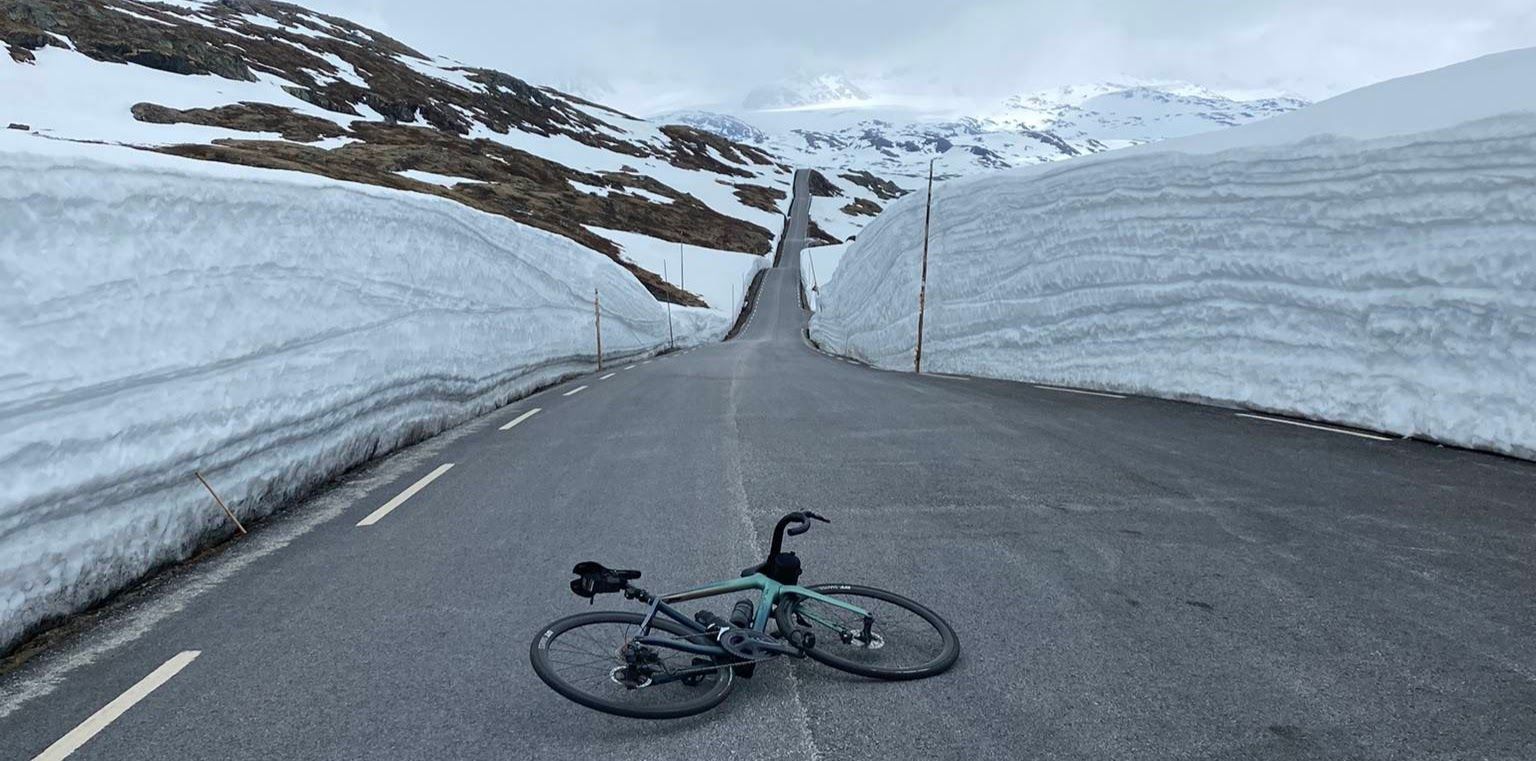
Hiking around Prestesteinsvatnet offers access to high-alpine landscapes in Norway's Vestland and Innlandet counties. Situated at an elevation of 4,452 feet (1,357 meters), the area features dramatic, rocky terrain that can retain snow even during the hiking season. It lies north of Fannaråki mountain, providing views of the Jostedalsbreen Glacier and serving as a gateway to Jotunheimen National Park. The region is also traversed by the Sognefjellsvegen road, Northern Europe's highest mountain pass.
Best hiking trails around Prestesteinsvatnet
- The most popular hiking route is View of Jostedalsbreen Glacier – Sognefjellshytta loop from Prestesteinsvatnet, a 6.6 miles (10.6 km) moderate trail that takes about 3 hours to complete, offering expansive views of the Jostedalsbreen Glacier.
- Another top favourite among local hikers is Mefjellet Stone Sculpture by Knut Wold – Rocky Landscape With Snow loop from Prestesteinsvatnet, an easy 1.6 miles (2.7 km) path. This route leads through a rocky landscape, featuring the Mefjellet Stone Sculpture by Knut Wold.
- Local hikers also love the Sognefjellshytta – Mefjellet Stone Sculpture by Knut Wold loop from Prestesteinsvatnet, a 4.8 miles (7.7 km) trail leading through mountainous terrain, often completed in about 2 hours 6 minutes.
- Hiking around Prestesteinsvatnet is defined by high-alpine landscapes, mountainous terrain, and glacier views. The network offers options for different ability levels, from easy loops to more challenging mountain ascents.
- The routes in Prestesteinsvatnet are highly rated by the komoot community with an average score of 4.6 stars from over 240 reviews. More than 1300 hikers have used komoot to explore Prestesteinsvatnet's varied terrain.
Last updated: August 20, 2026
4.5
(4)
26
hikers
Moderate hike. Good fitness required. Mostly accessible paths. Sure-footedness required.
4.8
(5)
27
hikers
Easy hike. Great for any fitness level. Easily-accessible paths. Suitable for all skill levels.

Sign up for free
4.5
(2)
7
hikers
Moderate hike. Good fitness required. Mostly accessible paths. Sure-footedness required.
5.0
(2)
62
hikers
20.0km
06:37
790m
790m
Hike the challenging Signatur Massiv Trail from Sognefjellshytta to Fannaråkhytta, featuring a glacier crossing and panoramic views.
4.7
(41)
159
hikers
Moderate hike. Great for any fitness level. Mostly accessible paths. Sure-footedness required.
Get access to more routes and recommendations from other explorers.
Sign up for free
Already have an account?
Our route recommendations are based on thousands of hikes, rides, and runs completed by other people on komoot.
Start today with a free account
Your next adventure awaits.
Login or Signup
Popular around Prestesteinsvatnet
Other adventures around Prestesteinsvatnet

Tips from the Community

Hi Jo. We are not going over the glacier. I would definitely ask at a hut if it is possibly safe to go alone. Otherwise, there will surely be a guide!
1
0

@Mikael Hi! Is it possible to cross Fannaråkbreen alone in August, or are there guides at the hut?
1
0

Very friendly hut owners who prepare delicious food.
1
0

Old and new, superbly packaged, a real eye-catcher. You can also stay overnight here and go on wonderful hikes
4
0

And stay at Europe's highest mountain pass at 1,428 m and enjoy summer skiing (until mid-July) and the snowy areas.
0
0
At the highest mountain pass in Northern Europe, at 1528
0
0

Here you get breathtaking views.
1
0

The Mefjellet rest area is located right on top of Storevasskrysset. From here you have a fantastic view of Fanaråken and the surrounding mountains. The stone sculpture (1997) by Knut Wold is a popular photo motif in the midst of a picturesque mountain landscape.
2
0
Frequently Asked Questions
What kind of terrain can I expect when hiking around Prestesteinsvatnet?
The area around Prestesteinsvatnet is characterized by dramatic, high-alpine landscapes with rugged, rocky terrain. Due to its elevation of 1,357 meters (4,452 ft), you might encounter snow even during the main hiking season. This environment offers challenging and rewarding hikes with expansive vistas.
Are there any easy hiking trails suitable for beginners or those looking for a shorter walk?
Yes, there are several easier options. For instance, the Mefjellet Stone Sculpture by Knut Wold – Rocky Landscape With Snow loop from Prestesteinsvatnet is an easy 1.6-mile (2.7 km) path that leads through a rocky landscape and features the Mefjellet Stone Sculpture by Knut Wold.
What are the main natural attractions or landmarks to see while hiking in the Prestesteinsvatnet area?
Hikers can enjoy views of the majestic Jostedalsbreen Glacier, continental Europe's largest glacier. The area is also north of Fannaråki mountain and features the unique Mefjellet Stone Sculpture by Knut Wold. Additionally, Prestesteinsvatnet serves as a gateway to Jotunheimen National Park, renowned for its numerous peaks exceeding 2,300 meters.
Can I find circular hiking routes around Prestesteinsvatnet?
Yes, many routes in the area are circular. A popular moderate option is the View of Jostedalsbreen Glacier – Sognefjellshytta loop from Prestesteinsvatnet, which is 6.6 miles (10.6 km) long and offers expansive glacier views. Another is the View of Jostedalsbreen Glacier – Fantesteinen Pass Summit loop from Sognefjellshytta, a moderate 3.3-mile (5.4 km) loop.
What is the best time of year to go hiking around Prestesteinsvatnet?
The best time for hiking is typically during the warmer months when the Sognefjellsvegen road is open and snow conditions are more favorable. However, due to the high-alpine environment, snow can persist even into the summer, so it's always advisable to check local conditions before setting out.
How many hiking trails are available in the Prestesteinsvatnet region?
There are over 35 hiking trails available around Prestesteinsvatnet, catering to various fitness levels. This includes 6 easy routes, 24 moderate routes, and 7 difficult routes, ensuring options for most hikers.
What do other hikers say about the trails in Prestesteinsvatnet?
The trails in Prestesteinsvatnet are highly rated by the komoot community, with an average score of 4.6 stars from over 240 reviews. Hikers often praise the stunning high-alpine landscapes, the dramatic views of glaciers, and the diverse terrain that makes for a rewarding outdoor experience.
Are there any challenging or difficult hikes in the Prestesteinsvatnet area?
Yes, for experienced hikers, there are challenging routes available. An example is the Signatur Massiv Trail: Sognefjellshytta to Fannaråkhytta, which is a difficult 12.4-mile (20 km) hike with significant elevation gain, requiring very good fitness, sure-footedness, sturdy shoes, and alpine experience.
Is Prestesteinsvatnet located near any major national parks?
Yes, Prestesteinsvatnet is situated just outside the borders of Jotunheimen National Park. This park is a prime area for outdoor enthusiasts, offering extensive opportunities for mountain hiking and glacier walks among its many peaks.
What is the Sognefjellsvegen road and how does it relate to hiking in Prestesteinsvatnet?
The Sognefjellsvegen road is recognized as Northern Europe's highest mountain pass. Prestesteinsvatnet is located along this scenic route, which provides breathtaking views and accessible starting points for various treks into the surrounding mountainous terrain.
Are there any moderate length hikes that offer good views?
Absolutely. The Sognefjellshytta – Mefjellet Stone Sculpture by Knut Wold loop from Prestesteinsvatnet is a moderate 4.8-mile (7.7 km) trail that leads through mountainous terrain and is often completed in about 2 hours and 6 minutes, providing excellent views along the way.
What kind of preparation is recommended for hiking in this high-alpine region?
Given the high-alpine and often rocky landscape, even with potential snow, it's recommended to have good fitness, be sure-footed, and wear sturdy hiking shoes. For more challenging routes, alpine experience is advisable. Always check weather forecasts and trail conditions before heading out.
Most popular routes around Prestesteinsvatnet

Get inspired with the komoot mobile app


Explore more
Browse the best Hikes in other regions.
