The best walks and hikes around Hammervatnet
4.7
(9)
62
hikers
12
hikes
Hiking around Hammervatnet in Levanger Municipality, Trøndelag county, Norway, offers routes through a diverse natural setting. The region is characterized by the serene Hammervatnet lake, which spans approximately 2.33 square miles (6.03 sq km) and features two islands, Innerøya and Ytterøya. The eastern part of the lake is protected as the Hammervatnet Nature Reserve, encompassing swamp forests of alder and mixed forests with rowan. Surrounding the lake are open cultural landscapes and dense forests, providing varied terrain for exploration.
Best…
Last updated: August 22, 2026
5.0
(1)
6
hikers
4.75km
01:24
140m
140m
Moderate hike. Great for any fitness level. Mostly accessible paths. Sure-footedness required.
5
hikers
6.68km
01:56
170m
170m
Moderate hike. Great for any fitness level. Mostly accessible paths. Sure-footedness required.

Sign up for free
5.0
(1)
2
hikers
2.86km
00:52
90m
100m
Easy hike. Great for any fitness level. Easily-accessible paths. Suitable for all skill levels.
4.0
(1)
10
hikers
8.12km
02:13
130m
130m
Moderate hike. Good fitness required. Easily-accessible paths. Suitable for all skill levels.
8
hikers
17.6km
05:03
430m
430m
Hard hike. Very good fitness required. Mostly accessible paths. Sure-footedness required.
Get access to more routes and recommendations from other explorers.
Sign up for free
Already have an account?
Our route recommendations are based on thousands of hikes, rides, and runs completed by other people on komoot.
Start today with a free account
Your next adventure awaits.
Login or Signup
Popular around Hammervatnet
Tips from the Community

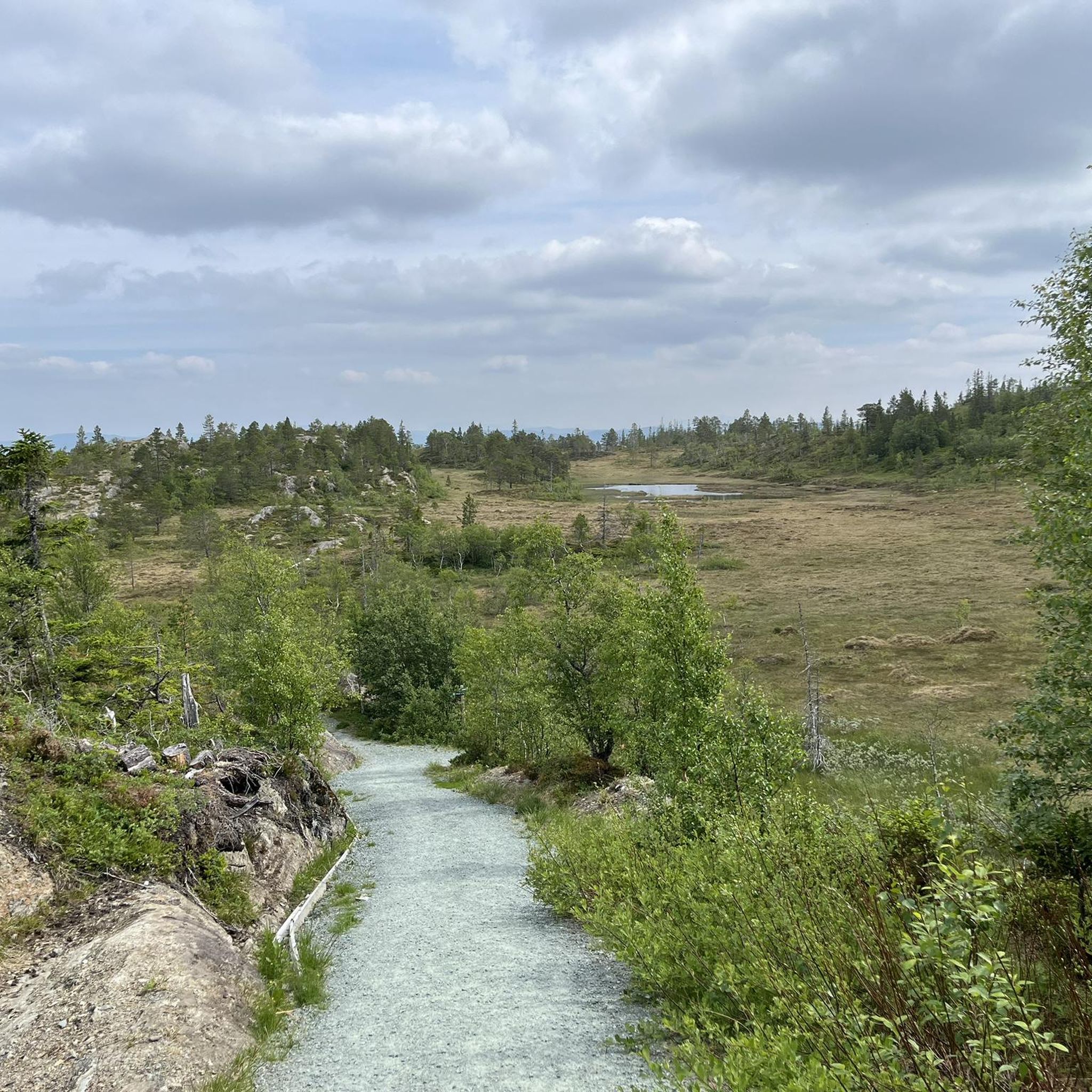
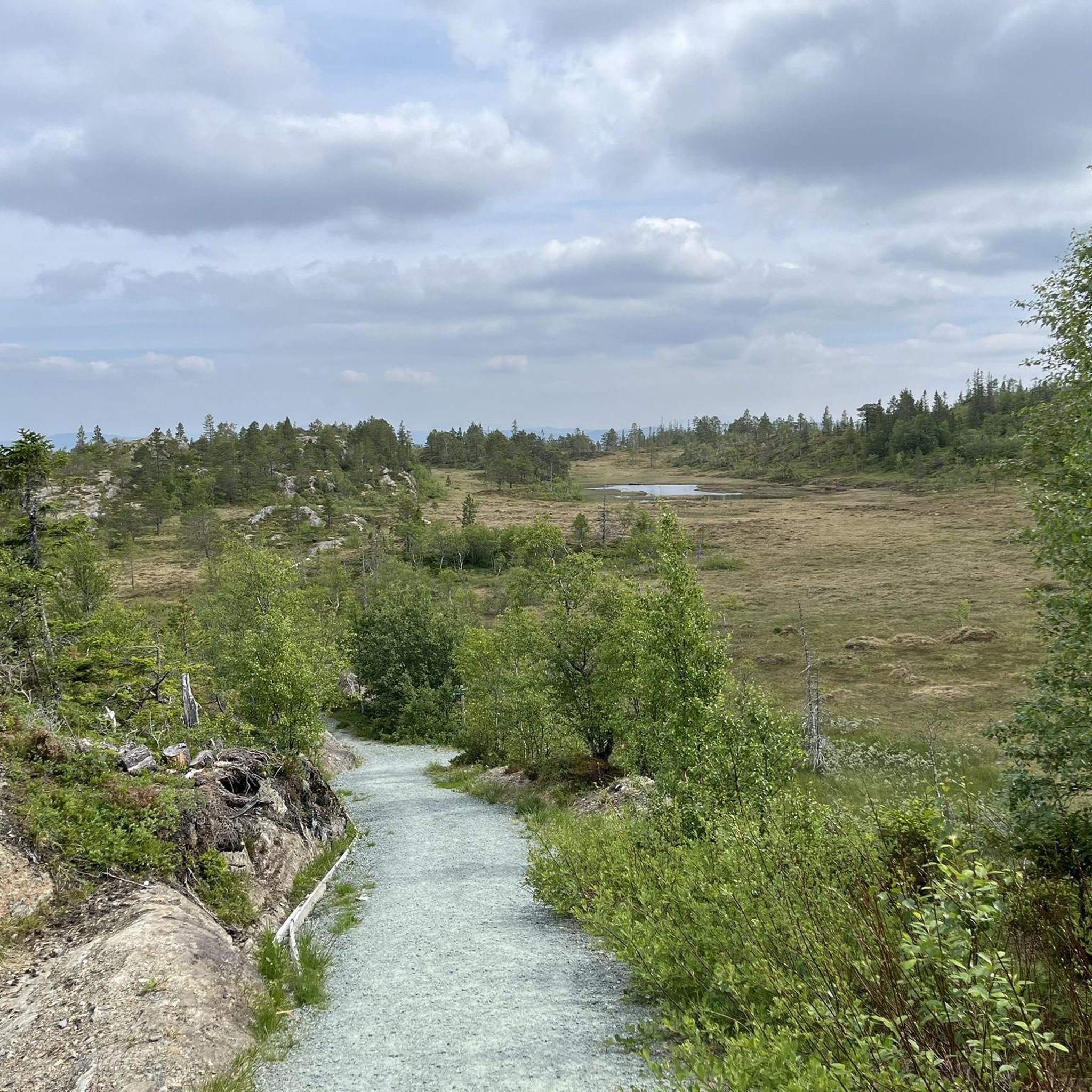
Whether you’re hiking through the summer greenery or gliding through a winter wonderland, Migtjønna Lake is a fantastic year-round hiking destination. The route follows a well-maintained tractor road and a clearly defined path, making for an easy and enjoyable walk. Once you arrive, you’ll find a brand-new shelter perfectly situated by the water—an ideal spot to rest and refuel. You can enjoy your packed lunch under cover or take advantage of the fire pit for a cozy outdoor break.
0
0

No special skills required. Hard to reach on foot in winter (thanks to the snow).
2
0
Frequently Asked Questions
How many hiking trails are available around Hammervatnet?
There are over 10 hiking trails around Hammervatnet, offering various experiences for different skill levels. In total, komoot lists 13 routes in the area.
What are the different difficulty levels for hiking trails in the Hammervatnet area?
The trails around Hammervatnet range from easy to difficult. You'll find 3 easy routes, 9 moderate routes, and 1 difficult route, ensuring options for various fitness levels.
Are there any easy hikes suitable for beginners or families around Hammervatnet?
Yes, there are several easy routes. For a pleasant walk through cultural landscapes, consider the Hiking loop from Lobakken, which is 1.8 miles (2.9 km) long and typically takes about 51 minutes.
What kind of natural features can I expect to see while hiking around Hammervatnet?
Hiking around Hammervatnet offers diverse scenery. You'll encounter the serene lake itself, which features two islands, Innerøya and Ytterøya. The eastern part of the lake is a nature reserve with swamp forests of alder and mixed forests with rowan. The trails also traverse open cultural landscapes and dense forests.
Are there any circular hiking routes in the Hammervatnet region?
Yes, many routes around Hammervatnet are circular. A popular moderate option is the Faarahøgda loop from Hopla mikrokraftverk, a 3.0-mile (4.8 km) trail offering views of forested hills. Another is the Stokkvola – Stokkvola Midway Point loop from Møssingdalen, a 4.2-mile (6.7 km) path through varied terrain.
What is the best time of year to go hiking around Hammervatnet?
The Hammervatnet area is suitable for outdoor activities throughout the year. While specific hiking conditions vary, the warmer months offer lush landscapes. In winter, the frozen lake becomes a popular spot for ice fishing, and the surrounding areas can be explored for winter walks, though specific winter hiking trails may require checking local conditions.
Are there any longer or more challenging hikes for experienced hikers?
For experienced hikers seeking a challenge, the Svartåsen – Stokkvola Midway Point loop from Fossingtrøa is a difficult 10.9-mile (17.6 km) route with significant elevation gain, providing a more demanding experience.
What do other hikers say about the trails in Hammervatnet?
The trails in Hammervatnet are highly rated by the komoot community, with an average score of 4.9 stars from over 8 reviews. Hikers often praise the serene lake views, diverse forests, and the variety of terrain available for exploration.
Is there parking available near the hiking trailheads?
The Hammervatnet area is relatively accessible, with its proximity to the village of Åsen and the European route E6 highway. While specific parking details for each trailhead are not universally listed, routes often start from locations like Hopla mikrokraftverk or Møssingdalen, where parking is typically available for hikers.
Can I bring my dog on the hiking trails around Hammervatnet?
Generally, dogs are welcome on hiking trails in Norway, provided they are kept on a leash, especially during certain times of the year to protect wildlife. It's always advisable to check local regulations or signage at specific trailheads regarding dog policies.
Are there any facilities or accommodation options near Hammervatnet?
While specific cafes or pubs directly on the trails are not noted, the nearby village of Åsen would offer basic amenities. Accommodation near the lake emphasizes a quiet, nature-focused stay, catering to those who appreciate the serene environment.
Are there any hikes that lead to other lakes or bodies of water besides Hammervatnet?
Yes, some routes in the area explore beyond Hammervatnet. For example, the Migtjønna Lake from Kjølåskorsen is a moderate 5.0-mile (8.1 km) hike that takes you to another scenic lake.
Most popular routes around Hammervatnet

Get inspired with the komoot mobile app


Explore more
Browse the best Hikes in other regions.
