The best walks and hikes in Lehigh County
4.6
(33)
578
hikers
63
hikes
Hiking in Lehigh County offers diverse landscapes, characterized by the Blue Mountain to the north and the South and Lehigh Mountains to the south, providing varied terrain and panoramic views. The region is shaped by the Lehigh River and its tributaries, such as the Little Lehigh Creek and Jordan Creek, with many trails following these waterways. Extensive forests and woodlands are found in numerous preserves and parks, including Trexler Nature Preserve and South Mountain Preserve. This varied topography provides a range of hiking experiences for all skill levels.
Best hiking trails in Lehigh County
- The most popular hiking route is Little Lehigh Parkway Trail loop — Lehigh Parkway, a 6.2 miles (10.0 km) trail that takes 2 hours 34 minutes to complete. This moderate route follows the Little Lehigh Creek, passing by historic features.
- Another top favourite among local hikers is Leaser Lake Trail loop — Leaser Lake Park, an easy 3.9 miles (6.4 km) path. This trail offers scenic views around Leaser Lake.
- Local hikers also love the Elk Viewing Trail loop — Trexler Nature Preserve, a 2.8 miles (4.5 km) trail leading through woodlands, often completed in about 1 hour 23 minutes.
- Hiking in Lehigh County is defined by mountain ridges, river valleys, and dense woodlands. The network offers options for various ability levels, from easy paths to more challenging routes with significant elevation gain.
- The routes in Lehigh County are highly rated by the komoot community with an average score of 4.5 stars from over 20 reviews. More than 400 hikers have used komoot to explore Lehigh County's varied terrain.
Last updated: August 3, 2026
5.0
(1)
20
hikers
16.7km
04:43
360m
340m
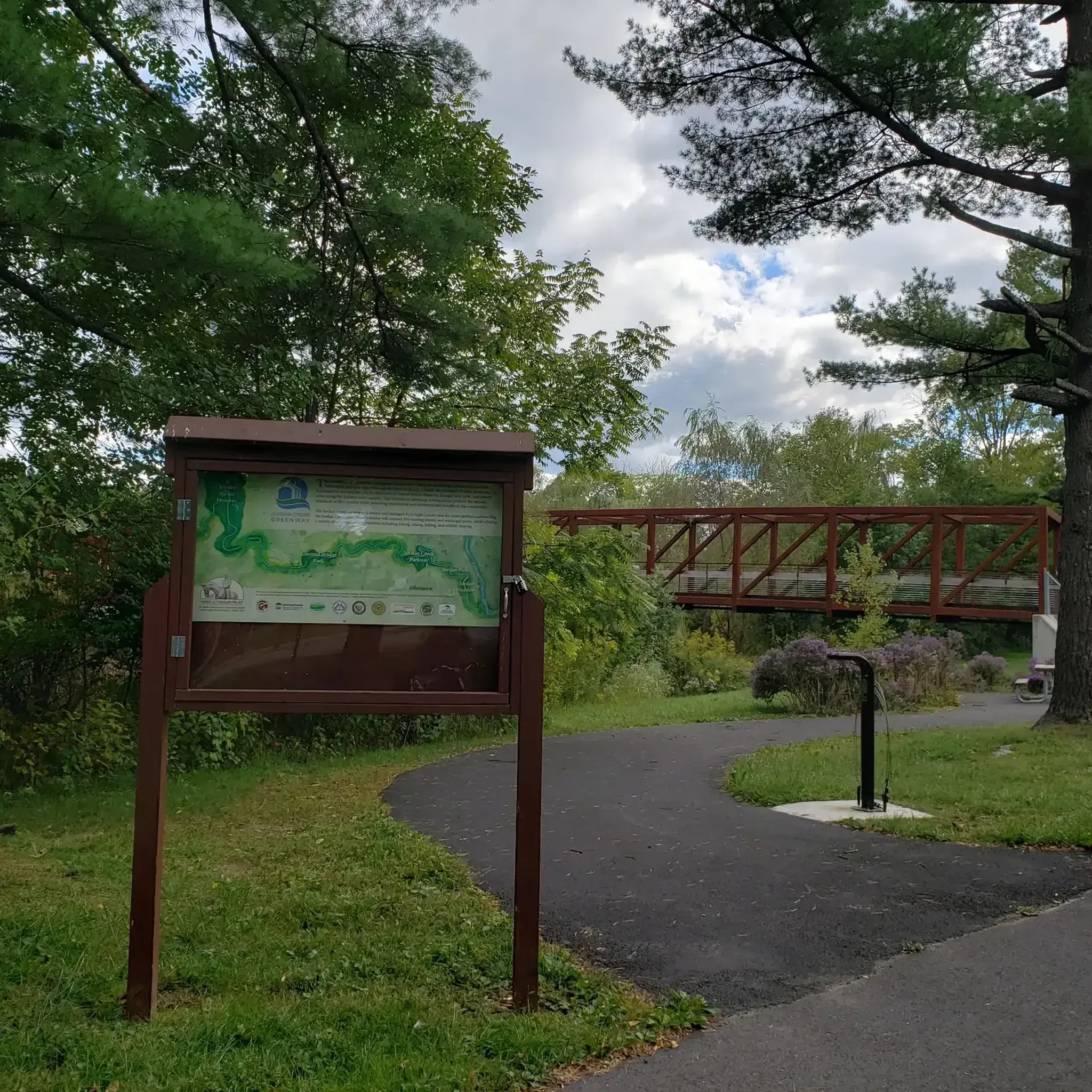
If you're looking for a rewarding hike with diverse scenery, the Trexler Border Trail offers a moderate journey through open hilltop meadows and dense wooded areas, featuring conifer and Eastern Hemlock trees. This 10.4-mile (16.7 km) route presents a steady challenge, with an elevation gain of 1197 feet (365 metres), and typically takes around 4 hours and 43 minutes to complete. As you hike, you'll enjoy constant views of eastern Pennsylvania river valleys and pass over a picturesque covered bridge crossing Jordan Creek, adding a charming touch to your adventure.
When planning your visit, remember that the trail is dog-friendly, but your furry companion must remain on a leash at all times. Be aware that a section of the route passes through authorized hunting grounds; it's a good idea to wear fluorescent colors, and blaze orange fabric strips are often available on hunting days for added safety. You will find helpful amenities along the way, including benches for rest, large maps to guide you, and clear mileage markers to track your progress.
Beyond the varied landscapes, the Trexler Border Trail offers a unique opportunity to observe wildlife. Keep an eye out for bison and elk at the Trexler Nature Preserve Bison Viewing Area, a distinctive feature that sets this trail apart. In spring and summer, the route comes alive with vibrant wildflowers, enhancing the natural beauty of your hike. This trail provides a comprehensive outdoor experience, blending natural beauty with practical amenities for a memorable day out.
5.0
(1)
17
hikers
8.09km
02:51
360m
160m
Embark on the Bypass and Woodpecker Trail Loop, a moderate hike that takes you through diverse natural ecosystems within the Lehigh Gap Wildlife Refuge. This route covers 5.0 miles (8.1 km) and involves a significant elevation gain of 1186 feet (361 metres), offering a solid workout. You can expect to complete this journey in about 2 hours and 50 minutes, exploring both forested sections and open areas as you go.
When planning your visit, remember to check local conditions, especially after rain, as some sections might become muddy or slippery. Parking is generally available near the trailheads within the Lehigh Gap Wildlife Refuge, making access straightforward. Always bring enough water and wear appropriate footwear to ensure a comfortable and safe hiking experience on this trail.
Keep an eye out for local wildlife, particularly birds, as the trail's name suggests excellent birdwatching opportunities. The path itself offers a dynamic experience, transitioning between well-maintained sections and more natural, rooty terrain. This loop provides a great way to immerse yourself in the varied landscapes of the refuge.

Sign up for free
7
hikers
10.7km
03:42
200m
200m
Embark on a moderate hike along Bear Rocks via Appalachian Trail, a route that spans 6.6 miles (10.7 km) and involves a total elevation gain of 641 feet (195 metres). You can expect to complete this journey in about 3 hours and 42 minutes. The trail offers a diverse landscape, moving from relatively flat stretches to rugged, rocky sections. As you ascend, you will encounter thickets of laurel and hemlock, leading to the highlight: a challenging rock scramble to the summit of Bear Rocks. From there, you are treated to expansive, 360-degree views of the Lehigh Valley. Further along, P's Peak provides another stunning southward vista.
You can begin your adventure from the parking lot for Bake Oven Knob, located along Bake Oven Road in Germansville, Pennsylvania. Since the trail crosses State Game Lands #217, it is important to wear bright orange clothing during hunting season for your safety. While the route is generally accessible, be prepared for rock scrambles at Bear Rocks and Knife's Edge, which require careful navigation. Plan your visit to allow ample time for these more challenging sections.
This trail is notable for its dramatic rock formations and panoramic overlooks, offering a true sense of wilderness within State Game Land 217. Beyond the immediate views, during colder months, the absence of foliage reveals distant ridges and rolling farmlands, adding another layer to the scenic experience. The combination of varied terrain and rewarding vistas makes this a popular choice for hikers seeking a fulfilling outdoor excursion.
6
hikers
9.69km
02:47
280m
160m
Embark on the Alpine St, Uplands, and Log Trail Loop, a moderate hike spanning 6.0 miles (9.7 km) with an elevation gain of 920 feet (280 metres). You can expect to complete this journey in about 2 hours and 46 minutes. The route takes you through a heavily forested landscape, offering diverse natural features and varied terrain. Along the Alpine Street section, you will discover babbling brooks, impressive glacial boulders, and towering tulip poplars. The Uplands Trail provides scenic views, while the Log Trail is notable for its extensive communities of spring flowers like Mayapple. Keep an eye out for local wildlife, including deer and various bird species, as you explore.
The South Mountain Preserve, where this loop is located, is easily accessible if you are coming from Emmaus, Pennsylvania. Parking is generally available at the trailheads, but it is always wise to check local signage upon arrival to confirm. If you plan to bring your canine companion, dogs are welcome on the trails; however, please ensure they remain on a leash throughout your hike. This ensures a safe and enjoyable experience for everyone on the path.
This trail offers a varied experience within the Wildlands Conservancy South Mountain Preserve, making it a popular choice for outdoor activities. The heavily forested environment provides a refreshing escape, with sections like the Alpine Street Trail showcasing unique boulder formations. The Log Trail's spring flower displays add a seasonal highlight, distinguishing this route from others in the region. It is a great way to immerse yourself in the natural beauty of the preserve.
5.0
(1)
6
hikers
4.15km
01:04
20m
10m
The Sherwood Forest, Bones, and North Side Path Trail Loop offers a delightful, low-key escape into nature, perfect for when you need a quick refresh. You'll wander through pleasant wooded areas, possibly encountering historic stone walls and varied forest terrain, characteristic of trails in the Sherwood Forest region. This easy hiking route is a gentle 2.6 miles (4.1 km) with just 59 feet (18 metres) of elevation gain, making it accessible for almost anyone and completable in about 1 hour and 3 minutes.
Planning your visit to the Sherwood Forest, Bones, and North Side Path Trail Loop is straightforward; it's a great option for a spontaneous outing. While specific parking information isn't readily available, arriving earlier in the day is always a good strategy, especially on weekends. The trail is enjoyable in most seasons, but spring and fall provide particularly comfortable temperatures and vibrant scenery. Remember to bring water, even for this shorter distance, and wear sturdy shoes as some sections might be damp or rocky.
This loop is an excellent choice for beginner hikers, families, or anyone looking for a peaceful walk without a strenuous climb. The name 'Sherwood Forest' often evokes images of ancient woodlands, and while specific details for this combined loop are scarce, you can expect a tranquil, natural setting. It's a wonderful way to experience the outdoors without committing to a long or challenging expedition.
6
hikers
1.94km
00:30
10m
10m
The Rodale Cycle and Fitness Trail offers a pleasant blend of paved and natural surfaces, winding through peaceful pine woodlands and open areas. This easy 1.2-mile (1.9 km) loop, with just 20 feet (6 metres) of elevation gain, provides a quick escape into nature, taking around 29 minutes to complete. You'll encounter the serene Trexlertown Pines and a wetlands boardwalk, offering a tranquil ambiance for your stroll.
Parking is readily available at the 103-acre Bob Rodale Cycling and Fitness Park, making access straightforward. The trail is dog-friendly, so your leashed companion can join you. It's a multi-use facility, so expect to share the path with cyclists and inline skaters, but separate lanes help manage the flow. This makes it a great option for a casual walk at almost any time.
Beyond the trail itself, the park is notable for its proximity to the Valley Preferred Cycling Center, a renowned velodrome and US Olympic Training Facility. The park also features playgrounds, soccer fields, and basketball courts, making it a comprehensive recreational hub. This diverse environment adds an interesting backdrop to your easy hike.
5
hikers
2.12km
00:33
10m
10m
The Creamery Park Loop offers a delightful, easy stroll through 56 acres of open green spaces in Alburtis, Pennsylvania. You'll find well-maintained walking paths that wind past sports fields, providing a pleasant, unchallenging experience. It's a great option for a quick escape into nature, ideal for those seeking a relaxed outdoor activity rather than a strenuous hike.
Planning your visit to Creamery Park is straightforward, with ample parking available on-site. The trail is accessible throughout the year, though the mild temperatures of spring and autumn make for particularly enjoyable walks. This loop is especially family-friendly, offering a safe and easy environment for all ages to enjoy a bit of fresh air.
Beyond the walking loops, Creamery Park is a community hub, featuring a pavilion with a kitchen and picnic tables, a handicap-accessible ramp, and a 4 Series Fitness Center. You can also find soccer fields and opportunities for fishing, making it a versatile destination for various recreational activities in Lehigh County.
3
hikers
14.7km
05:10
210m
530m
Prepare for a challenging hike on the Appalachian Trail from Bake Oven Knob to Lehigh Gap, a route known for its rugged "Rocksylvania" terrain. You will navigate over small boulders and encounter demanding footing throughout this difficult 9.1-mile (14.7 km) journey. Expect significant elevation changes, with 696 feet (212 metres) of climbing, taking around 5 hours and 10 minutes to complete. The trail rewards your effort with abundant scenic vistas, including a magnificent 180-degree panoramic view of the Lehigh Valley from Bake Oven Knob.
Accessing the start of the Appalachian Trail at Bake Oven Knob is straightforward, with a nearby parking lot available for your convenience. Be aware that the descent into Lehigh Gap is particularly challenging and can become very slippery, especially if conditions are wet or icy. If you are hiking in adverse weather, a specific "Winter Trail" bypass offers an alternative to the steepest section. Remember to plan your water supply carefully, as sources near shelters can sometimes be scarce along this route.
This section of the Appalachian Trail offers a classic example of the demanding, rocky terrain found in this region. The route is situated within State Game Lands 217, providing a wild and undeveloped hiking experience. While the trail is popular, its rugged nature ensures a true wilderness feel. This hike is a great way to experience a significant portion of the Appalachian Trail's unique character in Pennsylvania.
2
hikers
28.4km
07:16
90m
130m
The Ironton Rail Trail offers a substantial hiking challenge, stretching 17.6 miles (28.4 km) through a varied landscape. You will gain 304 feet (93 metres) in elevation over its course, making it a difficult route that typically takes around 7 hours and 16 minutes to complete. As you hike, you will experience peaceful woodlands and follow Coplay Creek, with the impressive 90-foot-high Saylor Cement kilns in Coplay serving as a striking landmark of the region's industrial past.
Planning your visit is straightforward, as the trail features a well-maintained surface of asphalt, fine gravel, or crushed stone, suitable for various users. Parking is generally available at multiple trailheads along the route, offering convenient access points. Since it is a multi-use path, you should expect to share the way with cyclists and runners, creating a lively community atmosphere. This accessible trail welcomes hikers, including those with motorized wheelchairs and dogs on a leash.
This route stands out for its unique blend of natural beauty and rich industrial heritage, showcasing the Lehigh Valley's past. Beyond the scenic woodlands and creek, you will encounter historical markers and ruins that tell the story of the area. The trail serves as a community hub, providing a long and engaging outdoor experience that connects you with both nature and history.
3
hikers
711m
00:11
0m
0m
The North Side Path in Allentown, Pennsylvania, offers an incredibly gentle and brief outdoor escape. This easy hiking route is perfect for those seeking a quick stretch of the legs, covering just 0.4 miles (0.7 km) with a minimal 3 feet (1 metres) of elevation gain. It's a straightforward path designed for accessibility, making it a great option for a casual stroll or a family outing with young children.
Planning your visit to the North Side Path is simple; its short 10-minute duration means you can enjoy it any time of day. There are no specific access restrictions or seasonal closures to worry about. For trailhead access and parking, you'll want to check local Allentown resources, as it's situated within the city.
This particular North Side Path stands out as a convenient, no-fuss option for a moment of fresh air in Lehigh County. While many trails share this name across the US, this Allentown version is notable for its extreme ease and accessibility, providing a quick outdoor break without requiring any significant time commitment or preparation.
Get access to more routes and recommendations from other explorers.
Sign up for free
Already have an account?
Our route recommendations are based on thousands of hikes, rides, and runs completed by other people on komoot.
Start today with a free account
Your next adventure awaits.
Login or Signup




Tips from the Community

This road is a good place to turn around, or you can continue on the Appalachian Trail if you want to extend your hike. There is a parking/staging area here that makes an ideal location for a second vehicle or pick-up spot if you want to end your hike here.
0
0
This viewpoint is your reward for the last mile of rock hopping. It's a spectacular view and a perfect place to take a break and take in the scenery before heading back on the trail.
0
0
This natural preserve is the biggest park in Lehigh County, spanning over 1495 acres with stunning views of the Lehigh Valley. It is an ideal destination for nature lovers, with more than eighteen miles of trails to explore. There are plenty of opportunities for observing wildlife, hiking, walking, cycling, horseback riding, and mountain biking. It's a fantastic place to spend the day on a hike to explore this beautiful area.
0
0

The Wildlands Conservancy South Mountain Preserve spans 350 acres of woodland, featuring hard-packed dirt trails with some rocky sections throughout. This area is home to a wide variety of birds, so keep a lookout for them as you explore the trails.
1
0

The South Mountain Trails are a mix of terrain and difficulty, so worth checking for more info before riding here. The trails are generally packed earth, but are stony in places. It is a beautiful preserve, rich in wildlife and with many large boulders.
1
0

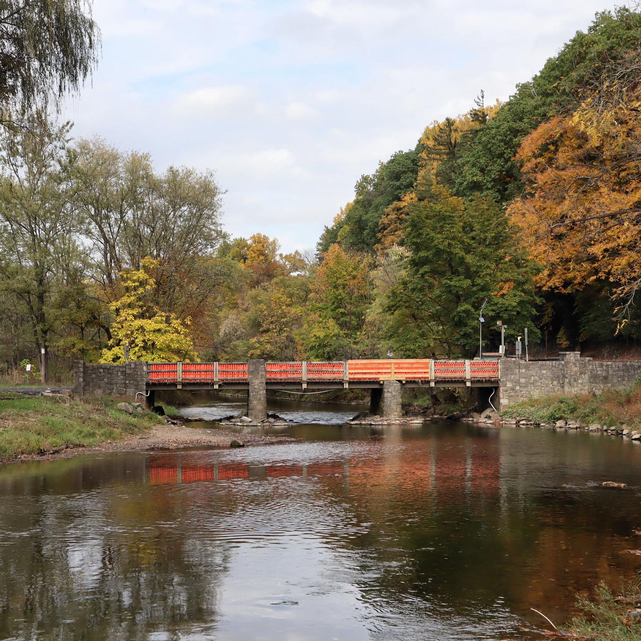
Coplay Creek is a 14-mile creek that runs into the Lehigh River through Lehigh County. There is a bridge here that crosses over Coplay Creek along the paved Ironton Trail.
1
0

The trails here are packed earth with rock gardens and log crossings. They are open and fun for mountain biking. Some of them are more technical than others. There are mostly marked trails but you might want to check a local shop to get more updated information. It takes less than 2 hours normally to ride all of the trails once.
0
0

The Trexler Nature Preserve is a nearly 1,500-acre wildlife preserve that is home to bison, elk, and deer. There are over 15 miles of singletrack trails and double-track paths that are open for hiking and lead to different lookouts and viewpoints of the preserve and surrounding hills.
0
0
Frequently Asked Questions
How many hiking trails are available in Lehigh County?
Lehigh County offers a wide variety of hiking experiences, with over 50 trails recorded on komoot. These range from easy strolls to more challenging routes, catering to all fitness levels. The region's diverse landscape, including mountains, rivers, and dense woodlands, provides a unique backdrop for each adventure.
Are there easy hiking trails suitable for beginners or families?
Yes, Lehigh County has numerous easy trails perfect for beginners, families, or those seeking a relaxed walk. For example, the Leaser Lake Trail loop offers scenic views around the lake, while the Trexler Memorial Park loop provides a gentle path through a beautiful park setting. Many parks, like Trexler Nature Preserve, also feature ADA-accessible trails.
What kind of natural features or landmarks can I expect to see on hikes?
Lehigh County's trails showcase a rich array of natural features. You can find majestic mountains like the Blue Mountain and South Mountain, serene rivers and creeks such as the Lehigh River and Little Lehigh Creek, and dense forests. Highlights include the historic Stone Bridges of Lehigh Parkway, glacial boulders in the South Mountain Preserve, and opportunities to spot bison and elk at Trexler Nature Preserve. Some trails, like those in Lehigh Gorge State Park, even feature waterfalls.
Are there any long-distance or challenging hikes in the area?
For experienced hikers seeking a challenge, Lehigh County offers routes with significant elevation gain and longer distances. The Lehigh Furnace Gap loop via Appalachian Trail is a difficult 16.8 km route with substantial climbing. The region also connects to the extensive 2,200-mile Appalachian Trail and the 165-mile D&L Trail, providing options for multi-day adventures.
Can I bring my dog on the hiking trails?
Many trails in Lehigh County are dog-friendly, but it's always best to check specific park regulations before you go. Generally, dogs are welcome on leash in most state and county parks. Trails like the Little Lehigh Parkway Trail loop are popular choices for walks with canine companions.
Are there any circular or loop hikes available?
Yes, many of Lehigh County's trails are designed as loops, offering varied scenery without retracing your steps. Popular loop options include the Elk Viewing Trail loop at Trexler Nature Preserve and the WPP Red & Blue Trail loop in Lehigh Mountain Park. These provide convenient options for a complete hiking experience.
What do other hikers say about the trails in Lehigh County?
The hiking trails in Lehigh County are highly regarded by the komoot community, with an average rating of 4.5 stars from over 20 reviews. Hikers frequently praise the diverse landscapes, well-maintained paths, and the variety of options available for different skill levels. Many appreciate the peaceful river walks and the rewarding views from the mountain ridges.
Are there trails that follow rivers or creeks?
Absolutely. The Lehigh River and its tributaries, such as the Little Lehigh Creek and Jordan Creek, are central to the county's natural beauty. Many trails run alongside these waterways, offering serene environments. The Jordan Creek Greenway and the Monocacy Way are excellent examples of trails that provide picturesque riverside walks.
What is the best time of year to hike in Lehigh County?
Lehigh County offers great hiking opportunities year-round. Spring brings lush greenery and blooming wildflowers, while summer is ideal for shaded forest trails. Autumn is particularly stunning, with vibrant fall foliage across the mountains and valleys. Even winter hiking can be rewarding, offering crisp air and unique snowy landscapes, though some trails may require appropriate gear.
Are there any parks with extensive trail networks in Lehigh County?
Lehigh County is home to several parks and preserves with extensive trail networks. Trexler Nature Preserve boasts over 12 miles of trails, while Lehigh Parkway features more than seven miles along the Little Lehigh Creek. Other notable areas include South Mountain Preserve and Jacobsburg State Park, all offering a wide range of hiking experiences.
Where can I find parking for trailheads?
Most major parks and preserves in Lehigh County, such as Trexler Nature Preserve, Lehigh Parkway, and Leaser Lake Park, offer designated parking areas near trailheads. For specific routes, komoot tours often provide details on starting points and available parking. For example, Cedar Beach Park is a common starting point for trails in Allentown.
Most popular routes in Lehigh County
Most popular attractions in Lehigh County

Get inspired with the komoot mobile app


Didn’t find what you were looking for?
Check out more Hikes throughout Lehigh County below and find the perfect route in your destination.
Explore more
Browse the best Hikes in other regions.
