The best MTB trails in Albany County
5.0
(2)
213
riders
12
rides
Mountain biking in Albany County offers diverse terrain across its parks and preserves. The region features the Helderberg Escarpment, providing panoramic views, and the unique Albany Pine Bush Preserve with its sandy trails. Multi-use paths like the Albany County Helderberg-Hudson Rail Trail and sections of the Erie Canalway Trail offer varied riding experiences. The landscape includes a mix of forested areas, open spaces, and trails with moderate climbs and technical sections.
Best mountain bike trails in Albany County
- The most popular mountain bike trail is Happy Jack loop, a 10.5 miles (16.9 km) trail that takes 2 hours 38 minutes to complete. This challenging route features significant elevation gain through varied terrain.
- Another top favourite among local mountain bikers is Medicine Bow Rail Trail, a moderate 24.5 miles (39.5 km) path. This longer trail offers a steady ride with gentle elevation changes, suitable for endurance.
- Local mountain bikers also love the Turtle Rock Loop Trail, a 2.8 miles (4.5 km) trail leading through natural landscapes, often completed in about 25 minutes.
- Mountain biking in Albany County is defined by escarpments, pine barrens, and multi-use rail trails. The network offers options for different ability levels, from easy loops to more technical singletrack.
- The routes in Albany County are highly rated by the komoot community with an average score of 5.0 stars from 1 review. More than 200 mountain bikers have used komoot to explore Albany County's varied terrain.
Last updated: August 17, 2026
3
riders
16.9km
02:38
390m
390m
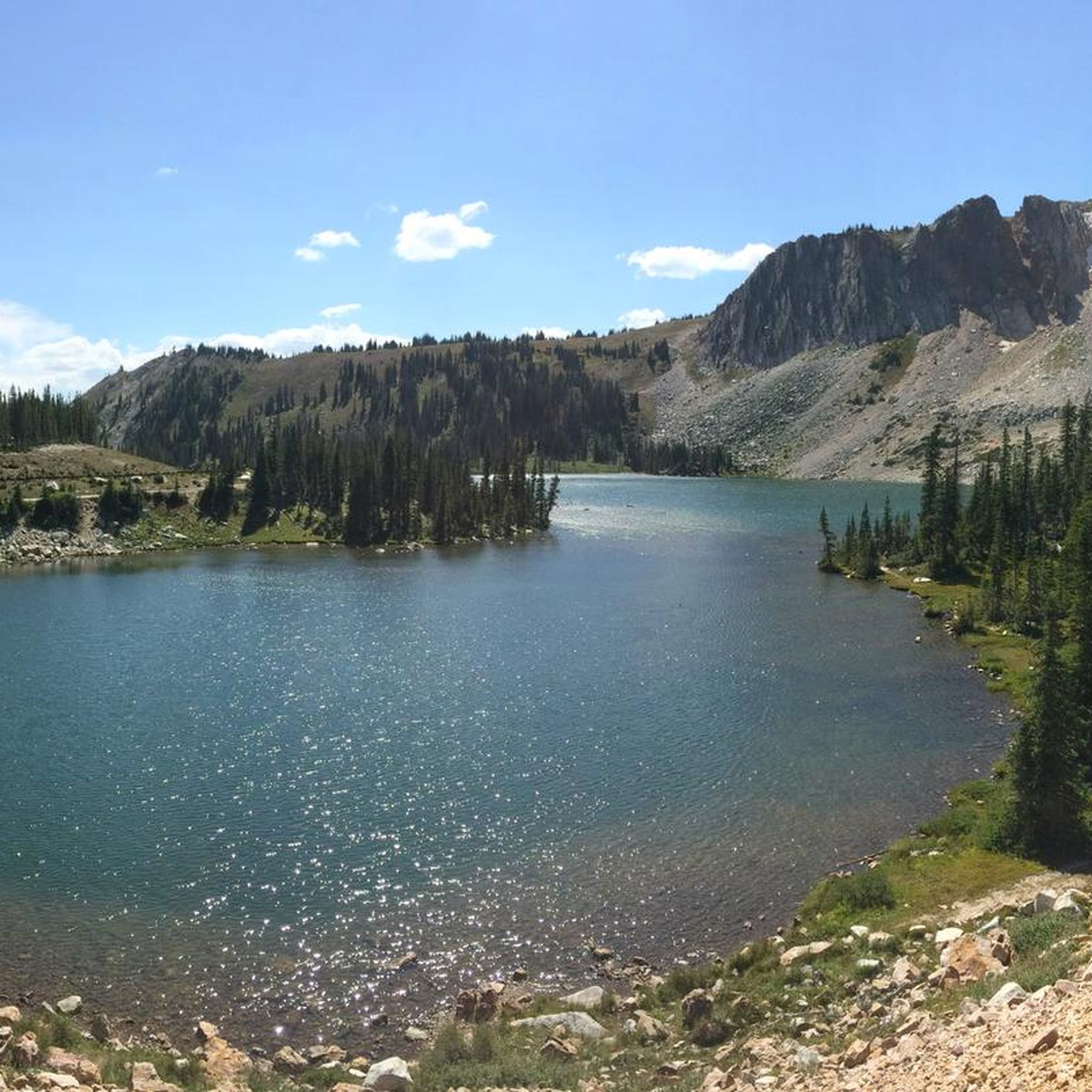
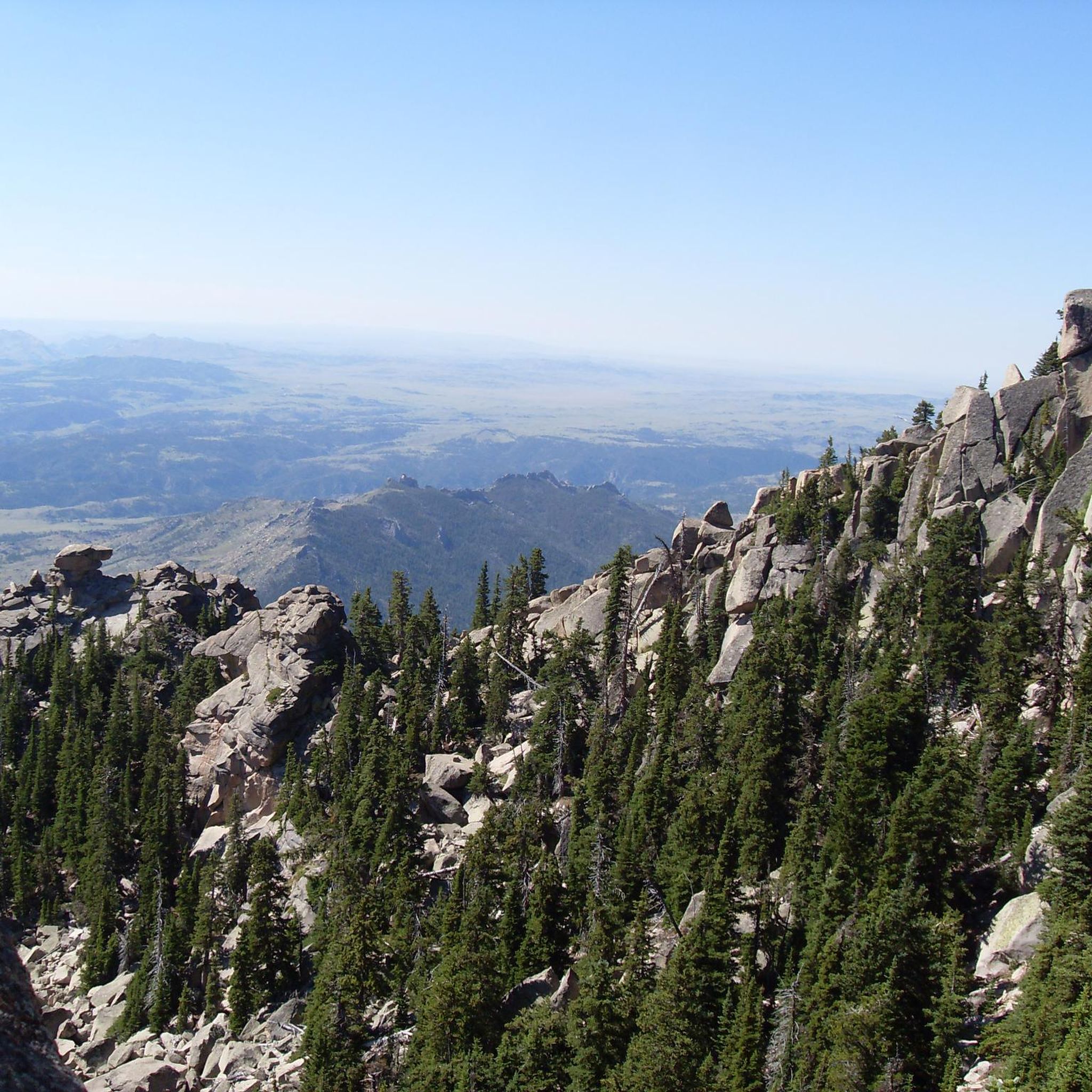
Embark on the Happy Jack loop, a challenging mountain biking route spanning 10.5 miles (16.9 km) with a significant 1269 feet (387 metres) of elevation gain. This difficult ride, estimated to take around 2 hours and 38 minutes, guides you through beautiful aspen groves and high desert meadows. From the Headquarters Overlook, you can enjoy impressive panoramic vistas across I-80, stretching to the mountains in both Colorado and Wyoming, making the effort worthwhile.
When planning your mountain biking trip, be aware that the trails are typically rideable from late May to late October. This timing depends heavily on snow conditions, so you should always check local Happy Jack trail conditions by month before you go. The area is a popular multi-use trail system, so you will likely encounter others enjoying the outdoors.
This route is nestled within the scenic Medicine Bow National Forest, offering a true taste of Wyoming's natural beauty. As you mountain bike, keep an eye out for wildlife, including moose, especially near the beaver ponds along Old Happy Jack Road. These natural features add a unique element to your adventure on the Happy Jack loop.
2
riders
4.52km
00:25
80m
70m
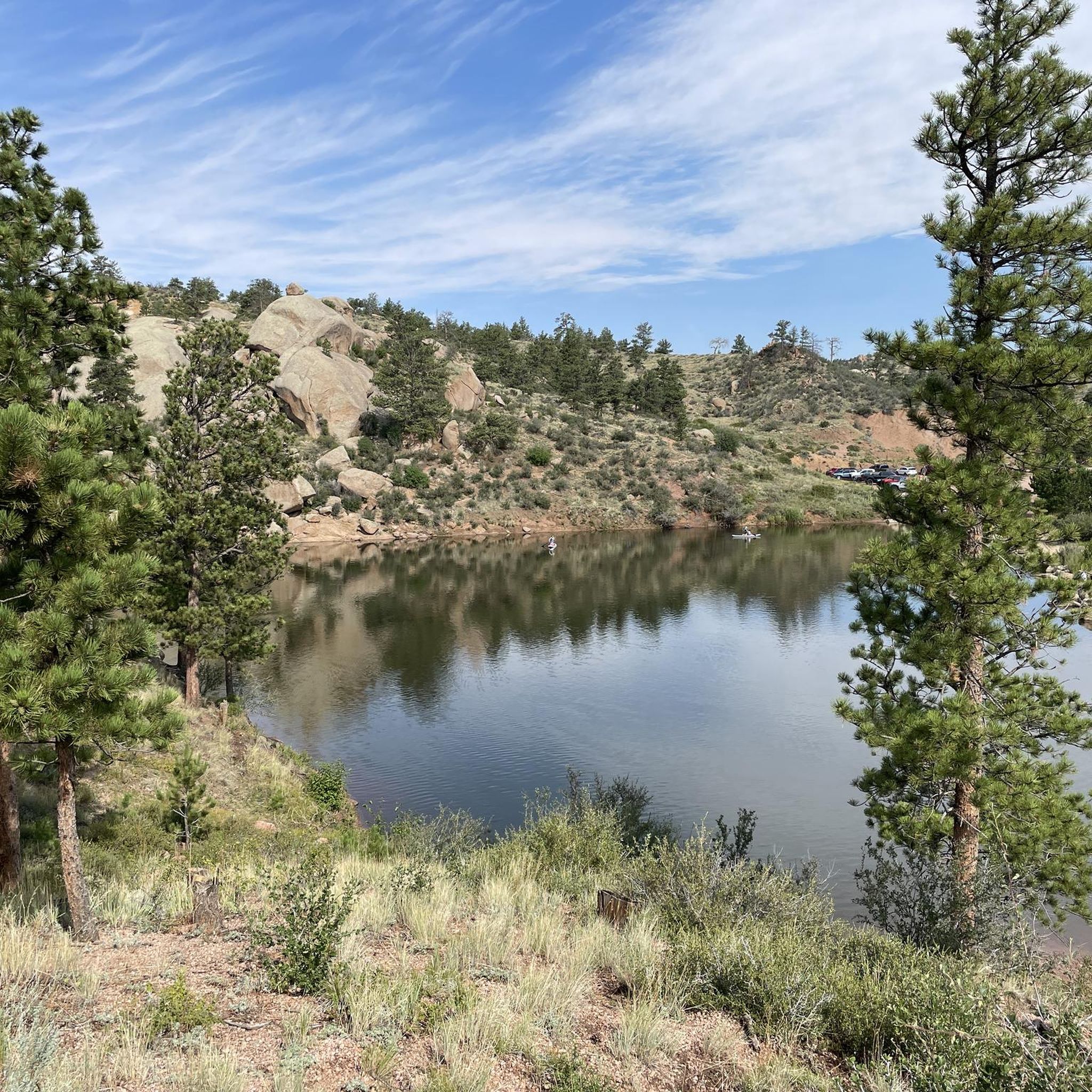
The Turtle Rock Loop Trail offers an easy mountain biking experience, winding 2.8 miles (4.5 km) through the Medicine Bow-Routt National Forest. You'll navigate among wild granite formations, with the route looping around the iconic Sherman Granite outcropping that resembles a turtle. This 24-minute ride involves gaining 246 feet (75 metres) of elevation, making it a quick and accessible option. Expect to ride through pine trees and aspens, passing beaver ponds along the way. Some sections feature rocks, roots, and even downed trees, adding to the natural feel.
Planning your visit to the Turtle Rock Loop Trail is straightforward, but keep a few things in mind. Parking is generally available at the trailhead, making access convenient for most riders. This trail is very popular, especially during summer weekends, so be prepared to share the path with hikers and trail runners. To avoid crowds, consider an early morning ride or visiting on a weekday. Always check local conditions before heading out, as mountain weather can change rapidly and impact your experience.
This route is sometimes called a 'bike roller coaster' by riders due to its undulating nature. The trail's name comes from the distinctive Sherman Granite outcropping, which truly looks like a turtle. You'll find yourself riding through varied scenery, including dense pine forests, vibrant aspens, and serene beaver ponds. It's a great choice if you are looking for a quick ride to explore the area and enjoy the unique geology.

Sign up for free
39.5km
03:15
160m
160m
Embark on a moderate mountain biking adventure along the Medicine Bow Rail Trail, a 24.5 miles (39.5 km) route that takes about 3 hours and 14 minutes to complete. You will gain 529 feet (161 metres) in elevation as you pedal through the remote and rugged Medicine Bow-Routt National Forest. Expect varied forest landscapes, including areas affected by past burns, and keep an eye out for wildlife like moose. The trail offers a unique high-altitude experience, winding through scenic terrain.
When planning your visit, remember that the trail sits at over 9,000 feet, so be prepared for potential high-altitude sickness and sudden weather changes, including snow at any time of year. While most trailheads provide restrooms, water is generally not available, so bring enough for your ride. If you visit during hunting season, typically October, it is wise to wear orange vests for visibility. The Lake Owen Trailhead serves as a main gateway to the trail.
This route offers a glimpse into the 'Old West' as you traverse national forest land in southeastern Wyoming. The fall season is particularly rewarding, bringing vibrant colors and abundant wildlife to the area. The trail's high elevation and remote setting make it a distinctive option for those seeking a true mountain biking escape in a wild environment.
10.4km
01:11
340m
340m
Embark on the Barber Lake Trail for a moderate mountain biking adventure through Medicine Bow National Forest. This scenic route stretches 6.4 miles (10.4 km) and challenges you with 1107 feet (337 metres) of elevation gain, typically taking about 1 hour and 10 minutes to complete. As you ride, you will follow Libby Creek and pass by the serene Barber Lake, enjoying picturesque views and varied terrain that includes some rocky sections.
To begin your ride, you can access the trail from either the Green Rock Picnic Ground, located on Highway 130, or the Centennial Visitor Center. If you choose to park at the Green Rock Picnic Ground, be aware that a daily use fee might be required. Plan your visit accordingly to ensure a smooth start to your mountain biking experience.
This trail offers more than just a ride; it provides a chance to immerse yourself in the natural beauty of the area. Beyond the immediate views of Libby Creek and Barber Lake, you will also catch glimpses of the majestic peaks of the Snowy Range in the distance. The varied landscape and natural features make this a rewarding outing for mountain bikers looking for a true forest experience.
9.44km
01:00
250m
250m
Embark on the Centennial Ridge Road mountain biking route, an easy 5.9 miles (9.4 km) journey that takes you through the scenic Medicine Bow-Routt National Forest. You will encounter old Forest Service roads, which can be rocky and rutted in places as you ascend, gaining 818 feet (249 metres) in elevation. This ride is estimated to take about 1 hour, offering a straightforward experience where the effort is well rewarded with expansive panoramic views from the top.
To begin your adventure, you can find the trailhead conveniently located across from the USDA Forest Service Visitor Center on Wyoming Highway 130. This spot provides accessible parking, making your arrival and departure smooth. There are no specific permits or fees mentioned for riding this route, so you can focus on enjoying the ride without extra administrative steps.
Beyond the physical challenge, the Centennial Ridge Road offers a unique blend of natural beauty and historical interest. As you reach higher elevations, you can visit the Miner's Cabin, adding a touch of local history to your ride. The route also provides an excellent overlook of Centennial, Wyoming, allowing you to appreciate the varied terrain and the sense of adventure that defines this part of the national forest.
21
riders
24.5km
03:16
500m
490m
Hard mountain bike ride. Good fitness required. Advanced riding skills necessary. Some portions of the route may require you to push your bike.
4.5
(2)
18
riders
42.8km
04:35
780m
780m
Hard mountain bike ride. Good fitness required. Advanced riding skills necessary. Some portions of the route may require you to push your bike.
8
riders
29.8km
02:35
470m
470m
Moderate mountain bike ride. Good fitness required. Advanced riding skills necessary.
Get access to more routes and recommendations from other explorers.
Sign up for free
Already have an account?
Our route recommendations are based on thousands of hikes, rides, and runs completed by other people on komoot.
Start today with a free account
Your next adventure awaits.
Login or Signup
Tips from the Community

The University of Wyoming sits at an elevation of 7,220 feet above sea level, making it one of the highest-altitude universities in the United States, mostly rivaling Colorado schools. The mascot is "Pistol Pete", very fitting with Wyoming's cowboy and railroad history. The most notable thing about this school is that the student-to-faculty ratio is about 15:1, and the school spans over 785 acres.
0
0
If you didn't know this was here, there is a chance you would roll right past it. Sheran Summit is a nice rest stop, home to the Abraham Lincoln Memorial Monument, Robert and Adele Russin honor plaques, lots of covered picnic spaces, clean restrooms, and more. It's a great pit stop on a long ride.
0
0

The network of trails you're entering is very popular with mountain bikers, but it's great for runners and hikers too. It's possible to put together an almost endless combination of trail loops here, but watch out for rocks and sometimes tree roots underfoot. The forested trails have lots of wildflowers in season, and occasional openings in the trees where you can enjoy some great vistas.
1
0
The network of trails you're entering is very popular with mountain bikers, but it's great for hikers and runners too. It's possible to put together an almost endless combination of trail loops here. The forested trails have lots of wildflowers in season, and occasional openings in the trees where you can enjoy some great vistas.
1
0
This popular trail isn't a hard run as such, but it is made more challenging than it seems at first due to the presence of lots of rocks and roots and even the occasional fallen tree in the trail, and lots of other trail users including walkers and mountain bikers. The centerpiece of the loop is an iconic outcropping of Sherman Granite that does look a bit like a turtle when viewed from the right angle.
1
0
This easy — and very popular — trail loops around an iconic outcropping of Sherman Granite that does look a bit like a turtle when viewed from the right angle. Watch for lots of rocks, roots, and even the occasional downed tree. Although this is a popular spot for mountain biking you'll see lots of hikers and trail runners here too, so please take care and be respectful of other trail users.
1
0
This easy — and very popular — hiking trail loops around an iconic outcropping of Sherman Granite that does look a bit like a turtle when viewed from the right angle.
2
0
Barber Lake's roadside access makes it a great place to start, stop, or turn around on a ride along the nearby Barber Lake Trail (sometimes also called the Libby Creek Trail, since it ties in to the trail of that same name). If you start your ride here you can power up the trail's consistent elevation gain, then pretty much coast on the way back. Or you can make a loop by riding one way on Barber Lake Road. Barber Lake Trail, itself, is fun single and double track. Believe it or not, this is a great place for spotting butterflies too. Keep an eye out for species like the hoary anglewing and the green comma if you pause in your ride.
1
0
Frequently Asked Questions
What kind of terrain can I expect on mountain bike trails in Albany County?
Albany County offers a diverse range of terrain for mountain biking. You'll find everything from the unique sandy surfaces of the Albany Pine Bush Preserve, which dry quickly and offer a distinct riding experience, to multi-use trails with moderate climbs and fun downhill sections. The region also features more technical singletrack trails with rocky features, berms, and rollers, particularly in parks like Colonie Town Park.
Are there mountain bike trails suitable for beginners in Albany County?
Yes, Albany County has several trails suitable for beginners. For instance, the Heart Lake Trail is an easy 3.5-mile route, and the Centennial Ridge Road offers an easy 5.9-mile ride. The Albany Pine Bush Preserve also features 18 miles of well-marked trails suitable for various levels, including easier sections.
Where can I find more challenging mountain bike trails in Albany County?
For more challenging rides, Albany County offers several difficult trails. The Happy Jack loop is a demanding 10.5-mile route with significant elevation gain. Another difficult option is the Pilot Hill Recreation Area loop from University of Wyoming, which spans over 17 miles.
Are there any mountain bike trails with scenic views or natural landmarks in Albany County?
Absolutely. John Boyd Thacher State Park is renowned for its spectacular panoramic views of the Hudson-Mohawk Valleys, the Adirondack Mountains, and the Green Mountains of Vermont. You can also encounter waterfalls within the park. The Albany Pine Bush Preserve offers a unique ecological landscape. For specific landmarks, consider visiting Libby Flats Observation Point or exploring trails near Medicine Bow Peak.
Can I find family-friendly mountain biking options in Albany County?
Yes, Albany County provides family-friendly options. The Albany County Helderberg-Hudson Rail Trail is a 9-mile paved path suitable for biking, offering a smooth and scenic ride. Sections of the Erie Canalway Trail (Mohawk-Hudson Bikeway) also provide accessible, scenic rides along the rivers, perfect for families.
Are there any loop mountain bike trails in Albany County?
Yes, there are several loop trails available. The Happy Jack loop is a popular 10.5-mile option. Another shorter loop is the Turtle Rock Loop Trail, which is 2.8 miles long and often completed in about 25 minutes. The Pilot Hill Recreation Area loop from University of Wyoming also offers a substantial loop experience.
What is the best time of year for mountain biking in Albany County?
The best time for mountain biking in Albany County generally spans from spring through fall. The Albany Pine Bush Preserve's sandy trails dry out quickly, making it a good option even after some rain. Always check local trail conditions, especially after heavy rainfall, as some areas like Colonie Town Park can be prone to holding water.
Are there any places to explore or attractions near the mountain bike trails?
Beyond the trails, Albany County offers several attractions. You can visit Lookout Lake or explore the area around Laramie Peak. Grafton Lakes State Park, while not exclusively for mountain biking, offers 25 miles of trails, access to six ponds, and swimming opportunities, making it a great spot for post-ride relaxation.
What do other mountain bikers enjoy most about mountain biking in Albany County?
The mountain biking experience in Albany County is highly rated by the komoot community, with an average score of 5.0 stars. Riders often praise the diverse terrain, from the unique pine barrens to scenic multi-use paths, and the variety of options catering to different skill levels, from easy loops to challenging singletrack.
Are there any long-distance mountain bike routes in Albany County?
Yes, for those seeking longer rides, the Medicine Bow Rail Trail is a moderate 24.5-mile path offering a steady ride with gentle elevation changes. Another significant option is the Bennet Hill – Happy Jack Trail Area loop from Point Crawford, which covers over 26 miles.
Are dogs allowed on mountain bike trails in Albany County?
While specific regulations can vary by park and trail, many multi-use trails in Albany County are dog-friendly, provided dogs are kept on a leash. It's always best to check the specific rules for the park or preserve you plan to visit, such as John Boyd Thacher State Park or the Albany Pine Bush Preserve, before heading out with your dog.
Are there mountain bike trails accessible by public transport in Albany County?
The Albany County Helderberg-Hudson Rail Trail and sections of the Erie Canalway Trail (Mohawk-Hudson Bikeway) are designed to connect communities, making them more accessible. While direct public transport access to every trailhead might vary, these multi-use paths often have access points within or near urban areas that are served by local transit.
Most popular attractions in Albany County

Get inspired with the komoot mobile app


Explore more
Browse the best MTB trails in other regions.
