The best road cycling routes in Mohave County
5.0
(4)
486
riders
18
rides
Road cycling in Mohave County features diverse terrain, including scenic desert highways, paved backroads, and sections of Historic Route 66. The region offers routes with views of the Colorado River and ascents into the Hualapai Mountains. Cyclists can navigate open desert vistas and areas with rolling terrain.
Best road cycling routes in Mohave County
- The most popular road cycling route is Lake Havasu Olympic Distance Triathlon loop, a 21.1 miles (34.0 km) trail that takes 1 hour 38 minutes to complete. This easy route offers views of Lake Havasu.
- Another top favourite among local road cyclists is Kingman to Hackberry General Store via Route 66, a moderate 55.6 miles (89.6 km) path. This route follows a historic highway through desert landscapes.
- Local road cyclists also love the Kingman to Hualapai Mountain Park climb, a 26.5 miles (42.7 km) trail leading through the Hualapai Mountains, often completed in about 2 hours 28 minutes.
- Road cycling in Mohave County is defined by scenic desert highways, historic Route 66, and routes along the Colorado River. The network offers options for various ability levels, from easy loops to challenging mountain climbs.
- The routes in Mohave County are highly rated by the komoot community with an average score of 5.0 stars from over 2 reviews. More than 100 road cyclists have used komoot to explore Mohave County's varied terrain.
Last updated: October 24, 2026
20
riders
34.0km
01:38
200m
200m
Embark on an easy road cycling journey around Lake Havasu, covering 21.1 miles (34.0 km) with a manageable 649 feet (198 metres) of elevation gain. This loop, designed for the Olympic Distance Triathlon, offers picturesque views of the lake and the Arizona landscape. You will cycle along London Bridge Road, catching glimpses of the iconic London Bridge, and experience rolling sections with some short, steep climbs in the Crystal Beach residential area, all under clear blue skies. Expect to complete this route in about 1 hour and 37 minutes.
To begin your ride, parking is typically available at the south state park entry/exit, which also serves as the starting point for the loop. Be aware that the road surfaces can be rough in places, with sections of sun-baked, cracked asphalt, and sand may occasionally blow onto the road. Always check local conditions before you head out, especially concerning weather, to ensure a safe and enjoyable road cycling experience.
This route is notable for its connection to the Olympic Distance Triathlon, allowing you to experience a course used by athletes. As you reach some of the higher points, you will be rewarded with panoramic vistas that stretch across Lake Havasu and into California. The blend of scenic beauty and a well-defined course makes this a distinctive ride in the region.
11
riders
17.9km
01:15
380m
380m
If you're after a road cycling route that delivers big on views without demanding too much, the Historic Railroad Trail Loop is a fantastic choice. You'll ride along an old railroad bed, enjoying continuous panoramic vistas of Lake Mead and Boulder Basin, all while passing through five impressive historic tunnels. The trail's surface is mostly hard-packed gravel, making for a smooth ride through the desert landscape, where you might even spot bighorn sheep.
Planning your visit means keeping the desert heat in mind; this trail is within the Lake Mead National Recreation Area, so an entrance fee is usually required. To avoid the scorching summer temperatures, aim for cooler morning or evening rides, or consider visiting outside of peak summer. Always bring plenty of water, as shade is scarce, especially at the start of the route.
This moderate 11.1-mile (17.9 km) loop, with 1245 feet (379 metres) of elevation gain, takes about 1 hour and 15 minutes to complete, making it accessible for most skill levels. The route's historical significance, as it once transported materials for the Hoover Dam, adds an extra layer of interest to the stunning natural scenery and the impressive views of the Hoover Dam and the Mike O'Callaghan–Pat Tillman Memorial Bridge.

5
riders
39.6km
01:50
350m
350m
Embark on a moderate road cycling adventure around Lake Havasu City and its island, offering continuous views of the sparkling lake and distant desert mountains. This 24.6-mile (39.6 km) loop, with a total elevation gain of 1149 feet (350 metres), guides you past the iconic London Bridge and a replica lighthouse. You can expect a smooth ride, especially on the recently resurfaced 3.6-mile island section. The route is designed for racebike enthusiasts and typically takes about 1 hour and 50 minutes to complete, providing a comfortable yet engaging experience. You'll enjoy the unique atmosphere of cycling an island trail with urban and natural scenery blending seamlessly.
Planning your ride is straightforward, with convenient parking options available. You can start your journey from the trailhead located at the intersection of McCulloch Boulevard and Beachcomber Boulevard. Additional parking can also be found at various parks and marinas situated along the route. For your safety and the safety of others, remember that cyclists are required to travel the island loop in a clockwise direction. This ensures a consistent flow and helps prevent head-on encounters on the narrower sections.
This trail stands out for its distinctive island setting, a rare feature for a road cycling route. The presence of the historic London Bridge, relocated and rebuilt here, adds a unique cultural landmark to your ride. Beyond the bridge, the route showcases the blend of desert landscape with the expansive Lake Havasu, creating a scenic backdrop. It's an excellent option if you're looking for a well-maintained path that combines natural beauty with interesting man-made attractions.
5
riders
92.2km
04:14
1,100m
1,100m
Embark on the Kingman to Oatman via Route 66, a difficult racebike route that plunges you into Arizona's iconic desert landscape. This challenging ride covers 57.3 miles (92.2 km) and demands a significant 3600 feet (1097 metres) of elevation gain, typically taking around 4 hours and 14 minutes. You will experience a dramatic shift from flat terrain to a winding ascent through the Black Mountains, offering expansive vistas and unique rock formations as you climb towards Sitgreaves Pass.
Planning your ride requires careful consideration due to the route's demanding nature. The last 15 miles into Oatman are particularly challenging, featuring narrow, winding roads, steep grades, and often a lack of shoulder. Exercise extreme caution, as drivers may have difficulty seeing cyclists on this stretch. The ascent and descent of Sitgreaves Pass demand considerable physical exertion, so ensure you are well-prepared for a strenuous effort.
This route is a journey through a historic and scenic section of America's famous Mother Road. As you crest Sitgreaves Pass, you can enjoy views stretching across three different states before descending into the charming and historic Oatman Ghost Town. Here, you will find yourself amidst the town's famous wild burros, adding a unique touch to the end of your challenging desert adventure.
8
riders
89.6km
03:30
310m
310m
Embark on a moderate road cycling journey from Kingman to the iconic Hackberry General Store, covering 55.6 miles (89.6 km) with an elevation gain of 1006 feet (307 metres). This route takes you through the raw beauty of the Arizona desert, offering expansive views of mountains and unique rock formations. As you pedal, you'll encounter a landscape dotted with vintage motels, classic signs, and other relics that transport you back to the golden age of Route 66. The ride culminates at the Hackberry General Store, a famous museum-store filled with memorabilia, vintage gas pumps, and classic cars, providing a tangible connection to the Mother Road's storied past. Expect to complete this adventure in about 3 hours and 30 minutes.
When planning your ride, you'll find that this segment of Historic Route 66 is primarily a wide, two-lane highway, generally featuring a shoulder suitable for road cycling. Traffic is usually light, contributing to a pleasant experience. It's wise to consider parking options in Kingman before you begin your journey. Be aware that winds can be a significant factor along this high-altitude route, often blowing from west to east, so check the forecast before you set out.
This route offers a unique opportunity to immerse yourself in historic Americana and the enduring legacy of the Mother Road. The Hackberry General Store isn't just a destination; it's a living museum, showcasing the vibrant history of Route 66 through its extensive collection of memorabilia. This journey provides a distinct blend of scenic desert cycling and a deep dive into American cultural heritage, making it a notable experience for any road cyclist.
5
riders
42.7km
02:28
1,000m
1,000m
Embark on the Kingman to Hualapai Mountain Park climb, a challenging road cycling route that takes you from the desert floor to cooler mountain air. This difficult ride covers 26.5 miles (42.7 km) and involves a significant elevation gain of 3274 feet (998 metres), typically completed in about 2 hours and 28 minutes. As you ascend, you will notice the landscape transform from arid desert chaparral to lush Pinyon Pine, Juniper, and Oak forests, eventually leading to towering Ponderosa Pine and Gambel Oak at higher elevations.
When planning your ride, be aware that the roadway is well-paved but lacks a dedicated shoulder for cyclists. Traffic is usually light to moderate at the start of the climb, becoming even lighter as you gain altitude. This route is best enjoyed during cooler parts of the day or year, given the desert starting point. Remember to carry enough water and supplies for the duration of this demanding ascent.
This climb offers more than just a physical challenge; it provides expansive panoramic views of the desert basin below, stretching out to the distant Cerbat Mountains. Your destination, Hualapai Mountain Park, is Mohave County's oldest park, offering a unique natural environment. Keep an eye out for local wildlife, such as deer and elk, especially as you approach the park boundaries.
1
riders
62.0km
02:34
350m
350m
This racebike route takes you on a scenic journey from Colorado City to the unique Coral Pink Sand Dunes State Park. You will cycle through classic desert landscapes, featuring vast open spaces, striking red rock formations, and scattered juniper and piñon pine trees. The 38.5-mile (62.0 km) ride, with its moderate difficulty and 1155 feet (352 metres) of elevation gain, offers a distinct visual shift as you approach the destination, where the landscape transforms into a sea of vibrant red sand.
Plan for a ride lasting around 2 hours and 33 minutes, but be prepared for potential strong winds and extreme temperatures, especially if you are cycling during the summer months. While state highways are generally paved, some remote sections might have variable pavement quality. Also, be aware that the final approach to Coral Pink Sand Dunes State Park on the county road could include unpaved sections with loose sand, and services are minimal along these stretches.
The Coral Pink Sand Dunes are particularly notable for their distinctive hue, which comes from iron oxide present in the Navajo sandstone. Wind erosion has sculpted these dunes into a truly unique natural wonder, making this route a memorable experience. This journey offers a great way to explore the Arizona Strip and southern Utah, culminating in a visit to one of the region's most iconic geological features.
5.0
(1)
1
riders
52.5km
02:15
440m
440m
Embark on a moderate road cycling adventure from Lake Havasu City to Cattail Cove State Park, covering 32.6 miles (52.5 km) with an elevation gain of 1446 feet (441 metres). This route offers a scenic ride that takes approximately 2 hours and 15 minutes to complete. As you pedal, you'll experience sweeping views of Lake Havasu and the surrounding mountains, especially along Arizona Highway 95, with the iconic London Bridge visible near your starting point.
When planning your ride, be aware that Arizona Highway 95 is a main thoroughfare and can experience heavy traffic, particularly on weekends, so exercise caution. The best time to tackle this route is between October and April, when the desert temperatures are most favorable for outdoor activities. You can typically find parking in Lake Havasu City close to the beginning of the route.
This route stands out for its unique blend of desert landscape and vast lake vistas, culminating at Cattail Cove State Park, which provides picturesque lake views and low desert hills. The journey offers a distinct perspective of the region, showcasing both the developed areas around Lake Havasu City and the natural beauty of the Arizona desert.
113km
06:20
1,310m
1,310m
The Willow Beach to Temple Bar Marina road cycling route offers a deep dive into the rugged beauty of the Lake Mead National Recreation Area. You'll pedal through dramatic desert landscapes, encountering colorful rock formations and expansive views that stretch to the horizon. Starting near Willow Beach in the scenic Black Canyon, the route eventually leads you to Temple Bar, where a distinctive rock formation overlooks the vastness of Lake Mead.
This is a difficult 70.0-mile (112.6 km) ride with a substantial 4290 feet (1307 metres) of elevation gain, typically taking around 6 hours and 20 minutes. It's best suited for experienced cyclists with excellent fitness who are prepared for a demanding day. Be sure to carry ample water, as remote sections mean limited access to supplies, and prepare for potential temperature extremes.
This route takes you through the United States' first national recreation area, known for its diverse natural environment. While much of the surface is paved, some segments can be unpaved and difficult, adding to the challenge. E-bikes are allowed on park roads, providing an option to tackle the significant elevation, and amenities like camping and a restaurant await at Temple Bar Marina.
1
riders
111km
04:34
750m
750m
Embark on a racebike journey along a classic stretch of Arizona's historic Route 66, cycling 69.3 miles (111.5 km) from the Hackberry General Store to the Grand Canyon Caverns. This moderate route takes you through the iconic Arizona high desert, offering expansive views of mountains and unique rock formations. You will gain 2473 feet (754 metres) in elevation, with an estimated duration of 4 hours and 34 minutes. The ride feels like a step back in time, showcasing classic American roadside landscapes dotted with vintage signs and artifacts, particularly around the legendary Hackberry General Store with its memorabilia and vintage cars.
Plan your ride by starting at the Hackberry General Store, where ample parking is available. This section of Historic Route 66 is a wide two-lane highway, often featuring a shoulder, which contributes to a more pleasant racebike experience. You will find that it is not heavily traveled by large trucks. While the road surface is paved, be prepared for varying pavement quality, which is common on historic roads.
This route offers a unique way to experience a piece of American history, connecting two distinctive landmarks. You will pass through the Hualapai Indian Reservation near Peach Springs, adding a rich cultural dimension to your ride. The journey culminates at the quirky Grand Canyon Caverns, which offers tours 21 stories below ground, providing a memorable end to your desert adventure.
Get access to more routes and recommendations from other explorers.
Already have an account?
Our route recommendations are based on thousands of hikes, rides, and runs completed by other people on komoot.
Start today with a free account
Your next adventure awaits.
Popular around Mohave County

Road Cycling Routes in Havasu National Wildlife Refuge

Road Cycling Routes in Lake Mead National Recreation Area

Road Cycling Routes around Desert Hills

Road Cycling Routes around Lake Havasu

Road Cycling Routes around Lake Havasu City

Road Cycling Routes in the Black Mountains

Road Cycling Routes in Beaver Dam Mountains Wilderness

Road Cycling Routes in the Virgin Mountains
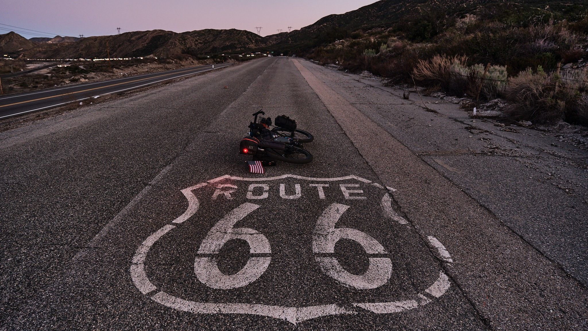
Adventure Cycling Association's Bicycle Route 66 — LA to Chicago

Hiking in Mohave County
Other adventures in Mohave County

Tips from the Community

A store that is still largely preserved in its original state from the 1920s and is still in operation today. The owner, who openly carries a weapon, is also worth seeing.
0
0

The view of the museum and the dam are extremely interesting, the guides are very good at getting the public excited.
0
0


Great, world-famous building - a must-see. Easy to get to.
0
0

Hualapai Mountain Park is the oldest park in Mohave County, the beginnings of which can be traced to the Civilian Conservation Corps' work in the 1930s. There are miles of trails to explore, including a hike to the summit of Hualapai Mountain which reaches nearly 8,500 feet. You can also stay at a campground or splash out and book a night or two at the Hualapai Mountain Resort. This is a great place to visit any time of year, but due to elevation you'll want to check road conditions during winter.
0
0
Willow Beach is located along the sparkling waters of the Colorado River as it exits the Hoover Dam. You'll find a stunning desert views, a marina, and a campground. The beach is a popular place for fishing, boating, and kayaking.
0
0
These kinds of roads seem to go on forever, but each pedal stroke gets you that much closer to your destination. Of course, this being Arizona, attempting this stretch in the summer is not advised, but the rest of the year the weather can be quite pleasant.
0
0
Temple Bar sits on the shores of Lake Mead with excellent views of the dramatic rock formation that gave the area its name. Along with the stunning views you'll also find camping, a restaurant & bar, as well as cabins and a motel. If you do decide to stay a while all manner of watercraft are available to rent, ranging from small fishing boats to ski boats, plus kayaks, canoes, wakeboards and more.
0
0
Frequently Asked Questions
How many road cycling routes are available in Mohave County?
Mohave County offers a diverse selection of over 15 road cycling routes. These routes cater to various skill levels, from easy scenic rides to challenging mountain climbs.
What kind of terrain can I expect when road cycling in Mohave County?
You can expect a diverse range of terrain, including scenic desert highways, paved backroads, and sections of Historic Route 66. Routes also offer views of the Colorado River and ascents into the Hualapai Mountains, providing both open desert vistas and rolling terrain.
Are there road cycling routes suitable for beginners in Mohave County?
Yes, there are routes suitable for beginners. An excellent option is the Lake Havasu Olympic Distance Triathlon loop, an easy 21.1-mile ride offering beautiful views of Lake Havasu.
Can I cycle on Historic Route 66 in Mohave County?
Absolutely. Mohave County features several road cycling routes along Historic Route 66. A popular choice is the moderate Kingman to Hackberry General Store via Route 66, which covers 55.6 miles through historic desert landscapes. Another option is the challenging Kingman to Oatman via Route 66, a 57.3-mile route with significant elevation gain.
Are there challenging road cycling routes for experienced riders?
Yes, experienced riders will find challenging options. The Kingman to Hualapai Mountain Park climb is a difficult 26.5-mile route with substantial elevation gain, leading through the scenic Hualapai Mountains. Another demanding route is Willow Beach to Temple Bar Marina, a difficult 70-mile ride with over 4,200 feet of climbing.
What scenic views and natural features can I see along the road cycling routes?
Many routes offer expansive desert vistas and views of the Colorado River. You can also cycle through forested areas in the Hualapai Mountains. Specific highlights include views of Hoover Dam and the Mike O'Callaghan–Pat Tillman Memorial Bridge, and the iconic Lake Havasu Lighthouse.
Are there any historical landmarks or attractions near the cycling routes?
Yes, Mohave County is rich in historical sites. You can find routes passing near the Oatman Historic Town Center, the Hackberry General Store, and the Chloride Historical Museum. The famous Hoover Dam is also a significant attraction in the region.
What is the best time of year to road cycle in Mohave County?
Mohave County is a premier destination for outdoor activities, and road cycling is particularly enjoyable during the cooler months. Spring and fall offer pleasant temperatures, making them ideal for exploring the diverse landscapes without the intense summer heat.
Are there loop road cycling routes in Mohave County?
Yes, several loop routes are available. The Lake Havasu Olympic Distance Triathlon loop is an easy option, and the Lake Havasu City and Island Trail Loop offers a moderate 24.6-mile ride. Another moderate choice is the Historic Railroad Trail Loop.
What do other cyclists say about road cycling in Mohave County?
The road cycling routes in Mohave County are highly rated by the komoot community, with an average score of 5.0 stars. Cyclists often praise the diverse terrain, from scenic desert highways to historic routes, and the variety of options for all ability levels.
Are there routes that offer views of the Colorado River?
Yes, routes near Bullhead City and the Laughlin area provide picturesque views of the Colorado River. For example, the moderate Lake Havasu City to Cattail Cove State Park route offers river scenery as it leads to Cattail Cove State Park.
Are there any routes that lead to state parks or natural areas?
Yes, you can cycle to several natural areas. The Lake Havasu City to Cattail Cove State Park route takes you to a beautiful state park. Additionally, the Kingman to Hualapai Mountain Park climb leads directly into the scenic Hualapai Mountains.
Most popular routes in Mohave County
Most popular attractions in Mohave County

Get inspired with the komoot mobile app


Didn’t find what you were looking for?
Check out more Road cycling routes throughout Mohave County below and find the perfect route in your destination.
Explore more
Browse the best Road cycling routes in other regions.
