Routes

Planner

Features

Updates

App

Login or Signup

Get the App

Login or Signup

Login or Signup

Routes
Hikes
United States
Connecticut

Northwest Hills Planning Region

Routes
Hikes
United States
Connecticut

Northwest Hills Planning Region

The best walks and hikes in Northwest Hills Planning Region

4.7

(103)

1,610

hikers

171

hikes

Hiking in Northwest Hills Planning Region, located in Connecticut's Litchfield Hills, features an extensive network of trails across diverse landscapes. The region is characterized by rolling hills, significant peaks such as Bear Mountain, and expansive forests including Mount Washington State Forest. Hikers can explore scenic valleys, discover water features like the Barkhamsted Reservoir and Housatonic River, and traverse varied topography that includes both challenging climbs and gentler paths.

Best hiking trails in Northwest Hills Planning Region

  • The most popular hiking route is Pine Knob Loop Trail, a 2.4 miles (3.9 km) trail that takes 1 hour 20 minutes to complete. This easy route offers views of the Housatonic River Valley.
  • Another top favourite among local hikers is Little Pond Boardwalk Trail, an easy 1.8 miles (2.9 km) path. This route features a boardwalk through wetlands, suitable for wildlife spotting.
  • Local hikers also love the Steep Rock Loop, a 5.0 miles (8.1 km) trail leading through varied terrain, often completed in about 2 hours 17 minutes.
  • Hiking in Northwest Hills Planning Region is defined by rolling hills, dense forests, and significant peaks, including sections of the Appalachian Trail. The network offers options for various ability levels, from easy walks to more challenging mountain ascents.
  • The routes in Northwest Hills Planning Region are highly rated by the komoot community with an average score of 4.7 stars from around 60 reviews. More than 1000 hikers have used komoot to explore Northwest Hills Planning Region's varied terrain.

Last updated: May 12, 2026

5.0

(1)

37

hikers

#1.

Pine Knob Loop Trail

3.86km

01:20

210m

200m

Discover the Pine Knob Loop Trail, an easy hike that winds through forests of white pines and scrub oak. As you hike, you'll encounter rock ledges and the peaceful Hatch Brook before reaching Pine Knob, where expansive vistas await over the Housatonic River Valley and surrounding hills. This route covers 2.4 miles (3.9 km) with an elevation gain of 685 feet (209 metres), typically taking about 1 hour and 19 minutes to complete.

When planning your visit, be aware that while the trail is generally easy, some sections feature steep inclines and rocky terrain. Good gripping hiking boots are highly recommended to navigate these parts safely. Wet or icy conditions can make certain rock slabs hazardous, so check the weather before you go. Starting your hike early is a good idea, as this popular trail can attract crowds, especially on weekends.

Located within Housatonic Meadows State Park, this loop offers more than just a walk; it provides a chance to immerse yourself in the natural beauty of the region. From Pine Knob, you can identify prominent peaks like Bald Mountain and Bread Loaf Mountain in the distance. The diverse ecosystem you pass through, from dense woods to open views, highlights the varied landscape of this part of Connecticut.

Navigate with device

Send to Phone

Save

Easy

5.0

(2)

38

hikers

Embark on an easy hike along the Little Pond Boardwalk Trail, a gentle route spanning 1.8 miles (2.9 km) with a minimal elevation gain of just 17 feet (5 metres). You can comfortably complete this loop in about 43 minutes. The trail offers a unique experience, primarily featuring an elevated wooden boardwalk that meanders through a serene wetland environment surrounding Little Pond. As you walk, you'll also find yourself winding through dense woods, with the path crossing the Bantam River twice. This varied terrain provides a peaceful atmosphere, perfect for a relaxing outdoor escape.

When planning your visit, remember that while the Little Pond Boardwalk Trail is generally easy, certain natural sections can become muddy after rainfall. Additionally, parts of the boardwalk might be uneven or even submerged in ankle-deep water during heavy rains, so waterproof footwear is a good idea. Dogs are welcome to join you on the route, but please ensure they remain on a leash at all times. If you prefer a quieter experience, consider starting your hike early in the morning or visiting on a weekday to avoid larger crowds.

This trail is a highlight within the White Memorial Conservation Center, offering an immersive way to explore a vibrant wetland ecosystem. Keep your eyes peeled for numerous species of waterfowl and other wildlife, especially if you visit during the spring or fall bird migrations. The well-maintained boardwalk itself is a notable feature, allowing you to traverse sensitive areas without disturbing the natural habitat. It's an excellent opportunity to connect with nature and observe local flora and fauna up close.

Easy
guide_signup
Let us show you the way with the komoot mobile app
With a free komoot account, you can easily find, customize, and navigate endless outdoor adventures.

Sign up for free

4.7

(3)

27

hikers

8.09km

02:17

180m

120m

Embark on the Steep Rock Loop, a moderate hiking route that guides you through varied landscapes and offers rewarding views. You will follow the tranquil Shepaug River, enjoying serene waterside scenery before the trail ascends through dense pine woods. This 5.0-mile (8.1 km) journey involves a climb of 604 feet (184 metres) and typically takes around 2 hours and 16 minutes to complete.

To begin your hike, head to the Steep Rock Preserve in Washington, Connecticut. Parking is usually available directly at the trailhead, making access straightforward for visitors. Be aware that the final 0.4 miles to the summit can be quite steep, so plan your energy accordingly. This trail is a great option for a half-day outing when you are looking for a solid workout with scenic rewards.

The route is known for blending natural beauty with historical elements. As you hike, you will reach the Steep Rock Summit, which provides panoramic views over the Clamshell section of the Shepaug River Valley. The trail also features unique points of interest, including a historic railroad tunnel and a picturesque suspension bridge, adding layers of discovery to your outdoor experience.

Moderate

5.0

(2)

26

hikers

11.1km

04:06

450m

460m

Embark on the Macedonia Ridge Trail for a moderate hiking challenge spanning 6.9 miles (11.1 km) with a significant elevation gain of 1491 feet (454 metres). This route, estimated to take around 4 hours and 6 minutes, offers a rugged and diverse experience through varied terrain. You will encounter steep slopes and rocky sections, including challenging rock scrambles, leading to panoramic views from Cobble Mountain.

When planning your visit, be aware that the trail is accessible year-round, but conditions can vary greatly; winter hikes may require crampons due to potential snow and ice. Always wear sturdy hiking shoes and carry plenty of water, especially for the demanding ascents. Dogs are welcome on leash, though some of the rock scrambles might prove difficult for them.

Located within Macedonia Brook State Park, this trail is renowned for its expansive vistas. From Cobble Mountain, you can enjoy broad panoramic views that stretch across the Catskills, the Hudson River Valley, and the Taconic Range. These views are particularly stunning during the vibrant fall foliage season, making it a standout destination in the region.

Moderate

4.6

(5)

23

hikers

5.60km

01:38

150m

150m

Embark on an easy hike through the Roxbury Mines, a 3.5-mile (5.6 km) route that takes approximately 1 hour and 38 minutes to complete. You'll gain 503 feet (153 metres) in elevation as you explore scenic woodlands and a diverse landscape. The trail offers a unique blend of natural beauty, featuring rocky outcroppings and views of the Shepaug River, alongside fascinating historical remnants. Keep an eye out for the old roasting ovens and abandoned quarries that dot the path, providing a glimpse into the area's past.

Planning your visit to Roxbury Mines is straightforward. The trail is generally well-maintained and clearly marked, making navigation simple for hikers of all experience levels. You can typically find parking available at the Mine Hill Preserve, which serves as the trailhead. While the route is considered easy, some sections might have loose rocks, so wearing sturdy hiking boots is a good idea to ensure a comfortable and safe journey.

This trail is notable for its rich history, as the Mine Hill Preserve is a National Historic Landmark. As you hike, you'll encounter remnants of a 19th-century iron-making complex, including a blast furnace, which adds a unique historical dimension to your outdoor adventure. The varied terrain, combining natural features with these historical sites, makes Roxbury Mines a distinctive and engaging experience in the region.

Easy

5.0

(1)

19

hikers

Embark on an easy hike around Burr Pond via the Wolcott Trail (Blue Blaze), a pleasant loop covering 2.6 miles (4.2 km). You'll experience continuous scenic views of the 85-acre Burr Pond, with its small inlets and islands, as you gain a gentle 113 feet (34 metres) in elevation. The route winds through wooded areas, showcasing large trees and rocky outcrops right alongside the shoreline. Expect to spend about 1 hour and 5 minutes enjoying this tranquil path, passing below a dam and through a pleasant picnic grove.

Burr Pond State Park offers convenient amenities for your visit, including a swimming beach and picnic areas. You can also find seasonal boat rentals if you wish to explore the water. If you plan to bring your dog, pets are welcome on a leash on the trails and in the picnic areas. However, please note that dogs are not allowed on the swimming beach.

This trail is a great way to explore Burr Pond State Park, offering diverse sights along the way. The 85-acre pond itself is a central feature, providing a calm backdrop to your walk. In winter, without the leaves, the views across the pond become even more open, offering a different perspective of the landscape.

Easy

11

hikers

6.27km

01:45

130m

120m

Explore the Whittemore Sanctuary on an easy 3.9-mile (6.3 km) hike, designed to take you about 1 hour and 45 minutes. This route offers a gentle ascent of 418 feet (127 metres) as you wander through a mosaic of open meadows and serene, shaded forests. You will pass by tranquil ponds and streams, with opportunities to spot a notable bog and catch glimpses of Lake Quassapaug.

When you plan your visit, you will find the trails at Whittemore Sanctuary are well-maintained and clearly marked with color-coded blazes, making navigation simple. Maps are readily available for download or can be picked up at the Flanders Nature Center administrative office. Remember that leashed dogs are welcome to join you on this pedestrian-only trail, adding to the enjoyment of your outdoor adventure.

The sanctuary provides a rich ecological experience, showcasing varied scenery that includes not just forests and meadows, but also unique features like the bog. As you hike, you can enjoy views that extend to Blackmans Hill, offering a sense of the wider landscape. This trail is a great option for those seeking a peaceful and accessible natural escape in the region.

Easy

6

hikers

4.02km

01:22

200m

190m

Embark on an easy hiking adventure along the Black Rock Trail, a route that guides you through the serene natural landscape of Black Rock State Park. This journey spans 2.5 miles (4.0 km) and involves an elevation gain of 642 feet (196 metres), typically taking you around 1 hour and 21 minutes to complete. As you hike, you will discover the park's pleasant scenery, culminating in the rewarding views from the Black Rock Lookout, a perfect spot to pause and appreciate your surroundings.

When planning your visit, you will find that the Black Rock Trail is generally accessible, making it a suitable option for many hikers. Parking is usually available directly at the trailhead within Black Rock State Park, ensuring a convenient start to your outing. Before heading out, it is always a good idea to check local park information for any specific alerts, such as seasonal considerations or temporary closures, to ensure a smooth and enjoyable experience.

This trail provides a wonderful opportunity to connect with nature and enjoy the outdoors within the established boundaries of Black Rock State Park. It stands out as a straightforward yet engaging option for those looking to immerse themselves in a natural setting without committing to a strenuous trek. The route's design allows you to experience the park's unique atmosphere and features, making it a notable choice for a refreshing escape.

Easy

5.0

(2)

7

hikers

Embark on an easy hike along the Kent Falls Red and Yellow Loop Trail, a short 0.8 miles (1.3 km) route that takes about 27 minutes to complete. You will gain 249 feet (76 metres) in elevation, offering a gentle climb through lush forested surroundings. The highlight is the impressive 250-foot multi-tiered Kent Falls, which you can admire from various viewing platforms as you ascend. Near the trailhead, a picturesque covered bridge adds to the charm, making this a rewarding outdoor experience. The scenery transforms with the seasons, from vibrant autumn colors to icy winter formations.

Parking is conveniently available at Kent Falls State Park, providing easy access to the trailhead. Be prepared for sections of the route that can be steep and potentially muddy, particularly after rainfall, so appropriate footwear is advisable. Leashed dogs are welcome to accompany you on your hike, allowing your furry friends to enjoy the natural beauty. Consider visiting during the shoulder seasons for fewer crowds and pleasant weather, though the falls are captivating year-round.

This trail is a popular choice within Kent Falls State Park, primarily due to its focus on the magnificent cascades. The multi-tiered falls are a significant natural feature, drawing visitors to experience their power and beauty up close. It offers a quick immersion into nature, perfect for those seeking a brief yet scenic escape. The park's well-maintained paths make it accessible for many, highlighting the natural splendor of the region.

Easy

5.0

(1)

5

hikers

Embark on the Mile of Ledges and Tory Den Trail, a moderate hiking route spanning 4.4 miles (7.1 km) with an elevation gain of 357 feet (109 metres). You can expect to complete this loop in about 2 hours. The trail offers a varied experience, starting with the famous Mile of Ledges where you will navigate rugged terrain and large boulders. After this challenging section, the path transitions into a more gentle forest walk, providing a pleasant change of pace.

Accessing the trailhead is straightforward, as parking is typically available on site. This loop is generally considered dog-friendly, so you are welcome to bring your canine companion along for the adventure. Plan your visit during favorable weather to best enjoy the diverse landscapes and ensure a comfortable hike.

This route is notable for its historical significance, particularly the Tory Den. This landmark once provided shelter to Tories during the Revolutionary War and later became associated with the legendary Old Leatherman. The trail's unique blend of challenging ledges and peaceful forest paths makes it a distinctive experience within the Tunxis Trail System.

Moderate
Sign up for free to see 162 more hikes in Northwest Hills Planning Region.

Get access to more routes and recommendations from other explorers.

Sign up for free

Already have an account?

Our route recommendations are based on thousands of hikes, rides, and runs completed by other people on komoot.

Start today with a free account

Your next adventure awaits.

Login or Signup

Popular around Northwest Hills Planning Region

Hiking around Torrington

Hiking around Northwest Harwinton

Hiking around Pleasant Valley

Hiking in American Legion State Forest

Hiking in Peoples State Forest

Hiking around Bridgewater

Hiking around Canaan

Hiking around Oakville

Hiking around Winsted

Hiking around New Hartford Center

Other adventures in Northwest Hills Planning Region
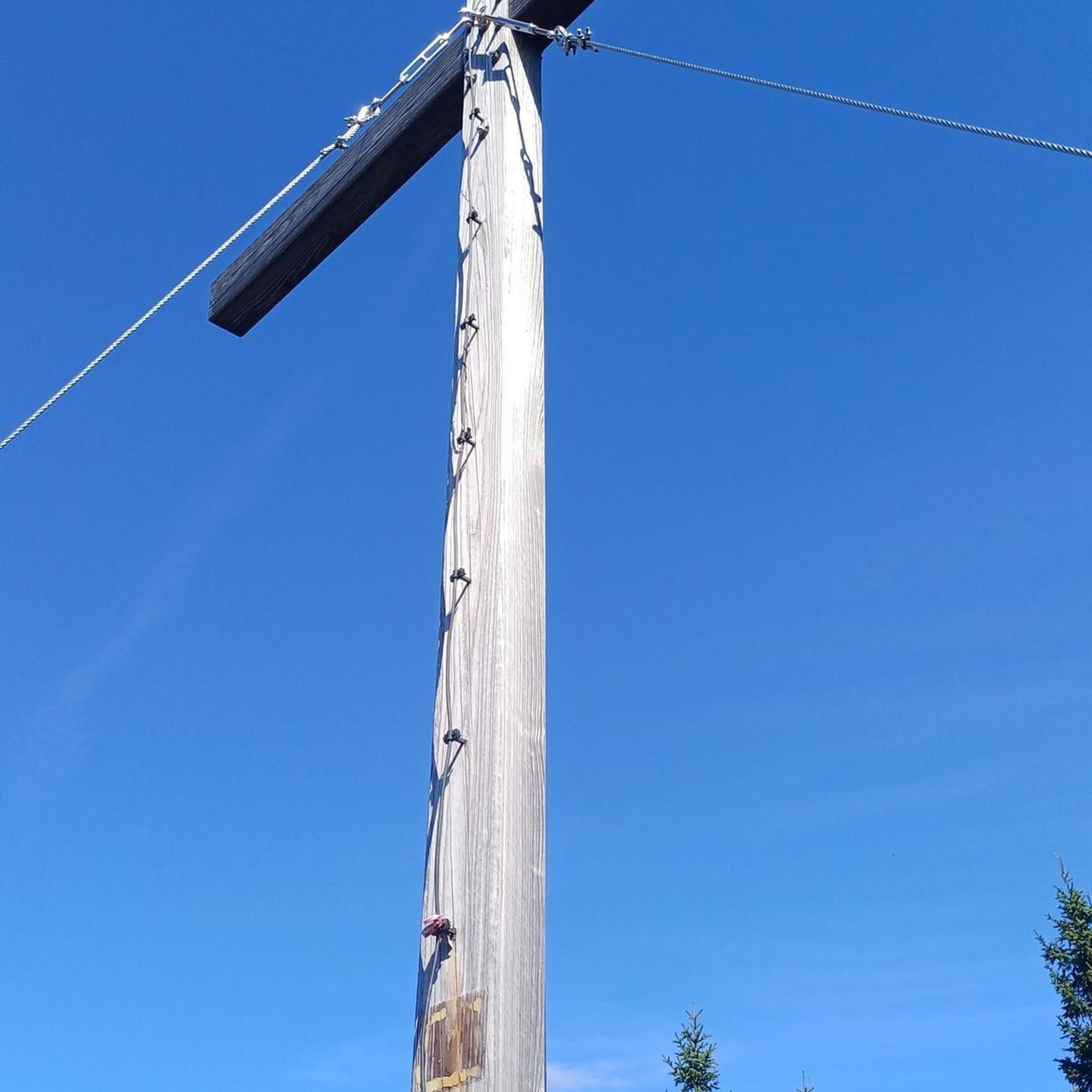
The Appalachian Trail — America's most iconic long-distance hike

Hiking Collection by

Jamie S.

Tips from the Community

J.D.
September 28, 2025, Old Mine Preserve

Interesting trails around the site of an old mining operation. Shepaug River views and an active distillery on site!

0

0

Nice Lookout westwards

0

0

To reach this point, you'll go through a heavily forested area with several viewpoints along the way. From here, you can enjoy one of these viewpoints, offering a scenic vista of the rolling hills of the Housatonic Meadows State Park.

1

0

Will
December 7, 2023, Burr Pond

This is a great local pond for swimming and picnicking. There are several trails that run parallel to the pond, making it an accessible hiking destination.

0

0

Scott
December 4, 2023, Tory's Den

In the woods of Burlington lies the impressive rock formation known as the "Tory Den," where British sympathizers once hid. This massive rock structure, with nooks, crannies, and a small escape hole, reveals its historical secrets amid blackened walls and rock ledges.

0

0

AverieOutside
December 3, 2023, Little Pond

Little Pond is a stop along the Little Pond Boardwalk Trail through the White Memorial Conservation Area. The area is known as a hot spot for birding and can be a good area for spotting wildlife.

0

0

maniboyflex
November 26, 2023, Blackmans Hill

Blackmans Hill is a small forested 930 ft summit in Whittemore Sanctuary and has a bit of a view but is mostly obscured by trees. The hike there is an easy and modest incline, and it is possible to pass the summit on a loop around the Whittemore Sanctuary, which has many different trails crossing the park.

0

0

Can be slippery with leaves and water or ice. Take your time. Easier to climb up than slide down imho

1

0

Frequently Asked Questions

How many hiking trails are available in the Northwest Hills Planning Region?

The Northwest Hills Planning Region offers a wide array of hiking opportunities, with over 75 trails recorded on komoot. These trails cater to various skill levels, from easy walks to more challenging mountain ascents.

What kind of landscapes can I expect to see while hiking in this region?

Hikers in the Northwest Hills Planning Region will encounter diverse landscapes, including rolling hills, significant peaks like Bear Mountain, and expansive forests such as Mount Washington State Forest. The region also features scenic valleys, clear streams, and picturesque water bodies like the Barkhamsted Reservoir, providing a dynamic outdoor experience.

Are there any easy or family-friendly hiking options in the Northwest Hills Planning Region?

Yes, the region offers numerous easy trails suitable for families. For instance, the Little Pond – Little Pond Boardwalk Trail loop from Litchfield Historic District is an easy option, covering just under 3 km. Another gentle choice is the Scenic Nature Pathway loop from New Preston, which is about 6.7 km long.

What do other hikers say about the trails in Northwest Hills Planning Region?

The trails in the Northwest Hills Planning Region are highly regarded by the komoot community, holding an average rating of 4.7 stars from over 45 reviews. Hikers frequently praise the well-maintained paths, the serene forest environments, and the rewarding views from higher elevations.

Are there any notable landmarks or natural features to look out for along the trails?

Yes, the region is rich with natural and historical landmarks. Hikers can explore features like Bear Mountain (2,320 feet), the highest peak in Connecticut, or visit scenic water bodies such as Lake Waramaug State Park and Little Pond. Other points of interest include the historic Bulls Bridge and the unique Steep Rock Tunnel.

Can I find trails with waterfalls in the Northwest Hills Planning Region?

Yes, the region features picturesque water features, including hidden waterfalls. Enders Brook Falls in Peoples State Forest is a notable example, enhancing the hiking experience with its natural beauty.

Are there any circular hiking routes available?

Many trails in the Northwest Hills Planning Region are designed as loops, offering varied scenery without retracing your steps. An example is the Bear Mountain (2,320 feet) – Sage's Ravine loop from Salisbury, which takes you through mountainous terrain and ravines.

What is the best time of year to go hiking in the Northwest Hills Planning Region?

The Northwest Hills Planning Region offers beautiful hiking experiences throughout the year. Spring brings lush greenery and blooming wildflowers, while autumn is particularly stunning with vibrant fall foliage. Summer provides shaded trails in the extensive forests, and winter offers opportunities for snowshoeing or quiet walks, though some trails may be more challenging.

Is there public transport or parking available near the trailheads?

While specific public transport options to all trailheads may be limited, many popular hiking areas in the Northwest Hills Planning Region, such as state parks and forests, typically offer designated parking facilities. It's advisable to check specific trail information for parking details before your visit.

Are there any trails that are part of the Appalachian Trail in this region?

Yes, a significant portion of the Appalachian Trail, approximately 47 miles, traverses the Northwest Hills Planning Region. This offers hikers the chance to experience a world-renowned long-distance trail within the local landscape.

What is the general difficulty level of hikes in the Northwest Hills Planning Region?

The region offers a good mix of difficulties. Out of 77 recorded tours, 35 are rated as easy, 36 as moderate, and 6 as difficult. This variety ensures that hikers of all experience levels can find suitable routes, from gentle strolls to challenging ascents with significant elevation changes.

Where can I find more detailed maps or information about the trails?

The Northwest Hills Council of Governments (NHCOG) has developed an interactive trails map for the region, which can be a useful resource for finding trails based on location, distance, difficulty, and allowed uses. You can also find more information on the Housatonic Heritage website.

Most popular routes in Northwest Hills Planning Region

Easy hikes in Northwest Hills Planning Region

Most popular attractions in Northwest Hills Planning Region

Places to see

Store rating

Get inspired with the komoot mobile app

With a free komoot account, you can easily find, customize, and navigate endless outdoor adventures.

or

Join komoot Now

Store rating

Didn’t find what you were looking for?

Check out more Hikes throughout Northwest Hills Planning Region below and find the perfect route in your destination.

Pleasant ValleyAlgonquin State ForestNepaug State ForestGreat Mountain ForestMount Tom State ParkMacedonia Brook State ParkBurr Pond State ParkChimney PointRivertonThomastonPeoples State ForestMount Bushnell State Park Scenic ReserveCampbell Falls State Park ReserveSunny Brook State ParkPaugnut State ForestMattatuck State ForestAmerican Legion State ForestWoodbury CenterNew Hartford CenterFalls VillageWatertownStillwater Pond State ParkCornwallSharonPlatt Hill State ParkWyantenock State ForestLake Winfield Recreation AreaBethlehem VillageJohn A. Minetto State ParkHumaston Brook State ParkOakvilleNew PrestonNew MilfordCamp Columbia State ParkBantamLakevilleDennis Hill State ParkWest CornwallGaylordsvilleNorfolkAlgonquin State Forest, Kitchel PreserveHousatonic State Forest, Gold'S Pines BlockBridgewaterCanaanLake Waramaug State ParkTorringtonWinstedTerryvilleCornwall BridgeNorthwest HarwintonMount Riga State ParkLitchfieldBridgewater Recreation AreaAbove All State ParkHaystack Mountain State ParkLovers Leap State Park

Other places to explore

Nearby adventure guides

Things to Do around Bantam

background

Get ready to conquer new peaks

Sign up for Free

Explore
RoutesRoute plannerFeaturesHikesMTB TrailsRoad cycling routesBikepackingSitemap
Download the app
Follow Us on Socials

© komoot GmbH

Privacy Policy