The best road cycling routes in Sherburne County
18
riders
5
rides
Road cycling in Sherburne County offers diverse landscapes, including restored prairies, oak savannas, and riverine habitats along the Mississippi River. The region features a mix of flat, paved trails and routes with rolling topography and gentle elevation changes. Cyclists can explore areas characterized by oak forests and wetlands, providing varied scenic backdrops. The county's trail systems cater to different preferences, from dedicated paved paths to routes incorporating natural features.
Best road cycling routes in Sherburne County
- The most popular road…
Last updated: May 16, 2026
4
riders
29.1km
01:24
120m
120m
Easy road ride. Great for any fitness level. Mostly well-paved surfaces and easy to ride.
4
riders
54.8km
02:13
200m
200m
Moderate road ride. Good fitness required. Mostly well-paved surfaces and easy to ride.

Sign up for free
5
riders
26.9km
01:18
110m
110m
Easy road ride. Great for any fitness level. Mostly well-paved surfaces and easy to ride.
3
riders
24.4km
00:56
70m
70m
Easy road ride. Great for any fitness level. Mostly well-paved surfaces and easy to ride.
2
riders
54.9km
02:13
230m
230m
Moderate road ride. Good fitness required. Mostly well-paved surfaces and easy to ride.
Our route recommendations are based on thousands of hikes, rides, and runs completed by other people on komoot.
Start today with a free account
Your next adventure awaits.
Login or Signup
Popular around Sherburne County
Tips from the Community

Dayton River Road is lightly trafficked route ideal for road cycling. It runs parallel to the river, offering a steady ride with mild elevation changes. Key access points to nearby trails and parks are available along the route.
1
0
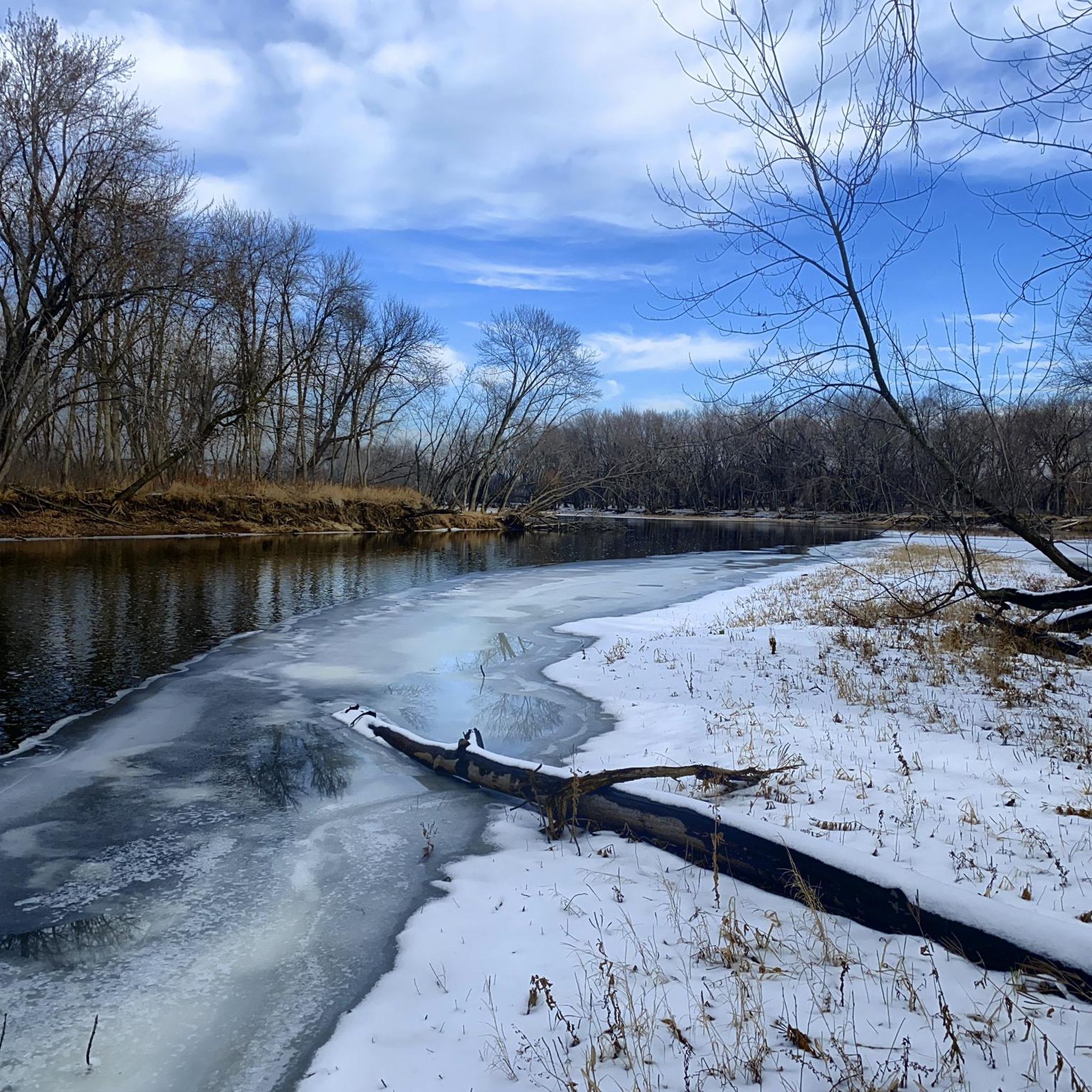
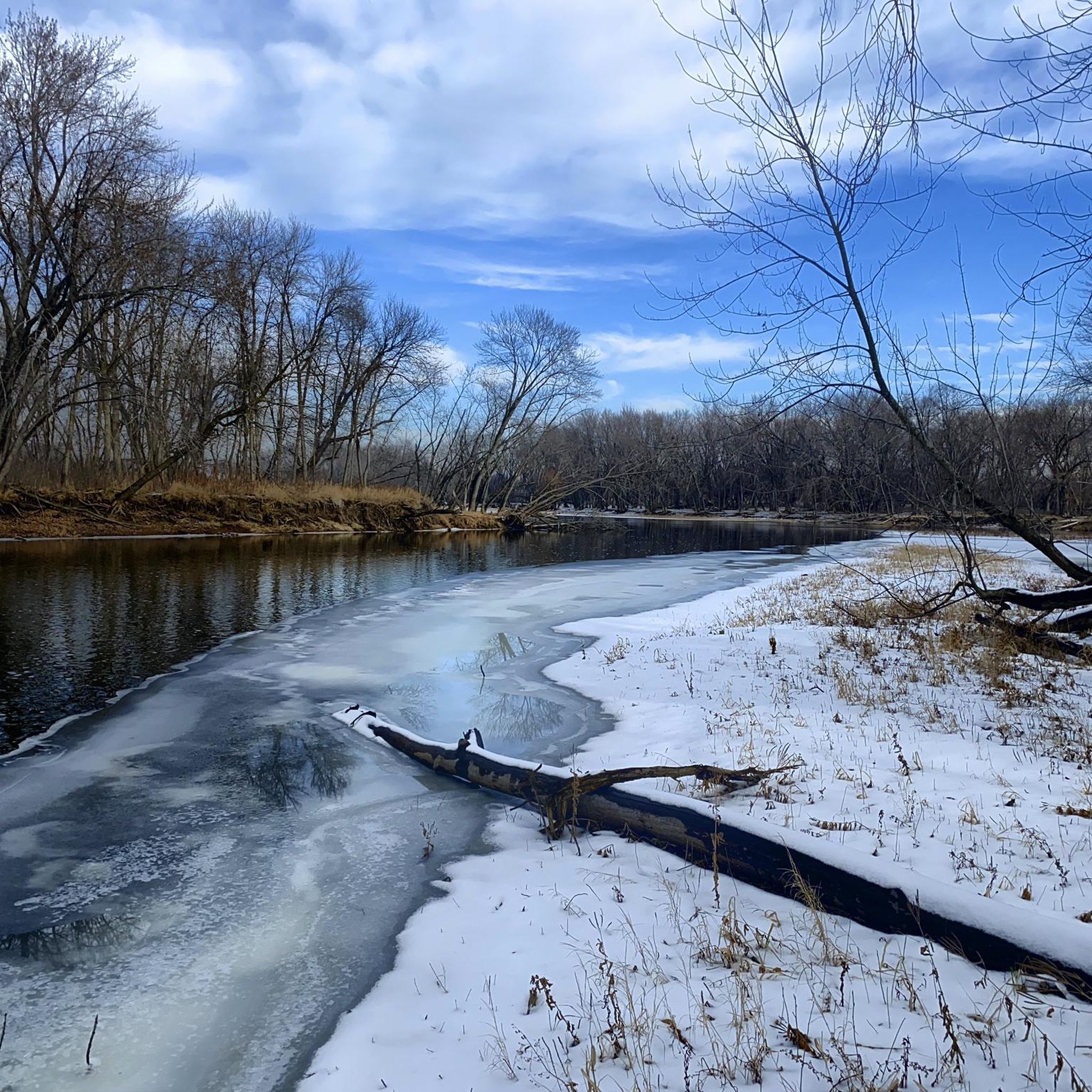
This section of Mississippi River Trail goes under the South Ferry Street Bridge. Close by, there is a boardwalk if you want to have a closer look to the river.
0
0
Dayton River Road is lightly trafficked route ideal for road cycling. It runs parallel to the river, offering a steady ride with mild elevation changes. Key access points to nearby trails and parks are available along the route.
0
0

The Rum River Regional Trail extends upstream for 3.16 miles along the east bank of the Rum River from its confluence with the Mississippi to Anoka Nature Preserve at its northern terminus. At the trailhead there is plenty of public parking but no public toilets.
3
0
The loop trail around the perimeter of the Anoka Nature Preserve is about 2 miles long. Here is a link to more information on the Anoka Nature Preserve: http://anokanaturepreserve.org/.
3
0

The Beaver Island Trail is a beautiful 5-mile long trail. It follows the Mississisppi River from St. Cloud. The trail is paved and gives you great views of the water.
1
0
Nice view of the St. Cloud Hydroelectic Facility and dam. From the trail, you also get a great view of the Mississippi River.
1
0

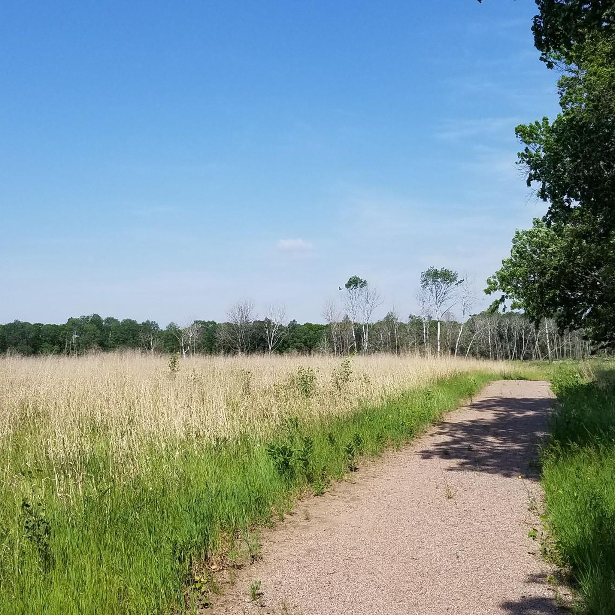
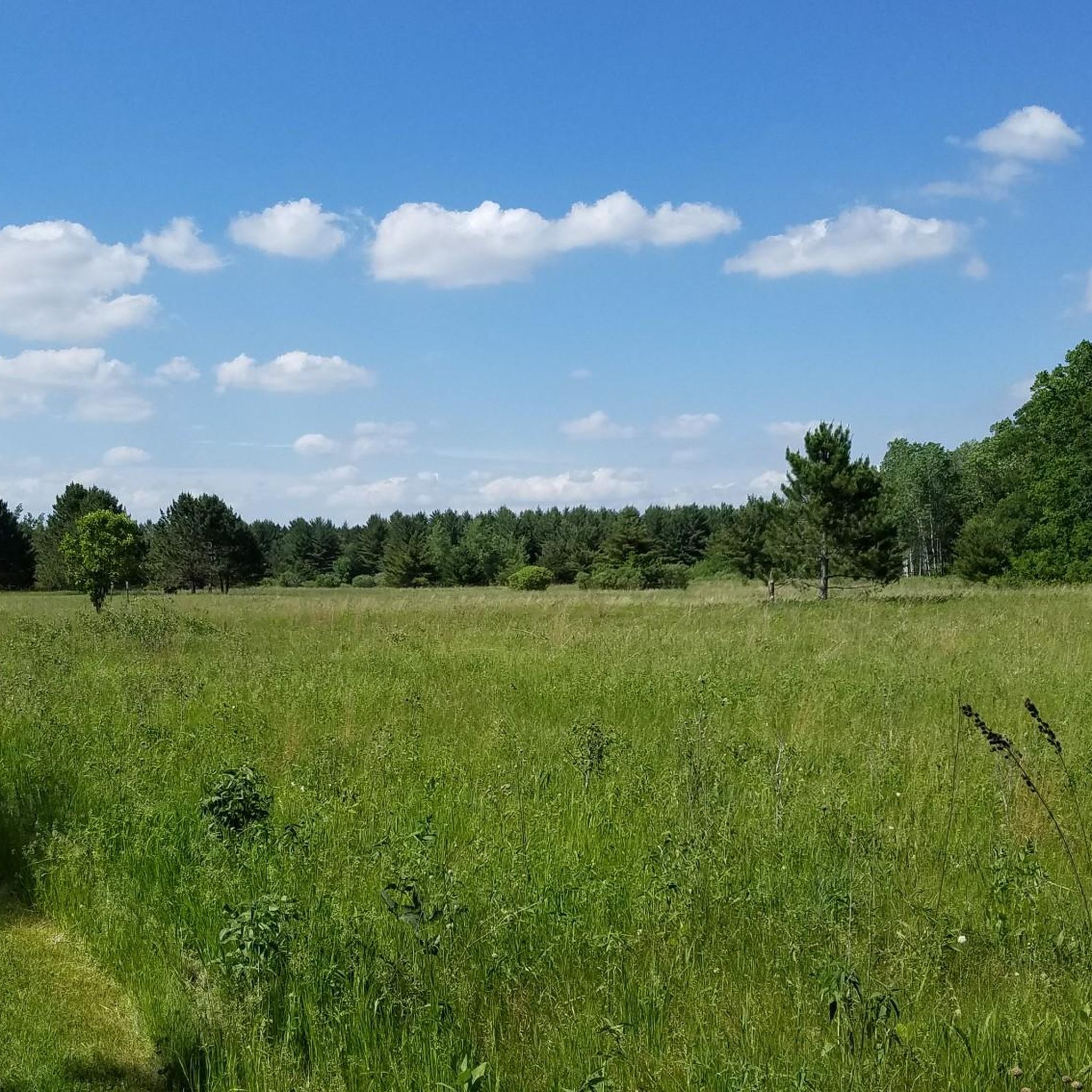
The Anoka Nature Preserve features over 200 acres of woodlands, meadows, and forests. Wide gravel trails pass through the property, making this a great spot to check out on two wheels.
0
0
Frequently Asked Questions
How many road cycling routes are available in Sherburne County?
Sherburne County offers a selection of 6 road cycling routes on komoot, catering to various preferences. These include 2 easy routes and 4 moderate routes, providing options for different skill levels.
What kind of terrain can I expect on road cycling routes in Sherburne County?
Road cycling in Sherburne County features diverse landscapes, including restored prairies, oak savannas, oak forests, wetlands, and riverine habitats along the Mississippi River. You'll find a mix of flat, paved trails and routes with rolling topography and gentle elevation changes, offering varied scenic backdrops.
Are there road cycling routes suitable for beginners in Sherburne County?
Yes, Sherburne County has routes perfect for beginners. For an easy ride, consider the Roadbike loop from Saint Cloud, which is 18.1 miles (29.1 km) long. Another accessible option is the Fuller Lake loop from Clearwater, spanning 15.1 miles (24.3 km).
What is the best time of year for road cycling in Sherburne County?
The best time for road cycling in Sherburne County is typically from spring through fall, when the weather is mild and the natural landscapes are vibrant. Summer offers lush scenery, while spring and fall provide comfortable temperatures and beautiful foliage. Always check local weather conditions before heading out.
Can I cycle within the Sherburne National Wildlife Refuge?
Yes, the Sherburne National Wildlife Refuge offers opportunities for cycling. Brande Road within the refuge is open for biking during certain times of the year, allowing cyclists to immerse themselves in this natural setting of oak savanna, prairie, forests, and wetlands. For more information on the refuge, visit fws.gov/refuge/sherburne. You can also find the refuge listed as a highlight here: Sherburne National Wildlife Refuge.
Are there road cycling routes along the Mississippi River in Sherburne County?
Yes, several routes offer views and access to the Mississippi River. The Ferry Street underpass – Dayton River Road loop from West Twin Lake is a moderate 34.0-mile (54.8 km) path that provides varied terrain and views along the river corridor. The Beaver Island Trail, though starting from St. Cloud, also offers picturesque paved cycling along the river.
Are there any family-friendly road cycling options in Sherburne County?
For families, the paved sections of trails like the Great Northern Regional Trail and Woodland Trails Park are excellent choices. These trails offer smooth surfaces and pass through pleasant natural settings, making them suitable for cyclists of all ages. The easy routes mentioned previously, such as the Fuller Lake loop from Clearwater, are also good options.
Where can I find parking for road cycling routes in Sherburne County?
Parking is available at various access points for trails and parks throughout Sherburne County. For example, the Woodland Trails Park Trailhead offers convenient parking. Many local parks and trailheads provide designated parking areas for cyclists.
What are some scenic highlights I might encounter on a road cycling route?
Sherburne County's routes often pass through beautiful natural areas. You might cycle through restored prairies, oak savannas, and wetlands, or along the Mississippi River, where you can spot bald eagles and trumpeter swans. The Great Northern Regional Trail, for instance, passes through woodlands and by ponds, offering a pleasant experience.
Are there any longer, more challenging road cycling routes in the area?
For those seeking a longer and more challenging ride, Sherburne County offers several moderate routes. The Rum River Regional Trail – Ferry Street underpass loop from 96 Av N is a substantial 48.0-mile (77.3 km) route, often completed in about 3 hours and 9 minutes, leading through areas near the Rum River. Another option is the Dayton River Road – Ferry Street underpass loop from #1201, which covers 33.3 miles (53.6 km).
Are there any facilities or parks along the road cycling routes?
Yes, you'll find various parks and facilities along or near the cycling routes. For example, Zimmerman Lions Club Memorial Park and Nature Play Area offer amenities. Many routes also connect to or pass through county parks that may provide restrooms, picnic areas, or other services.
Most popular attractions in Sherburne County

Get inspired with the komoot mobile app


Didn’t find what you were looking for?
Check out more Road cycling routes throughout Sherburne County below and find the perfect route in your destination.
Explore more
Browse the best Road cycling routes in other regions.
