The best walks and hikes in Larimer County
4.7
(851)
16,272
hikers
534
hikes
Hiking in Larimer County covers a varied landscape, from the foothills and grasslands near Fort Collins to the alpine terrain of the Rocky Mountains. The region is characterized by numerous open spaces, state parks, and a large portion of Rocky Mountain National Park. This provides a network of trails that pass by alpine lakes, ascend to prominent rock formations, and traverse forested canyons.
Best hiking trails in Larimer County
- The most popular hiking route is Nymph, Dream, Haiyaha, Mills, and…
Last updated: August 18, 2026
4.8
(58)
1,239
hikers
5.21km
01:36
190m
200m
The Emerald Lake Trail offers a quintessential Rocky Mountain National Park experience, winding through dense forests and past three stunning alpine lakes. You'll first encounter the lily-pad-dotted Nymph Lake, then…
4.9
(89)
741
hikers
17.6km
05:52
930m
410m
Embark on a challenging hike through Rocky Mountain National Park with the Sky Pond, The Loch, and Timberline Falls via Glacier Gorge Loop. This difficult route spans 10.9 miles (17.6…

Sign up for free
4.8
(70)
566
hikers
11.2km
03:33
370m
370m
The Glacier Gorge, Lake Haiyaha and Emerald Lake Loop is a fantastic way to immerse yourself in Rocky Mountain National Park's alpine beauty. You'll journey through diverse terrain, from initial…
5.0
(4)
109
hikers
13.0km
04:10
410m
420m
This epic Rocky Mountain National Park hike strings together some of the park's most iconic alpine lakes, offering a diverse and stunning exploration. You'll wander through subalpine forests, past the…
4.9
(45)
568
hikers
14.0km
04:20
520m
520m
Embark on the Sky Pond Trail, a moderate hiking route that takes you deep into Rocky Mountain National Park. This 8.7-mile (14.0 km) journey involves a steady climb, gaining 1691…
5.0
(7)
84
hikers
19.6km
06:34
930m
700m
Embark on a challenging hike through Rocky Mountain National Park on the Mills Lake, Black Lake, and Frozen Lake via Glacier Gorge Trail. This difficult route spans 12.2 miles (19.6…
5.0
(3)
101
hikers
2.66km
00:52
200m
0m
The Emerald Lake Trail offers a quintessential Rocky Mountain National Park experience, winding through pine and spruce forests to reveal three stunning alpine lakes. You'll first encounter Nymph Lake, often…
5.0
(3)
90
hikers
8.07km
02:38
520m
80m
Embark on the Sky Pond via Glacier Gorge Trail, a moderate hike covering 5.0 miles (8.1 km) with a significant elevation gain of 1709 feet (521 metres), typically completed in…
5.0
(2)
76
hikers
6.89km
01:53
50m
200m
The Coyote Ridge Trail near Fort Collins offers a unique journey through a transition zone of high desert prairie and rocky ridges. You'll start on a wide, flat path before…
5.0
(2)
68
hikers
1.83km
00:29
20m
10m
Embark on an easy hike around Sprague Lake, a gentle 1.1-mile (1.8 km) loop that offers stunning reflections of the Continental Divide. You will gain a minimal 49 feet (15…
Get access to more routes and recommendations from other explorers.
Sign up for free
Already have an account?
Our route recommendations are based on thousands of hikes, rides, and runs completed by other people on komoot.
Start today with a free account
Your next adventure awaits.
Login or Signup
Popular around Larimer County




Tips from the Community

A historical note: a friend and I hiked here way back on July 2, 1976. The trail had just opened the day before. Although it was hot and we were in shorts and tank tops, at some points the trail was still waist deep in snow, and there was still snow melting into the far side of the lake. Unlike modern times, we had the trail and lake completely to ourselves. Because it was so hot, and there was no one else around, we did the natural thing: stripped down and jumped in off a big rock. It was then we learned the true reason for the name Haiyaha!
0
0

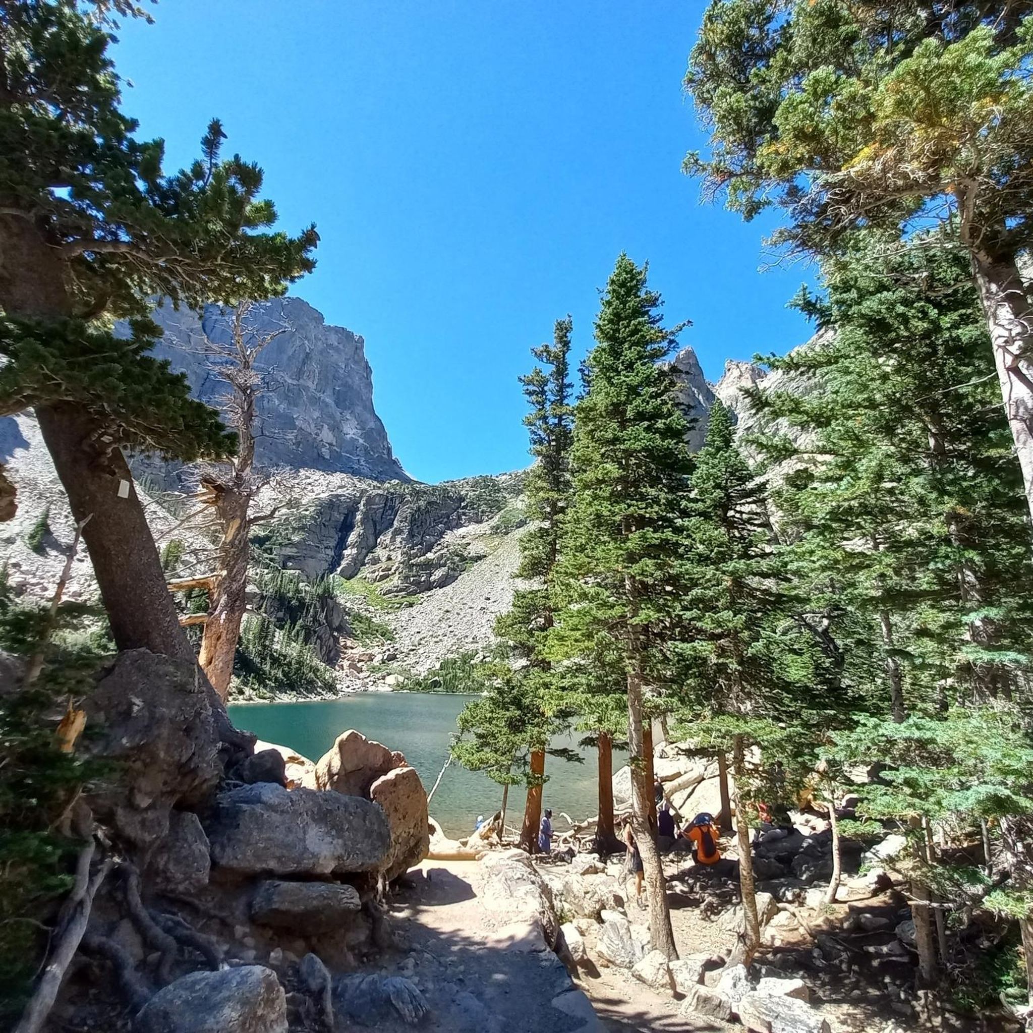
A very beautiful mountain lake with a wonderful color. Many rocks line the lake, offering places to rest.
0
0
Beautiful views of the lake and the surrounding mountains, nice little wooden bridge.
0
0
A scenic hike in the eastern part of Rocky Mountains National Park, passing several lakes, including The Loch, Lake Haiyaha, Dream Lake, Nymph Lake, and Bear Lake. After about 3 kilometers on the Glacier Gorge Trail, you first pass the 9-meter-high Alberta Falls. Continuing uphill through the autumn-colored forest, you pass numerous viewpoints and reach the picturesque "The Loch," framed by a majestic mountain backdrop with occasional snowcapped peaks.
0
0
A scenic hike in the eastern part of Rocky Mountains National Park, passing several lakes, including The Loch, Lake Haiyaha, Dream Lake, Nymph Lake, and Bear Lake. After about 3 kilometers on the Glacier Gorge Trail, you first pass the 9-meter-high Alberta Falls. Continuing uphill through the autumn-colored forest, you pass numerous viewpoints and reach the picturesque "The Loch," framed by a majestic mountain backdrop with occasional snowcapped peaks.
0
0
Rocky Mountain National Park (RMNP) in Colorado is one of the most famous and highest national parks in the USA. Longs Peak is the highest point at 4,345 meters. The landscape is characterized by mountain forests with aspens, pines, and expansive meadows, where elk are common. Dense coniferous forests and mountain lakes, as well as rugged, treeless plateaus with only low-growing plants, bighorn sheep, and marmots can also be found. A highlight is the Trail Ridge Road, the highest continuously paved mountain pass in North America, leading through the alpine tundra. The most popular hiking area, with its numerous lakes, is the Bear Lake Corridor. The park is open year-round, although many roads and trails are closed during the winter months due to snow or are only accessible with appropriate equipment. Due to its immense popularity, time-slot reservations are often required for access during peak season.
1
0
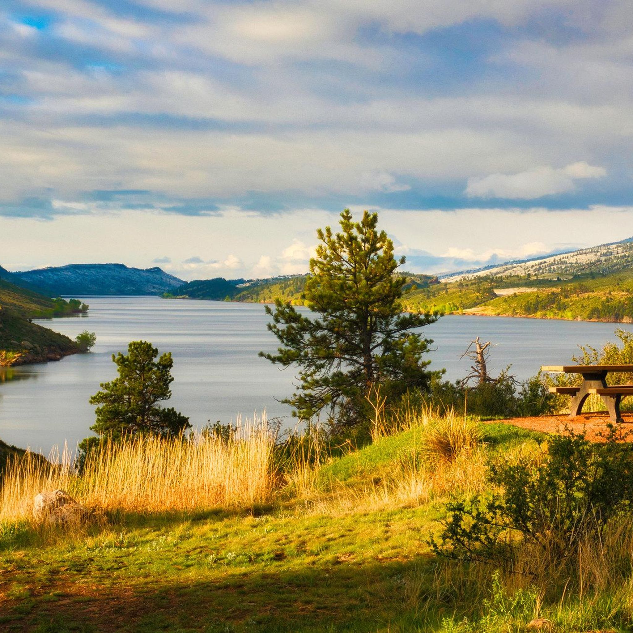
Beautiful, quiet lake with a great view.
1
0

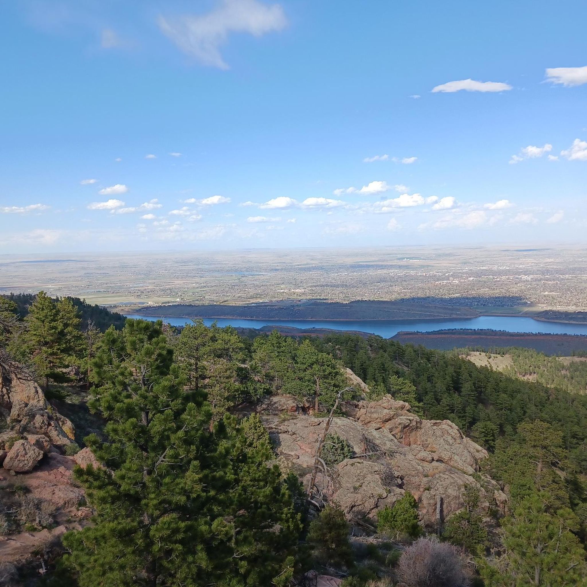
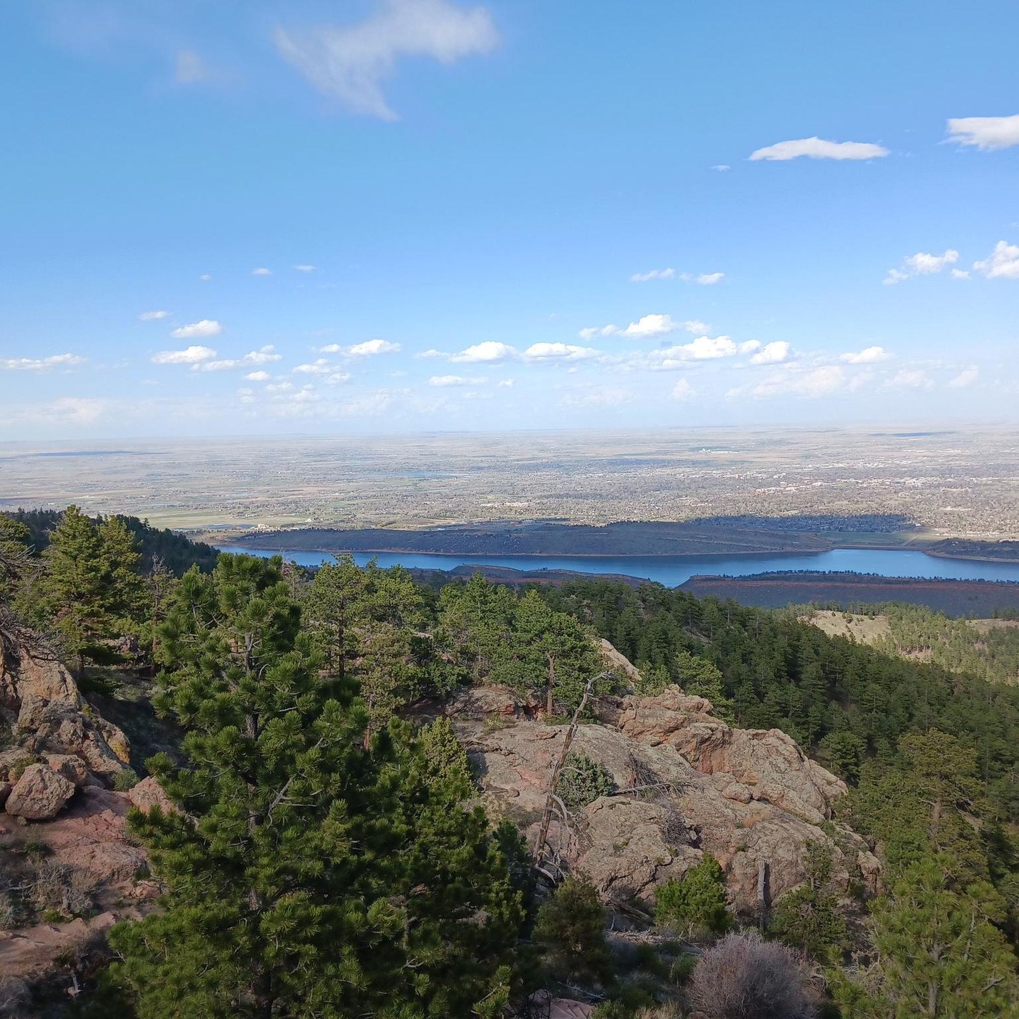
Not far from the hiking trail you can enjoy this beautiful view over the valley.
0
0
Frequently Asked Questions
Are there many easy, family-friendly hikes in Larimer County?
Yes, the region offers many options for families and beginners, with over 150 easy trails to choose from. A great choice within Rocky Mountain National Park is the Mills Lake via Glacier Gorge loop, which is a relatively gentle walk to a scenic alpine lake. Many of the county's open spaces, like Devil's Backbone, also feature flatter trails suitable for all ages.
Where can I find a challenging hike in Larimer County?
For a truly demanding day out, the Longs Peak via Keyhole Route is a classic mountaineering challenge that requires experience and an early start. This strenuous 13.4-mile (21.6 km) trek involves significant elevation gain and scrambling to the summit of the park's highest peak.
Are there any good hikes with waterfalls?
Absolutely. One of the most popular waterfall hikes is located in Horsetooth Mountain Open Space. The trail to Horsetooth Falls is a rewarding trek that leads to a beautiful cascade, especially in the spring and early summer. The area is a local favorite for its accessible trails and scenic beauty.
Can I bring my dog on the trails in Larimer County?
Dog policies vary by location. Dogs are generally not permitted on trails within Rocky Mountain National Park. However, they are welcome on-leash in many of Larimer County's Open Spaces, such as Horsetooth Mountain and Devil's Backbone, as well as in Lory State Park. Always check the specific regulations for the park you plan to visit before you go.
What are some popular places for hiking in Larimer County?
Larimer County is home to several highly-regarded hiking destinations.
Horsetooth Mountain Open Space is a local favorite near Fort Collins, offering 29 miles of trails with scenic vistas. For a unique geological landscape, Devil's Backbone Open Space near Loveland provides trails for hiking and wildlife viewing amidst its iconic rock formations. For a quieter experience, consider Red Mountain Open Space, a preserve known for its peaceful atmosphere and panoramic trails.
Are there any good loop trails?
Yes, Larimer County has many excellent circular routes. For a moderate loop with fantastic views, the Twin Sisters Peaks trail offers a steady climb to a rewarding summit. Many of the county's parks and open spaces are designed with loop trails in mind. You can find more options on the county's official loop trails page.
What is the best time of year for wildflower hikes?
The best time to see wildflowers depends on the elevation. In the foothills and lower elevations, such as Lory State Park, wildflowers typically peak from late spring to early summer (May and June). In the higher alpine environments of Rocky Mountain National Park, the wildflower season is shorter, usually from late June through July.
How many hiking trails are there in Larimer County?
There are over 360 designated hiking routes in Larimer County, offering a vast range of experiences. These trails cover everything from easy strolls in the foothills to difficult ascents in the Rocky Mountains, ensuring there's a path for every skill level.
What do other hikers enjoy about the trails in Larimer County?
The area is highly rated by the komoot community, with an average score of 4.7 stars. Hikers often praise the incredible variety, from the iconic rock formations at Horsetooth Mountain to the stunning alpine lakes found on trails like the Sky Pond & The Loch Trail. The well-maintained trail networks in the open spaces are also frequently mentioned.
Do I need a pass for parking or entry at the trailheads?
Yes, entrance and parking fees are required for most managed areas. Rocky Mountain National Park has its own timed-entry permit system and entrance fees. For county-managed areas like Horsetooth Mountain and Devil's Backbone, you will need a Larimer County Parks pass. You can find more information on purchasing daily or annual passes at the official Larimer County website.
What kind of wildlife might I see while hiking?
Larimer County's diverse ecosystems support a wide variety of wildlife. In the foothills and open spaces, it's common to see mule deer, wild turkeys, and various birds of prey. At higher elevations within Rocky Mountain National Park, you have a chance to spot elk, bighorn sheep, and marmots, especially on trails like the one to Mount Ida.
Are there any paved or stroller-friendly trails?
While most trails in the open spaces and national park are unpaved with natural surfaces, some areas offer accessible options. The trail around Sprague Lake in Rocky Mountain National Park is a flat, packed-gravel path that is generally suitable for strollers. Additionally, many of the city parks in Fort Collins and Loveland feature extensive paved trail systems.
Most popular routes in Larimer County
Most popular attractions in Larimer County

Get inspired with the komoot mobile app


Didn’t find what you were looking for?
Check out more Hikes throughout Larimer County below and find the perfect route in your destination.
Explore more
Browse the best Hikes in other regions.
