The best running trails in Floyd County
5.0
(2)
517
runners
27
runs
Jogging routes in Floyd County traverse a mountainous, rural landscape within the Blue Ridge Highlands, providing varied terrain for runners. The region features elevations ranging from 2,300 to 4,000 feet, with gently rolling mountains. Nearly 40 miles of the Blue Ridge Parkway also pass through the county, offering additional running opportunities. Natural areas like Buffalo Mountain Natural Area Preserve and Rocky Knob Recreation Area contribute to the diverse environment.
Best jogging routes in Floyd County
- The most popular jogging route…
Last updated: October 11, 2026
4.66km
00:29
10m
10m
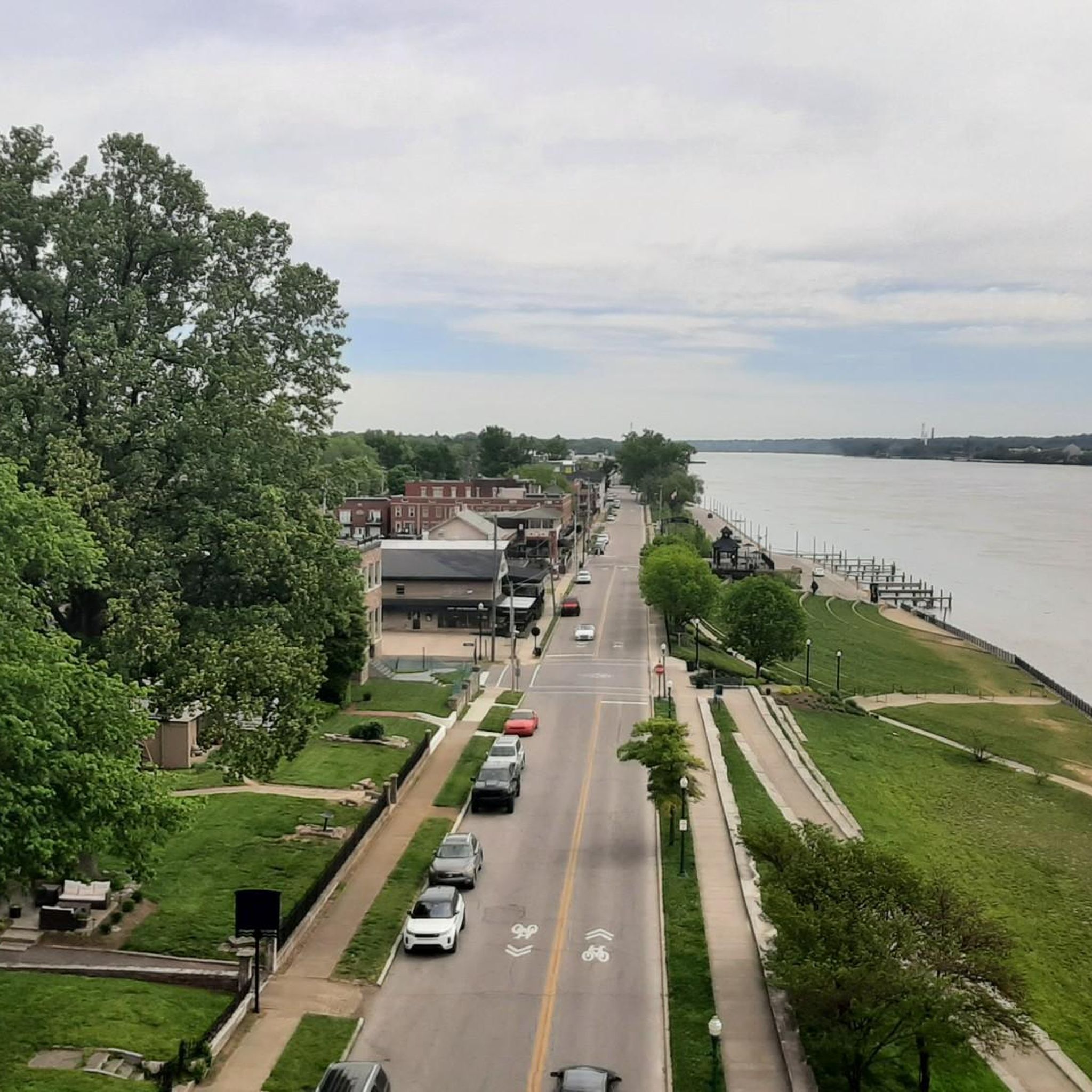
Jog the easy 2.9-mile Louisville Loop through historic Shawnee Park, enjoying Ohio River views and passing a lily pond.
67
runners
Moderate run. Good fitness required. Mostly paved surfaces. Suitable for all skill levels.

47
runners
10.1km
01:02
40m
40m
Moderate run. Good fitness required. Mostly paved surfaces. Suitable for all skill levels.
5.0
(1)
50
runners
20.5km
02:08
130m
130m
Hard run. Very good fitness required. Mostly paved surfaces. Suitable for all skill levels.
36
runners
17.6km
01:49
60m
60m
Hard run. Very good fitness required. Mostly paved surfaces. Suitable for all skill levels.
20
runners
25.2km
02:36
110m
110m
Hard run. Very good fitness required. Mostly paved surfaces. Suitable for all skill levels.
11
runners
18.9km
01:57
70m
70m
Hard run. Very good fitness required. Mostly paved surfaces. Suitable for all skill levels.
9
runners
11.5km
01:12
60m
60m
Moderate run. Good fitness required. Mostly paved surfaces. Suitable for all skill levels.
10
runners
Hard run. Very good fitness required. Mostly paved surfaces. Suitable for all skill levels.
10
runners
18.0km
01:51
50m
50m
Hard run. Very good fitness required. Mostly paved surfaces. Suitable for all skill levels.
Get access to more routes and recommendations from other explorers.
Already have an account?
Our route recommendations are based on thousands of hikes, rides, and runs completed by other people on komoot.
Start today with a free account
Your next adventure awaits.



Tips from the Community

Main Street in downtown Louisville is commonly known as Whiskey Row or Museum Row. It is full of interesting architecture and has one of the US’s largest collections of 19th‑ to early 20th‑century cast‑iron facades.
0
0
Cherokee Park is a 400‑acre municipal park in East Louisville. It was created in 1891 by landscape architect Frederick Law Olmsted. It has several trails, including a paved loop trail, as well as restrooms and picnic areas.
1
0

Originally constructed in 1895 as a railroad bridge the Big Four Bridge was converted as pedestrian and bike connector between Louisville, Kentucky, and Jeffersonville, Indiana. This has proven to be an extremely popular conversion as the bridge sees over 1.5 million crossings per year.
0
0
This is a nice, riverside park with ample parking and restrooms, which makes it a great place to start and finish your ride. The, as yet, incomplete Louisville Loop Trail runs through the park, giving riders access to other parts of the city.
0
0

The Scenic Loop is a paved path through Cherokee Park that is open to both bikes and foot-traffic. It is next to the road a lot of the time, so you will have cars close by for a lot of the run. This is a great addition to the actual trail loop that you can also run in the park.
0
0

Situated along the Louisville Loop Trail, this fountain is a nice spot for a short break. There is a large green space on the other side, making it an ideal spot for a picnic with great views of the Ohio River.
0
0
The Louisville Extreme Park is one of the top skate parks in the country, featuring a 24-foot full pipe and a blend of street, transition, and vert skating areas. Opened in April 2002, it spans 40,000 square feet of outdoor concrete space, including a wooden vert ramp and restrooms, and is accessible 24 hours a day. Catering to skateboarders, inline skaters, and bikers of all ages and skill levels, the park is centrally located downtown, near Waterfront Park and Slugger Field. It can be easily reached by bus, car, or by walking and biking along the RiverWalk. Designed with local input, it’s also a great place to relax and people watch!
0
0
Big Four Station Park covers ten acres at the base of the Big 4 Bridge. It is a picturesque spot with plenty of green space, restrooms, picnic tables, paved pathways, and a bike-sharing station. It is a hub for walkers and cyclists traveling between Louisville and Indiana. There are stunning views of the Ohio River and the Louisville skyline, and the bridge is filled with lights at night, making it a popular destination in the evening. There is also a great local farmers market here on Saturdays.
0
0
Frequently Asked Questions
How many running routes are available in Floyd County?
Komoot features over 20 running routes in Floyd County. These trails offer a variety of experiences, from easy park loops to more challenging paths with significant elevation changes, catering to different fitness levels.
Are there easy jogging routes suitable for beginners or families in Floyd County?
Yes, Floyd County offers several easy running paths. For instance, Claytor Lake State Park, though primarily known for water sports, features a 2.2-mile loop trail that is suitable for all ages and skill levels. Local community parks like Warren G. Lineberry Memorial Park and Floyd Recreation Park also provide accessible spaces for a gentle run.
Where can I find scenic running trails with viewpoints in Floyd County?
Floyd County is rich in scenic running opportunities. The nearly 40 miles of the Blue Ridge Parkway traversing the county offer breathtaking views. For elevated vistas, consider trails at Buffalo Mountain Natural Area Preserve, which boasts a 3,971-foot peak with views stretching over 50 miles on clear days. Rocky Knob Recreation Area also provides stunning views, particularly from the Rock Castle Gorge viewpoint, overlooking the entire recreation area and surrounding mountains.
What kind of terrain can I expect on running trails in Floyd County?
The terrain in Floyd County is characterized by a mountainous, rural landscape within the Blue Ridge Highlands. You'll encounter gently rolling mountains with elevations ranging from 2,300 to 4,000 feet, providing varied gradients for a challenging yet rewarding experience. Trails can range from flat park paths to steep ascents, such as the one-mile trail at Buffalo Mountain.
Are there any long-distance running options in Floyd County?
For those seeking longer runs, the extensive trail networks within areas like Rocky Knob Recreation Area and the numerous access points along the Blue Ridge Parkway provide ample opportunities to combine sections for extended distances. While specific long-distance routes are not detailed, the interconnectedness of trails allows for customizable longer runs.
What do other runners enjoy most about jogging in Floyd County?
The running routes in Floyd County are highly rated by the komoot community, with an average score of 5.0 stars. Runners often praise the unspoiled natural beauty, the varied terrain, and the peaceful environment that allows for an immersive outdoor experience amidst the Blue Ridge Highlands.
Are there any specific natural attractions or landmarks to look out for while running in Floyd County?
Absolutely! While running in Floyd County, you can explore the unique natural communities at Buffalo Mountain Natural Area Preserve, known for its rare plant and animal species. Rocky Knob Recreation Area offers diverse native tree varieties, wildflowers, and wildlife. Fred Clifton Park provides opportunities to observe colorful birds. The Blue Ridge Parkway itself is a major landmark, offering continuous scenic beauty.
Is Floyd County suitable for advanced runners looking for a challenge?
Yes, advanced runners will find challenging options in Floyd County. The region's topography includes significant elevation changes, with routes reaching up to 4,000 feet. Trails like the steep ascent at Buffalo Mountain Natural Area Preserve, or longer, more strenuous paths within the Rocky Knob Recreation Area, can provide a demanding workout.
What is the best time of year for running in Floyd County?
Floyd County offers beautiful running conditions throughout much of the year. Spring and fall provide pleasant temperatures and stunning natural scenery, with wildflowers in spring and vibrant foliage in autumn. Summer can be warm, but higher elevations offer cooler air. Winter running is possible, but runners should be prepared for colder temperatures and potential snow or ice, especially on higher trails.
Are there opportunities for trail running or off-road jogging in Floyd County?
Yes, Floyd County is an excellent destination for trail running. The mountainous and rural landscape, particularly within areas like Buffalo Mountain Natural Area Preserve and Rocky Knob Recreation Area, features extensive trail networks that are perfect for off-road jogging. These trails offer a more rugged and immersive experience compared to paved paths.
Where can I find more information about outdoor recreation in Floyd County?
For additional details on outdoor activities and recreation opportunities in the area, you can visit the official Floyd County tourism website: visitfloydva.com.

Get inspired with the komoot mobile app


Didn’t find what you were looking for?
Check out more Running Trails & Routes throughout Floyd County below and find the perfect route in your destination.
Explore more
Browse the best Running Trails & Routes in other regions.
