The best walks and hikes in Itasca County
3.0
(3)
17
hikers
12
hikes
Hiking in Itasca County, Minnesota, offers trails through a landscape characterized by extensive forests, numerous lakes, and rolling terrain. The region is part of the larger Chippewa National Forest, featuring diverse ecosystems. Hikers can expect paths that traverse woodlands and provide views of various water bodies. The elevation changes are generally moderate, making many routes accessible.
Best hiking trails in Itasca County
- The most popular hiking route is Trout Lake Trail to Joyce Estate — Chippewa National Forest, a…
Last updated: October 24, 2026
12.6km
03:17
80m
80m
Embark on a moderate hike along the Mesabi Trail from Grand Rapids to Bovey, a route that spans 7.9 miles (12.6 km) and involves a gentle climb of 276 feet…
1.54km
00:24
10m
10m
Embark on the easy Chase Point Trail, a 1.0-mile (1.5 km) hike that offers unique perspectives of Coon and Sandwick Lakes. You will experience a gentle elevation gain of just…

2.0
(2)
3
hikers
11.3km
02:56
70m
70m
Embark on a moderate hike along the Trout Lake Trail, a 7.0-mile (11.3 km) route that guides you through the serene Chippewa National Forest. You will experience the tranquil lakeside…
4.0
(1)
1
hikers
7.50km
02:00
80m
80m
Embark on the Spruce Island Lake Trail Loop for an easy hike through the scenic Chippewa National Forest. This route spans 4.7 miles (7.5 km) with a gentle elevation gain…
7.41km
01:55
50m
50m
Embark on an easy hike along the Suomi Hills Trail, a peaceful escape into Minnesota's wilderness. This route winds through rolling topography on unpaved singletrack paths, offering a serene experience.…
6.91km
01:50
70m
70m
Embark on an easy hike along the Barney Lake Trail Loop, a peaceful route spanning 4.3 miles (6.9 km) with a gentle elevation gain of 227 feet (69 metres). You…
6.89km
01:46
30m
30m
The Simpson Creek Trail Loop offers a delightful and accessible journey through the diverse landscapes of the Chippewa National Forest. You'll experience the serene beauty of towering red and white…
9.05km
02:19
30m
30m
Explore the moderate Simpson Creek Trail, a 5.6-mile (9.1 km) hike that takes about 2 hours and 18 minutes to complete. You will experience a gentle elevation gain of 100…
38.2km
09:44
110m
110m
Embark on a challenging hike along the Cut Foot Sioux Trail, a demanding route that stretches 23.8 miles (38.2 km) through the heart of Northern Minnesota's wilderness. You will navigate…
32.1km
08:11
110m
110m
Embark on the Cut Foot Sioux Trail, a challenging 19.9 miles (32.1 km) hike through the diverse landscapes of the Chippewa National Forest. You will navigate old forest roads and…
Get access to more routes and recommendations from other explorers.
Already have an account?
Our route recommendations are based on thousands of hikes, rides, and runs completed by other people on komoot.
Start today with a free account
Your next adventure awaits.



Tips from the Community

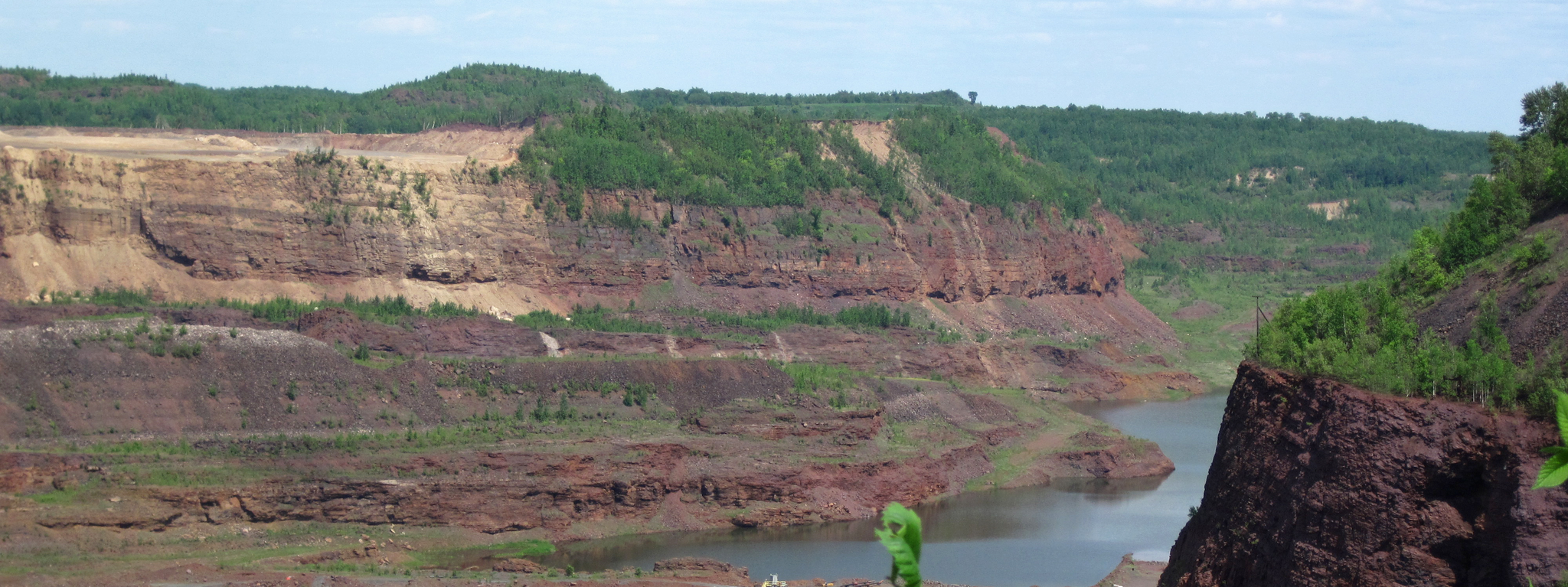
The Mesabi Trail hugs a segment of the Prairie River, boasting views of red iron-rich hills around it. The river looks great today, considering that in 1991, Enbridge Line 3 pipeline burst and resulted in the largest inland oil spill in U.S. history, releasing about 1.7 million gallons of oil into the area, including the Prairie River.
0
0
The western terminus of the Mesabi Trail in Grand Rapids marks the beginning of a popular paved multi-use path. From here, the trail stretches northeast for over 160 miles, eventually reaching the town of Ely near the Boundary Waters.
1
0

This is the western terminus of the Mesabi Trail that eventually. will run all the way from Grand Rapids to Ely.
4
0

The Suomi Hills include 19 miles of hiking and biking trails. The name comes from the nearby town of Suomi, which was founded by Finnish immigrants in the early 1900s. The Suomi Hills Recreation is a great place for beaver, otter, bald eagle, osprey, and loon sightings.
0
0
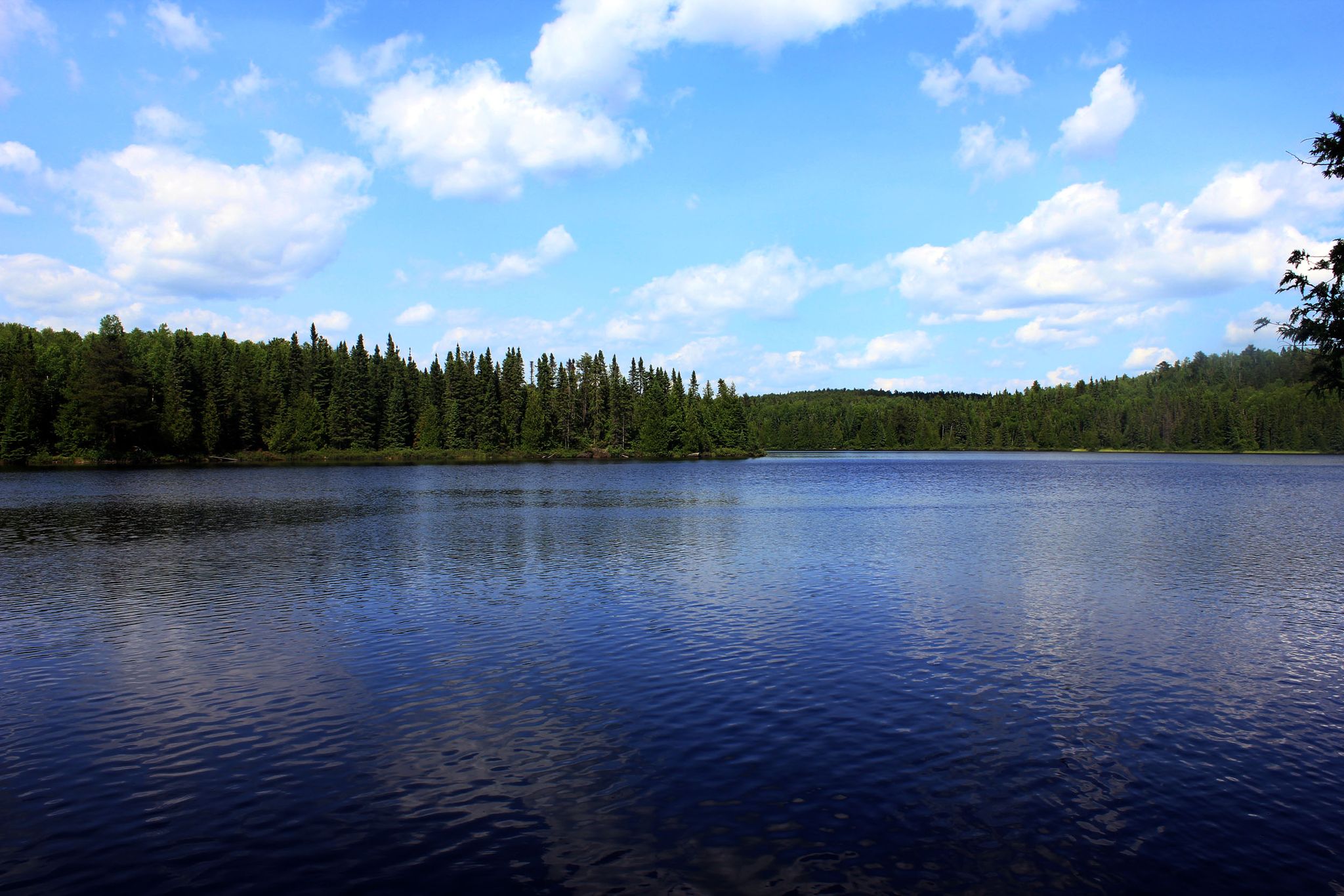
Lucky Lake is one of a few lakes in the area sometimes frequented by bald eagles. Keep an eye out for osprey, loons, beavers, otters, and other fauna. The adjacent Hill Lake to the east is also a great spot for wildlife sightings. For hikers looking for a shorter adventure, Lucky Lake makes a great turn-around point.
0
0
Spruce Island Lake is one of a few lakes in the area sometimes frequented by bald eagles. Keep an eye out for osprey, loons, beavers, otters, and other wildlife.
0
0
Miller Lake is a "sunken" lake. Like most of the lakes in the Suomi Hills Recreation Area, it is the site of beaver activity. Due to washouts over the years the water of the lake has drained repeatedly as it fills into Amen Lake.
0
0
Like much of Minnesota, the Suomi Hills were the site of extensive logging. This region was logged for pine between 1905 and 1910, and today the forest has transitioned to deciduous maple, oak, and basswood that makes the region beautiful to visit in the fall. Beaver, loons, and many other birds make the Suomi Hills a great place to experience wildlife.
0
0
Frequently Asked Questions
How many hiking trails are available in Itasca County?
Itasca County offers a selection of 12 hiking trails, catering to various skill levels. You'll find 7 easy routes, 3 moderate, and 2 more challenging options to explore.
What kind of terrain can I expect on Itasca County hiking trails?
Hiking in Itasca County primarily features trails through dense forests, alongside numerous lakes, and over gentle, rolling hills. The region is part of the larger Chippewa National Forest, providing diverse woodland ecosystems and moderate elevation changes.
Are there any long-distance hiking options in Itasca County?
Yes, for those seeking a longer adventure, the Cut Foot Sioux Full Loop — Chippewa National Forest is a challenging 38.2 km (23.7 miles) trail. Another significant option is the Cut Foot Sioux West Loop — Chippewa National Forest, which spans 32.1 km (19.9 miles).
Are there any easy, family-friendly loop trails in Itasca County?
Absolutely. The Spruce Island Lake Trail Loop — Suomi Hills — Chippewa National Forest is an easy 7.5 km (4.7 miles) path, offering pleasant views. Another great choice is the Miller Lake Trail Loop — Suomi Hills — Chippewa National Forest, an easy 7.4 km (4.6 miles) route.
What do other hikers say about the trails in Itasca County?
The trails in Itasca County are well-regarded by the komoot community, holding an average rating of 3.0 stars from 3 reviews. Hikers often appreciate the quiet woodlands and the scenic views of the many lakes.
Are there any notable landmarks or attractions near the hiking trails?
Yes, Itasca County offers several points of interest. You can visit the historic Joyce Estate, which is accessible via the Trout Lake Trail. Other attractions include the Western Terminus of the Mesabi Trail and the Prairie River.
Can I find trails that offer views of lakes?
Many trails in Itasca County provide lake views. For example, the Barney Lake Trail Loop — Suomi Hills — Chippewa National Forest leads past Barney Lake, and the Spruce Island Lake Trail Loop offers views of Spruce Island Lake.
Are there any short, easy hikes for a quick outing?
For a shorter, easy walk, consider the Lost 40 Loop — Chippewa National Forest. This trail is only about 1.5 km (0.9 miles) long and can be completed in under 30 minutes, making it perfect for a brief exploration.
What is the best time of year to go hiking in Itasca County?
While specific seasonal details are not provided, Itasca County's landscape of forests and lakes suggests that spring and fall would offer pleasant hiking conditions with mild temperatures and beautiful foliage. Summer is also popular, though be prepared for warmer weather and insects.
Are there any trails within the Suomi Hills area of Chippewa National Forest?
Yes, the Suomi Hills area within the Chippewa National Forest features several trails. Popular options include the Spruce Island Lake Trail Loop, the Barney Lake Trail Loop, and the Miller Lake Trail Loop.
Are there any trails that follow a creek?
Yes, the Simpson Creek Trail Loop — Chippewa National Forest is an easy 6.9 km (4.3 miles) route that follows Simpson Creek. For a longer option, consider the Simpson Creek Trail Extended Loop.
Most popular attractions in Itasca County

Get inspired with the komoot mobile app


Explore more
Browse the best Hikes in other regions.
