The best walks and hikes in Montgomery County
4.9
(40)
282
hikers
50
hikes
Hiking in Montgomery County offers diverse outdoor experiences across its extensive park systems and varied landscapes. The region features trails through national forests, along creek-side paths, and around ponds and gorges. Terrain includes forested hills, riverbanks, and rolling areas, providing a mix of paved multi-use paths and natural surface trails with varied elevation.
Best hiking trails in Montgomery County
- The most popular hiking route is Huckleberry Trail, a 16.0 miles (25.8 km) trail that takes over 6 hours to complete. This difficult route features significant elevation gain through forested areas.
- Another top favourite among local hikers is Gateway Trail to Jacob's Ladder to Snakeroot Loop Trail, a moderate 6.4 miles (10.3 km) path. The trail involves ascents and descents within a forest landscape.
- Local hikers also love the Stiles Falls Trail, a 1.5 miles (2.5 km) trail leading through a natural area, often completed in about 44 minutes.
- Hiking in Montgomery County is defined by trails in national forests, creek gorges, and community parks. The network of routes provides options for both easy walks and more difficult hikes with substantial elevation.
- The routes in Montgomery County are highly rated by the komoot community with an average score of 4.8 stars from over 30 reviews. More than 200 hikers have used komoot to explore Montgomery County's varied terrain.
Last updated: August 17, 2026
1
hikers
25.8km
06:46
210m
200m
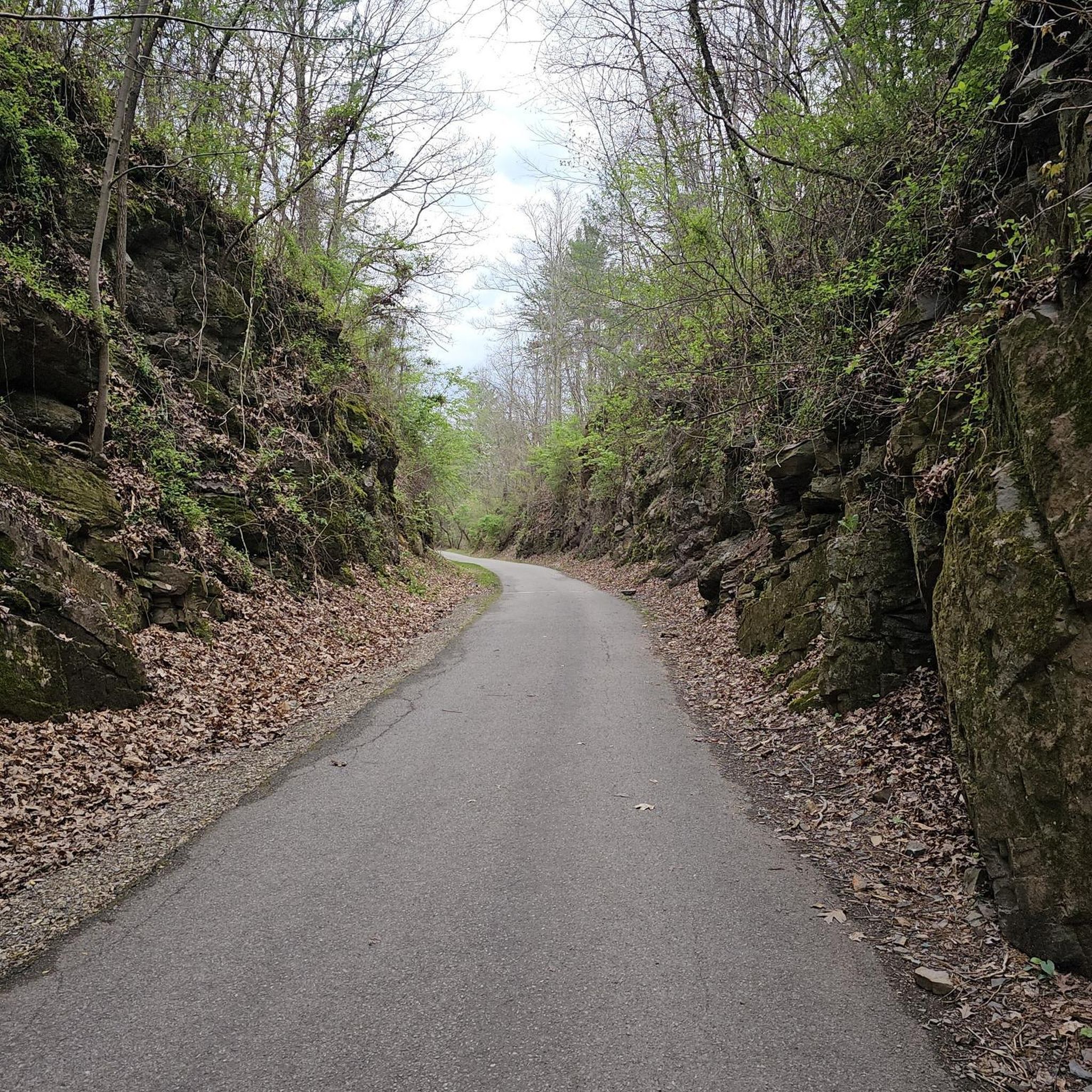
Hike the 16.0-mile Huckleberry Trail, a challenging paved route connecting Blacksburg and Christiansburg, featuring diverse scenery.
1
hikers
25.8km
06:46
210m
200m
Hike the difficult 16.0-mile Huckleberry Trail in Virginia, gaining 703 feet in elevation over varied landscapes and past historical sites.

Sign up for free
1
hikers
10.3km
03:10
470m
230m
The Gateway Trail to Jacob's Ladder to Snakeroot Loop Trail offers a challenging hike through a dense hardwood forest, providing a true 'green tunnel' experience in the warmer months. You'll navigate varied terrain, from the steep, rocky climbs of the Gateway Trail to the technical descents of Jacob's Ladder, eventually reaching a creek crossing. Keep an eye out for the rewarding viewpoint from Brush Mountain along the way.
This moderate 6.4-mile (10.3 km) loop involves a significant 1530 feet (466 metres) of elevation gain, typically taking around 3 hours and 10 minutes. Parking is available at trailheads like the Poverty Creek Trailhead. Be mindful that this is a multi-use trail, so you'll be sharing the path with mountain bikers and horseback riders; always yield to horses and watch for downhill bikers.
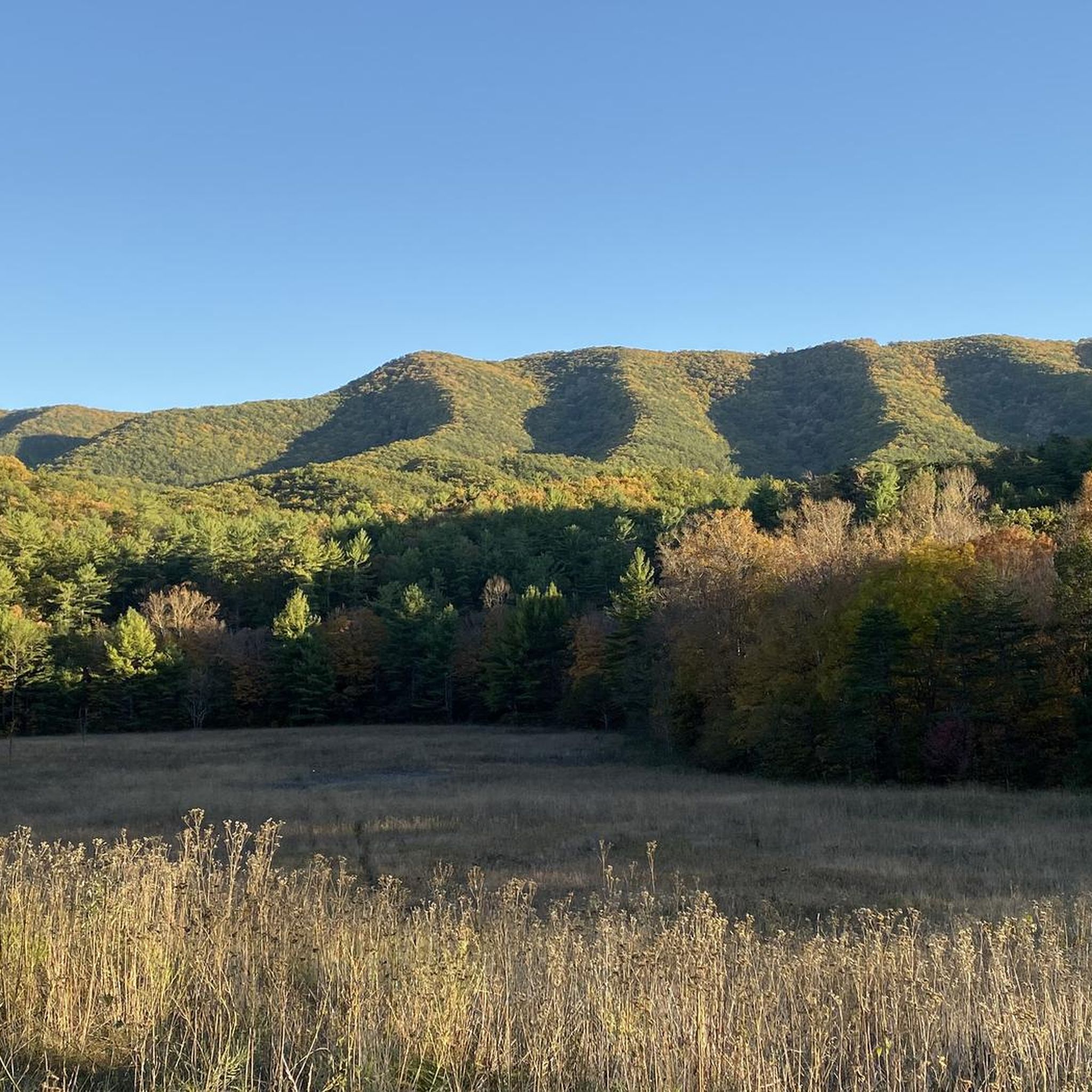
Located in the Jefferson National Forest near Blacksburg, Virginia, this trail system is a fantastic option if you're seeking a strenuous workout in a natural setting. It's known for being less trafficked than some other routes, offering a peaceful escape. While dramatic vistas are limited, the autumn season transforms the forest into a vibrant display of changing foliage, making it a particularly scenic time to visit.
1
hikers
6.79km
01:53
110m
140m
This loop combines several trails within the George Washington & Jefferson National Forest, offering a pleasant forest walk. You'll traverse sections of the main Poverty Creek Trail, known for its gentle, rolling slopes, and experience the narrower May Apple Trail with its charming creek crossings. The route winds through hardwood and rhododendron forests, which are particularly vibrant when in bloom, providing a peaceful and varied natural setting.
Access the trail from the Pandapas Pond Day Use Area, where parking is available. This area is a hub for the Poverty Creek Trail System, so consider arriving early on busy days. The trail is generally accessible year-round, but spring and fall offer the most comfortable temperatures and beautiful scenery. No permits are needed for this easy 4.2-mile (6.8 km) hike.
The Poverty Creek Trail System is a versatile network, serving as the main artery for over 20 miles of interconnected trails. This particular loop, with its 376 feet (115 metres) of elevation gain and estimated duration of 1 hour and 52 minutes, is rated easy and is ideal for beginner hikers, families, or anyone looking for a quick, refreshing escape into nature. It's a multi-use trail, so you'll share the path with mountain bikers and horseback riders.
2.48km
00:44
120m
0m
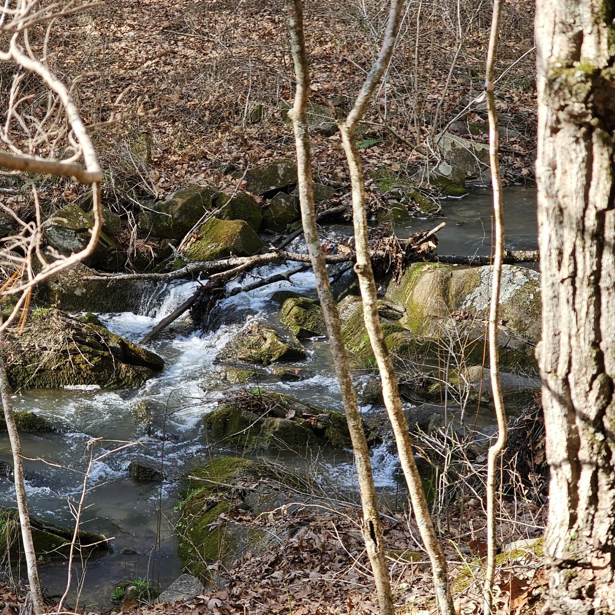
The Stiles Falls Trail offers a delightful escape into nature, leading you through varied terrain to a picturesque 40- to 50-foot waterfall. Starting on a gravel path, the route soon transitions to dirt and rock, closely following Purgatory Creek where you'll encounter lush greenery and wildflowers. This easy hiking route covers 1.5 miles (2.5 km) with 388 feet (118 metres) of elevation gain, typically completed in about 44 minutes, making it a perfect short adventure.
To plan your visit, know that the trail is on the private land of Camp Alta Mons but is open to the public from dawn to dusk; remember to sign in at the trailhead. Sturdy hiking boots are highly recommended for the three creek crossings and the final rocky scramble to the falls. Spring and fall offer the most comfortable temperatures and beautiful scenery for your hike.
This trail is notable not just for its natural beauty but also for its unique history, said to be named after Randolph Stiles, a Confederate sailor who met an unfortunate end here. It's a popular spot for families and beginners, providing a rewarding destination that feels much further from civilization than its short distance suggests.
2.94km
00:48
40m
40m
The Heritage Community Park Loop offers a delightful, easy hike through Blacksburg's largest park, immersing you in lush natural surroundings. You'll traverse meadows and floodplains, keeping an eye out for historical sites like the Very Old Hidden Cemetery and the Old Farmhouse, all while enjoying the park's serene ambiance. This 1.8-mile (2.9 km) route is perfect for a quick nature fix, taking about 47 minutes to complete with a gentle 127 feet (39 metres) of elevation gain.
Accessing the Heritage Community Park Loop is simple, with ample parking available at this extensive 169-acre park. Blacksburg's moderate climate ensures pleasant hiking conditions for most of the year, making it an ideal spot for a spontaneous outing. The trail is well-maintained and suitable for walkers, runners, and families, offering a welcoming environment for outdoor enthusiasts of all levels.
Heritage Community Park is particularly notable for its rich biodiversity, with over 120 species of birds documented, making it a prime location for wildlife spotting, especially during fall migration. Beyond the natural beauty, the park provides amenities like picnic tables and shelters, enhancing its appeal as a community hub. It's a fantastic option for an easy, family-friendly outdoor experience in the region.
1.06km
00:17
10m
10m
The H. L. Price Trail offers a delightful, easy stroll through a tranquil agricultural landscape near Prices Fork, Virginia. Following an old wagon road alongside Walls Branch, you'll enjoy the peaceful atmosphere and the gentle sound of rushing water as you make your way to the historical grist mill site at Stroubles Creek. This 0.7-mile (1.1 km) hike with only 45 feet (14 metres) of elevation gain is a perfect, quick escape, taking just about 17 minutes to complete.
Planning your visit to this accessible trail is straightforward, as it's suitable for all skill levels and doesn't require special permits. The trailhead is conveniently located near Prices Fork, making it an easy stop for locals and visitors alike. There are no specific warnings about parking or seasonal closures, so you can generally visit at your leisure, though pleasant weather will enhance the experience.
What truly sets the H. L. Price Trail apart is its unique historical context; it traces the path of an old wagon road that once served the colonial-era community of Prices Fork, leading to a vital grist mill. While the surrounding region boasts more rugged options in the Jefferson National Forest, this trail provides a gentle, family-friendly alternative, offering a quiet connection to the area's past and natural beauty.
5.0
(1)
29
hikers
4.97km
01:27
130m
130m
The Stiles Falls Trail offers a rewarding journey through diverse terrain, culminating in the majestic 40-50 foot Stiles Falls. As you hike, you'll follow Purgatory Creek, enjoying continuous views of cascading water and large boulders, surrounded by lush forests and wildflowers. The path transitions from a gravel road to grass, dirt, and rocks, providing a varied and engaging experience for hikers of all levels.
Planning your visit requires a quick check of the Alta Mons website, as the trail is on private property and may close during camps or inclement weather. You'll need to sign in upon arrival, and while the trail is generally open from dawn to dusk, verifying its status is key. Be prepared for three stream crossings over Purgatory Creek, which often involve rock-hopping and could lead to wet feet.
This easy 3.1-mile (5.0 km) hike, with 421 feet (128 metres) of elevation gain and an estimated duration of 1 hour and 26 minutes, is a fantastic option for families. Beyond the waterfall, you'll find information plaques detailing the history of the Crockett family, who once bottled water from the area, adding a touch of local lore to your adventure.
4.8
(5)
11
hikers
5.47km
01:29
80m
80m
Escape into the Jefferson National Forest on the Pandapas Pond Loop via Joe Pye and Horse Nettle, a delightful journey through varied terrain. You'll wander through lush Appalachian hardwoods, past fragrant rhododendron thickets, and along wooded singletrack. The centerpiece is the serene 8-acre Pandapas Pond, where a wooden boardwalk offers peaceful views and opportunities to spot painted turtles and other aquatic life. This trail provides a refreshing forest experience with diverse scenery.
Planning your visit is straightforward, with accessible parking at the trailhead. Be aware that the broader trail system is multi-use, so you might encounter mountain bikers and horseback riders sharing the paths. The 3.4-mile (5.5 km) loop is rated easy, with 254 feet (77 metres) of elevation gain, and typically takes about 1 hour and 29 minutes. It's a great option for a leisurely outing, though the Horse Nettle section does offer a sustained climb for a bit more challenge.
This area is a haven for wildlife, making it excellent for birdwatching and observing creatures like white-tailed deer, eastern box turtles, and various frogs. The trail showcases a rich variety of plant life, including flame azalea, adding seasonal color. The Pandapas Pond Loop offers a tranquil escape into nature, perfect for families or anyone seeking a gentle yet engaging hike near Blacksburg, Virginia.
4.0
(1)
4
hikers
6.27km
01:53
200m
200m
The Knight & Johnston Trail offers a delightful journey through the Bottom Creek Gorge Preserve, where you'll experience the powerful Roanoke River tributary up close. The route meanders through old-growth hardwoods, providing ample shade and a chance to spot spring wildflowers. You'll encounter the creek's rapids and kettles, with the Johnston Trail leading to the impressive Falls Overlook for views of Bent Mountain Falls, making it a rewarding hike for nature lovers.
This easy 3.9-mile (6.3 km) hike involves 642 feet (196 metres) of elevation gain and typically takes around 1 hour and 53 minutes. While the Knight Trail has some adventurous sections, including a steep drop to the water, the overall difficulty is manageable for most. Be aware that the Johnston Trail can be quite popular, especially on summer weekends, so an early start is advisable to avoid crowds.
Located in Montgomery County, Virginia, this trail system is notable for its close proximity to Bottom Creek, allowing hikers to truly immerse themselves in the sounds and sights of the water. The varied terrain, from flat sections to the steep drop and gentle uphill meanders, keeps the experience engaging. It's a fantastic option for those seeking scenic viewpoints and a relatively easy route to enjoy the natural beauty of the region.
Get access to more routes and recommendations from other explorers.
Sign up for free
Already have an account?
Our route recommendations are based on thousands of hikes, rides, and runs completed by other people on komoot.
Start today with a free account
Your next adventure awaits.
Login or Signup
Popular around Montgomery County



Tips from the Community

This overlook point offers a view of the cascade that falls down Bottom Creek Gorge. The viewpoint is named in honor of Malcolm and Jimmie Black, who were dedicated volunteer monitors at Bottom Creek Gorge Preserve. Bent Mountain Falls, also known as Puncheon Run Falls, is the second highest waterfall in Virginia. It features a series of cascading steps formed by unique rock formations called kettles.
1
0

The hike to the falls is pretty mellow but the final approach to the waterfall might be challenging for some. Please note that this area is on private property that is controlled by a church camp. It's open to the public for most of the year but is closed while camp is in session. You can check the closing dates here: www.altamons.org/hike.html
1
0

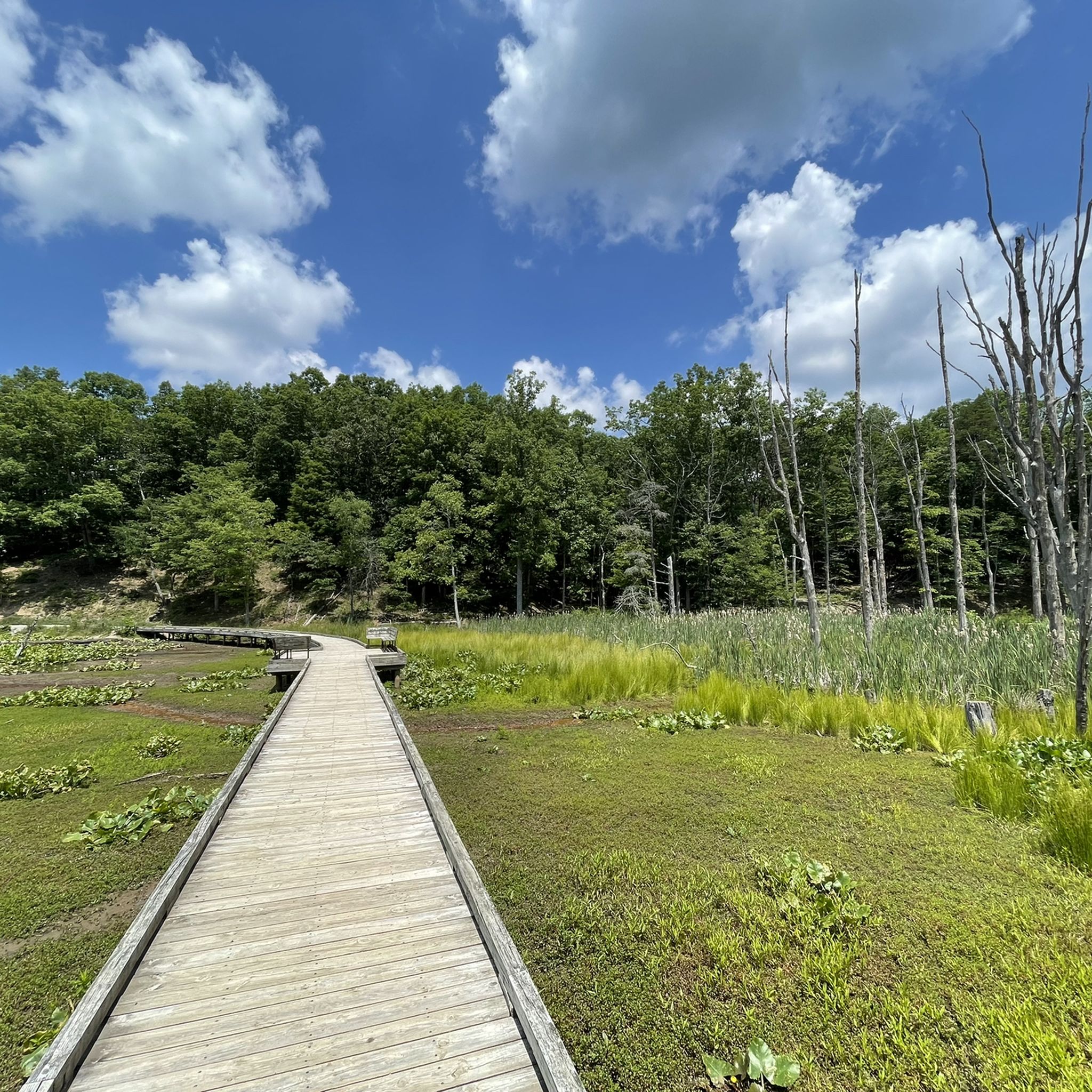
Pandapas Pond is a small 8-acre reservoir outside of Blacksburg, Virginia. The pond was man-made and is encompassed by a hiking and running trail featuring a boardwalk in areas.
0
0

From Horse Nettle Trail you can peek through the trees for a view of the Gap Mountain ridge.
0
0
From here you have a great view of Bent Mountain Falls, at 200 feet the second highest waterfall in Virginia.
0
0
This is where the Coal Mining Trail starts. It loops around the Huckleberry Trail and remembers the past of the area with mining artifacts along the way.
0
0
The loop around the pond is about one mile and accessible with a wheelchair. Apart from hiking, the pond offers fishing and canoeing opportunities as well as picnic sites.
0
0
Some of the headstones date back to the early 19th century.
0
0
Frequently Asked Questions
What are the most challenging hikes in Montgomery County?
For a serious challenge, the region is known for the Billy Goat Trail in the C&O Canal National Historical Park, which involves significant rock scrambling over boulders with views of the Potomac River. For a difficult, long-distance forest hike, consider the Horse Nettle, Snakeroot, Poverty Creek, Skullcap, & Prickly Pear loop, which covers over 11 miles with considerable elevation gain.
Are there any easy, family-friendly hikes available?
Yes, Montgomery County has many options for families. The Lake Shore Trail in Seneca Creek State Park is a scenic and relatively flat walk around Clopper Lake. For an easy walk through a unique landscape, the Knight & Johnston Trail — Bottom Creek Gorge Preserve offers a pleasant 3.9-mile route. Rock Creek Regional Park is also a popular choice, with gentle trails around Lake Needwood and Lake Frank.
Can I bring my dog on the hiking trails?
Many parks in Montgomery County are dog-friendly, but rules vary and dogs must typically be leashed. Parks like Black Hill Regional Park and Rock Creek Regional Park are popular with dog walkers. However, note that dogs are not permitted on certain trails, such as Section A of the Billy Goat Trail, for safety reasons. Always check the specific park's regulations before you go.
Where can I find hikes with good lake views?
Black Hill Regional Park is a top choice for lake views, centered around Little Seneca Lake with over 20 miles of trails offering scenic vistas. Rock Creek Regional Park also provides beautiful waterside hiking around its two lakes, Lake Needwood and Lake Frank. For a different experience, the Horse Nettle, Joe Pye and Pandapas Pond Trail offers a peaceful walk around Pandapas Pond.
Are there any paved trails for walking or running?
Yes, the county has several excellent paved trails. The C&O Canal towpath offers a very long, flat, and scenic path along the Potomac River. The Black Hill Trail within Black Hill Regional Park is a popular 4.6-mile paved loop. For a longer, multi-use path, the Huckleberry Trail North is a great option for both hiking and running.
What are some good moderate-level hikes?
For a hike that's more than a simple walk but not overly strenuous, the Gateway and Horse Nettle Trail is a great choice, featuring ascents and descents within the Jefferson National Forest. Another solid option is the Snake Root, Jacobs Ladder and May Apple Trail, which provides a good workout over varied terrain.
Are there any trails with historical significance?
Absolutely. The C&O Canal National Historical Park is steeped in 19th-century history, with its preserved towpath, lockhouses, and aqueducts. For a deeply meaningful experience, The Underground Railroad Experience Trail in Sandy Spring allows you to walk a path that commemorates the journey of freedom seekers.
How many hiking trails are there in Montgomery County?
There are over 35 designated hiking routes in Montgomery County on komoot, ranging from easy strolls to difficult mountain treks. This network covers everything from state parks and national forests to local conservation areas, offering a wide variety of landscapes to explore.
What do other hikers think of the trails in Montgomery County?
The trails in this region are highly regarded by the komoot community, earning an average rating of 4.9 out of 5 stars. Hikers frequently praise the variety of terrain, from the flat C&O Canal towpath to the rocky climbs at Sugarloaf Mountain, and the well-maintained paths in parks like Black Hill and Seneca Creek.
Where can I find a hike with a waterfall?
While large waterfalls are not a primary feature of the immediate area, some trails lead to beautiful water features. The hike to Stiles Falls is a rewarding 3-mile out-and-back trail that culminates at a lovely waterfall. The trails along Seneca Creek, especially after rain, can also feature smaller cascades and beautiful rapids.
What kind of unique landscapes can I explore?
Montgomery County offers several unique hiking environments. You can climb the isolated peak of Sugarloaf Mountain, a monadnock with quartzite cliffs and panoramic views. For a rare ecosystem, the Serpentine Barrens Conservation Park features greenish, desert-like soil and supports rare plant species. Blockhouse Point Conservation Park offers riverside views and Civil War ruins.
Are there any good loop hikes?
Yes, there are many excellent loop trails. The Brush Mountain, Crosscut, Wilkes Wood, & Ida May Trail loop is a great 4.1-mile circuit in Brush Mountain Park. For an easier loop, the Huckleberry Trail and Heritage Community Park route provides a pleasant 3.5-mile walk.
Most popular routes in Montgomery County
Most popular attractions in Montgomery County

Get inspired with the komoot mobile app


Didn’t find what you were looking for?
Check out more Hikes throughout Montgomery County below and find the perfect route in your destination.
Explore more
Browse the best Hikes in other regions.
