The 7 Most Amazing Peaks around Cervera
Best mountain peaks around Cervera are found in a region characterized by diverse mountainous terrain, including areas within the Montaña Palentina Natural Park. This area offers a range of elevations and landscapes, from high summits to scenic viewpoints. The region provides varied hiking experiences, catering to different skill levels. Its natural features include prominent peaks and expansive vistas across the Cantabrian Mountains and surrounding natural parks.
Best mountain peaks around Cervera
- The most popular mountain peaks is Piedrasluengas Viewpoint,…
Last updated: September 28, 2026
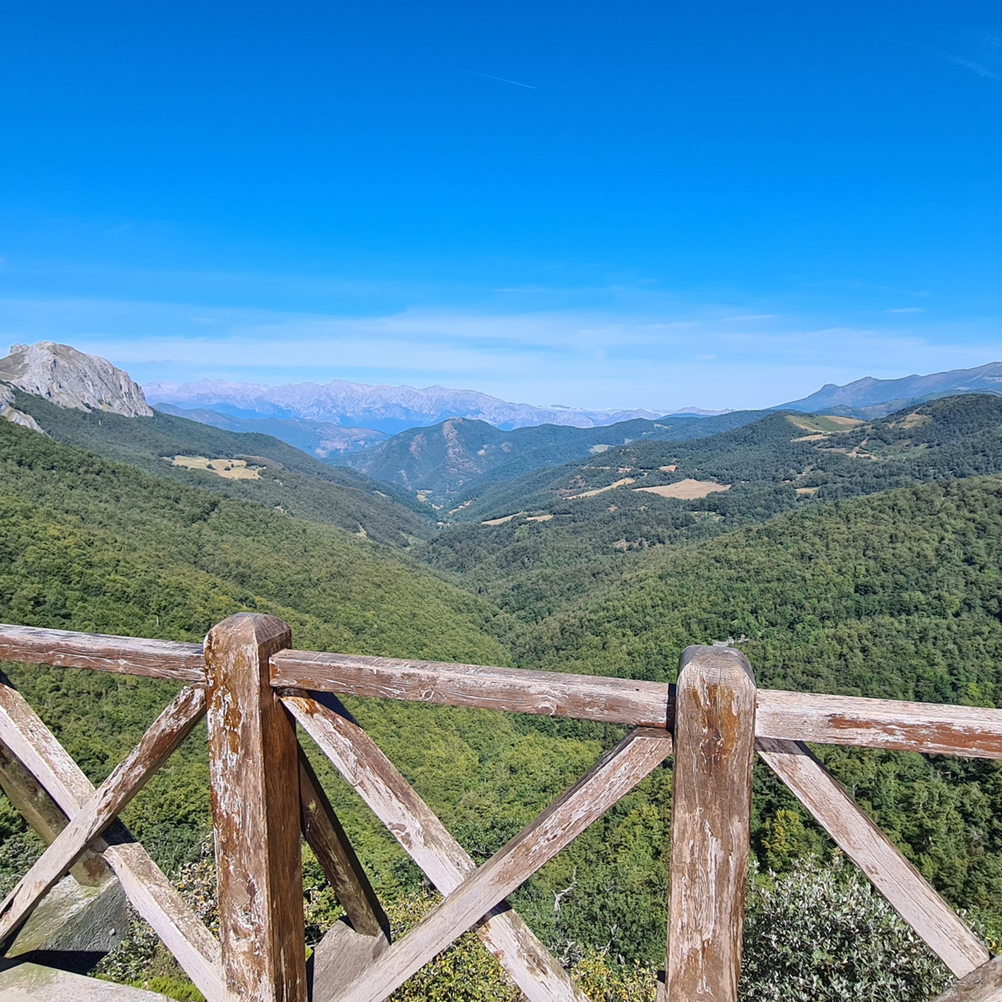
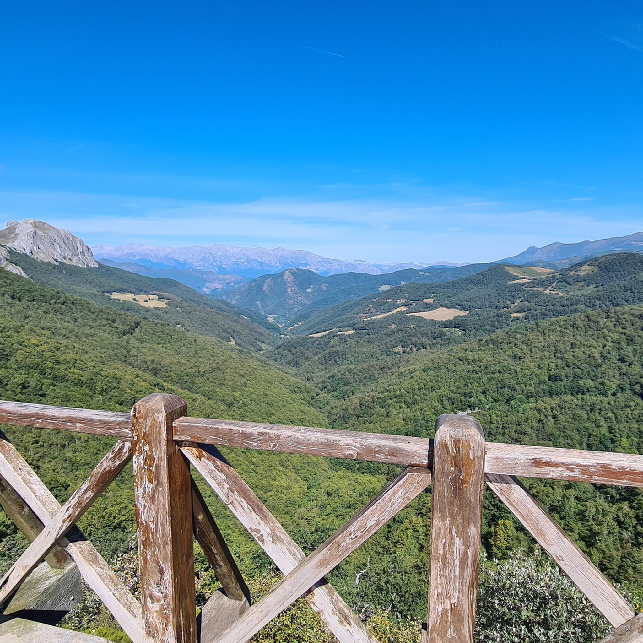
Piedrasluengas Viewpoint
Highlight • Viewpoint
Translated by Google •
Tip by

Curavacas (2524m)
Highlight • Summit
Translated by Google •
Tip by

Sign up now to discover places like this
Get recommendations on the best single tracks, peaks, & plenty of other exciting outdoor places.
Peña Labra
Highlight • Summit
Translated by Google •
Tip by

Tres Mares Peak
Highlight • Summit
Translated by Google •
Tip by
Peña Redonda Summit
Highlight • Summit
Translated by Google •
Tip by
Hell's Crag
Highlight • Summit
Translated by Google •
Tip by

Los Navales Summit
Highlight • Summit
Translated by Google •
Tip by
View of Cervera de Pisuerga and Curavacas Peak
Highlight • Viewpoint
72 kilometers. 920 positive meters.
The second day has common sections with the previous stage and a small road connection. The first kilometers …
Translated by Google •
Tip by

Peña del Águila Summit (1,435 m)
Highlight • Summit
Translated by Google •
Tip by
View of Castro Zacarriel
Highlight • Viewpoint
Translated by Google •
Tip by

Start today with a free account
Your next adventure awaits.


Other adventures around Cervera

Tips from the Community

The Pico Tres Mares offers a great view of the surrounding peaks and valleys. The three valleys, each separated by mountain ridges, drain via their respective river systems into the Mediterranean Sea (Rio Hijar / Ebro), the Cantabrian Sea (Rio Nansa), and the Atlantic Ocean (Rio Pisuerga), from which the summit gets its name. From up here, you can also clearly see the beginning of the path to Peña Labra, which essentially runs along or near the ridge to the west - and with reasonably good visibility, the Picos de Europa are clearly visible to the northwest, standing out distinctly from the surrounding mountains of the Cordillera Cantabrica, even if some are not that much lower. There is a viewing platform at the summit - not pretty, but it allows even visitors without mountain experience to look around safely.
0
0

Spectacular viewpoint, great reward after the long and pleasant climb!
0
0

All these landscapes are simply spectacular, while the climbs to them are very tough.
0
0

Los Navales, in the municipality of Triollo, is a mountainous area located in the heart of the Fuentes Carrionas and Fuente Cobre Natural Park - Montaña Palentina, in the province of Palencia. Although not as well-known as other iconic spots such as Espigüete or Curavacas, Los Navales is an area of great scenic and ecological value, ideal for hiking and nature lovers.
1
0
Climbing Curavacas is an exciting experience for mountain lovers. There are several routes available, such as Callejo Grande and Senda del Notario, which offer different levels of difficulty. In addition, in the area you can find glacial lagoons, such as Pozo Curavacas and Pozos del Ves, which add a special touch to the landscape.
5
0

Spectacular views of the eastern massif of Picos de Europa
0
0


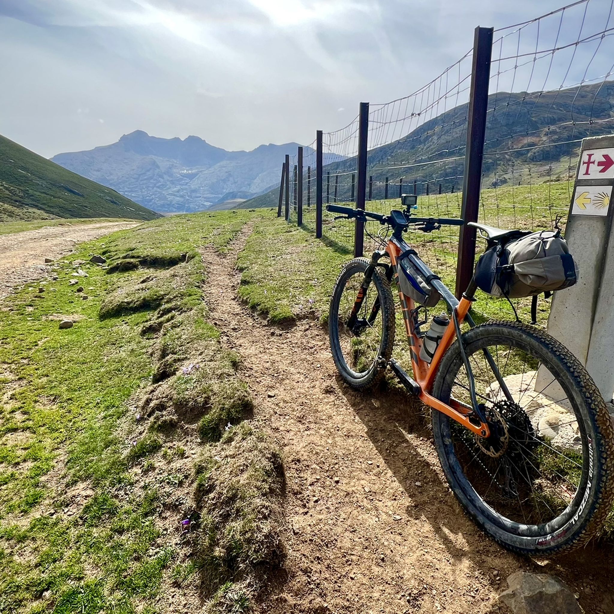
Stage 2. Cervera de Pisuerga/Alar del Rey 72 kilometers. 920 positive meters. The second day has common sections with the previous stage and a small road connection. The first kilometers are known and it is a mental help to overcome the Peña Umoma slope from Vado in the opposite direction. The exit from Cervera through the old town is comfortable and pleasant. And almost without pedaling we enter Vado, connect with the red milestones and begin the cycling adventure through the fields of the Valdeados plain. In reality, only the last kilometer is hard, we overcome the panoramic hill and stop at the La Estación viewpoint, always contemplating the magnificent rocky backdrop of the Curavacas peak in the background. In Dehesa de Montejo, the Perazancas de Ojeda alternative detour leaves and a new route begins through the towns and rural landscapes of La Ojeda. The rural road has a good surface and without stopping we reach Colmenares de Ojeda. The entrance to the church of San Fructuoso is fantastic, it has three arches with a cross vault and a Romanesque portico. The jewel is a baptismal font from the 12th century kept inside, one of the best of the Palencia Romanesque, it is a sandstone rock font carved with high reliefs of religious scenes and ceremonies. The towns are small, people barely appear on the streets, and it is surprising to find so much artistic wealth in each rural center. The path does not have slopes as hard as the previous day, it is still a constant ups and downs through holm oak mountains, fallow lands and agricultural meadows but without slopes of five per hour. The valley of the Fuente de los Moros stream is delicious, the bicycles glide over the crops to Pisón de Ojeda. The church of San Pelayo dominates the town's plain from a hill, preserving the Romanesque apse from the 13th century. And then comes the hardest slope of the day, although it has a lot of uncomfortable gravel, it is short and immediately a new plateau appears with views and the descent to Montoto de Ojeda. The church is also on the hill of the town and we went straight up, shortcutting the milestones of the Natural Trail. The best part of the temple is the apse, from the 12th century, inside it has capitals and wall paintings. The portico is Cistercian from the 13th century, it is a temple that has more content than meets the eye. The route continues along the gravel road, jumps over the mountain through a plain of crops and descends to Perazancas de Ojeda. The parish church has a beautiful Romanesque doorway with three archivolts on carved capitals, from the 12th century. And at the exit of the town is the hermitage of San Pelayo, with interesting mural paintings from the 12th century and a portico with a semicircular arch on Mozarabic capitals, a valuable artistic complex declared a National Monument in 1931. The red milestone posts continue towards the connection with the Coal Route of Cok and Cozuelos de Ojeda, returning directly towards Alar del Rey. The route leaves the Nature Trail for now and continues along the road towards Olmos de Ojeda. Before arriving, pass by the Monastery of Santa Eufemia, former residence of kings, princes and nobles, it is one of the most valuable monumental complexes of the Palencia Romanesque, it was declared a Historic-Artistic Monument in 1931 and can be visited on weekends. The price of the visit is four euros per person. In Olmos de Ojeda the red indications appear again and shortly after the Payo de Ojeda variant appears. The town is on a hill along a lonely rural road of bowling alleys and boulders. The church is outside the hamlet, it has a walk of acacias and a beautiful doorway composed of a pointed arch and an archivolt, inside it houses a Romanesque baptismal font with carved ornaments. The route returns along the same path to the Olmos de Ojeda intersection and turns to the right to visit the last enclaves of the gravel journey through the Romanesque of Palencia. The first town is Moarves de Ojeda, which has one of the most precious jewels of the Palencia rural Romanesque in the façade of the church of San Juan Bautista, declared a Historic-Artistic Monument in 1931. The entrance has an elegant portico with five semicircular archivolts on capitals decorated with great detail and artistic level. The cake goes to the upper frieze, presided over by a Pantocrator surrounded by the tetramorphs and the twelve apostles, a marvel of Romanesque sculpture that especially attracts attention being in a small town in the Palencia wasteland. The attraction may also be due to the reddish color of the stone or the careful details of the sculptures. Inside it has a Romanesque baptismal font.
0
0
Frequently Asked Questions
Which mountain peaks around Cervera offer the most impressive views?
For expansive vistas, consider visiting Piedrasluengas Viewpoint, which provides views of the Picos de Europa, Peña Labra, and the Liébana Valley from over 1,300 meters above sea level. Another excellent choice is Tres Mares Peak, where you can see the Cantabrian interior, Picos de Europa National Park, and Montaña Palentina Natural Park from 2,149 meters. In the Cervera Mountains (Valencian Community), Perdiguera (516m) is known for views of up to 16 towns.
Are there challenging mountain ascents for experienced hikers near Cervera?
Yes, several peaks offer challenging ascents. Curavacas (2524m) is a notable summit with routes like Callejo Grande and Senda del Notario, catering to experienced mountain lovers. Peña Labra, at 2029 meters, offers very technical sectors and is recommended for the daring. Additionally, Peña Prieta (2,538 m) is another challenging summit in the region.
What kind of natural features can I expect to see in the mountain areas around Cervera?
The region boasts diverse natural features. You'll find high summits and panoramic viewpoints, especially within the Montaña Palentina Natural Park. Glacial lagoons, such as Pozo Curavacas and Pozos del Ves, are present near Curavacas. The Cervera Mountains in the Valencian Community are characterized by Mediterranean Maquis shrubland and rocky, thorny landscapes. Pine forests and unique rock formations also contribute to the varied scenery.
Are there family-friendly mountain peaks or viewpoints suitable for all ages?
Yes, Piedrasluengas Viewpoint is categorized as family-friendly and is easily accessible, making it a great option for all ages to enjoy stunning mountain views without a strenuous climb. The Montaña Palentina Natural Park also offers easier, circular paths like the 'El Roblón de Estalaya' (PRC-P 4) which are suitable for families.
What outdoor activities can I do near the mountain peaks around Cervera?
Beyond hiking and climbing the peaks, the area around Cervera offers a variety of outdoor activities. You can explore numerous MTB trails, including the 'Senda del Oso' or routes around the Embalse de la Ruesga. For road cycling enthusiasts, there are scenic road cycling routes like the 'Palencian Romanesque: Aguilar Reservoir Loop'. Additionally, you can discover beautiful waterfall hikes such as the Mazobre Waterfall Trail.
What is the best time of year to visit the mountain peaks near Cervera?
The best time to visit largely depends on your preferred activity. For hiking and climbing, late spring to early autumn (May to October) generally offers the most favorable weather conditions. In winter, especially in the Cervera Mountains (Valencian Community), summits can be covered in snow for several days after a snowstorm, which might appeal to winter sports enthusiasts but requires appropriate gear and experience.
Are there any historical or cultural sites near the mountain peaks?
Yes, in the Cervera Mountains (Valencian Community), on the eastern side, you can find the Reial Santuari de Nostra Senyora de la Font de la Salut (Our Lady of Health shrine), which dates back to the 14th century. This offers a cultural and historical point of interest amidst the natural landscape.
Where can I find easy hiking trails around Cervera?
For easier walks, the Montaña Palentina Natural Park, accessible from Cervera de Pisuerga, has several options. The 'Path El Roblón de Estalaya' (PRC-P 4) is an easy, 4.5 km circular path suitable for all skill levels. Another easy option is the 'Base of the mill diversion – Ancient Forest loop from Cucayo' which is about 4.2 km.
What are some less crowded mountain hikes or viewpoints near Cervera?
While specific crowd levels aren't always documented, exploring some of the lesser-known summits or trails within the broader Montaña Palentina Natural Park might offer a more secluded experience. Peaks like Peña Redonda Summit or Los Navales Summit, while still offering great views, might be less frequented than the most popular spots.
Can I bring my dog on the hiking trails around Cervera's mountain peaks?
While specific regulations for every trail are not listed, many natural parks in Spain, including the Montaña Palentina Natural Park, generally allow dogs on trails, often requiring them to be on a leash. It's always advisable to check local signage or park regulations for specific areas before heading out with your dog.
What is the highest peak in the Cervera region?
The highest peak mentioned in the immediate vicinity of Cervera (referring to the Montaña Palentina area) is Peña Prieta (2,538 m). In the Cervera Mountains of the Valencian Community, Revoltons is the highest point at 635 meters.
Are there any viewpoints accessible by bike?
Yes, Piedrasluengas Viewpoint is described as a perfect place to reach by bike. Located in the heart of the Cantabrian Mountains, it offers stunning views and is a popular destination for cyclists.
Most popular routes around Cervera
Most popular attractions around Cervera

Get inspired with the komoot mobile app


Didn’t find what you were looking for?
Discover Cervera’s best peaks and summits by region:
Explore more
See even more amazing summits around Cervera with these guides:
