The best walks and hikes around Gravieres De La Riviere Kersan
4.5
(628)
3,856
hikers
197
hikes
Hiking around Gravieres De La Riviere Kersan offers a network of trails primarily situated around a beautiful lake and river system, including the La Rivière Kersan. The terrain features paths alongside waterways, through local countryside, and past historic mills. Elevation gains are generally moderate, making the area accessible for various hiking abilities.
Best hiking trails around Gravieres De La Riviere Kersan
- The most popular hiking route is Pont-Réan – Boël Mill loop from Pont-Réan (Bruz), a 8.8 miles (14.1…
Last updated: May 24, 2026
13
hikers
5.51km
01:24
10m
10m
Easy hike. Great for any fitness level. Easily-accessible paths. Suitable for all skill levels.
4.5
(35)
181
hikers
14.7km
04:00
210m
210m
Moderate hike. Good fitness required. Mostly accessible paths. Sure-footedness required.

Sign up for free
4.7
(26)
160
hikers
8.49km
02:16
100m
100m
Moderate hike. Good fitness required. Easily-accessible paths. Suitable for all skill levels.
4.7
(12)
76
hikers
9.09km
02:31
160m
160m
Moderate hike. Good fitness required. Easily-accessible paths. Suitable for all skill levels.
4.8
(8)
70
hikers
16.1km
04:23
240m
240m
Moderate hike. Good fitness required. Easily-accessible paths. Suitable for all skill levels.
Get access to more routes and recommendations from other explorers.
Sign up for free
Already have an account?
Our route recommendations are based on thousands of hikes, rides, and runs completed by other people on komoot.
Start today with a free account
Your next adventure awaits.
Login or Signup

Tips from the Community

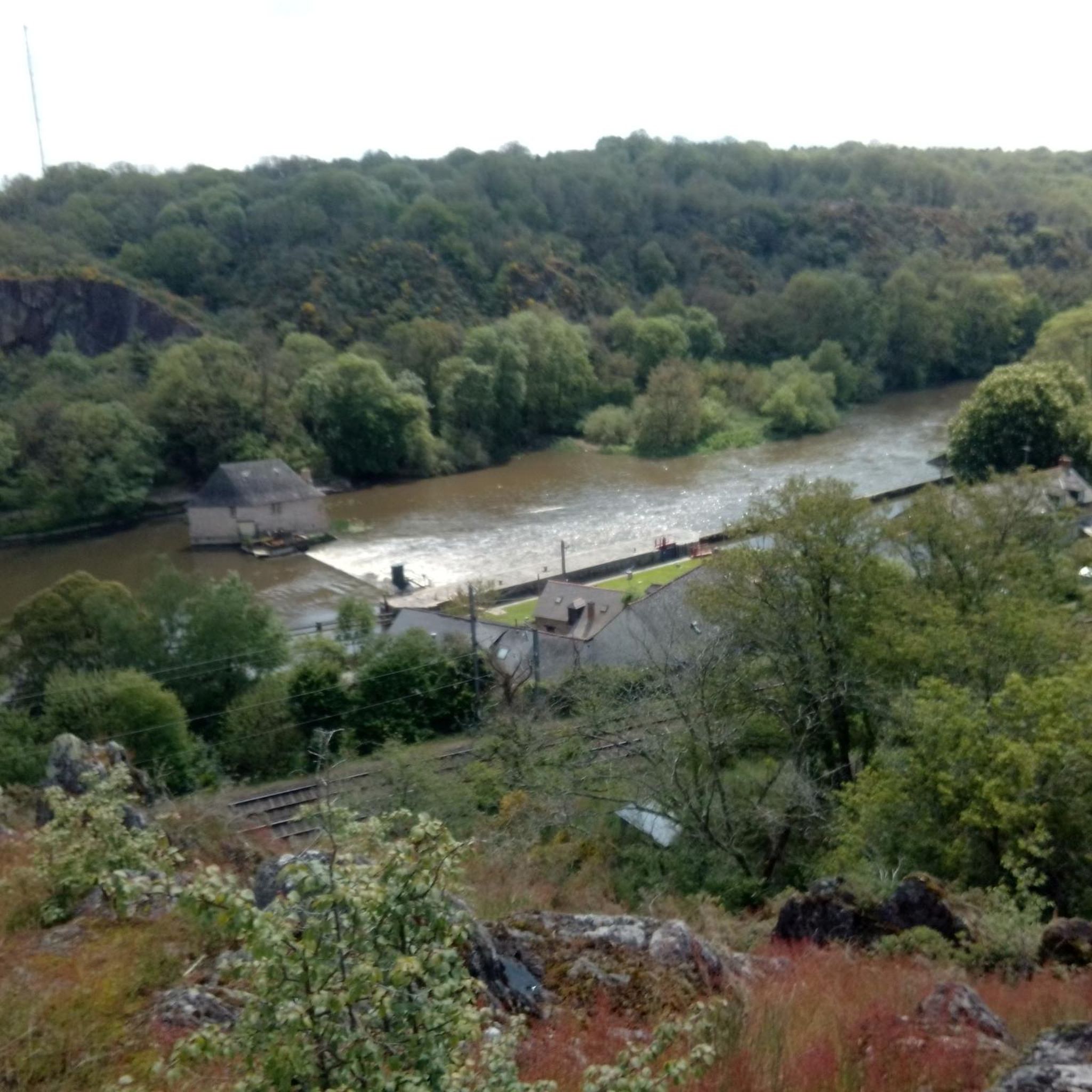
This viewpoint offers a lovely panorama of the Vilaine river flowing below.
0
0

I count 3 of them
1
0

Inflate the tires properly because flint
0
0

the rendo de pont péan too cool not too easy but not too hard
0
0

Beautiful view of the Vilaine and it’s a very nice area!
0
0

view of the vilaine and the mill of the boel
0
0

Frequently Asked Questions
How many hiking trails are available in Gravieres De La Riviere Kersan?
There are over 190 hiking trails around Gravieres De La Riviere Kersan, offering a wide range of options for different skill levels and preferences. This includes 88 easy routes, 98 moderate routes, and 6 more challenging trails.
Are there easy or family-friendly hiking options in Gravieres De La La Riviere Kersan?
Yes, the area is very suitable for families and beginners, with 88 easy routes available. These trails typically feature gentle terrain along the river and through the countryside, perfect for a relaxed outing. For example, the View of the Pont-Réan mill – Pont-Réan loop from Bruz is a moderate 8.4 km route that is relatively flat and offers pleasant scenery.
What kind of scenery can I expect on the hikes around Gravieres De La Riviere Kersan?
The hikes primarily follow paths alongside the La Rivière Kersan and other waterways, winding through local countryside and past historic mills. You'll experience a mix of riverside views, open fields, and charming rural landscapes, often with moderate elevation changes.
Are there any circular walks or loop trails in the area?
Yes, many of the trails in Gravieres De La Riviere Kersan are designed as circular routes or loops, allowing you to start and end at the same point without retracing your steps. An example is the challenging Boël Mill – View of the Boël Mill loop from Pont-Réan (Guichen), which is a 29 km loop.
What do other hikers say about the trails in Gravieres De La Riviere Kersan?
The hiking trails in Gravieres De La Riviere Kersan are highly regarded by the komoot community, with an average rating of 4.5 stars from over 600 reviews. Hikers frequently praise the well-maintained paths, the peaceful riverside atmosphere, and the picturesque views of the historic mills.
Are dogs allowed on the hiking trails?
While specific regulations can vary by trail section or private land, generally, dogs are welcome on many of the public footpaths in the Gravieres De La Riviere Kersan area, especially if kept on a leash. It's always advisable to check local signage and be respectful of wildlife and other hikers.
What is the best time of year to go hiking in Gravieres De La Riviere Kersan?
The region is enjoyable for hiking throughout much of the year. Spring and autumn offer pleasant temperatures and beautiful natural colors, while summer provides longer daylight hours. Even in winter, many trails remain accessible, though conditions can be damp, especially along the riverbanks.
Are there any longer or more challenging hikes available?
Yes, for those seeking a greater challenge, there are 6 difficult routes. The longest and most challenging is the Boël Mill – View of the Boël Mill loop from Pont-Réan (Guichen), a 29 km trail that typically takes over 8 hours to complete and features significant elevation changes.
Where can I find parking for the trailheads?
Many of the popular trailheads, particularly those starting from villages like Pont-Réan, offer designated parking areas. As the trails often pass through or near small towns, street parking might also be available, but it's always best to arrive early, especially on weekends, to secure a spot.
Are there any places to eat or drink near the hiking routes?
Given that many routes pass through or near villages such as Pont-Réan, you can often find local cafes, bakeries, or small restaurants where you can refuel before or after your hike. The presence of historic mills also suggests areas that might have visitor amenities.
What are the typical durations for hikes in this region?
Hike durations vary significantly depending on the route's length and difficulty. You can find shorter, easy walks lasting an hour or two, such as the 8.4 km View of the Pont-Réan mill – Pont-Réan loop from Bruz which takes about 2 hours 8 minutes. Longer, more challenging routes can extend to over 8 hours, like the 29 km Boël Mill – View of the Boël Mill loop from Pont-Réan (Guichen).
Most popular routes around Gravieres De La Riviere Kersan

Get inspired with the komoot mobile app


Explore more
Browse the best Hikes in other regions.
