The best walks and hikes around Réservoir De Grand-Maison
4.5
(1725)
17,603
hikers
188
hikes
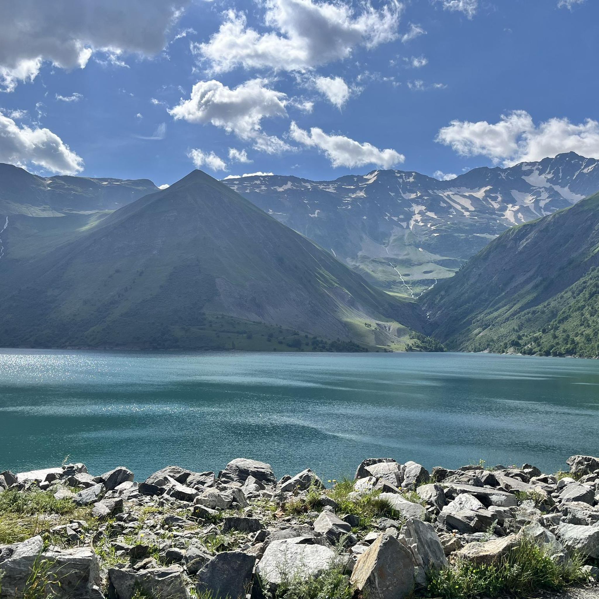
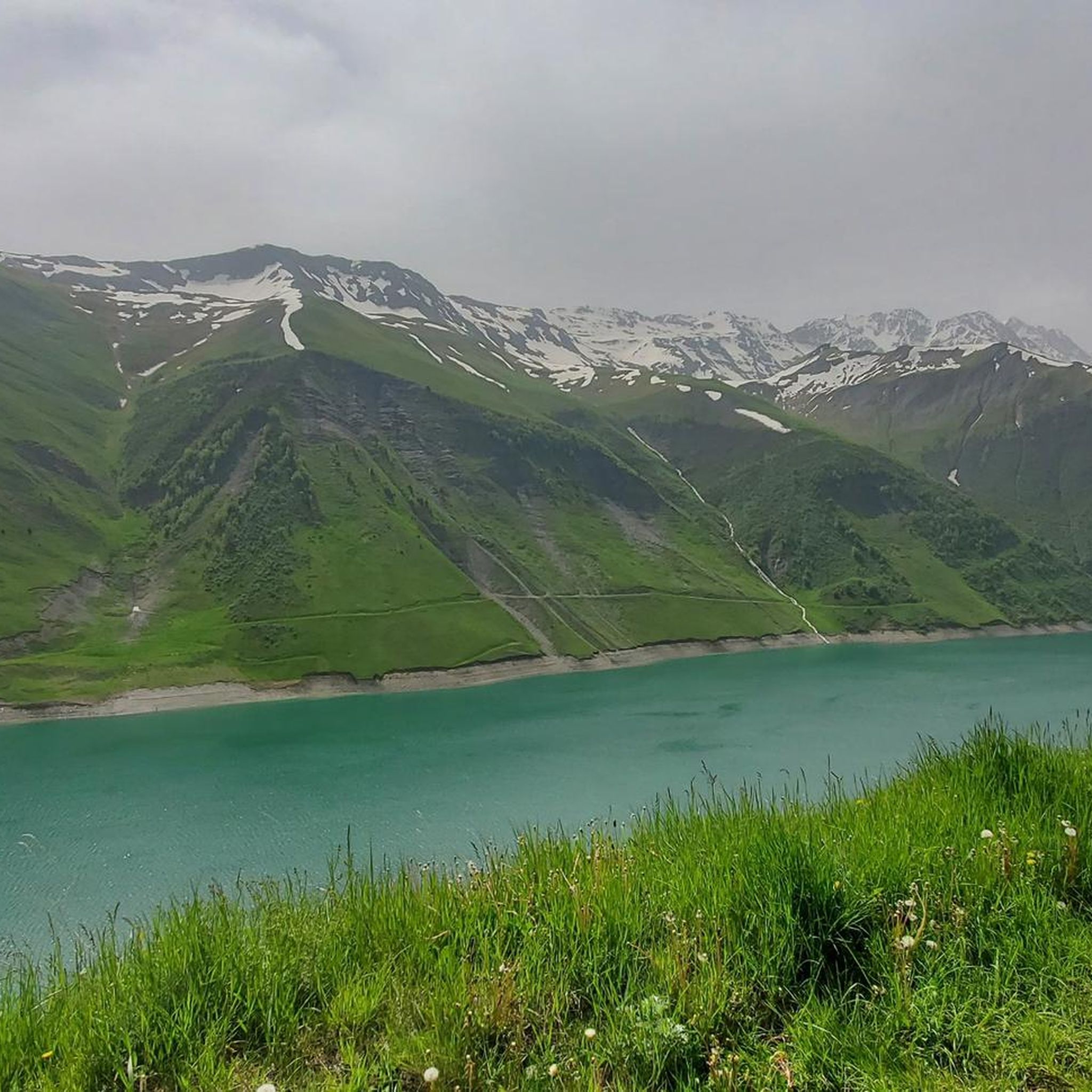
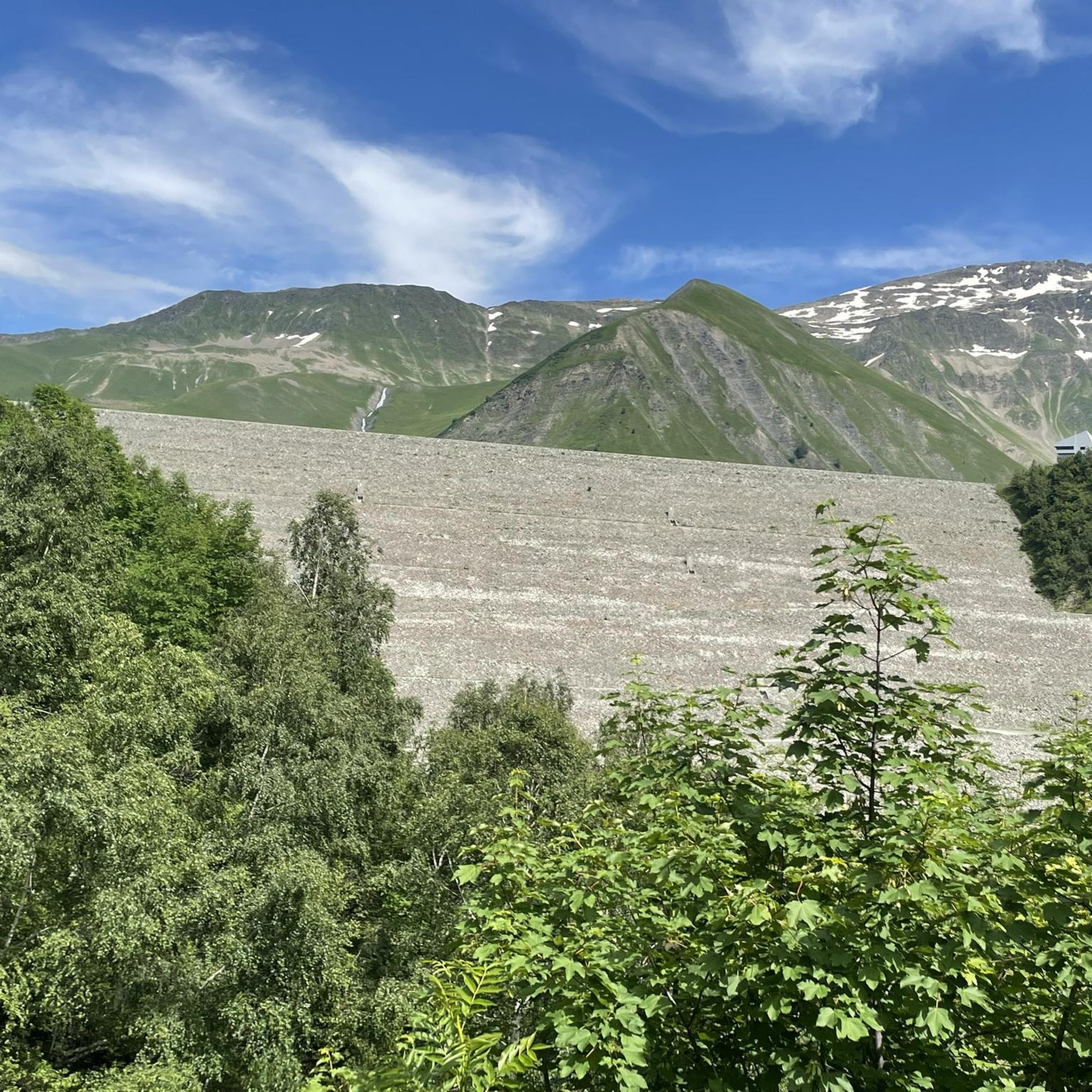
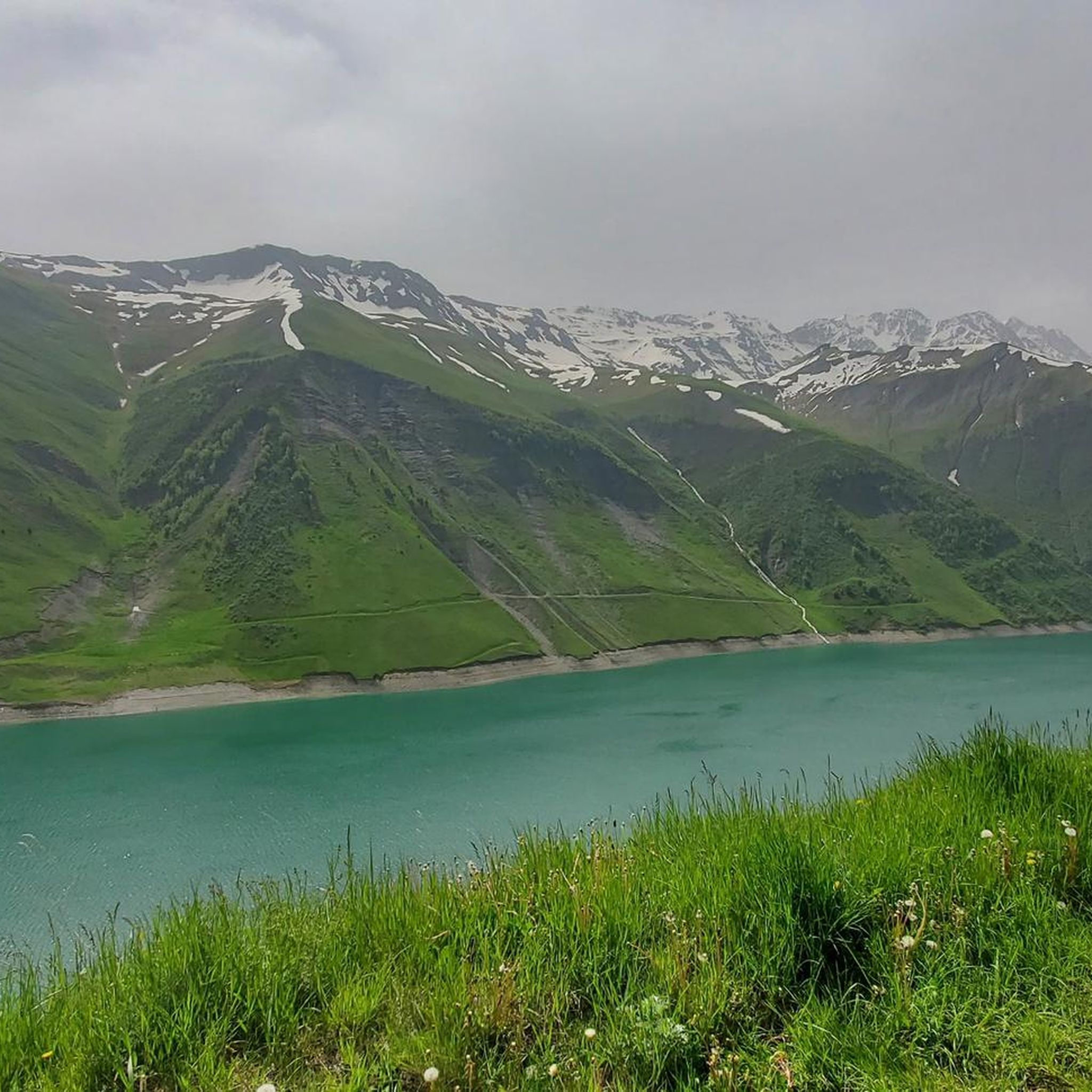
Hiking around Réservoir De Grand-Maison offers diverse trails within the French Alps, characterized by rugged mountain ranges and the artificial Lac de Grand'Maison. The region features the impressive Grand'Maison Dam, which also serves France's largest hydroelectric power station. Hikers can experience views of the reservoir and dam, with the Eau d'Olle valley providing additional picturesque surroundings. This area provides a blend of natural alpine beauty and significant engineering landmarks.
Best hiking trails around Réservoir De Grand-Maison
- The most popular hiking…
Last updated: October 4, 2026
5.0
(2)
70
hikers
6.31km
03:41
650m
650m
Moderate hike. Good fitness required. Mostly accessible paths. Sure-footedness required.
31
hikers
8.80km
04:54
830m
830m
Moderate hike. Good fitness required. Mostly accessible paths. Sure-footedness required.

15
hikers
5.30km
02:09
410m
410m
Moderate hike. Good fitness required. Easily-accessible paths. Suitable for all skill levels.
4.3
(7)
16
hikers
9.30km
03:40
670m
670m
Moderate hike. Good fitness required. Mostly accessible paths. Sure-footedness required.
18
hikers
4.50km
01:39
280m
280m
Easy hike. Great for any fitness level. Easily-accessible paths. Suitable for all skill levels.
Get access to more routes and recommendations from other explorers.
Already have an account?
Our route recommendations are based on thousands of hikes, rides, and runs completed by other people on komoot.
Start today with a free account
Your next adventure awaits.

Tips from the Community

Descend a few tens of meters to discover a magnificent view towards Mont Blanc, the Glandon pass and the Grand'Maison lake.
0
0

Lac de l'Ane is a mountain lake in the Belledonne massif, located at an altitude of 2,400 m. It is rarely visited, and ibex are regularly seen there.
0
0

The descent to Vaujany is technical and challenging. Bring a walking stick with you!
1
0

Situated at an altitude of 2,227 metres, the Col du Couard offers views of the Aiguillettes from below. It also offers superb panoramas of the surrounding peaks, such as the summits and the dome of La Cochette.
0
0

Very nice climb. The road to the top changes with the landscape and gradually becomes less good. No more loose gravel seen. No problem at all on the way up, but pay close attention at first on the descent. There was minimal traffic.
1
0

Very demanding climb but the landscapes are worth the detour!! Much less frequented than other major passes in the Alps.
1
0

It is one of the great discoveries of the French Alps in my last decade. It is not a mountain pass because it only has one road side. On foot (or even with a Gravel bike), once you reach the top, you can reach the Lac de Grand-Maison, connecting with the final stretch of the climb to the Col de Glandon or the Col de la Croix-de-Fer . The climb to Col de Sabot has a gradient of 1,253 meters, 14.5 km in length with an average slope of 8.9%. It is a very tough port. It has 2 parts that are very well differentiated in every sense: - The first, until reaching Vaujany (about 5 km) is a very wide road, perfectly paved, with some traffic and hardly any views of the valley. - The second is a very narrow road, with a lot of gravel, hardly any traffic and views of the alpine meadows. In a quiet environment where only the sounds of the mountain can be heard.
3
1

The Col du Sabot – 2100 m – is the highest point of the Isère passes and only 2000. From the pass the view is magnificent and you can see Lake Verney below.
0
0
Frequently Asked Questions
How many hiking trails are available around Réservoir De Grand-Maison?
There are over 170 hiking routes around Réservoir De Grand-Maison, offering a wide range of options for different skill levels and preferences. The komoot community has rated these trails highly, with an average score of 4.5 stars.
What is the best time of year to go hiking in Réservoir De Grand-Maison?
The hiking season around Réservoir De Grand-Maison typically runs from June 1st to October 31st. This period covers spring, summer, and autumn, allowing you to experience the changing beauty of the alpine landscape, from lush greenery to vibrant fall colors.
What kind of terrain can I expect on the hiking trails?
The terrain around Réservoir De Grand-Maison is characteristic of the French Alps, featuring rugged mountain ranges and varied paths. You'll find trails ranging from accessible walks around the artificial Lac de Grand'Maison to more challenging ascents with significant altitude changes, offering a mix of natural beauty and views of engineering marvels like the Grand'Maison Dam.
Are there any easy hiking trails suitable for beginners or families?
Yes, Réservoir De Grand-Maison offers a good selection of easy trails. For instance, the Les Aiguillettes – Les Aiguillettes loop from barrage de Grand'Maison is an easy 4.5 km (2.8 miles) route that provides a less strenuous option while still enjoying the scenery.
What natural features or landmarks can I expect to see on the trails?
Hikers can enjoy breathtaking views of the artificial Lac de Grand'Maison, surrounded by majestic mountain ranges. A prominent landmark is the impressive Grand'Maison Dam, which also serves as the upper reservoir for France's largest hydroelectric power station. Some routes offer plunging views of the dam and reservoir, providing a unique blend of natural beauty and engineering.
Are there any circular hiking routes available?
Yes, many trails around Réservoir De Grand-Maison are circular, allowing you to start and end at the same point. An example is the Donkey Lake loop from Le Rieu Claret, a moderate 6.3 km (3.9 miles) trail that explores the area around Donkey Lake.
Is it possible to hike to the Grand'Maison Dam?
Yes, some routes lead directly to the Grand'Maison Dam, offering magnificent views of the reservoir as you cross the spillway. Be aware that some paths to the dam, especially from areas like the Col du Sabot car park, may require good physical and technical condition due to significant altitude changes.
What do other hikers enjoy most about the trails in Réservoir De Grand-Maison?
The area is highly rated by the komoot community, with an average score of 4.5 stars from over 1300 reviews. Hikers often praise the majestic mountain ranges, the stunning views of Lac de Grand'Maison, and the unique experience of seeing the impressive Grand'Maison Dam.
Are there any challenging hikes for experienced hikers?
Yes, Réservoir De Grand-Maison offers challenging routes for experienced hikers. For example, the Lake of the Cross – Lac de la Combe loop from Col du Glandon is a difficult 7.9 km (4.9 miles) trail with significant elevation changes, perfect for those seeking a more strenuous adventure.
Is fishing allowed in Lac de Grand'Maison?
Beyond hiking, Lac de Grand'Maison is known for fishing, with various fish species inhabiting its waters. However, specific regulations and permits may apply, so it's advisable to check local guidelines before planning a fishing trip.
Are there options for longer hikes in the region?
Yes, for those looking for longer excursions, routes like the Donkey Lake – Col de l'Agnelin loop from Le Rieu Claret offer an extended experience. This moderate 8.8 km (5.5 miles) path provides varied terrain and takes you through a mountain pass, offering more time to explore the alpine landscapes.
Most popular routes around Réservoir De Grand-Maison

Get inspired with the komoot mobile app


Explore more
Browse the best Hikes in other regions.
