The best mountain hikes around Steinsee
4.9
(75)
771
hikers
13
hikes
Mountaineering routes around Steinsee are characterized by high alpine terrain, glacial landscapes, and rugged mountain passes. The region, situated in the Swiss Alps, features prominent peaks, deep valleys, and the Steinsee lake itself, often surrounded by rock and ice. These routes frequently involve significant elevation gain and exposure, traversing varied surfaces from rocky trails to snowfields.
Best mountaineering routes around Steinsee
- The most popular mountaineering route is Tierbergli Via Ferrata – Steingletscher loop from Sustenpass, a 5.7 miles (9.2…
Last updated: November 6, 2026
5.0
(3)
60
hikers
9.18km
06:25
820m
820m
Hard mountaineering route. Very good fitness required. Sure-footedness, sturdy shoes and alpine experience required.
5.0
(2)
7
hikers
4.37km
01:46
230m
230m
Moderate mountaineering route. Mostly walkable paths. Sure-footedness required.

4.9
(18)
179
hikers
4.81km
05:00
670m
670m
Hard mountaineering route. Good fitness required. Sure-footedness, sturdy shoes and alpine experience required.
5.0
(2)
70
hikers
8.83km
07:00
920m
920m
Hard mountaineering route. Very good fitness required. Sure-footedness, sturdy shoes and alpine experience required.
13
hikers
2.36km
02:11
290m
290m
Hard mountaineering route. Good fitness required. Sure-footedness, sturdy shoes and alpine experience required.
Get access to more routes and recommendations from other explorers.
Already have an account?
Our route recommendations are based on thousands of hikes, rides, and runs completed by other people on komoot.
Start today with a free account
Your next adventure awaits.
Tips from the Community

The Tierberglihütte is located at 2,795 m above the Steingletscher and offers a fantastic view of the glaciated high mountain world of the Uri Alps. 🧊⛰️ It is a popular destination for mountain hikers and via ferrata fans, as well as an important starting point for high-alpine tours, for example to the Sustenhorn. Its location directly above the glacier and rocks makes the hut a real highlight – perfect for a well-deserved break with a high-mountain panorama. 🥾☕🧗♀️✨
0
0

Very pretty but as with all such glaciers receding quickly
0
0
Relatively easy but in shadow early on so can be cold &/or damp
0
0
Alpine adventure with a glacier view! From the Umpol parking lot (2,111 m), the route leads directly onto the varied via ferrata (K4/B/C) 🧗♂️ – from moderate passages to the slightly overhanging crux (optional) 💪🔗. The view of the Steingletscher and peaks like the Sustenhorn and Vorder Tierberg is simply breathtaking 🤩❄️. After the exit, a marked trail leads through scree and rocky ledges up to the Tierberglihütte SAC (2,795 m) 🛖☀️ – a perfect place for a break with a stunning panorama 🏞️. Descend via the Alpine hiking trail (white, blue, white) back to the parking lot. 📌 Facts & Figures 🥾 Distance: approx. 4.5 km ⏱️ Duration: 4–5 hours (total) ⛰ Elevation Gain: approx. 680 m ⚠️ Difficulty: K4/B/C, T3 – surefooted, free from vertigo, and full via ferrata equipment required! 🎒🪢
1
0

Total time for both sections of the via ferrata is 4.5 hours, of which the via ferrata takes 2.5 hours, the further section to the hut takes 30 minutes, and the descent takes 1.5 hours.
1
0
The via ferrata, an alternative to the approach from the Tierbergli Hut, takes place against a wonderful Alpine backdrop. This is where the first stage of the via ferrata starts. It is a very scenic ferrata, although the course is not very uniform: the first section is mostly K2, at most K3, but with a tough crux quite high up (K4). The route includes a loop over lots of scree and moderately steep rock to a slightly overhanging wall section, which is quite challenging as a crux despite the ample protection. After the first stage, the descent takes a T3 hiking route back to the starting point (car park). The second section is somewhat more difficult than the first. At the top, you can get food and drink at the Tierbergli Hut. The total time for both sections is 4.5 hours, of which both sections of the via ferrata take 2.5 hours, the walk to the hut takes 30 minutes, and the descent takes 1.5 hours.
0
0
The via ferrata, an alternative to the approach from the Tierbergli Hut, takes place against a stunning Alpine backdrop. At this point, you can exit the first stage and descend via a T3 hiking route back to the starting point (parking lot). This point also marks the start of the second section of the via ferrata. The second section is somewhat more difficult than the first. The second section is predominantly K3 with scree sections in between. Only attempt this route in good weather; in wet (or icy) conditions, the blocky rocks are dangerously slippery. At the top, you can get food and drink at the Tierbergli Hut.
1
0

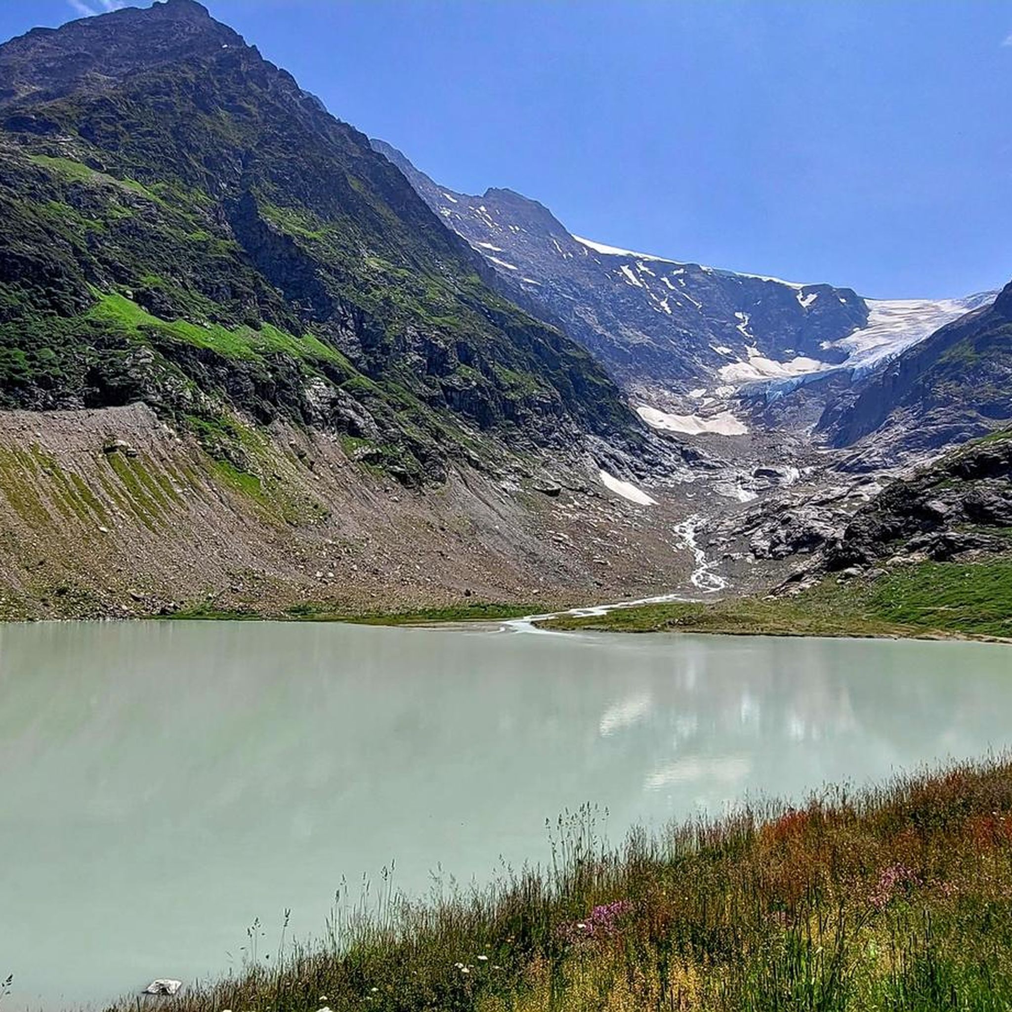
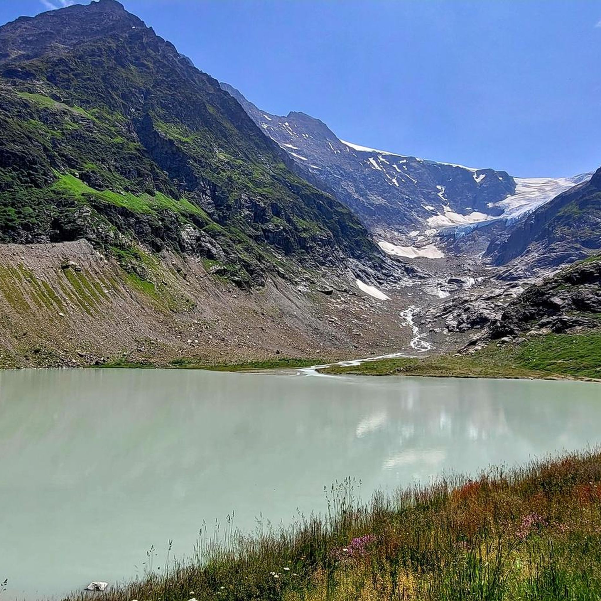
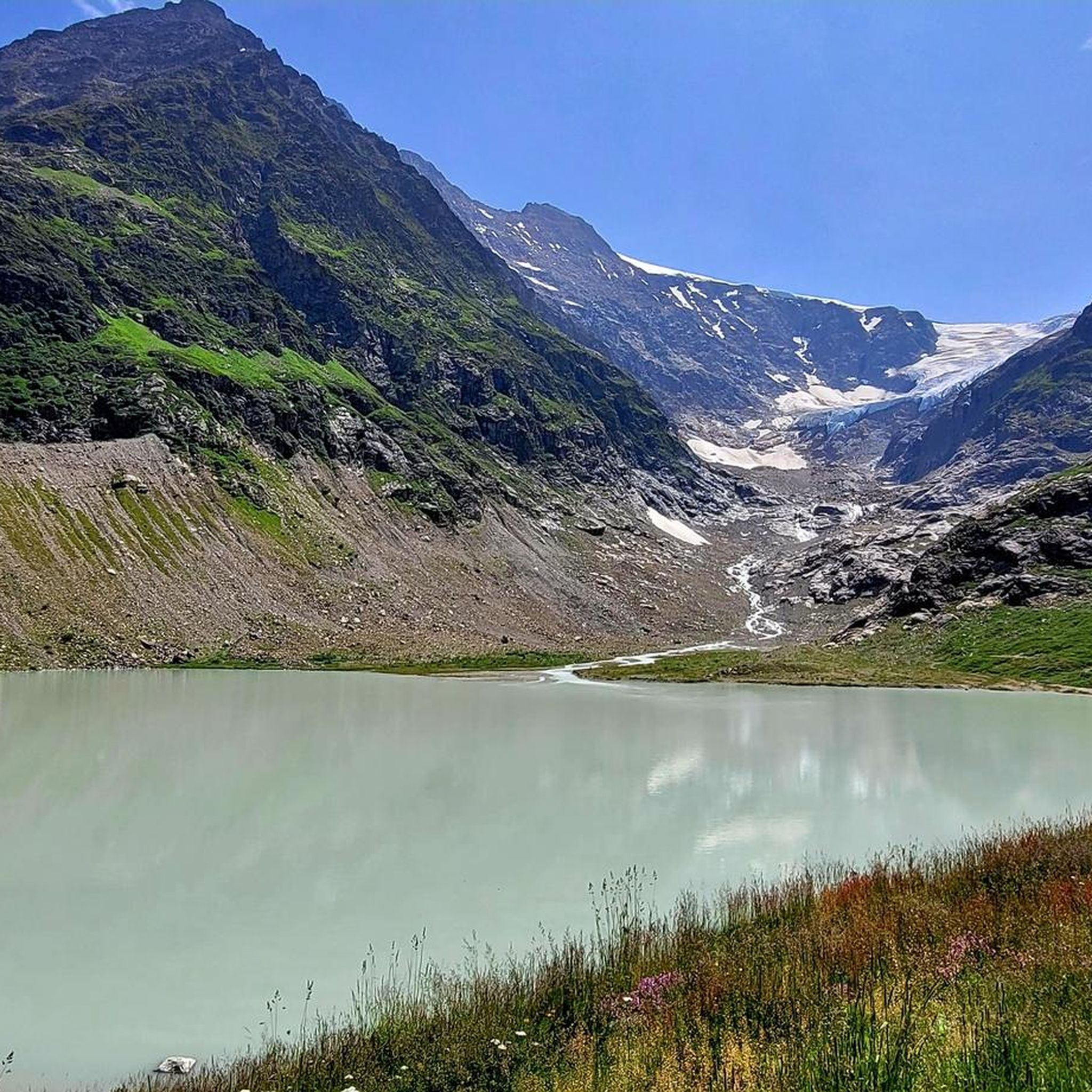
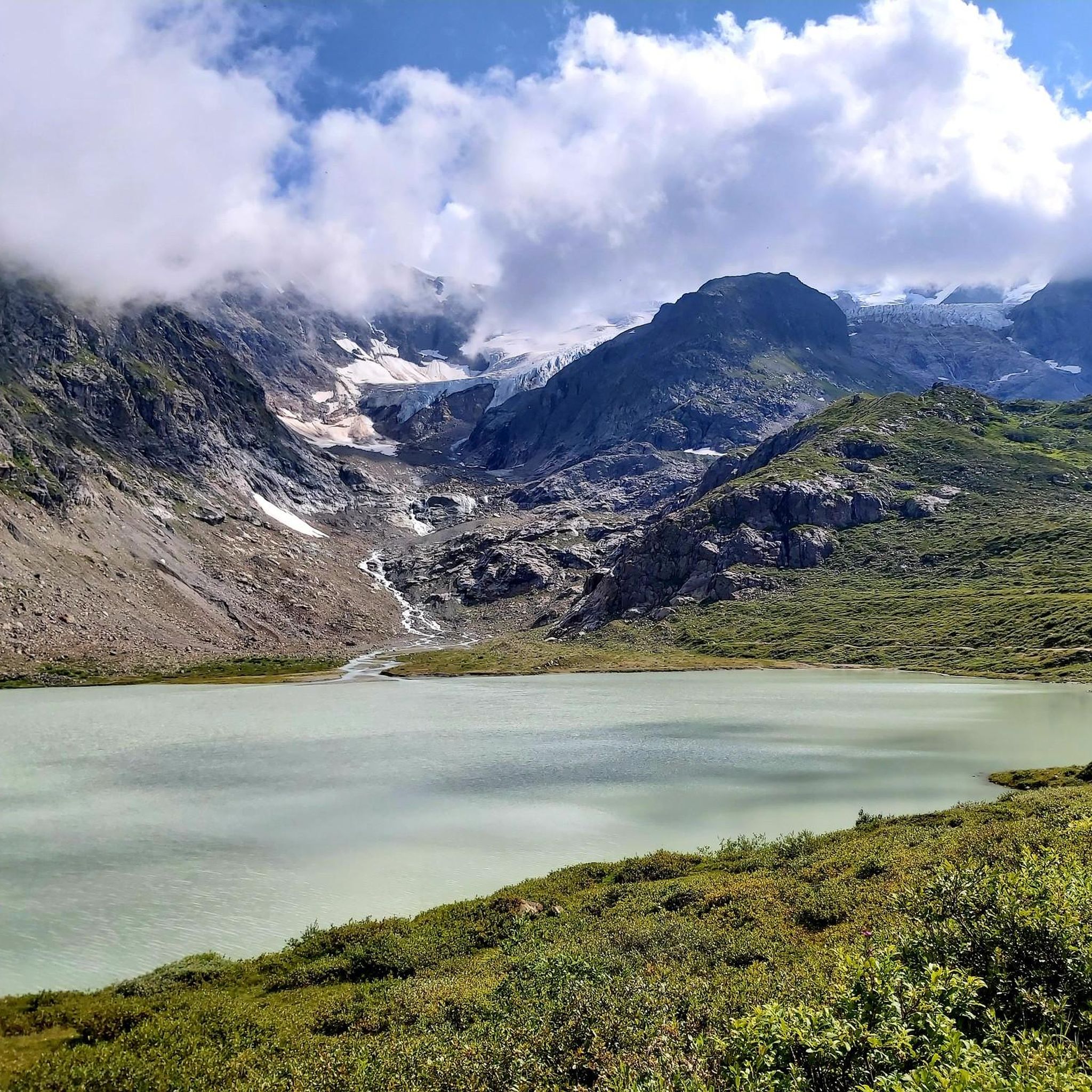
You are at the top of the Tierbärgli, at an altitude of 2,800 metres. But more than the summit, the star here is called the Stein Glacier. In front of you, it presents itself in all its splendour.
0
0
Frequently Asked Questions
What is the general difficulty level of mountaineering routes around Steinsee?
The mountaineering routes around Steinsee are predominantly challenging. Out of approximately 15 available routes, 13 are classified as difficult, with others being moderate or easy. They often involve significant elevation gain, exposure, and varied terrain from rocky paths to snowfields.
Are there any moderate mountaineering routes suitable for those with less experience?
Yes, there is at least one moderate route available. The Steinsee loop from Sustenpass is a moderate 2.7-mile (4.4 km) trail that takes about 1 hour 46 minutes to complete, leading through alpine meadows and rocky paths around the lake.
What is the typical duration for mountaineering routes in the Steinsee region?
The duration of routes varies significantly based on difficulty and length. For example, the moderate Steinsee loop from Sustenpass can be completed in under 2 hours, while more demanding routes like the Seebodensee – Steingletscher loop from Sustenpass can take nearly 8 hours.
Are there any circular mountaineering routes around Steinsee?
Yes, several routes are designed as loops. A popular option is the Tierbergli Via Ferrata – Steingletscher loop from Sustenpass, which is a difficult 5.7-mile (9.2 km) trail. Another is the Steinsee loop from Sustenpass, a moderate option.
What is the best time of year for mountaineering around Steinsee?
Given the high alpine and glacial nature of the region, the best time for mountaineering around Steinsee is typically during the summer and early autumn months (roughly June to September). During this period, snowmelt is more advanced, and weather conditions are generally more stable, though high-alpine conditions can change rapidly.
What kind of gear should I bring for mountaineering in Steinsee?
Due to the high alpine terrain, glacial landscapes, and potential for snowfields, appropriate mountaineering gear is essential. This includes sturdy hiking boots, layered clothing, waterproof and windproof outerwear, a helmet for via ferrata sections, and potentially crampons and an ice axe depending on the specific route and conditions. Always check current conditions before heading out.
Are there any specific permits required for mountaineering routes in the Steinsee region?
Generally, permits are not required for standard mountaineering routes in the Swiss Alps. However, if you plan to use specific facilities like mountain huts or engage in activities like via ferrata, it's advisable to check with local authorities or hut operators for any specific requirements or bookings. The Tierbergli Via Ferrata – Steingletscher loop from Sustenpass, for instance, involves via ferrata sections which require specific equipment and experience.
What do other mountaineers enjoy most about the Steinsee routes?
The routes in Steinsee are highly rated by the komoot community, with an average score of 4.9 stars from over 60 reviews. Mountaineers often praise the challenging high alpine terrain, the stunning glacial landscapes, and the expansive views offered by routes like the Seebodensee – Steingletscher loop from Sustenpass.
Are there any routes that offer views of the Steingletscher?
Yes, several routes provide impressive views of the Steingletscher. The Tierbergli Via Ferrata – Steingletscher loop from Sustenpass and the Seebodensee – Steingletscher loop from Sustenpass both offer demanding ascents towards the glacier and panoramic vistas of the glacial landscape.
Is there parking available for accessing the mountaineering routes?
Many routes in the Steinsee area, including popular ones like the Tierbergli Via Ferrata – Steingletscher loop, start from the Sustenpass. There is typically parking available at major mountain passes and trailheads, though it can be limited during peak season. It's advisable to arrive early or check for specific parking information for your chosen starting point.
Are there any routes that start directly from Steingletscher?
Yes, some routes begin directly from the Steingletscher area. For example, the Tierbergli Via Ferrata – Steingletscher loop from Steingletscher and the Vorder Tierberg – Steingletscher loop from Steingletscher both offer challenging experiences starting from this location.

Get inspired with the komoot mobile app


Explore more
Browse the best Mountain Hikes & Routes in other regions.
