The best running trails around Lag da Pigniu
4.6
(11)
523
runners
37
runs
Jogging around Lag da Pigniu offers routes that explore the region's diverse natural landscape. The area features a prominent lake, a dam, and surrounding terrain that includes villages and natural paths. Running trails often follow the contours of the lake and extend into the nearby countryside, providing varied elevation changes.
Best jogging routes around Lag da Pigniu
- The most popular jogging route is Lai da Pigniu – Lag da Pigniu Dam loop from Andiast, a 9.1 miles (14.6 km)…
Last updated: October 23, 2026
15
runners
14.5km
01:51
380m
380m
Hard run. Very good fitness required. Sure-footedness, sturdy shoes and alpine experience required.
7
runners
5.74km
00:43
260m
250m
Moderate run. Good fitness required. Mostly paved surfaces.

13
runners
9.84km
01:09
270m
270m
Moderate run. Good fitness required. Mostly paved surfaces.
15
runners
8.92km
01:00
160m
160m
Moderate run. Good fitness required. Mostly paved surfaces.
28
runners
10.7km
01:14
310m
310m
Hard run. Very good fitness required. Mostly paved surfaces.
Get access to more routes and recommendations from other explorers.
Already have an account?
Our route recommendations are based on thousands of hikes, rides, and runs completed by other people on komoot.
Start today with a free account
Your next adventure awaits.



Tips from the Community

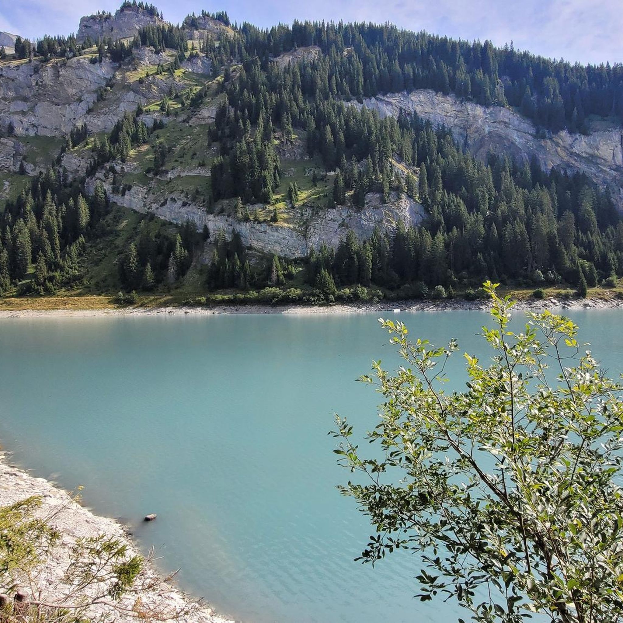
The Lag da Breil, or Brigelsersee in German, lies at around 1,255 m above sea level, directly above Brigels. The lake, approximately 500 meters long and up to 140 meters wide, was created as a reservoir in 1946 and is used for energy production. The lake is fed and drained by the Flem river. Despite its function as a reservoir, the Lag da Breil appears very idyllic and blends beautifully into the landscape around Brigels. A pleasant walking path leads all the way around the lake. Important: Swimming is not allowed in the reservoir.
0
0
Brigels, in Romansh Breil, lies on a sunny terrace at around 1,300 m above sea level and, with its old houses around the parish church, has certainly retained its original village character. However, I also noticed today that Brigels is significantly more tourist-oriented than I had expected. Numerous holiday apartments, hotels, and tourist facilities are located around the village. As a result, the place sometimes seems less quiet and original than one might expect from a mountain village. Nevertheless, Brigels is beautifully situated in terms of landscape and offers a good starting point for hikes in the Surselva.
0
0
The Lag da Breil, in German Brigelsersee, lies at around 1,255 m above sea level, directly above Brigels. The lake, approximately 500 meters long and up to 140 meters wide, was created as a reservoir in 1946 and is used for energy production. The lake is fed and drained by the Flem. Despite its function as a reservoir, the Lag da Breil appears very idyllic and blends beautifully into the landscape around Brigels. A pleasant walking path leads all the way around the lake. Important: Swimming is not permitted in the reservoir.
0
0
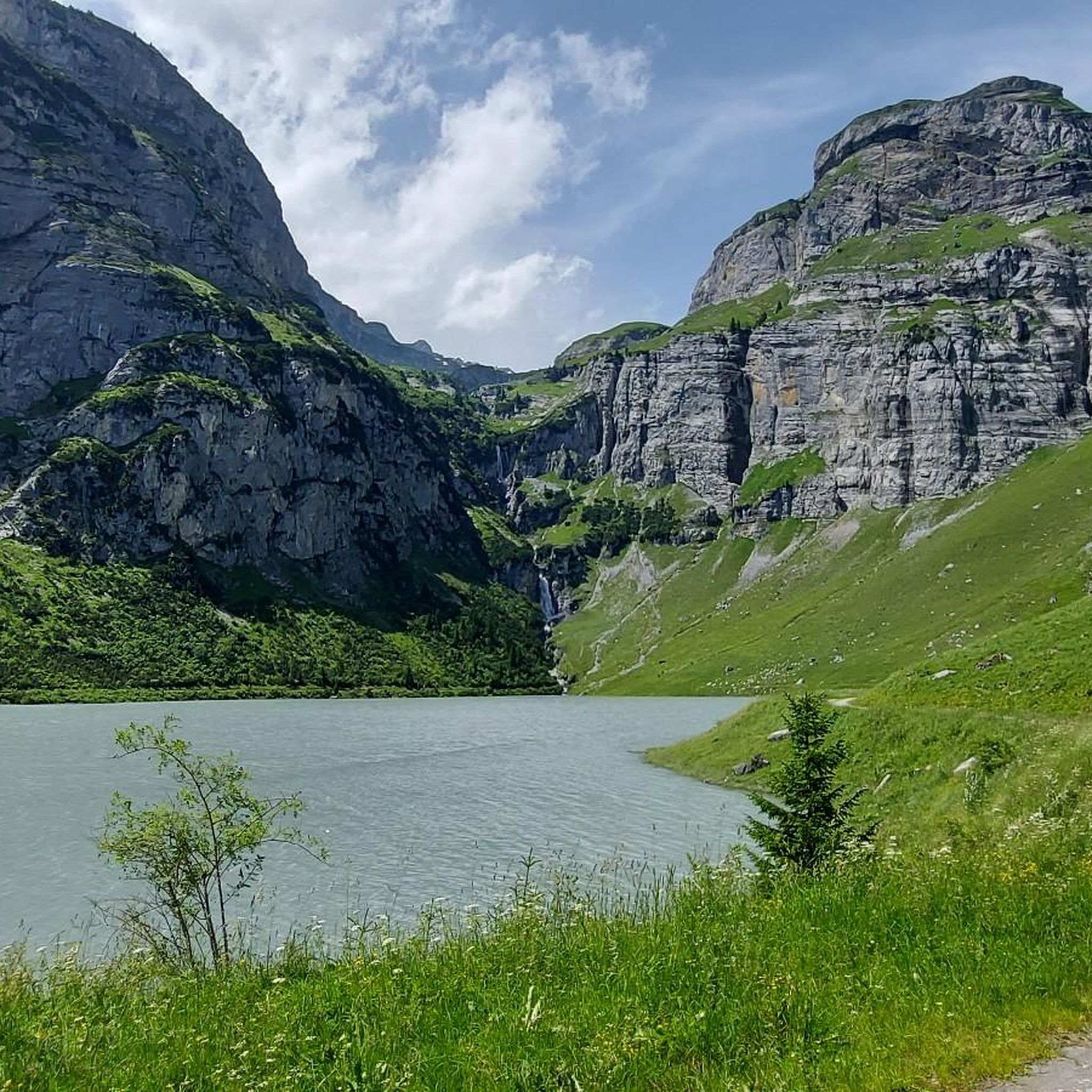
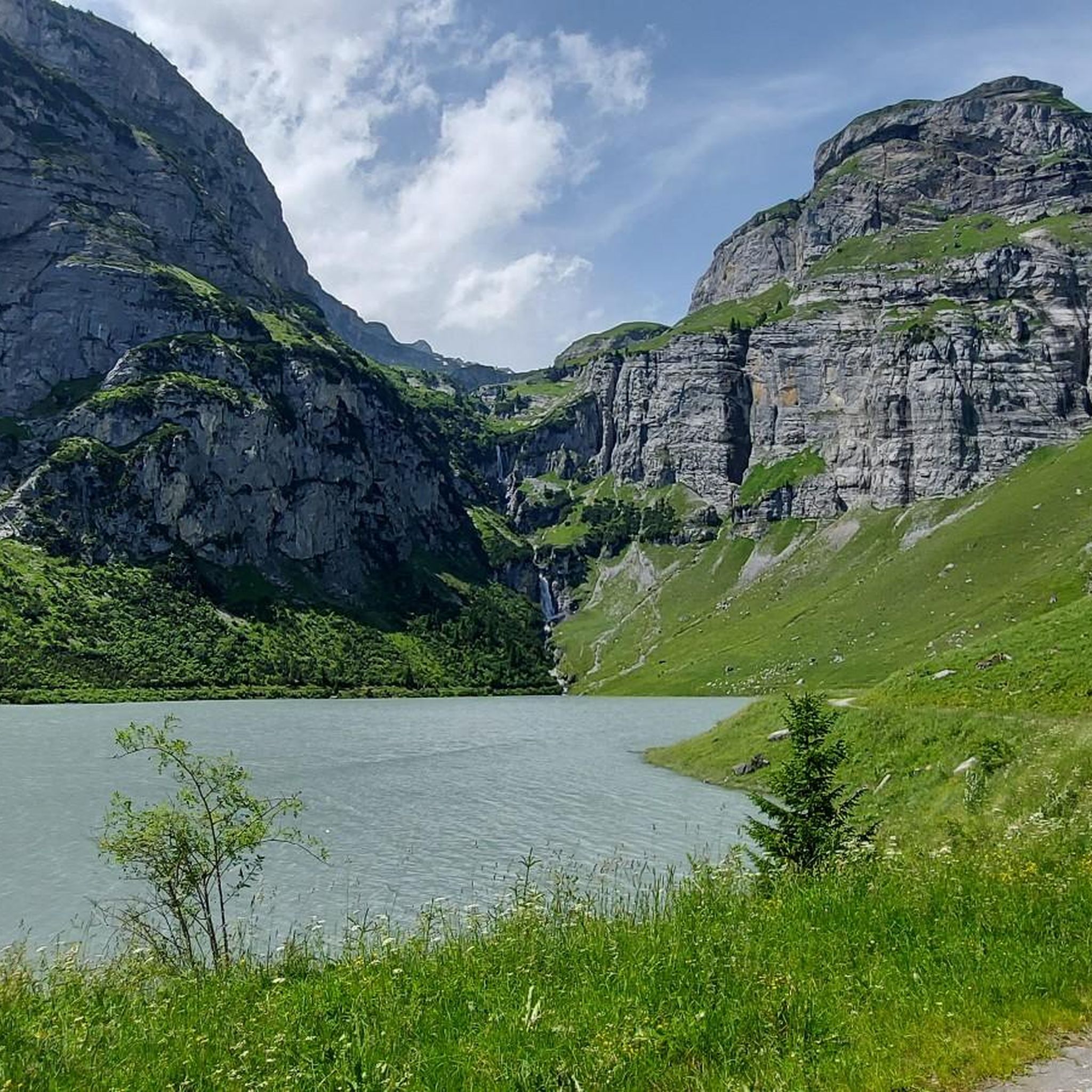
The Lag da Pigniu, also known as Panixersee, is beautifully nestled in an impressive alpine mountain landscape. The turquoise reservoir, the steep rock faces, and the imposing waterfalls at the far end of the lake make this place a special hiking destination. At the second, rear waterfall, a path also leads directly to it, allowing you to observe it up close and feel the water. Near the waterfalls, there is a beautiful barbecue and picnic area with tables and benches – ideal for a cozy break in the middle of nature. Important: One side of the path around the lake is currently closed. Therefore, a complete circuit is not possible at the moment. The closure must be strictly observed. Despite the restriction, the trip to the Panixersee is worthwhile. Especially the waterfalls and the quiet, impressive mountain scenery make the visit rewarding.
0
0
A beautifully located fire pit directly at the waterfalls at the back of Lag da Pigniu. With tables and benches, as well as a well, the spot offers ideal conditions for a cozy barbecue and picnic break – accompanied by the impressive view of the waterfalls and the surrounding rock faces.
0
0
The Lag da Pigniu, also known as Panixersee, is beautifully nestled in an impressive alpine mountain landscape. The turquoise reservoir, the steep rock faces, and the imposing waterfalls at the rear of the lake make this place a special hiking destination. At the waterfalls, there is a nice barbecue and picnic area with tables and benches – ideal for a cozy break in the middle of nature. Important: One side of the path around the lake is currently closed. Therefore, a complete circuit is not possible at the moment. The closure must be strictly observed. Despite the restriction, the trip to Panixersee is worthwhile. Especially the waterfalls and the quiet, impressive mountain backdrop make the visit rewarding.
0
0

In the farthest corner of Lag da Pigniu there is this impressive double or even triple waterfall. It is certainly one of the most beautiful in all of Switzerland.
0
0
Imposing rock faces around the lake and its peculiar color: The Lag da Pigniu is certainly worth an excursion! It is very easily accessible by bike.
0
0
Frequently Asked Questions
How many running routes are available around Lag da Pigniu?
There are over 40 running routes in the Lag da Pigniu area, offering a diverse range of options for different skill levels and preferences. These include lakeside paths, village routes, and natural trails with varying elevations.
Are there any easy or beginner-friendly running trails in Lag da Pigniu?
Yes, the Lag da Pigniu region offers several easier running options. While many routes have varied elevation, there are 4 routes classified as easy and 9 as moderate, suitable for beginners or those looking for a less strenuous run. For example, the Andiast Village Center loop from Andiast is a moderate 3.6 miles (5.7 km) path exploring the village surroundings.
What kind of natural sights or landmarks can I expect to see while running near Lag da Pigniu?
The running routes around Lag da Pigniu offer views of the prominent lake and its dam, as well as surrounding villages and natural paths. You can also explore nearby attractions such as the impressive Aua dil Mer Waterfall or the Panixersee Waterfall and Viewpoint. The Lag da Pigniu Dam itself is a notable man-made monument.
Are there any circular running routes around Lag da Pigniu?
Yes, many of the running routes in the area are circular, allowing you to start and end in the same location. A popular option is the Lai da Pigniu – Lag da Pigniu Dam loop from Andiast, which is 9.1 miles (14.6 km) and offers great views of the lake and dam. Another is the Lag da Breil – Lake Brigels loop from Waltensburg/Vuorz, a 6.1 miles (9.8 km) trail.
Is the Lag da Pigniu area suitable for family-friendly jogging?
While specific 'family-friendly' routes aren't explicitly categorized, the area offers a range of difficulties. Families might enjoy the moderate village loops or shorter sections of trails. It's best to check the distance and elevation gain of individual routes to ensure they match your family's fitness level. The Andiast Village Center loop from Andiast is a shorter, moderate option.
Can I bring my dog on the running trails around Lag da Pigniu?
Generally, dogs are welcome on trails in the Swiss Alps, but it's always recommended to keep them on a leash, especially in areas with livestock or wildlife. Be mindful of local regulations and ensure your dog is well-behaved and doesn't disturb other runners or the natural environment. Always carry water for your dog, especially on longer runs.
What is the best time of year to go running in Lag da Pigniu?
The best time for running in Lag da Pigniu is typically from late spring to early autumn (May to October) when the weather is milder and trails are clear of snow. During these months, you'll experience lush landscapes and comfortable temperatures. Always check local weather forecasts before heading out, as conditions can change rapidly in mountainous regions.
Are there options for winter jogging in Lag da Pigniu?
Winter jogging in Lag da Pigniu can be challenging due to snow and ice, especially on higher elevation trails. Some lower-lying paths or cleared village routes might be accessible, but conditions can vary greatly. It's crucial to wear appropriate winter running gear, including traction devices for your shoes, and to check local trail conditions and avalanche warnings before venturing out.
What are the parking options for accessing running routes in Lag da Pigniu?
Parking is generally available in the villages surrounding Lag da Pigniu, such as Andiast or Waltensburg/Vuorz, which serve as starting points for many routes. Specific parking areas may be designated near trailheads. It's advisable to check local signage for parking fees and regulations.
How accessible are the running trails around Lag da Pigniu by public transport?
The villages around Lag da Pigniu, like Andiast and Waltensburg/Vuorz, are typically served by local bus routes, which connect to larger transport hubs. This makes it possible to reach many trailheads using public transport. Check the local public transport schedules for the most up-to-date information on connections to your desired starting point.
Are there any places to get refreshments or food near the running routes?
Yes, the villages surrounding Lag da Pigniu, such as Andiast and Waltensburg/Vuorz, offer cafes and restaurants where you can refuel before or after your run. Additionally, you might find picnic areas, like the Picnic Area and Grill at Lake Partnun, which are perfect for a packed lunch.
What do other runners enjoy most about jogging in Lag da Pigniu?
The running routes in Lag da Pigniu are highly rated by the komoot community, with an average score of 4.75 stars from over 10 reviews. Runners often praise the diverse terrain, from lakeside paths to village routes, and the varying elevations that offer a good challenge. The scenic views of the lake and surrounding nature are also frequently highlighted.
Most popular routes around Lag da Pigniu
Most popular attractions around Lag da Pigniu

Get inspired with the komoot mobile app


Explore more
Browse the best Running Trails & Routes in other regions.
