The best walks and hikes around Haversham-Cum-Little Linford
4.6
(1036)
7,954
hikers
509
hikes
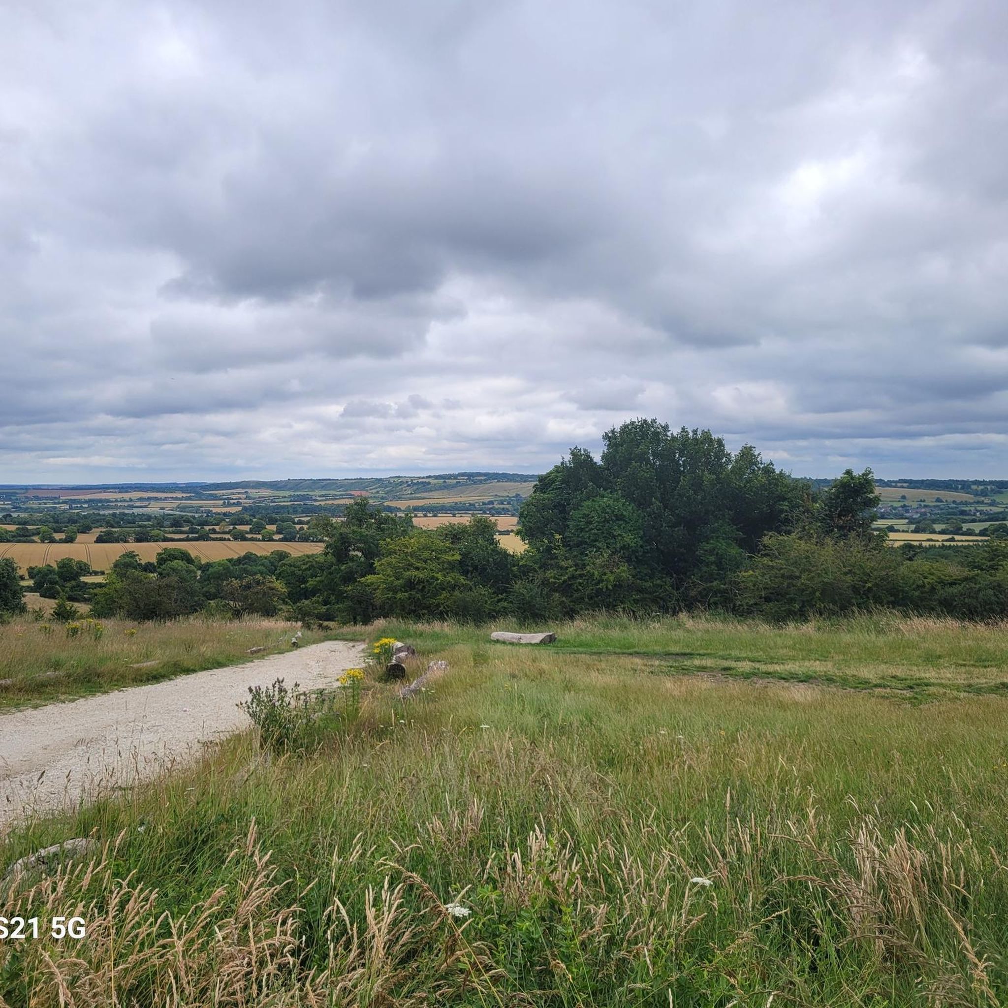
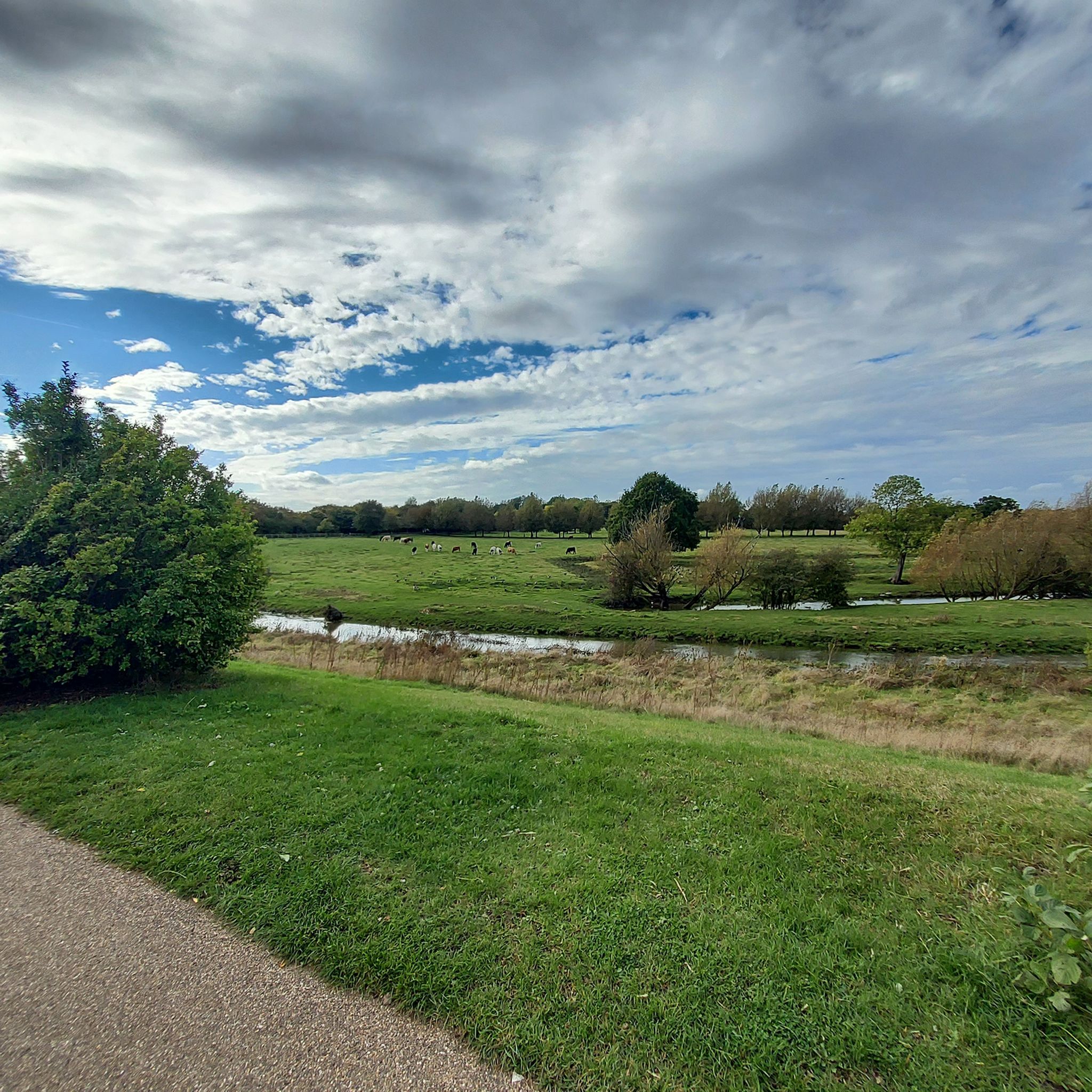
Hikes around Haversham-cum-Little Linford explore a landscape shaped by the meandering River Great Ouse and its surrounding valley. The area's terrain consists of gentle riverside paths, woodland trails, and routes through open farmland on the Hanslope Clay Plateau. Many walks feature lakes formed from old gravel pits, which are now part of local nature reserves.
Best hiking trails around Haversham-Cum-Little Linford
- The most popular hiking route is Iron Trunk Aqueduct – Stony Stratford Nature Reserve loop from Ouse Valley Park, a 5.1 mile (8.2 km) trail that takes around 2 hours 5 minutes to complete. The route features the historic Iron Trunk Aqueduct and passes through the Stony Stratford Nature Reserve.
- Another top favourite among local hiking enthusiasts is Little Linford Wood loop from Great Linford Manor, a moderate 7.5 mile (12.1 km) path. This trail leads through ancient woodland and offers views across the Ouse Valley.
- Local hiking enthusiasts also love the The Floodplain Forest Nature Reserve loop — The Parks Trust, a 2.7 mile (4.3 km) trail leading through a wetland habitat, often completed in about 1 hour 5 minutes.
- Hiking around Haversham-Cum-Little Linford is defined by tranquil riverside walks, ancient woodlands, and paths across open clay farmland. The network of trails provides options for various fitness levels, from easy loops to longer, more moderate hikes.
- The routes in Haversham-Cum-Little Linford are highly rated by the komoot community with an average score of 4.6 stars from over 890 reviews. More than 7,000 hikers have used komoot to explore Haversham-Cum-Little Linford's varied terrain.
Last updated: October 10, 2026
4.9
(21)
59
hikers
8.17km
02:07
50m
50m
The Milton Keynes Boundary Walk Circular offers a refreshing escape into surprisingly rural landscapes, despite its urban surroundings. You'll hike through diverse scenery, from peaceful river valleys to quiet canal towpaths, and explore woodlands and nature reserves. This moderate 5.1 miles (8.2 km) route involves a gentle 157 feet (48 metres) of elevation gain, making it a manageable challenge that takes around 2 hours and 6 minutes to complete. Keep an eye out for the impressive Iron Trunk Aqueduct, a historic structure carrying the Grand Union Canal over the River Great Ouse, adding a unique visual element to your journey. The trail provides a pleasant mix of natural beauty and historical interest.
Before you set out, be aware that parts of the trail, particularly along the River Ouse flood plain, can get quite muddy and wet after rain. It is a good idea to wear appropriate waterproof footwear, especially during wetter seasons. The route is clearly marked with distinctive oak leaf signs, which makes navigation simple and straightforward. You can usually find parking available at the starting point within Ouse Valley Park, making access convenient for drivers.
This circular route is notable for guiding you through surprisingly natural settings, even though it encircles a modern city. You will discover varied ecosystems, including the natural beauty of Stony Stratford Nature Reserve. The trail showcases how green spaces are preserved and integrated around urban development, offering a unique perspective on the region's landscape. It's a great way to experience the quieter side of Milton Keynes.
4.9
(7)
35
hikers
4.29km
01:06
20m
20m
Embark on an easy hike through the Floodplain Forest Nature Reserve, a route that spans 2.7 miles (4.3 km) with a gentle elevation gain of just 51 feet (15 metres). You can expect to complete this loop in about 1 hour and 5 minutes, enjoying serene wetlands and lush greenery along the way. As you follow the path, the River Great Ouse will often be in view, offering peaceful waterside scenery. Keep an eye out for the historic Iron Trunk Aqueduct, a notable landmark on your journey. The landscape, once pasture, now teems with diverse plant life and is a fantastic spot for birdwatching.
Before you set out, be aware that the reserve is designed to flood after heavy rainfall, which can make certain sections of the trail temporarily wet and difficult to pass. However, the water typically drains within a couple of days, so conditions usually improve quickly. Parking is conveniently available at the nearby Ouse Valley Park car parks, providing easy access to the reserve. Plan your visit during drier periods for the most comfortable experience.
This reserve is a haven for wildlife, especially if you enjoy birdwatching, as various wildfowl frequent the area. You might even spot Konik ponies grazing peacefully in the open meadows, adding to the unique charm of the landscape. The transformation of this former pasture into a thriving ecosystem makes it a special place to connect with nature. It stands out in the region for its commitment to natural flood management and biodiversity.

3.7
(6)
19
hikers
12.1km
03:09
80m
80m
Start your hike from Great Linford Manor Park, where historical gardens and playful art sculptures set the scene. This moderate 7.5-mile (12.1 km) loop takes about 3 hours and 8 minutes to complete, with an elevation gain of 253 feet (77 metres). As you continue, the route transitions into the ancient Little Linford Wood, offering a mix of wide grassy rides and narrower earth paths. You will also follow the meandering River Great Ouse and the Grand Union Canal, enjoying diverse scenery throughout.
While Great Linford Manor Park features both surfaced and unsurfaced paths, Little Linford Wood's narrower earth paths can be bumpy and muddy, especially after rain. Some sections may have appreciable slopes, making the route less practical for wheelchairs or buggies. Be prepared for varied terrain on this journey.
This trail is notable for blending historical significance with natural beauty. Great Linford Manor Park's 17th and 18th-century gardens have been restored, offering a glimpse into its Saxon-era past. Little Linford Wood, managed by the Berks, Bucks & Oxon Wildlife Trust, is an ecological success story, serving as a reintroduction center for Dormice and a habitat for Tree Sparrows, buzzards, and many other wildlife species.
5.0
(7)
23
hikers
8.57km
02:12
40m
40m
Embark on the Ouse Valley Way, a moderate hiking route spanning 5.3 miles (8.6 km) with a gentle elevation gain of 119 feet (36 metres). You can expect to complete this journey in about 2 hours and 11 minutes, moving through varied landscapes. The trail offers a pleasant experience, taking you from open countryside into fenland, and past the historic Iron Trunk Aqueduct, a notable landmark along the way.
When planning your visit, be aware that certain sections of the Ouse Valley Way can become quite muddy, especially after rain or during wetter seasons. It is a good idea to wear sturdy, waterproof boots to ensure a comfortable hike. Parking is generally available at various points near the trailheads within Ouse Valley Park, making it convenient to access the route.
This trail is special for its diverse natural environment, showcasing a transition from rolling fields to the unique ecosystem of fenland. As you hike, you might spot various wildlife within nature reserves like the Floodplain Forest Nature Reserve. The route combines natural beauty with glimpses of human history, highlighted by structures such as the impressive Iron Trunk Aqueduct.
4.7
(3)
12
hikers
5.70km
01:27
20m
20m
Embark on the Great Linford loop, an easy 3.5-mile (5.7 km) hike that takes about 1 hour and 27 minutes to complete, with a gentle elevation gain of just 55 feet (17 metres). This route guides you through the varied landscapes of Milton Keynes, blending village charm with expansive green spaces. You will follow scenic canal paths along the Grand Union Canal and riverbanks beside the meandering River Great Ouse, passing through the historic Great Linford Manor Park with its restored gardens, ornamental ponds, and features like the Veteran Lime Tree.
This accessible trail is suitable for any fitness level, offering mostly flat paths and gentle elevations. While many sections are surfaced, be aware that some grassy areas can become muddy when wet, so sensible footwear is a good idea. Although there are a few sets of steps within Great Linford Manor Park, you will often find alternative accessible routes available, ensuring a smooth journey for everyone.
What makes this loop particularly special is its rich blend of natural beauty and deep history. The trail allows you to explore significant historical features, uncovering the area's ancient origins that date back to Saxon times. The Great Linford Manor Park, a central part of your journey, has undergone extensive restoration, enhancing its historical and aesthetic appeal. Look out for the
Get access to more routes and recommendations from other explorers.
Already have an account?
Our route recommendations are based on thousands of hikes, rides, and runs completed by other people on komoot.
Start today with a free account
Your next adventure awaits.


Tips from the Community


Experience a sense of timelessness in Little Linford Wood in an ever-changing wildlife haven set in a sea of arable fields. A lovely spot to take some time out to enjoy the views.
1
0
The Midshires Way is a cracking long-distance footpath that runs from the Chiltern Hills through the Midlands counties of Northamptonshire, Leicestershire, Nottinghamshire and Derbyshire, to Stockport, Greater Manchester. It's about 230 miles long and the trail around Milton Keynes is particularly scnenic.
2
0
Using the closed Wolverton to Newport Pagnell train line as its base, the ‘Lost Track of Time Railway Walk’ takes you across the north of Milton Keynes through Great Linford and New Bradwell. This is very scenic with good views of the canal.
1
0
The Iron Trunk (aka Cosgrove Aqueduct) is a navigable cast iron trough aqueduct that carries the Grand Union Canal over the River Great Ouse at Milton Keynes. Formed of two cast iron trough spans, with a single central masonry pier, it is the world's first wide canal cast iron trough aqueduct.
0
0
The Midshires Way is a long-distance footpath and bridleway that runs for 230 miles (370 km) from the Chiltern Hills from near Bledlow in Buckinghamshire, through the Midlands counties of Northamptonshire, Leicestershire, Nottinghamshire and Derbyshire, to Stockport, Greater Manchester. It also links several other long-distance walking routes or trackways including The Ridgeway, the Pennine Bridleway and the Trans Pennine Trail.
0
0
Great Linford Manor Park is a unique site in Milton Keynes with a history stretching back to at least the Saxon times. Many features of the park, for example the Water Gardens and nearby Wilderness Garden date from the 17th and 18th centuries when the park was laid out to provide the setting to the impressive Manor House, which is now privately owned.
1
0
Frequently Asked Questions
Are there many circular walks starting from Haversham-cum-Little Linford?
Yes, the area is well-suited for circular hikes. Many trails are designed as loops, taking you through varied landscapes like the Ouse Valley Park and local woodlands before returning you to your starting point. This makes planning your walk straightforward, as you won't need to retrace your steps.
What are the trails like for beginners or easy family walks?
There are plenty of options for easier walks. The terrain is generally gentle, especially along the River Great Ouse. For a straightforward and pleasant family outing, consider the Great Linford loop — The Parks Trust. It's a relatively flat and manageable walk through parkland.
Are dogs allowed on the hiking trails?
Most trails in and around Haversham-cum-Little Linford are dog-friendly, particularly in open spaces like the Ouse Valley Park. However, some areas, especially nature reserves like Little Linford Wood or farmland, may require dogs to be kept on a lead to protect wildlife and livestock. Always look for local signage.
Where can I find a good woodland walk?
The region has several beautiful woodland areas. Besides the well-known Little Linford Wood, you can explore Linford Wood, which is highly regarded by locals for its peaceful, well-maintained trails that wind through picturesque natural surroundings. Salcey Forest, a short drive away, is another excellent option with ancient oak trees and marked paths.
Are there any walks with good panoramic views?
Yes, for expansive views, seek out trails that traverse the natural ridgeway on the Hanslope Clay Plateau. These paths offer fine panoramic vistas over the old village of Haversham and across the Ouse Valley. The mix of open arable land and gentle inclines provides a different perspective from the riverside walks.
What historical landmarks can I see while hiking?
The trails are rich with history. A notable route is the Ouse Valley Route — The Parks Trust, which takes you near historic sites. Keep an eye out for the 19th-century railway viaduct over the River Great Ouse and the ruins of St Peter's Church, both visible from local footpaths.
Where are the best places to park for a walk?
Many of the main walking areas have dedicated parking. The Floodplain Forest Nature Reserve is a popular spot with free parking, offering direct access to riverside trails. Ouse Valley Park also provides parking for visitors looking to explore its network of paths. For smaller trails, you may find informal parking in nearby villages, but be sure to park considerately.
What do other hikers think of the trails in this area?
The trails around Haversham-cum-Little Linford are highly rated by the komoot community, with an average score of 4.6 stars. Hikers often praise the tranquil riverside paths, the well-preserved natural habitats within the nature reserves, and the variety of walks available for different fitness levels.
How many hiking trails are there around Haversham-cum-Little Linford?
You can explore over 500 hiking routes in the region. These range from short, easy loops perfect for a quick stroll to more challenging moderate trails. The network includes over 350 easy routes and around 160 moderate ones, ensuring plenty of options for everyone.
Are there any walks that focus on the River Great Ouse?
Absolutely. The River Great Ouse is a central feature of the landscape, and many paths follow its banks. These walks are typically gentle and offer lovely views of the water, meadows, and associated wildlife. The Floodplain Forest Nature Reserve, a popular local spot, is an excellent place to start for a walk centered on the river and its environment.
What kind of difficulty should I expect from the trails?
The vast majority of trails are rated as easy or moderate. The landscape is characterized by gentle slopes and flat riverside paths, making it accessible for most walkers. While there are a few difficult trails, most routes involve minimal elevation gain and are suitable for a relaxed day of hiking.
Most popular routes around Haversham-Cum-Little Linford
Most popular attractions around Haversham-Cum-Little Linford

Get inspired with the komoot mobile app


Explore more
Browse the best Hikes in other regions.
