The best walks and hikes around Lake Agnel
4.6
(3296)
23,357
hikers
146
hikes
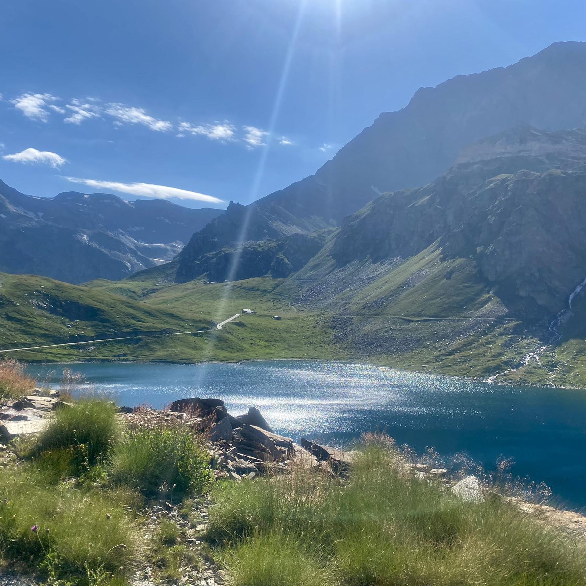
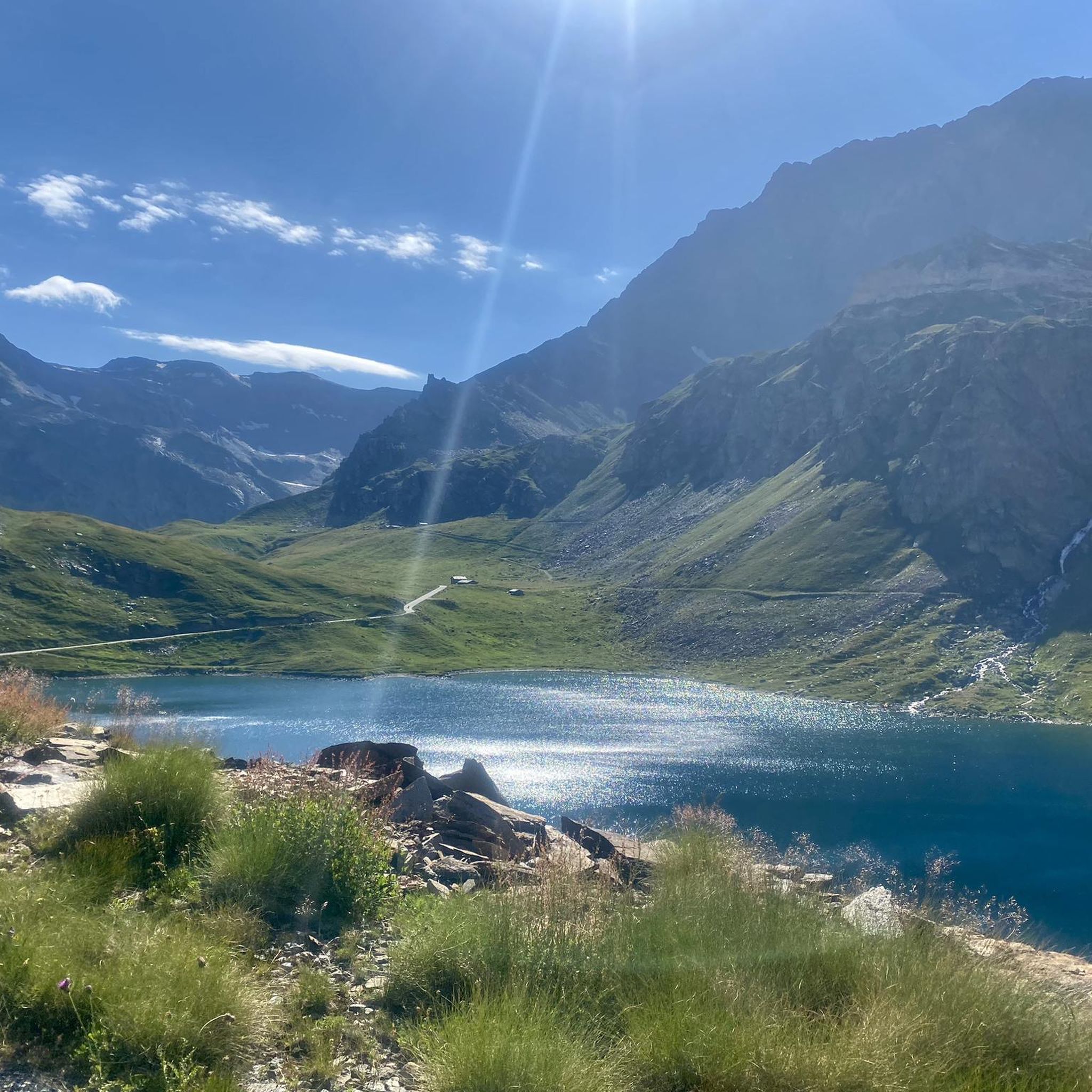
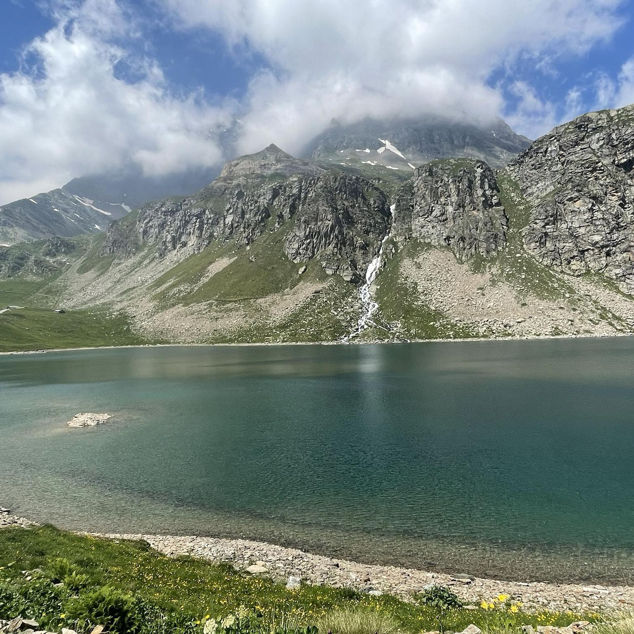
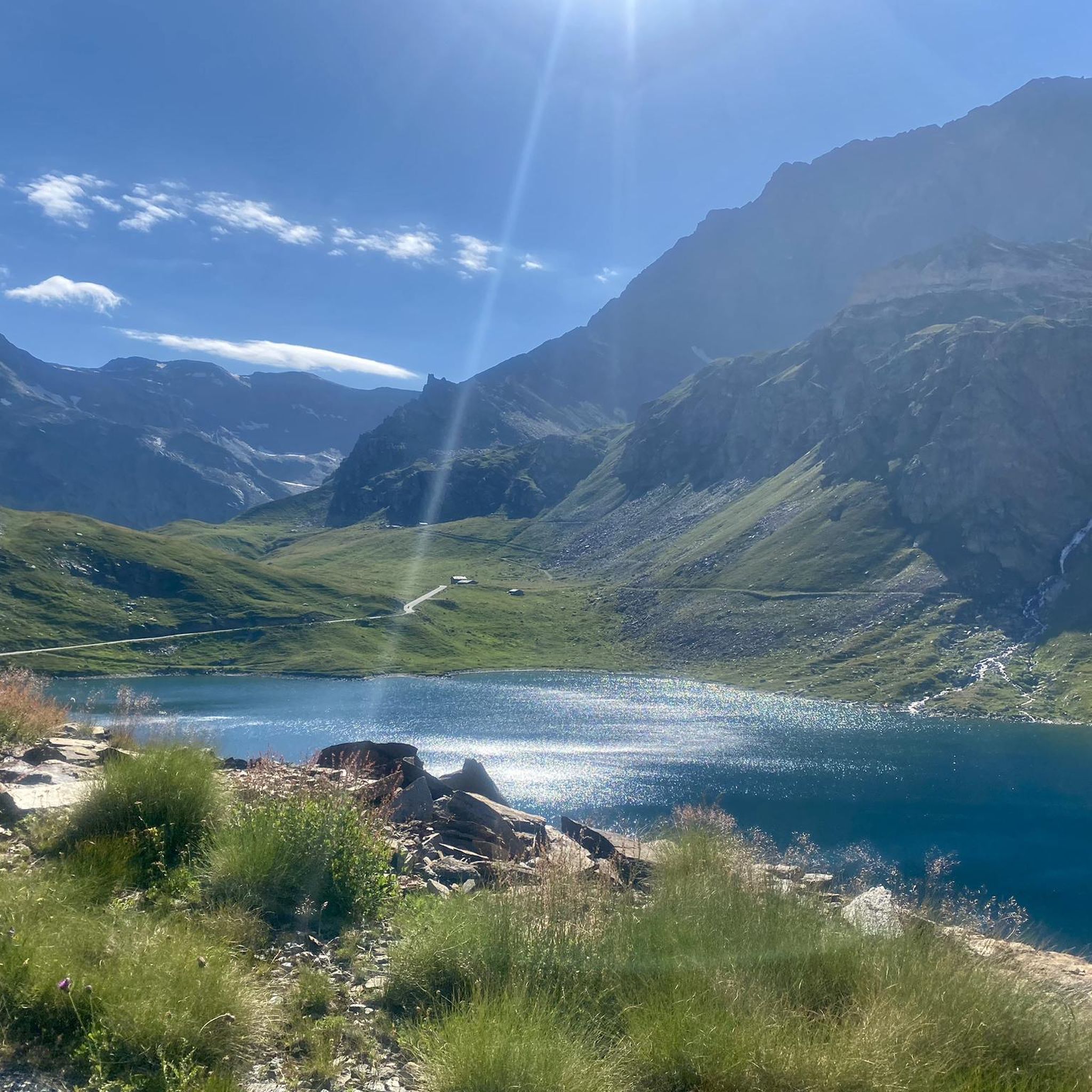
Hiking around Lake Agnel offers trails through a high-alpine environment within the Gran Paradiso National Park in Piedmont, Italy. The landscape is characterized by rocky shores, majestic mountain slopes, and several pristine alpine lakes, including Lake Serrù and the Nivolet Lakes. Situated at an elevation of approximately 7,500 feet (2300 meters), the area features a "mineral" terrain with sweeping views of the surrounding mountains and valleys.
Best hiking trails around Lake Agnel
- The most popular hiking route is From Nivolet Lakes to Taou Blanc — Gran Paradiso National Park, a 8.5 miles (13.7 km) trail that takes 6 hours 30 minutes to complete. This difficult route features significant elevation gain through high-alpine terrain.
- Another top favourite among local hikers is Lake Serrù Loop Trail, a moderate 2.9 miles (4.7 km) path. This loop offers alpine views around Lake Serrù and can be completed in about 1 hour 30 minutes.
- Local hikers also love the Rifugio Pian della Ballotta from the Serrù dam, a 2.3 miles (3.7 km) trail leading through mountain landscapes, often completed in about 1 hour 35 minutes.
- Hiking around Lake Agnel is defined by rocky shores, majestic mountain slopes, and pristine alpine lakes. The network offers options for various ability levels, from moderate loops to challenging high-alpine treks.
- The routes in Lake Agnel are highly rated by the komoot community with an average score of 4.6 stars from over 2500 reviews. More than 18000 hikers have used komoot to explore Lake Agnel's varied terrain.
Last updated: September 28, 2026
4.8
(100)
539
hikers
13.7km
06:31
930m
930m
Hard hike. Very good fitness required. Sure-footedness, sturdy shoes and alpine experience required.
4.5
(12)
63
hikers
4.67km
01:32
150m
150m
Moderate hike. Great for any fitness level. Mostly accessible paths. Sure-footedness required.

4.0
(3)
13
hikers
3.75km
01:36
140m
140m
Hard hike. Great for any fitness level. Sure-footedness, sturdy shoes and alpine experience required.
4.6
(16)
55
hikers
16.6km
05:51
780m
780m
Hard hike. Very good fitness required. Mostly accessible paths. Sure-footedness required.
4.3
(24)
99
hikers
12.4km
03:59
530m
530m
Moderate hike. Good fitness required. Mostly accessible paths. Sure-footedness required.
Get access to more routes and recommendations from other explorers.
Already have an account?
Our route recommendations are based on thousands of hikes, rides, and runs completed by other people on komoot.
Start today with a free account
Your next adventure awaits.

Tips from the Community

How fast do you push it on the bike?
0
0

Refuge in front of the Nivolet lakes. In my opinion it would have great potential given the fabulous location, but in my opinion it is not exploited.
0
0

Rifugio Savoia is located at an altitude of 2,534 meters on the picturesque Nivolet plateau, right in the heart of the Gran Paradiso National Park. Born from the renovation of a historic hunting lodge of King Vittorio Emanuele II dating back to 1860, today it offers 40 beds and a welcoming kitchen with typical dishes of the Aosta Valley tradition.
2
0


THE 18 KM CLIMB IS DEMANDING DUE TO THE GRADIENTS IT OFFERS BUT VERY REWARDING FOR THE VIEWS IT OFFERS.
0
0


The most beautiful climb in Piedmont. An Australian friend who has cycled around Europe says it is the most beautiful climb in Europe and perhaps in the world. The view from the balcony of the hill is nothing short of stunning...
0
1
The road that draws an "S" on the dam is very scenic. All that remains is to tackle the last hairpin bends to the top and then enjoy the most beautiful view of the Alps and perhaps the world...
0
0
Frequently Asked Questions
How many hiking trails are available around Lake Agnel?
There are over 130 hiking trails around Lake Agnel, offering a wide range of options for different skill levels. You'll find everything from moderate loops to challenging high-alpine treks within the Gran Paradiso National Park.
What do other hikers say about the trails around Lake Agnel?
The trails around Lake Agnel are highly rated by the komoot community, with an average score of 4.6 stars from over 2500 reviews. Hikers often praise the stunning alpine scenery, the pristine lakes, and the diverse terrain that offers something for everyone.
What kind of landscape can I expect when hiking around Lake Agnel?
The landscape around Lake Agnel is characterized by a high-alpine environment with rocky shores, majestic mountain slopes, and several pristine alpine lakes, including Lake Serrù and the Nivolet Lakes. The area, situated at approximately 7,500 feet (2300 meters), offers sweeping views of the Gran Paradiso National Park and a distinct 'mineral' terrain.
Are there easy hiking trails around Lake Agnel?
While many trails are moderate to difficult, there are 8 easy hiking routes available around Lake Agnel. These typically offer shorter distances and less elevation gain, making them suitable for a more relaxed experience.
Are there any circular hiking routes near Lake Agnel?
Yes, there are several circular routes. For example, the Lake Serrù – Colle del Nivolet loop from Colle del Nivolet is a moderate 12.4 km hike that offers beautiful views and can be completed in about 4 hours.
What natural features or landmarks can I see while hiking?
Beyond Lake Agnel itself, you can explore other pristine alpine lakes like Lake Serrù and the Nivolet Lakes. A significant attraction is the panoramic view from Colle del Nivolet (Nivolet Pass), which offers spectacular vistas of the lakes and surrounding mountains. Keep an eye out for wildlife, as ibex are frequently sighted in the area.
What is the best time of year to hike around Lake Agnel?
Given its high-alpine setting, the best time to hike around Lake Agnel is typically during the warmer months, from late spring to early autumn, when trails are clear of snow and weather conditions are more favorable. Always check local weather and trail conditions before heading out.
Is there parking available for hikers near Lake Agnel?
Parking is generally available at key access points and trailheads, particularly near popular starting points like the Nivolet Pass or the Serrù dam. It's advisable to arrive early during peak season to secure a spot.
Are there family-friendly hiking options around Lake Agnel?
Yes, there are options suitable for families, especially among the easier and moderate trails. The Lake Serrù Loop Trail is a moderate 4.7 km path that offers alpine views and can be completed in about 1 hour 30 minutes, making it a good choice for families.
Can I hike with my dog around Lake Agnel?
Lake Agnel is located within the Gran Paradiso National Park. While dogs are generally allowed in some areas, there are often specific regulations regarding leashes and restricted zones to protect wildlife. It's recommended to check the official Gran Paradiso National Park guidelines for the most current information on hiking with dogs.
Are there any challenging multi-hour hikes in the area?
Absolutely. For experienced hikers seeking a challenge, the From Nivolet Lakes to Taou Blanc — Gran Paradiso National Park is a difficult 13.7 km trail with significant elevation gain, typically taking around 6 hours 30 minutes to complete.
What is the elevation of Lake Agnel?
Lake Agnel is situated at an elevation of approximately 2300 meters (7,500 ft) above sea level, contributing to its high-alpine character and stunning mountain views.
Most popular routes around Lake Agnel
Most popular attractions around Lake Agnel

Get inspired with the komoot mobile app


Explore more
Browse the best Hikes in other regions.
