The best mountain hikes around Lake Cingino
4.5
(16)
326
hikers
8
hikes
Mountaineering routes Lake Cingino are set within an impressive alpine environment in the Antrona Valley, Piedmont, Italy, at an altitude of approximately 2,250 meters (7,382 ft). The region is characterized by rugged terrain, the significant Cingino Dam and its reservoir, and the presence of larch forests and waterfalls along the Troncone Valley. This area offers diverse terrain for mountaineering, from challenging ascents to routes featuring unique natural attractions.
Best mountaineering routes around Lake Cingino
- The most popular mountaineering route is…
Last updated: August 1, 2026
6
hikers
Hard mountaineering route. Good fitness required. Sure-footedness, sturdy shoes and alpine experience required.
5.0
(3)
46
hikers
13.4km
06:34
840m
840m
Hard mountaineering route. Very good fitness required. Sure-footedness, sturdy shoes and alpine experience required.

Sign up for free
3.0
(1)
11
hikers
Hard mountaineering route. Very good fitness required. Sure-footedness, sturdy shoes and alpine experience required.
4.7
(3)
10
hikers
Moderate mountaineering route. Good fitness required. Mostly accessible paths. Sure-footedness required.
5
hikers
Hard mountaineering route. Good fitness required. Sure-footedness, sturdy shoes and alpine experience required.
Get access to more routes and recommendations from other explorers.
Sign up for free
Already have an account?
Our route recommendations are based on thousands of hikes, rides, and runs completed by other people on komoot.
Start today with a free account
Your next adventure awaits.
Login or Signup
Tips from the Community

Wonderful tour up here. I was there in 2001 on a mountain training course of the Swiss army.
1
0

Beautiful viewpoint. Located on the Mattmark - Britanniahütte hiking trail.
6
0

A beautiful vantage point of the Mattmark Reservoir. This reservoir is located at the southern end of the Saas Valley at an altitude of 2,197 meters, nestled in the impressive mountains near Saas-Almagell. With a length of approximately three kilometers and a maximum width of 800 meters, it is one of the larger reservoirs in the region. It is fed by various mountain streams, such as the Saaser Vispa, the Schwarzbergbach, and the Ofentalbach. Behind the imposing 120-meter-high earthfill dam, the Vispa continues downstream toward the Rhone Valley.
0
0
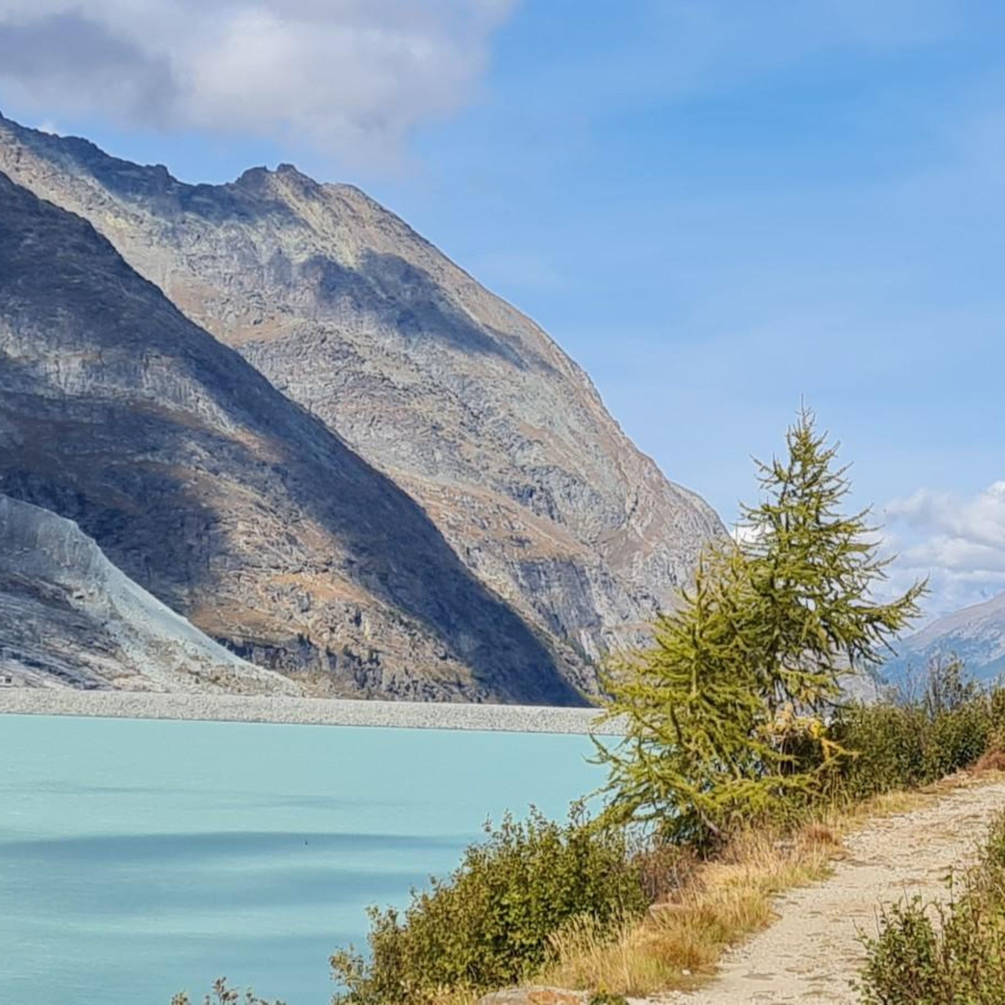
Surrounded by high alpine tranquility and glacial peaks, the turquoise-blue Mattmarksee lies at your feet. This artificial lake is located at over 2,000 meters in the farthest reaches of the Saas Valley. It stores meltwater and supplies the region with renewable energy.
1
0

The Mattmark Reservoir is a reservoir located in the municipality of Saas-Almagell at the southern end of the Saas Valley in the Visp district of the canton of Valais in Switzerland. The lake is used by Kraftwerke Mattmark AG to generate electricity. In 1965, a glacier collapse during construction claimed 88 lives. Wikipedia
2
0

The tunnel is on the right and is the beginning of the hiking trail around the lake. The trail is officially closed in winter.
0
0

When you arrive at the reservoir on the side of the Mattmark restaurant, you should definitely walk a short distance along the east side to the tunnel and cross it. In winter, a beautiful waterfall forms at the entrance and icicles hang from the ceiling inside too
0
0
Frequently Asked Questions
What kind of mountaineering routes can I expect around Lake Cingino?
The Lake Cingino area offers a diverse range of mountaineering routes, from moderate paths requiring good fitness to difficult routes demanding alpine experience and sure-footedness. You'll find challenging ascents and routes through rugged alpine terrain, including glaciated sections.
Are there any unique natural features or landmarks to see while mountaineering near Lake Cingino?
Absolutely! A truly unique sight is the presence of Alpine ibex that famously climb the almost vertical face of the Cingino Dam to lick salt deposits. This remarkable behavior is often observed between June and October. The area also features beautiful waterfalls, clearings, and ancient larch forests, especially along the Troncone Valley.
What is the best time of year for mountaineering around Lake Cingino?
The prime season for mountaineering around Lake Cingino is generally from June to October. During this period, the weather is more stable, and the unique spectacle of the Alpine ibex on the Cingino Dam is most frequently observed. Always check local weather conditions before heading out, as alpine environments can change rapidly.
How many mountaineering routes are available in the Lake Cingino region?
There are over 9 mountaineering routes documented around Lake Cingino, catering to various skill levels. These include moderate paths and more challenging difficult routes, offering plenty of options for exploration.
Are there any circular mountaineering routes in the area?
Yes, there are several circular routes available. For example, the Mattmark Reservoir – View of the Mattmark Reservoir loop from Staudamm Mattmark is a moderate option that allows you to experience the alpine scenery in a loop.
What do other mountaineers enjoy most about the Lake Cingino routes?
The routes in Lake Cingino are highly rated by the komoot community, with an average score of 4.6 stars. Mountaineers often praise the rugged alpine terrain, the challenging ascents, and the unique natural attractions like the Cingino Dam and its wildlife.
Are there any routes suitable for families or those new to mountaineering?
While many routes require good fitness and sure-footedness, the region does offer paths that are more accessible. For instance, the Lago di Alpe Russi loop from Antrona Schieranco is a moderate route that provides beautiful alpine views without extreme difficulty, making it a good option for those with some hiking experience.
Can I bring my dog on the mountaineering trails around Lake Cingino?
Many trails in the Antrona Valley are generally dog-friendly, but it's always best to check specific route regulations and local signage. Given the rugged terrain and potential for wildlife encounters, ensure your dog is well-behaved, on a leash, and capable of handling the physical demands of the trail.
Are there any challenging routes for experienced mountaineers?
Experienced mountaineers will find several challenging options. The Britannia Hut – Hohlaub Glacier loop from Staudamm Mattmark is a difficult trail leading through glaciated terrain, requiring very good fitness and alpine experience. Another demanding option is the Jatzilücke – Mattmark Dam loop from Staudamm Mattmark.
Is there public transport or parking available near the trailheads for Lake Cingino?
Access to the Lake Cingino area typically involves reaching the Antrona Valley. While specific public transport options directly to all trailheads might be limited, there are often parking facilities available at key starting points like Antrona Schieranco or near the Mattmark Dam. It's advisable to research specific access points for your chosen route.
Are there any other lakes to explore in the Antrona Valley besides Lake Cingino?
Yes, the Antrona Valley is home to a network of beautiful lakes. Besides Lake Cingino, you can also explore other notable lakes such as Lake Antrona and Lake Campiccioli, which offer additional hiking and scenic opportunities within the valley.
Most popular routes around Lake Cingino

Get inspired with the komoot mobile app


Explore more
Browse the best Mountain Hikes & Routes in other regions.
