The best mountain hikes around Lac de Calacuccia
4.9
(32)
212
hikers
4
hikes
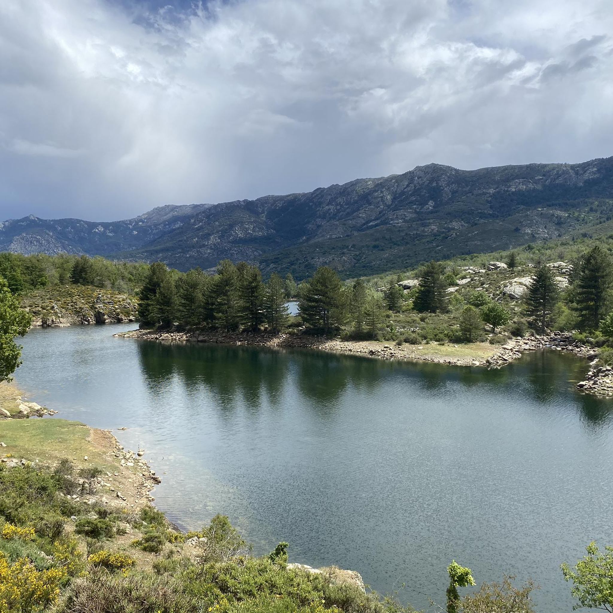
Mountaineering routes around Lac de Calacuccia are situated within the Niolu region of the Corsica Regional Natural Park, offering access to challenging peaks and diverse landscapes. The area is characterized by majestic mountain ranges, including the Cinto massif with summits exceeding 2500 meters, and the rugged Rotondo massif. High-altitude lakes, such as Lac de Ninu, and the Golo river, which feeds the reservoir at 793m, further define the terrain. This preserved natural environment provides a robust setting for mountain exploration.
Best mountaineering routes around Lac de Calacuccia
- The most popular mountaineering route is Monte Cinto – View towards the sea loop from Lozzi, an 8.2 miles (13.2 km) trail that takes 7 hours 48 minutes to complete, offering significant elevation gain towards Corsica's highest peak.
- Another top favourite among local mountaineers is Lac de Nino – Drinking fountain with shrine loop from Poppaghja, a difficult 7.1 miles (11.5 km) path. This route leads to the picturesque Lac de Ninu, known for its high-altitude meadows.
- Local mountaineers also love the Fantastic view – Ballone Shepherd's Hut loop from Calasima, a 6.4 miles (10.3 km) trail leading through varied mountain terrain, often completed in about 3 hours 37 minutes.
- Mountaineering around Lac de Calacuccia is defined by imposing peaks, high-altitude lakes, and preserved natural park environments. The network offers options for different ability levels, from moderate ascents to challenging high-mountain expeditions.
- The routes in Lac de Calacuccia are highly rated by the komoot community with an average score of 4.98 stars from over 30 reviews. More than 240 mountaineers have used komoot to explore Lac de Calacuccia's varied terrain.
Last updated: July 25, 2026
5.0
(1)
15
hikers
13.2km
07:48
1,290m
1,290m
Hard mountaineering route. Very good fitness required. Sure-footedness, sturdy shoes and alpine experience required.
3
hikers
10.3km
03:37
420m
420m
Moderate mountaineering route. Good fitness required. Mostly accessible paths. Sure-footedness required.

Sign up for free
2
hikers
12.5km
05:02
820m
830m
Hard mountaineering route. Very good fitness required. Sure-footedness, sturdy shoes and alpine experience required.
4.8
(6)
26
hikers
15.6km
06:48
860m
860m
Hard mountaineering route. Very good fitness required. Sure-footedness, sturdy shoes and alpine experience required.
5.0
(4)
40
hikers
20.0km
08:04
1,030m
1,030m
Hard mountaineering route. Very good fitness required. Sure-footedness, sturdy shoes and alpine experience required.
Our route recommendations are based on thousands of hikes, rides, and runs completed by other people on komoot.
Start today with a free account
Your next adventure awaits.
Login or Signup
Tips from the Community


pretty here, very pretty
0
0
pretty here, very pretty
0
0
Frequently Asked Questions
How many mountaineering routes are available around Lac de Calacuccia?
There are several mountaineering routes around Lac de Calacuccia, with komoot featuring 5 distinct tours. These routes offer a range of challenges, from moderate ascents to difficult high-mountain expeditions, all within the stunning Niolu region of the Corsica Regional Natural Park.
Are there any moderate mountaineering routes for those looking for a less strenuous challenge?
Yes, while many routes in the region are challenging, you can find moderate options. For instance, the Fantastic view – Ballone Shepherd's Hut loop from Calasima is a moderate 10.3 km trail that takes about 3 hours 37 minutes to complete, offering varied mountain terrain without the extreme difficulty of some other ascents.
What are some of the most challenging mountaineering routes near Lac de Calacuccia?
The region is known for its challenging peaks. One of the most demanding routes is the Monte Cinto – View towards the sea loop from Lozzi, an 8.2-mile (13.2 km) trail that takes nearly 8 hours and involves significant elevation gain towards Corsica's highest peak. Another difficult option is the Mountaineering loop from Calasima, which covers 12.5 km with substantial elevation changes.
Are there any circular mountaineering routes around Lac de Calacuccia?
Yes, many of the mountaineering routes in the area are designed as loops, allowing you to start and finish in the same location. Examples include the Lac de Nino – Drinking fountain with shrine loop from Poppaghja and the Lac de Nino – Tree shaped by the wind loop from Poppaghja, both offering stunning high-altitude scenery.
What natural attractions can I expect to see along the mountaineering routes?
Mountaineering routes around Lac de Calacuccia offer breathtaking natural features. You'll encounter majestic mountain ranges like the Cinto and Rotondo massifs, with peaks such as Monte Cinto, Paglia Orba, and Cinque Frati. High-altitude lakes, notably Lac de Ninu, are often highlights, known for their picturesque settings and free-roaming horses in summer. The Golo river also carves through the landscape, creating dramatic gorges like the Scala di Santa Regina.
What do other mountaineers say about the routes in Lac de Calacuccia?
The mountaineering routes in Lac de Calacuccia are highly regarded by the komoot community, boasting an average rating of 4.98 stars from over 30 reviews. Mountaineers frequently praise the challenging yet rewarding ascents, the stunning panoramic views from the peaks, and the immersive experience within the preserved natural park environment.
Is the Lac de Calacuccia region suitable for rock climbing?
Beyond traditional mountaineering, the Niolu region near Lac de Calacuccia offers natural rock climbing sites, such as those found in Cuccia. These sites cater to both beginners and experienced climbers, with routes typically ranging from 20 to 30 meters in length and varying in difficulty, providing a unique perspective of Corsica's rugged landscape.
Can I find long-distance hiking opportunities that connect with the mountaineering routes?
Yes, the region is a hub for extensive hiking and trekking networks. The famous GR20, one of Europe's most challenging long-distance hiking routes, passes through or is easily accessible from the area, offering multi-day treks through high mountains. The 'Mare a Mare Nord' also connects eastern and western Corsica, providing further long-distance options.
Are there any specific high-altitude lakes to aim for on a mountaineering trip?
Absolutely. Lac de Ninu is a prominent high-altitude lake that is a popular destination for mountaineers. Routes like the Lac de Nino – Drinking fountain with shrine loop from Poppaghja lead directly to this stunning lake, known for its high-altitude meadows and the chance to see free-roaming horses during the warmer months.
What is the general character of the landscape for mountaineering in this region?
The landscape around Lac de Calacuccia is characterized by a dramatic and preserved natural environment within the Corsica Regional Natural Park. You'll find a mix of herbaceous areas used for pastoralism and dense wooded sections, all set against a backdrop of imposing peaks and deep river valleys. It's an ideal setting for an immersive mountain experience.
Are there guided mountaineering activities available in the Lac de Calacuccia area?
Yes, for those looking to undertake challenging ascents or explore the mountainous terrain safely, regional guides and accompanying mountain professionals are available. They offer supervised activities including climbing, hiking, and even ski touring in winter, ensuring a safe and enriching experience.
Most popular routes around Lac de Calacuccia

Get inspired with the komoot mobile app


Explore more
Browse the best Mountain Hikes & Routes in other regions.
