The best running trails around East Lulworth
4.4
(92)
4,866
runners
181
runs
Jogging routes around East Lulworth are set within the Jurassic Coast World Heritage Site, offering a diverse landscape for runners. The region is characterized by dramatic limestone cliffs, iconic geological formations like Lulworth Cove and Durdle Door, and an extensive network of paths. Runners can explore coastal trails, ascend rolling hills such as Bindon Hill, and traverse ancient woodlands. This varied terrain provides options for different fitness levels and preferences.
Best jogging routes around East Lulworth
- The most popular jogging route is Coombe Keynes Village loop from Coombe Keynes, a 5.6 miles (9.0 km) trail that takes 1 hour 2 minutes to complete, winding through scenic village paths and surrounding countryside.
- Another top favourite among local runners is Running loop from West Lulworth, a moderate 5.5 miles (8.9 km) path, offering varied terrain with coastal views and inland trails.
- Local runners also love the Bat's Head loop from West Lulworth, a 6.6 miles (10.6 km) trail leading through dramatic coastal cliffs and rock formations, often completed in about 1 hour 15 minutes.
- Jogging around East Lulworth is defined by dramatic coastal paths, rolling hills, and ancient woodlands. The network offers options for different ability levels, from gentle runs to more challenging trail experiences.
- The routes in East Lulworth are highly rated by the komoot community with an average score of 4.5 stars from over 60 reviews. More than 5000 runners have used komoot to explore East Lulworth's varied terrain.
Last updated: September 30, 2026
85
runners
9.00km
01:02
140m
140m
Moderate run. Good fitness required. Mostly accessible paths. Some sure footedness required.
3.0
(1)
46
runners
8.77km
01:04
210m
210m
Moderate run. Good fitness required. Mostly accessible paths. Some sure footedness required.

41
runners
10.6km
01:15
280m
280m
Moderate run. Good fitness required. Mostly accessible paths. Some sure footedness required.
24
runners
7.36km
00:50
180m
180m
Moderate run. Good fitness required. Mostly paved surfaces. Suitable for all skill levels.
7
runners
Moderate run. Good fitness required. Mostly paved surfaces. Suitable for all skill levels.
Get access to more routes and recommendations from other explorers.
Already have an account?
Our route recommendations are based on thousands of hikes, rides, and runs completed by other people on komoot.
Start today with a free account
Your next adventure awaits.
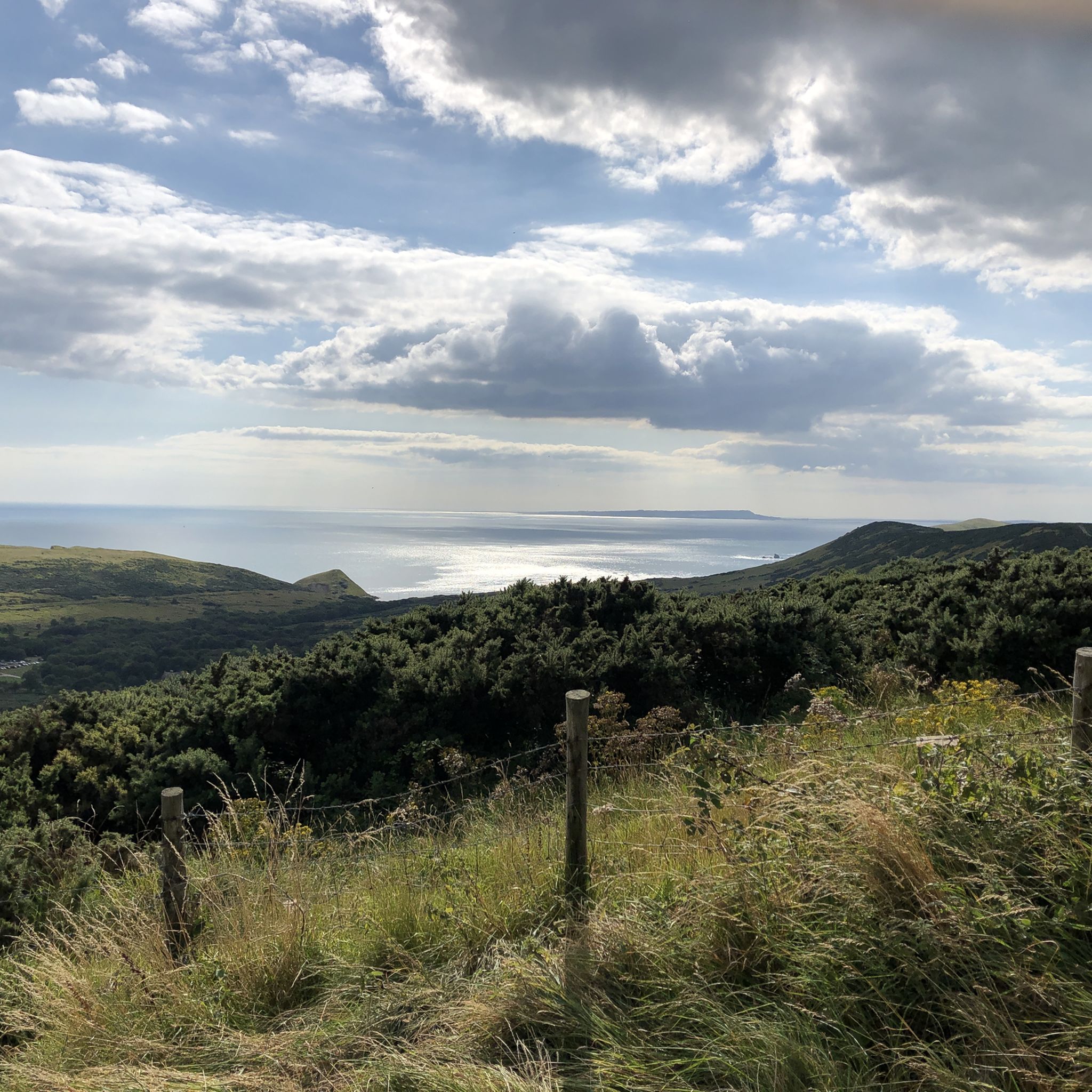
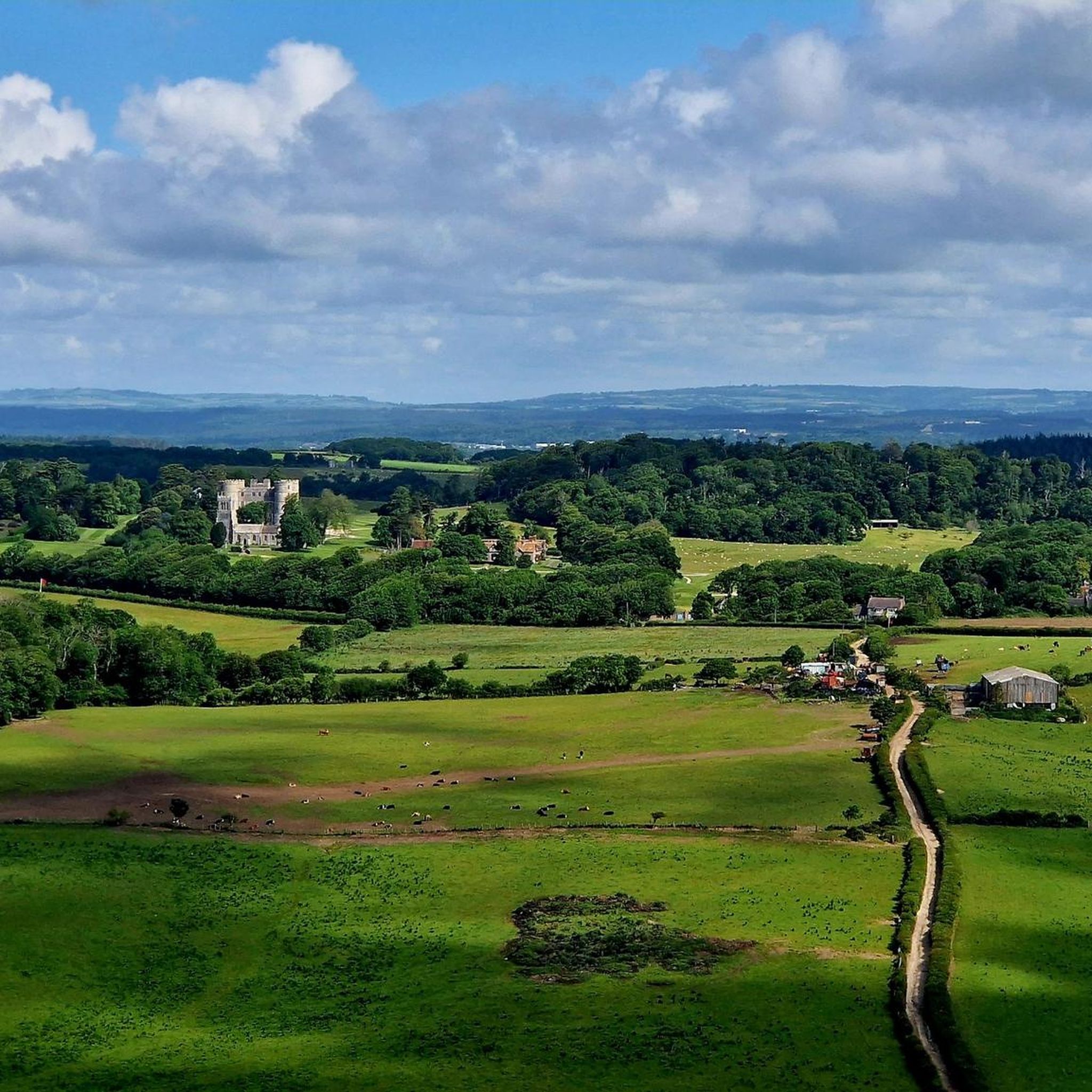
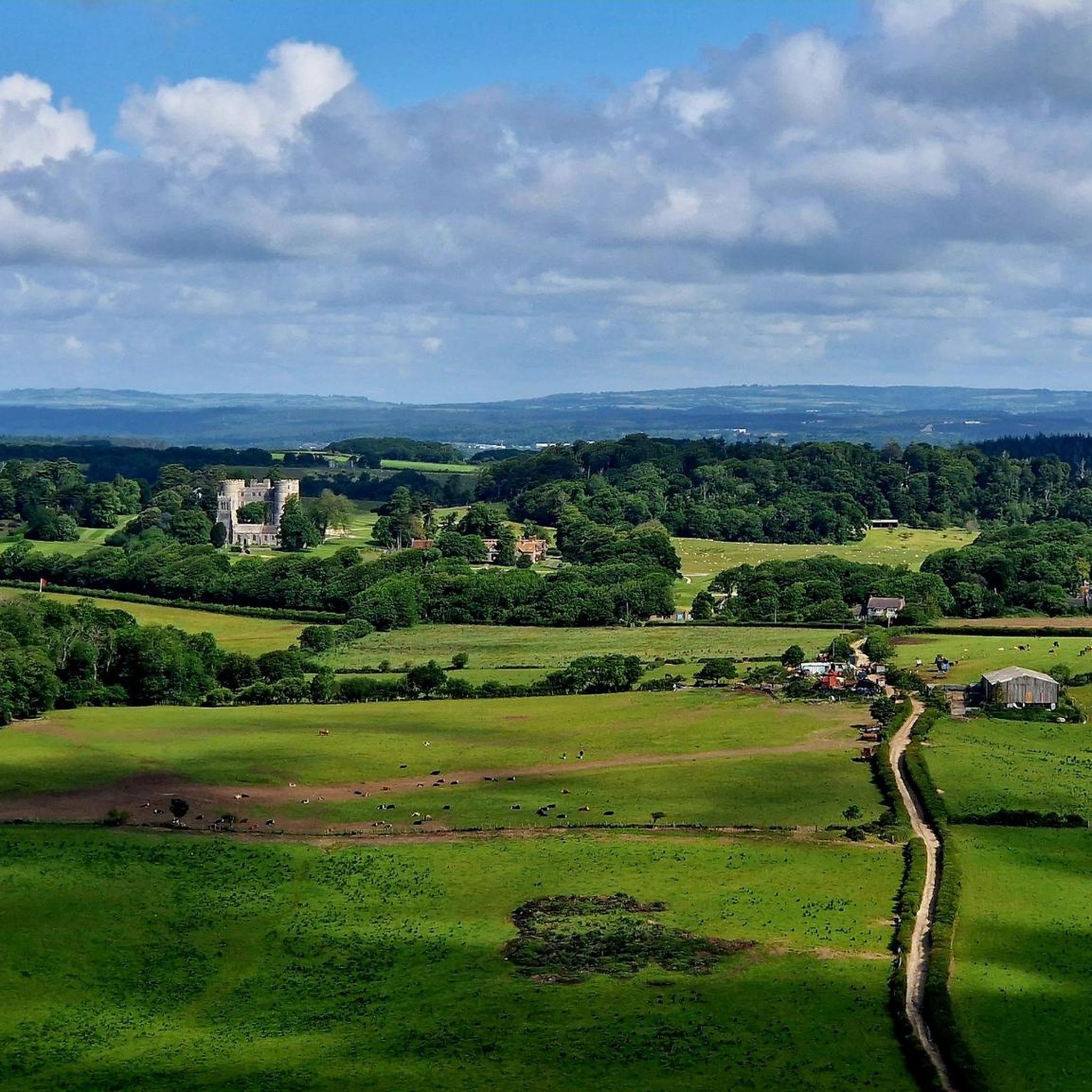
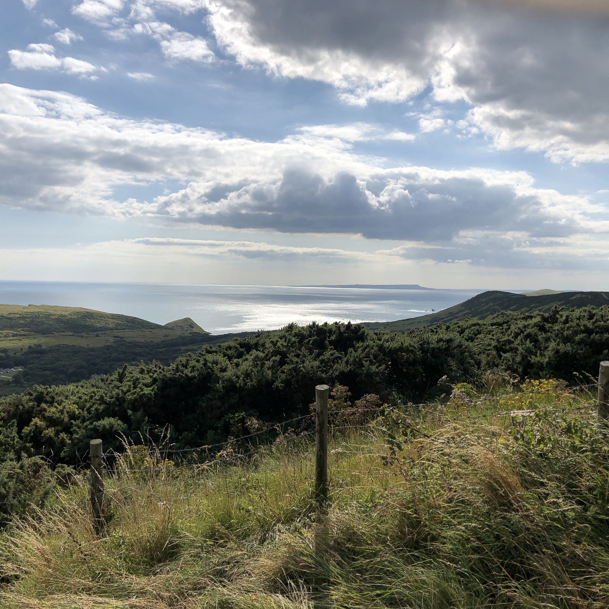
Tips from the Community

Nestled in West Lulworth, local spots like Finley’s Café, The Dolls House, and traditional village pubs offer essential rest stops for cyclists tackled by steep Purbeck hills. Enjoy cake, coffee, or a pint before Lulworth Cove.
0
0
Durdle Door was formed roughly 140 million years ago when powerful tectonic collisions pushed vertical layers of hard Portland limestone against softer rock. Over millennia, relentless waves punched through the softer stone, carving out the iconic archway seen today. Its name comes from the Old English word thirl, meaning "to pierce." Eventually, coastal erosion will cause the arch to collapse, leaving behind a isolated sea stack.
0
0
Durdle Door was formed roughly 140 million years ago when powerful tectonic collisions pushed vertical layers of hard Portland limestone against softer rock. Over millennia, relentless waves punched through the softer stone, carving out the iconic archway seen today. Its name comes from the Old English word thirl, meaning "to pierce." Eventually, coastal erosion will cause the arch to collapse, leaving behind a isolated sea stack.
0
0

We did not descend here. With strong east wind, it was too winding for us there.
0
0
A very beautiful and much-traveled coastal path.
0
0


What you will find there Free exhibition on the formation of Lulworth Cove, Durdle Door and the Jurassic Coast. Current information on paths, tides and any closures. Souvenir and fossil shop. Café and toilets directly at the visitor centre. Opening hours The visitor centre is open daily. Typically from 10:00 AM–5:00 PM in summer, usually until 4:00 PM in winter. Admission is free. Practical tip for your hike Get water or a coffee there before climbing up to Durdle Door. The route over the cliffs to Durdle Door and Hambury Tout offers hardly any refreshment stops along the way. Directly at the Cove, there is also the Boat Shed Cafe with a view of the bay.
1
0
Durdle Door is a natural limestone arch on the south coast of England in the county of Dorset. It is located on the famous Jurassic Coast, which is a UNESCO World Heritage Site. The rock arch was formed over millions of years by erosion: waves and weather wore away the softer rock, shaping the characteristic arch-like opening in the limestone.
1
0
Frequently Asked Questions
How many running routes are available around East Lulworth?
There are over 190 running routes around East Lulworth, offering a wide variety of options for different fitness levels and preferences. The komoot community has explored more than 5000 of these trails.
What kind of terrain can I expect on the jogging routes in East Lulworth?
The terrain around East Lulworth is incredibly diverse, ranging from dramatic coastal paths along the Jurassic Coast to rolling hills and ancient woodlands. You'll encounter limestone cliffs, pebble beaches, and varied surfaces, providing both challenging ascents and gentler stretches. Routes often feature sections of the South West Coast Path.
Are there easy running routes suitable for beginners or a more relaxed jog?
Yes, East Lulworth offers a selection of easier running routes. For example, the Coombe Keynes Village loop from Coombe Keynes is a moderate 5.6-mile (9.0 km) trail that winds through scenic village paths and countryside, making it a good option for a less strenuous run.
What natural landmarks can I see while running in East Lulworth?
The running routes in East Lulworth are rich with stunning natural landmarks. You can expect to see iconic formations like Lulworth Cove, the magnificent Durdle Door natural limestone arch, and the fascinating Stair Hole rock arches. Many routes also offer breathtaking views along the Lulworth Cove to Durdle Door Coastal Path.
Are there any longer or more challenging running trails for experienced runners?
Absolutely. For those seeking a greater challenge, routes like the Bat's Head loop from West Lulworth offer a 6.6-mile (10.6 km) trail leading through dramatic coastal cliffs and rock formations with significant elevation changes. The area also hosts organized trail running events with ultra-distance options, indicating the suitability of the landscape for serious trail running.
Can I bring my dog on the running trails in East Lulworth?
Many trails in the East Lulworth area are dog-friendly, allowing you to enjoy your run with your canine companion. However, it's always advisable to keep dogs on a lead, especially near livestock, cliffs, or in areas with sensitive wildlife. Please check specific route details for any restrictions.
When is the best time of year to go jogging in East Lulworth?
The best time to go jogging in East Lulworth depends on your preference. Spring and autumn offer pleasant temperatures and fewer crowds, with vibrant flora or beautiful autumnal colours. Summer provides longer daylight hours but can be busier. Winter runs can be dramatic with rugged coastal views, but paths may be muddy or slippery, and checking local conditions is recommended.
Are there circular running routes available?
Yes, many of the running routes in East Lulworth are designed as circular loops, allowing you to start and finish at the same point. Examples include the Running loop from West Lulworth and the Lulworth Camp Display Tanks – Chalky Valley Track loop from West Lulworth, which is a longer 12.7 km option.
What do other runners enjoy most about jogging in East Lulworth?
The running routes in East Lulworth are highly rated by the komoot community, with an average score of 4.5 stars. Reviewers often praise the stunning coastal views, the unique geological formations, and the variety of terrain that keeps runs interesting and engaging. The well-maintained paths and the sense of being immersed in a World Heritage Site are frequently highlighted.
Is parking available near the running trailheads?
Yes, parking is generally available in and around East Lulworth, particularly near popular starting points like Lulworth Cove. However, during peak season, these areas can get busy, so arriving early is advisable. Some routes may start from smaller villages or less frequented spots with more limited parking.
Are there any specific permits or access restrictions I should be aware of for running in the area?
While most public footpaths and trails are freely accessible, parts of the Lulworth Estate are occasionally used by the army for firing practice. Access to certain areas, such as the Fossil Forest or Mupe Bay, may be restricted during these times. It's always wise to check local information or signs for firing times before planning your run, especially if venturing off the main coastal path.
How can I reach East Lulworth and its running trails using public transport?
East Lulworth is accessible by public transport, though options may be more limited than by car. Local bus services connect East Lulworth with nearby towns and train stations. It's recommended to check current bus timetables and routes to plan your journey to the village and access points for the trails. For more information on the area, you can visit Visit Dorset.
Most popular attractions around East Lulworth

Get inspired with the komoot mobile app


Explore more
Browse the best Running Trails & Routes in other regions.
