The best running trails around Lac Lauvitel
4.2
(43)
6,632
runners
92
runs
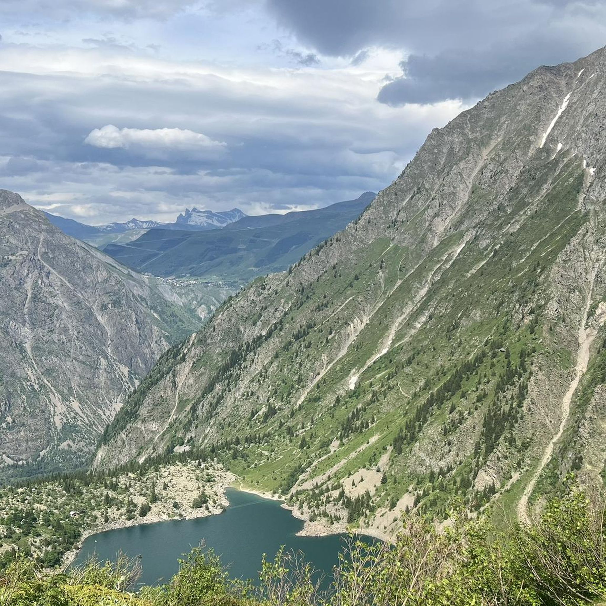
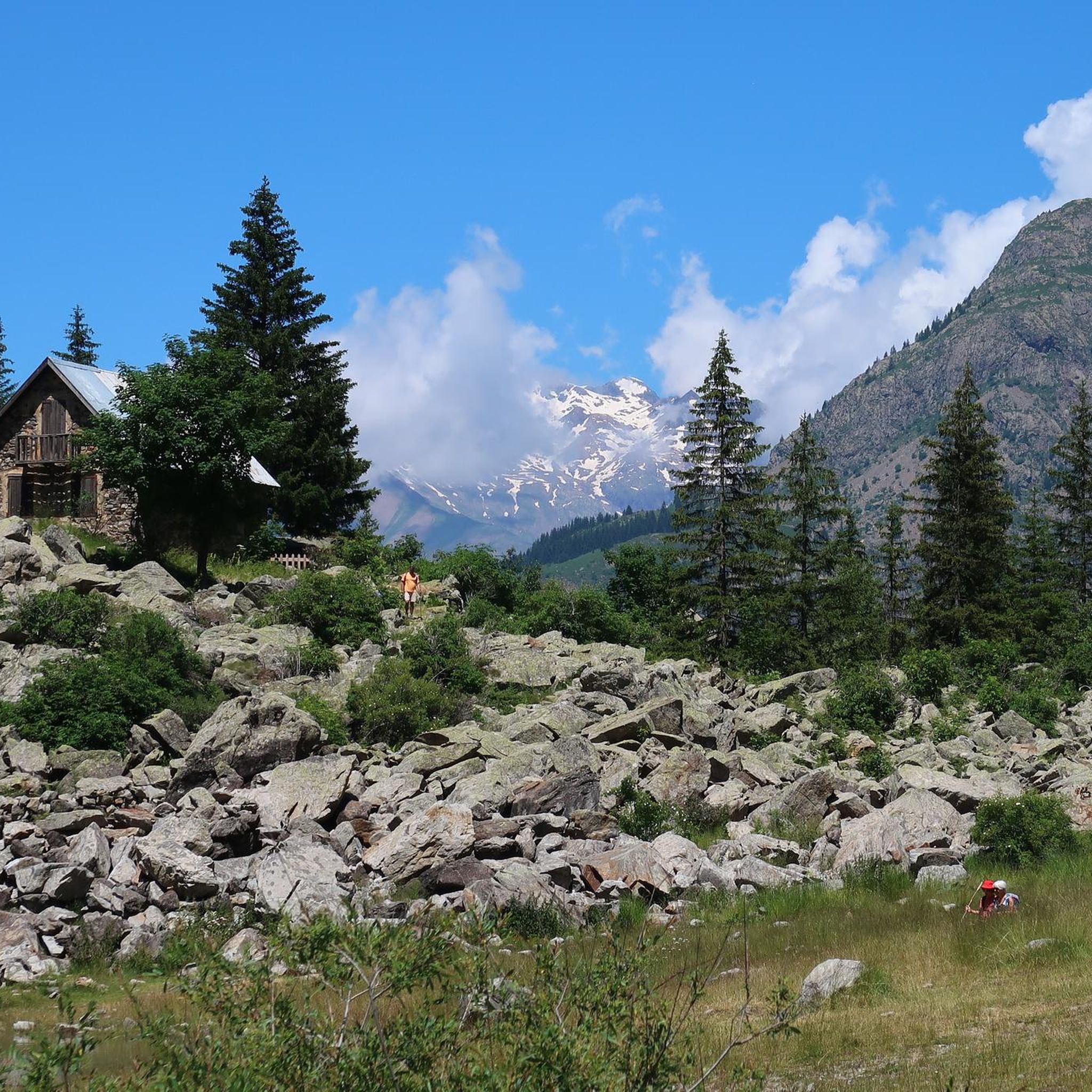
Jogging around Lac Lauvitel offers an immersive experience within the Écrins National Park, characterized by its magnificent mountain lake and surrounding steep rocky slopes. The region features diverse terrain, from paths winding through dense forests in the Vénéon Valley to trails with significant elevation changes leading to the lake. These running routes provide opportunities to explore the area's natural beauty, including mountain flora and views of high summits.
Best jogging routes around Lac Lauvitel
- The most popular jogging route is…
Last updated: October 4, 2026
7
runners
8.70km
01:04
160m
160m
Moderate run. Good fitness required. Mostly paved surfaces. Suitable for all skill levels.
153
runners
4.74km
01:03
440m
440m
Hard run. Very good fitness required. Sure-footedness, sturdy shoes and alpine experience required.

5.0
(1)
145
runners
7.50km
01:41
710m
710m
Hard run. Very good fitness required. Sure-footedness, sturdy shoes and alpine experience required.
5.0
(1)
41
runners
20.8km
02:19
320m
320m
Hard run. Very good fitness required. Mostly paved surfaces. Suitable for all skill levels.
22
runners
3.01km
00:27
120m
120m
Hard run. Good fitness required. Sure-footedness, sturdy shoes and alpine experience required.
Get access to more routes and recommendations from other explorers.
Already have an account?
Our route recommendations are based on thousands of hikes, rides, and runs completed by other people on komoot.
Start today with a free account
Your next adventure awaits.
Tips from the Community

In 2024, the region has been hit with massive flooding resulting in the flooding of upstream village La Bérarde. As a result of this flooding part of the cycling path has been swept away. This means cyclist are required to take the alternative off-road path. This contains of sections of hard-packed terrain and some rocky sections for roughly 1 kilometer. If you don't mind a bit of "hike a bike" you'll be fine, otherwise you might want to skip this one.
0
0

The bike path is not accessible throughout because the river has washed away parts of it. It is also not crossable on foot.
1
0

To be enjoyed throughout the descent
0
0

Access to the waterfall prohibited following a landslide
0
0


The Cascade de la Pisse is a very spectacular waterfall with a beautiful view of the mountains.
0
0
No longer accessible since February 2025 due to landslides - traffic is closed in one direction but not the other. Be careful as the direction of the hike is not indicated.
1
1

In the Écrins, the Pisse waterfall is a pleasant place to cool off at the foot of the impressive peaks of the massif.
0
0
Frequently Asked Questions
How many running routes are available around Lac Lauvitel?
There are over 90 running routes available around Lac Lauvitel, catering to various fitness levels. You'll find a mix of easy paths, moderate trails, and challenging runs within the stunning Écrins National Park.
What kind of terrain can I expect on the running trails?
The terrain around Lac Lauvitel is diverse, ranging from paths winding through dense forests in the Vénéon Valley to trails with significant elevation changes leading to the lake. You'll encounter mountain lake shores, steep rocky slopes, and clearings with prairies, offering a varied and scenic running experience.
Are there any easy running routes for beginners or those seeking a less strenuous run?
While many routes are challenging, there are a few easier options. The region offers 6 easy routes, though specific easy routes around the lake itself are limited. Most trails involve considerable elevation changes, making them ideal for those seeking a rewarding challenge.
Are there circular running routes around Lac Lauvitel?
Yes, there are several circular running routes. A popular option is the Lac Lauvitel – Lauvitel Lake loop from Lac Lauvitel, a 3.6-mile (5.8 km) difficult trail offering stunning views. Another favorite is the Lac Lauvitel – Lauvitel Lake loop from La Danchère, a 4.9-mile (7.9 km) difficult path starting from the hamlet of La Danchère.
What natural features or landmarks can I see while running in the area?
You'll be surrounded by the majestic landscapes of Écrins National Park. Key features include the magnificent mountain lake itself with its beautiful turquoise waters, steep rocky slopes from summits like Rochail, and the Vénéon River offering magical river walks through dense forests. You might also spot mountain flora like martagon and orange lilies, and even marmots.
Is there a waterfall I can visit on a running route?
Yes, you can explore a route that features a waterfall. Consider the Pisse Waterfall loop from Venosc, a moderate 7.3-mile (11.7 km) trail that includes this natural attraction.
What do other runners enjoy most about the trails around Lac Lauvitel?
The area is highly rated by the komoot community, with an average score of 4.3 stars from over 30 reviews. Runners frequently praise the stunning scenery, the challenging terrain perfect for trail running, and the sense of accomplishment gained from reaching the lake after a significant climb. The diverse landscapes, from tranquil lake shores to forest paths, are also highly appreciated.
Are the running trails around Lac Lauvitel suitable for families?
Many trails around Lac Lauvitel involve significant elevation changes and are classified as difficult, requiring very good fitness and sure-footedness. While some paths are well-maintained, the challenging nature of the terrain might be more suitable for families with older children or those accustomed to strenuous hikes. For a less demanding experience, look for routes with minimal elevation gain.
Can I bring my dog on the running trails in Écrins National Park?
Lac Lauvitel is located within Écrins National Park, which includes the Lauvitel Nature Reserve. National parks often have specific regulations regarding dogs to protect local fauna and flora. It's advisable to check the official Écrins National Park guidelines regarding dog access on trails before your visit to ensure compliance.
Where can I find parking for the running routes?
The hamlet of La Danchère often serves as a common starting point for routes to Lac Lauvitel, suggesting parking facilities may be available there. For specific parking information, it's best to check the details of individual routes on komoot or local signage upon arrival.
When is the best time of year to go running around Lac Lauvitel?
The Écrins National Park region is best enjoyed during warmer months when trails are clear of snow and ice. Late spring, summer, and early autumn generally offer the most favorable conditions for running, with pleasant temperatures and vibrant mountain flora. Always check local weather conditions and trail status before heading out, especially in shoulder seasons.
Are there any routes that follow the Vénéon River?
Yes, the Vénéon River offers magical river walks through dense forests. You can explore the Vénéon River loop from Les Escalons, a difficult 4.7-mile (7.6 km) route that follows the river and offers a different perspective of the valley.
Most popular routes around Lac Lauvitel

Get inspired with the komoot mobile app


Explore more
Browse the best Running Trails & Routes in other regions.
