The best road cycling routes around Uplyme
4.4
(42)
1,260
riders
13
rides
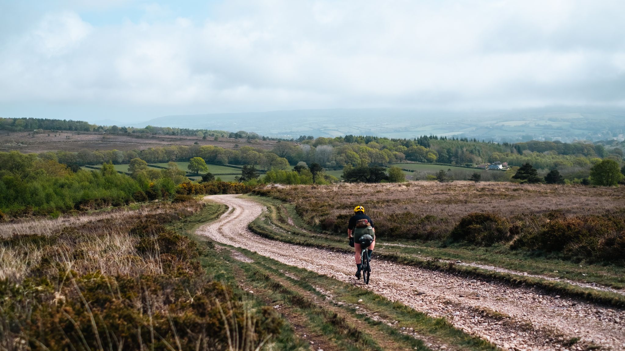
Road cycling routes around Uplyme navigate a landscape characterized by rolling hills, coastal stretches, and river valleys. The area features varied terrain, including ascents towards viewpoints like Pilsdon Pen and routes along the Lyme Bay cliffs. Road cyclists can expect a mix of open countryside and routes that pass through villages and along the coastline.
Best road cycling routes around Uplyme
- The most popular road cycling route is Colyton Town Center – Seaton Beach and Cliffs loop from Lyme Regis…
Last updated: November 1, 2026
5.0
(2)
14
riders
35.6km
02:12
630m
630m
Moderate road ride. Good fitness required. Mostly well-paved surfaces and easy to ride.
7
riders
19.8km
01:16
480m
480m
Moderate road ride. Good fitness required. Mostly well-paved surfaces and easy to ride.

12
riders
40.6km
01:56
500m
500m
Moderate road ride. Good fitness required. Mostly well-paved surfaces and easy to ride.
3.0
(1)
7
riders
45.3km
02:06
570m
570m
Moderate road ride. Good fitness required. Mostly well-paved surfaces and easy to ride.
7
riders
47.8km
02:42
620m
620m
Moderate road ride. Good fitness required. Some segments of this route may be unpaved and difficult to ride.
Get access to more routes and recommendations from other explorers.
Already have an account?
Our route recommendations are based on thousands of hikes, rides, and runs completed by other people on komoot.
Start today with a free account
Your next adventure awaits.


Other adventures around Uplyme

Tips from the Community

Very beautiful, long bay, with a view of the chalk cliffs.
0
0
Very beautiful, old seaside resort. A visit, or even just a swim in the sea, is definitely worthwhile.
0
0
Next to the modern bridge over the River Ax, you will find the old bridge with cobblestone pavement. Very nice!
0
0

Gazing south from the high ridges of Pilsdon Pen, the lush Dorset countryside rolls out toward Symondsbury in a vibrant patchwork of green hills and deep dales. Punctuating the horizon is the unmistakable, tree-crowned peak of Colmer’s Hill, guiding the eye across spectacular views that reach all the way to the coast.
0
0
From the Pilsdon Pen car park, you are treated to a stunning, sweeping panorama of West Dorset’s rolling hills. Looking south, the lush Marshwood Vale opens up dramatically, framed by distant coastal ridges near Charmouth. It is an expansive, breathtaking introduction to the landscape before you even begin the hill climb.
0
0
If you’re visiting St Mary's Church in Marshwood, you’re stepping into a Victorian "reboot" of a much older story. While it looks like a classic 19th-century country church, its history is a bit of a survivor's tale, involving ruins, 2,000-person parties, and birds hidden in the stone. Opening Times The church is part of the Golden Cap Team of Churches and is generally open every day for visitors (typically from around 10:00 AM to 4:00 PM). Sunday Best: Services are usually held at 11:00 AM, but check the local noticeboard in the porch—it's the village's "analog social media" and always has the most up-to-date timings. School Days: The church has a very cool partnership with the adjacent primary school. Don't be surprised if you see kids using the building as a classroom or hall! The "New" Old Church The original medieval chapel was closer to Marshwood Castle but became a ruin by the 1600s. The current building was a 19th-century "do-over": The Party of 1840: When they laid the foundation stone for the new tower in 1840, about 2,000 people turned up to watch. That’s a massive crowd for a tiny village—it must have been the Iron Age equivalent of a stadium concert! The "Pecking Birds": Keep a sharp eye on the stone pillars inside. The capitals (the tops of the pillars) are carved with "stiff-leaf" foliage and tiny birds pecking at the leaves. It’s like a Victorian version of Where's Waldo. A Bargain Rebuild: Most of the church was rebuilt in 1884 for just £900. While that sounds cheap now, back then it was a huge community effort led by the local Reverend. Why it’s Worth a Peek Aside from the bird-spotting, the church offers a quiet, contemplative atmosphere with great views over the Marshwood Vale. It’s constructed from local rubble walls with ashlar dressings, giving it a rugged, "honest" look that perfectly matches the surrounding Dorset hills.
0
0

If you’re looking for a breakfast that feels like a big, warm hug, The Town Mill Bakery is your spiritual home in Lyme Regis. This isn't your average "grab-and-go" spot; it’s a rustic, communal experience where you sit at long wooden trestle tables and pass the jam like one big happy family. The Vibe: It’s all about the open-plan theater of baking—watch the bakers work their magic while the scent of fresh sourdough fills the air. The Food: Reviewers rave about the "build-your-own" toast style and their legendary almond croissants. Self-Service Fun: Grab your own coffee and settle in for a slow, cozy morning by the mill stream.
0
0
Frequently Asked Questions
What kind of terrain can I expect on road cycling routes around Uplyme?
Road cycling routes around Uplyme feature a diverse landscape of rolling hills, coastal stretches, and river valleys. You'll encounter ascents towards viewpoints like Pilsdon Pen and routes along the Lyme Bay cliffs, offering a mix of open countryside and passages through charming villages and along the coastline.
Are there any easy road cycling routes around Uplyme suitable for beginners?
The road cycling routes around Uplyme are generally considered moderate to challenging. There are no routes specifically classified as 'easy' in this area, with most being moderate and one difficult. Cyclists should be prepared for varied terrain and elevation changes.
What are the typical distances and durations for road cycling routes in Uplyme?
Routes in Uplyme vary in length and duration. For example, the Cobb Gate Beach – Lyme Regis Seafront loop from Uplyme is about 12.3 miles (19.8 km) and takes around 1 hour 15 minutes. Longer routes, such as the View of the Lyme Bay cliffs – Seaton Beach and Cliffs loop from Uplyme, can be up to 29.8 miles (48 km) and take over 2 hours.
What kind of elevation gain can I expect on road cycling routes near Uplyme?
Road cycling routes in Uplyme often feature significant elevation changes due to the area's rolling hills. For instance, the Colyton Town Center – Seaton Beach and Cliffs loop from Lyme Regis includes over 600 meters of ascent, while the Marshwood Vale – Pilsdon Pen loop from Raymond's Hill has nearly 570 meters of climbing.
Are there circular road cycling routes available in Uplyme?
Yes, many of the road cycling routes around Uplyme are designed as loops. Examples include the View of Pilsdon Pen – Cannington Viaduct loop from Uplyme and the Cobb Gate Beach – Lyme Regis Seafront loop from Uplyme, allowing cyclists to start and finish in the same location.
What are some notable viewpoints or landmarks along the road cycling routes?
Cyclists can enjoy several scenic viewpoints and landmarks. Routes often offer views of the Lyme Bay cliffs and ascents towards Pilsdon Pen. The Cobb Gate Beach – Lyme Regis Seafront loop from Uplyme follows the picturesque Lyme Regis Seafront, and some routes pass near Charmouth Beach.
What do other road cyclists enjoy the most about road cycling in Uplyme?
The road cycling experience in Uplyme is highly rated by the komoot community, with an average score of 4.5 stars from over 30 reviews. Cyclists frequently praise the varied terrain, coastal paths, and scenic views of rolling hills and valleys.
Are there any challenging road cycling routes for experienced riders?
Yes, Uplyme offers challenging options for experienced road cyclists. One route is specifically classified as 'difficult', and many 'moderate' routes feature significant elevation gains and distances, such as the View of the Lyme Bay cliffs – Seaton Beach and Cliffs loop from Uplyme, which covers nearly 48 km with over 600 meters of climbing.
Where can I find parking when road cycling in Uplyme?
While specific parking details for individual routes are not always provided, Uplyme and nearby towns like Lyme Regis typically offer public car parks. It's advisable to check local council websites or parking apps for the most current information on parking facilities and charges in the area.
Is Uplyme accessible by public transport for road cyclists?
Uplyme is served by local bus routes connecting it to nearby towns such as Lyme Regis and Axminster. Axminster has a railway station, which may offer connections for cyclists traveling with bikes, though it's always recommended to check with the specific transport provider regarding bike carriage policies.
What is the best time of year for road cycling in Uplyme?
The spring and summer months (April to September) generally offer the most favorable weather conditions for road cycling in Uplyme, with milder temperatures and longer daylight hours. However, the coastal climate can be unpredictable, so checking the local forecast before heading out is always a good idea.
Most popular attractions around Uplyme

Get inspired with the komoot mobile app


Explore more
Browse the best Road cycling routes in other regions.
