The best road cycling routes around Étang de Lavalduc
4.2
(80)
3,045
riders
86
rides
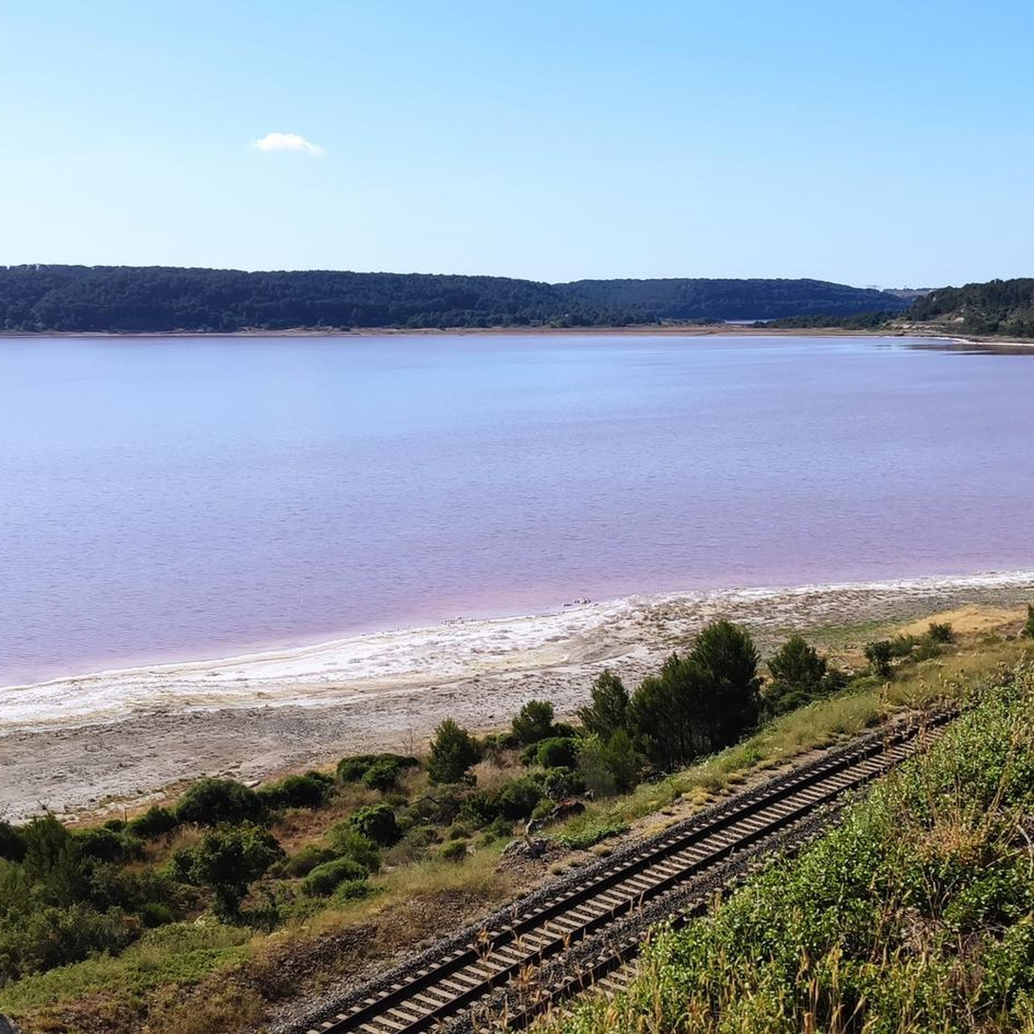
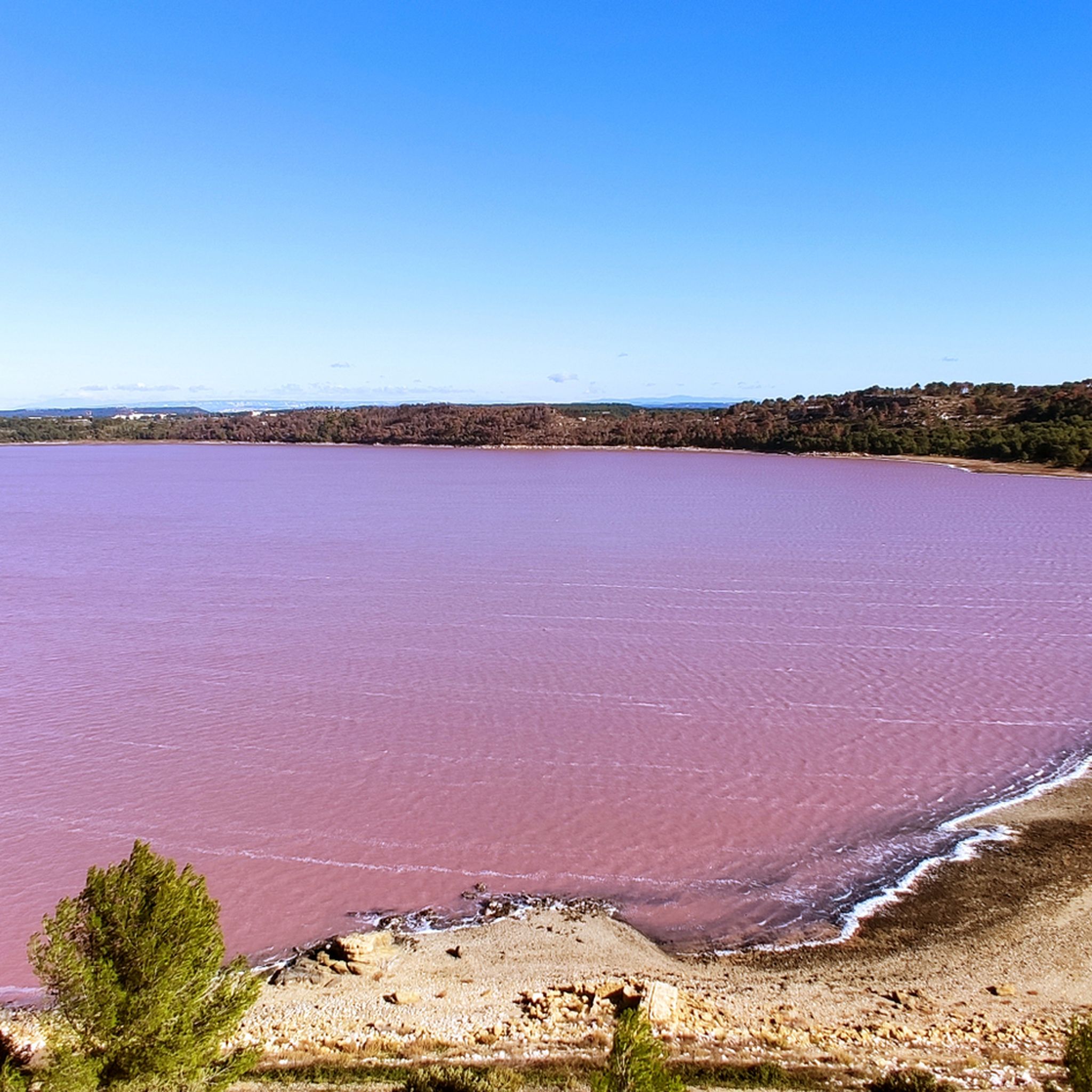
Road cycling routes around Étang de Lavalduc offer a unique experience through a landscape characterized by its iridescent pink-blue waters and low elevation, averaging 10 meters below sea level. The region, part of a cluster of ponds near the Étang de Berre and Gulf of Fos, features diverse terrain. Cyclists can expect routes through scrubland and pine forests to the east and west, alongside palustrine formations and riparian forests to the south and north.
Best road cycling routes around Étang…
Last updated: July 28, 2026
4.4
(7)
129
riders
43.9km
02:08
440m
450m
Moderate road ride. Good fitness required. Mostly well-paved surfaces and easy to ride.
4.0
(5)
95
riders
55.3km
02:38
530m
530m
Moderate road ride. Good fitness required. Mostly well-paved surfaces and easy to ride.

Sign up for free
5.0
(6)
76
riders
67.5km
02:52
380m
380m
Moderate road ride. Good fitness required. Mostly well-paved surfaces and easy to ride.
4.0
(1)
70
riders
57.4km
02:25
290m
290m
Moderate road ride. Good fitness required. Mostly well-paved surfaces and easy to ride.
3.0
(1)
54
riders
39.6km
01:36
90m
90m
Easy road ride. Great for any fitness level. Mostly well-paved surfaces and easy to ride.
Get access to more routes and recommendations from other explorers.
Sign up for free
Already have an account?
Our route recommendations are based on thousands of hikes, rides, and runs completed by other people on komoot.
Start today with a free account
Your next adventure awaits.
Login or Signup

Tips from the Community


pretty hilltop village with a beautiful view of the Lubéron mountain range and its surroundings
0
0

Fantastic view over the two Étangs de Lavalduc and de Citis.
0
0
Beautiful aqueduct in the center of Saint Chamas, which can also be visited.
1
0


Beautiful viewpoint with picnic area
0
0
Frequently Asked Questions
How many road cycling routes are available around Étang de Lavalduc?
There are over 115 road cycling routes available around Étang de Lavalduc on komoot, catering to various skill levels. This includes 19 easy routes, 77 moderate routes, and 19 difficult routes, ensuring options for every cyclist.
What kind of terrain can I expect on road cycling routes in the Étang de Lavalduc area?
The terrain around Étang de Lavalduc is quite diverse. You'll find routes winding through scrubland and pine forests to the east and west, as well as alongside palustrine formations and riparian forests to the south and north. The region is also notable for its low elevation, averaging 10 meters below sea level, offering a unique cycling experience.
Are there any particularly scenic routes that offer panoramic views?
Yes, for panoramic views, consider the Figuière Pass – Aureille panorama loop from Rassuen. This moderate 42.7-mile (68.7 km) route includes scenic climbs through the Figuière Pass, providing expansive vistas of the surrounding landscape.
What makes the Étang de Lavalduc area unique for road cycling?
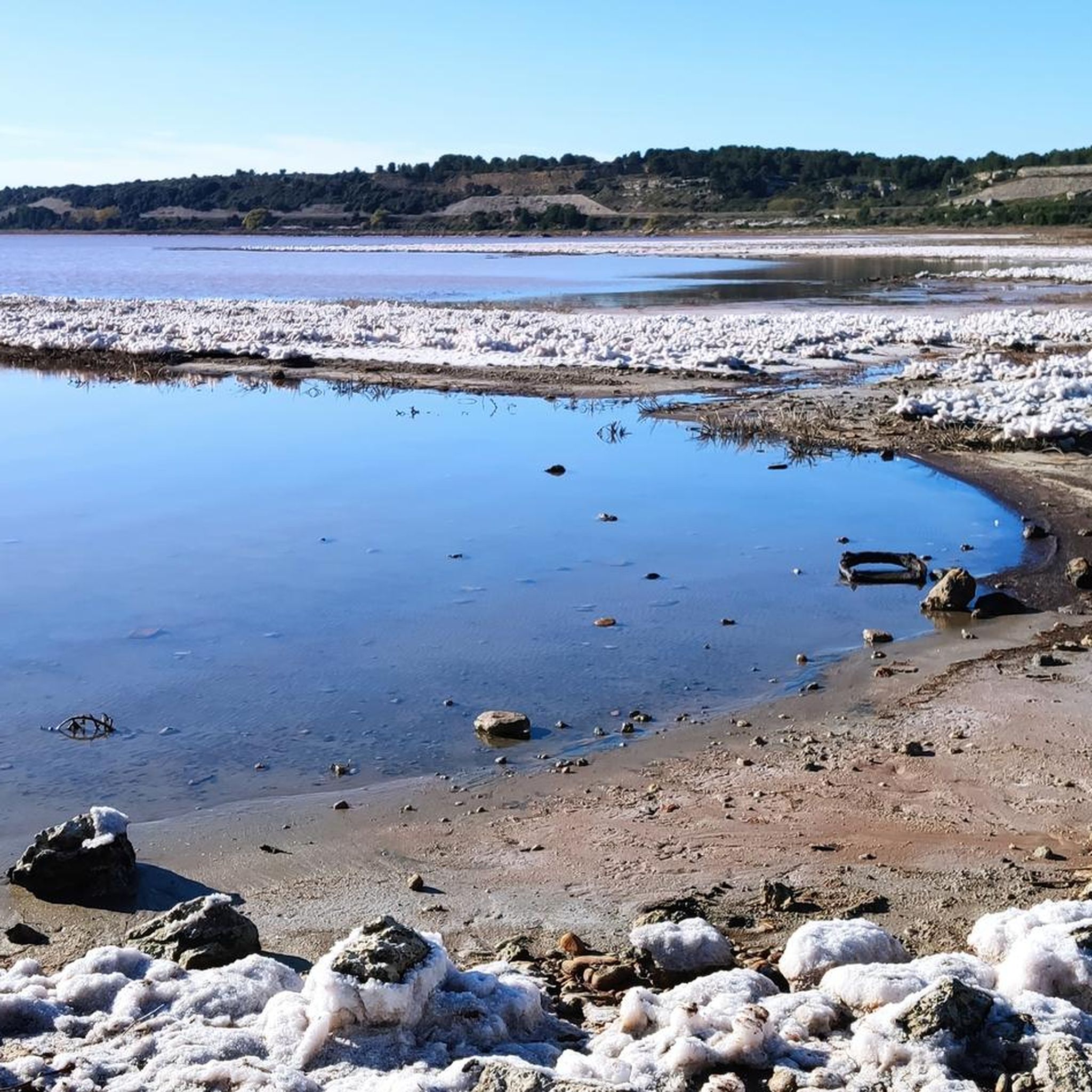
The Étang de Lavalduc area is unique due to its iridescent pink-blue waters, a natural phenomenon caused by microscopic brine shrimp. This vibrant coloration creates an otherworldly backdrop for your ride. The region's diverse landscape, including scrubland, pine forests, and various ponds, also contributes to a memorable cycling experience.
What do other road cyclists enjoy most about cycling in Étang de Lavalduc?
The area is highly rated by the komoot community, with an average score of 4.1 stars from over 80 reviews. Cyclists often praise the unique scenery of the pink lake, the tranquility of the routes, and the diverse terrain that offers options for different fitness levels.
Are there any family-friendly road cycling routes in the area?
While specific family-friendly routes are not detailed, the region offers 19 easy road cycling routes. These routes generally feature less elevation gain and shorter distances, making them suitable for families or those looking for a more relaxed ride. Look for routes with lower elevation and shorter distances on komoot for the best family options.
Can I access the Étang de Lavalduc cycling routes using public transport?
Yes, you can consider using public transport to get closer to the area. The Fos-sur-Mer train station is mentioned as a starting point for exploring the surrounding ponds and coastal scenery, which can also serve as a convenient access point for cyclists looking to start their routes.
Are there any circular road cycling routes around Étang de Lavalduc?
Yes, many routes in the area are designed as loops. For example, the Tour de Cornillon – Canals of Martigues loop from Rassuen is a popular circular route, as is the Étang de l'olivier – Tour de Cornillon loop from Rassuen. These offer the convenience of starting and ending at the same point.
What is the best time of year to go road cycling around Étang de Lavalduc?
While specific seasonal recommendations are not provided, the Provence region generally offers pleasant cycling conditions during spring and autumn with milder temperatures. Summer can be hot, so early mornings or late afternoons are preferable. Winter can be cooler but often still suitable for cycling.
Are there any facilities like cafes or restaurants near the cycling routes?
Étang de Lavalduc is described as a remote natural spot with no on-site facilities. It's advisable to bring your own provisions like snacks and drinks. For cafes and restaurants, you would need to venture into nearby towns or villages such as Rassuen or Martigues, which are often part of the longer cycling routes.
What are some of the longer road cycling routes available?
For longer rides, the Tour de Cornillon – Canals of Martigues loop from Rassuen covers 53.7 miles (86.4 km). Another option is the Les Baux-de-Provence – View of Les Baux-de-Provence loop from Rassuen, which is 84.6 miles (84.6 km) and offers significant elevation gain.
Is swimming allowed in Étang de Lavalduc?
No, swimming is not recommended in Étang de Lavalduc. The lake is used for industrial brine storage by the Salins du Midi company, resulting in artificially high salinity that makes it unsuitable for recreational swimming.
Most popular routes around Étang de Lavalduc

Get inspired with the komoot mobile app


Explore more
Browse the best Road cycling routes in other regions.
