Attractions and Places To See around La Hoya - Top 20
Best attractions and places to see around La Hoya include a variety of historical sites, natural monuments, and scenic trails. This region, located in Spain, offers diverse landscapes from mountain summits to old railway lines converted into cycle paths. Visitors can explore ancient hermitages, impressive viewpoints, and routes suitable for hiking and cycling. The area is characterized by its rich history and natural beauty, providing opportunities for outdoor activities and cultural exploration.
Best attractions and places to see around La Hoya
- The most popular attractions is Vía Verde de la Plata, a cycle way that is part of the old Astorga–Plasencia railway line, now a nature trail for hiking and cycling. This picturesque section runs through the Sierra de Béjar, offering a gravel track suitable for cycling and hiking.
- Another must-see spot is Torreón (Calvitero Summit), a summit and natural monument. Known as "the roof of Extremadura," it is located at 2400 meters above sea level and provides extensive views of the surrounding mountains.
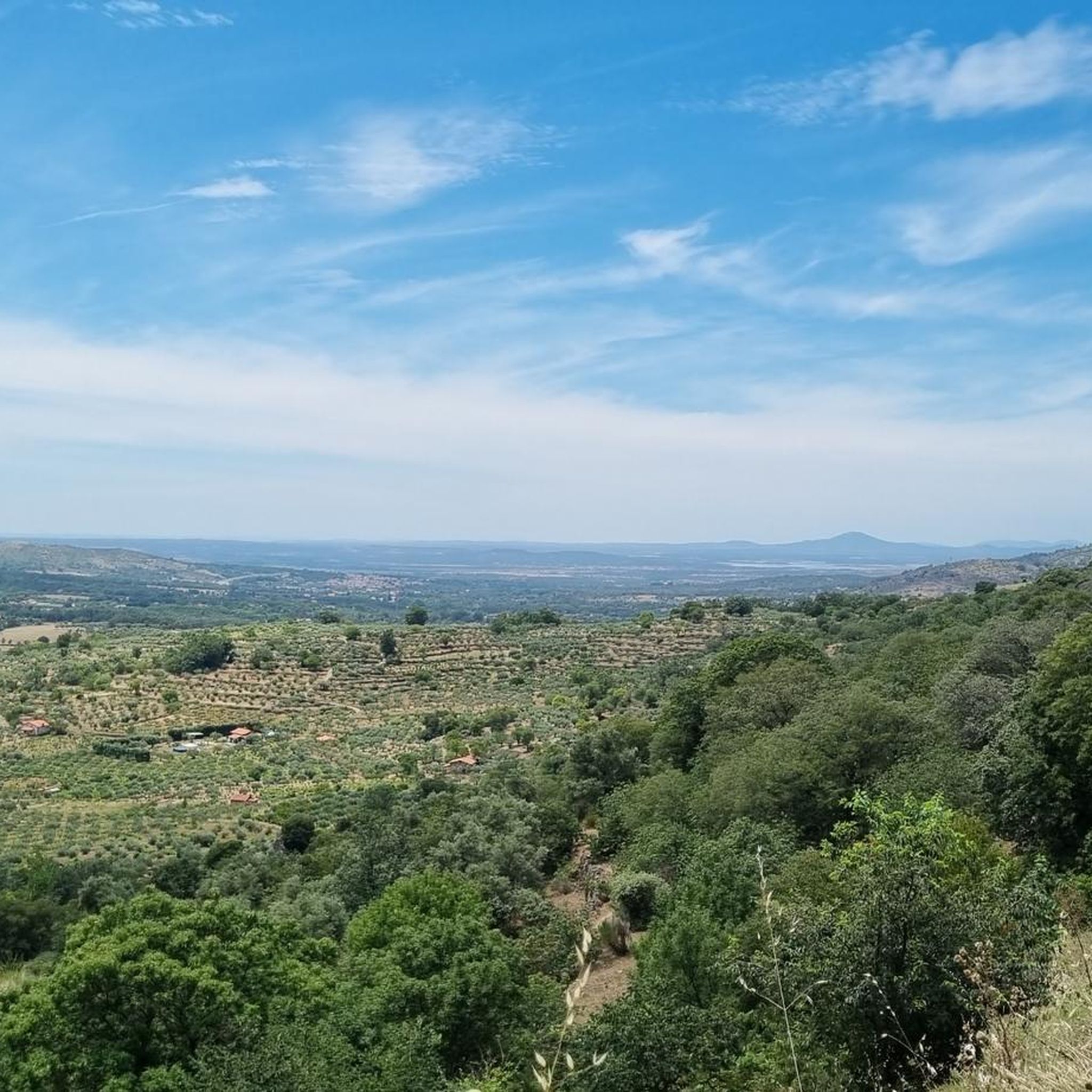
- Visitors also love Peña de la Cruz and Balanced Boulder, a man-made and natural monument. This popular place features a viewpoint with panoramic views of the Sierra de Béjar valley and the town below.
- La Hoya is known for its historical sites, natural monuments, and scenic trails. The region offers a variety of attractions for those interested in outdoor activities and cultural exploration.
- The attractions around La Hoya are appreciated by the komoot community, with 17 upvotes and 4 photos shared by visitors.
Last updated: May 21, 2026
Béjar Station and Vía de la Plata Tunnel
Highlight • Trail
80.1 kilometers. 730 positive meters.
The route leaves the Béjar station through a curved tunnel with automatic artificial lighting that passes under the historic complex, where the main monuments and buildings are located around the Plaza Mayor, the Doge's Palace, the churches and the streets with a medieval atmosphere. The route passes through another tunnel that ends in a small gorge, with climbing routes, and leaves the Corpus de Hombre river valley towards the Navalmoral de Béjar pastures, where the conditioning of the natural path ends. The last kilometer to the town still has the rails of the road but it can be easily reached by pedaling to the town. At the entrance you turn towards the town and at the first intersection you have to turn left again to go down towards the Camino de Santiago. Immediately the Béjar road appears, you must continue on the right, pass the Calzada de Béjar detour and 400 meters later the yellow arrows of the Jacobean route appear marking the Vía de la Plata to Astorga. The gravel journey continues in the opposite direction to the indication of the arrows and at many intersections it is difficult to see the signs because they are painted so that they are useful in the opposite direction, towards Santiago de Compostela. The path runs through a stretch of land and reaches the beautiful street on the way to Calzada de Béjar. At the entrance there is a pilgrim fountain and a sealing place, but the pilgrim hostel is at the end of the town. The street has facades typical of the popular architecture of the region, with stone and wood arcades and balconies, adapted to the centuries-old passage of migrating herds and the active commerce generated by the Vía de la Plata. The descent to the valley of the Body of Man River follows the original layout of the medieval road and there is a section with stones but it is easy to navigate slowly. And then the dirt road continues parallel to the Montemayor del Río highway. In this section you could go along the road to the Malena bridge, losing the possibility of seeing the original milestones that are on the Camino de Santiago.
The milestones marked the distance of the Roman roads, in this section there are several but they have been moved and do not coincide exactly with the original “miles”. The Sinforiano milestone is first, indicating mile 135, and then the Malena milestone appears, at the entrance to the medieval bridge that spans the Corpus de Hombre river. Mile 134 is about 200 meters after passing the bridge, at another milestone that is part of the wall of a farm. At the Malena bridge the hardest climb of the route begins, the slope is steep and there are sections with loose stones that require patience, grinding technique and good legs. The oak and chestnut forest and the beautiful rural environment help a lot to overcome the slope. The climb ends in Puerto de Béjar but it is not yet time to connect with the Vía de la Plata railway route. The route continues along the Camino de Santiago towards Baños de Montemayor and goes down a modern cobblestone built on the original one of the medieval itinerary. The views of the Ambroz Valley are fantastic. At the entrance to Baños de Montemayor the track leaves the urban complex on the right and continues along the La Garganta road to climb the Natural Path, right where the rest area and the stone fountain are. The bikepacking adventure continues through familiar terrain on the old railroad track. The slope is favorable, the bicycles fly along the side of the mountain, they pass by the Hervás station and one kilometer before the Aldeanueva del Camino station you have to take a detour to the right to enter the urban complex and connect again with the Camino de Santiago.
Translated by Google •
Tip by

Torreón (Calvitero Summit)
Highlight • Summit
Translated by Google •
Tip by

Sign up now to discover places like this
Get recommendations on the best single tracks, peaks, & plenty of other exciting outdoor places.
Sign up for free
Peña de la Cruz and Balanced Boulder
Highlight • Monument
At the end of the path we find a great esplanade with picnic areas and fountains that is presided over by a huge granite cross and its viewpoint located on a rock.
Translated by Google •
Tip by

Vía Verde de la Plata
Highlight (Segment) • Cycleway
Don't miss the Little Station: a bar/restaurant in the old station, with a terrace and railway atmosphere (open during tourist season).
Translated by Google •
Tip by
Ermita del Humilladero
Highlight • Religious Site
Translated by Google •
Tip by
Sign up for free to discover even more attractions around La Hoya.
Sign up for free
Already have an account?
Start today with a free account
Your next adventure awaits.
Login or Signup
Tips from the Community


The Silver Route (Vía Verde de la Plata) in the Port of Béjar is part of the old Astorga–Plasencia railway line, now a nature trail for hiking and cycling. Don't miss the Little Station: a bar/restaurant in the old station, with a terrace and railway atmosphere (open during tourist season).
4
0

Stage 2. Béjar/Plasencia 80.1 kilometers. 730 positive meters. The route leaves the Béjar station through a curved tunnel with automatic artificial lighting that passes under the historic complex, where the main monuments and buildings are located around the Plaza Mayor, the Doge's Palace, the churches and the streets with a medieval atmosphere. The route passes through another tunnel that ends in a small gorge, with climbing routes, and leaves the Corpus de Hombre river valley towards the Navalmoral de Béjar pastures, where the conditioning of the natural path ends. The last kilometer to the town still has the rails of the road but it can be easily reached by pedaling to the town. At the entrance you turn towards the town and at the first intersection you have to turn left again to go down towards the Camino de Santiago. Immediately the Béjar road appears, you must continue on the right, pass the Calzada de Béjar detour and 400 meters later the yellow arrows of the Jacobean route appear marking the Vía de la Plata to Astorga. The gravel journey continues in the opposite direction to the indication of the arrows and at many intersections it is difficult to see the signs because they are painted so that they are useful in the opposite direction, towards Santiago de Compostela. The path runs through a stretch of land and reaches the beautiful street on the way to Calzada de Béjar. At the entrance there is a pilgrim fountain and a sealing place, but the pilgrim hostel is at the end of the town. The street has facades typical of the popular architecture of the region, with stone and wood arcades and balconies, adapted to the centuries-old passage of migrating herds and the active commerce generated by the Vía de la Plata. The descent to the valley of the Body of Man River follows the original layout of the medieval road and there is a section with stones but it is easy to navigate slowly. And then the dirt road continues parallel to the Montemayor del Río highway. In this section you could go along the road to the Malena bridge, losing the possibility of seeing the original milestones that are on the Camino de Santiago. The milestones marked the distance of the Roman roads, in this section there are several but they have been moved and do not coincide exactly with the original “miles”. The Sinforiano milestone is first, indicating mile 135, and then the Malena milestone appears, at the entrance to the medieval bridge that spans the Corpus de Hombre river. Mile 134 is about 200 meters after passing the bridge, at another milestone that is part of the wall of a farm. At the Malena bridge the hardest climb of the route begins, the slope is steep and there are sections with loose stones that require patience, grinding technique and good legs. The oak and chestnut forest and the beautiful rural environment help a lot to overcome the slope. The climb ends in Puerto de Béjar but it is not yet time to connect with the Vía de la Plata railway route. The route continues along the Camino de Santiago towards Baños de Montemayor and goes down a modern cobblestone built on the original one of the medieval itinerary. The views of the Ambroz Valley are fantastic. At the entrance to Baños de Montemayor the track leaves the urban complex on the right and continues along the La Garganta road to climb the Natural Path, right where the rest area and the stone fountain are. The bikepacking adventure continues through familiar terrain on the old railroad track. The slope is favorable, the bicycles fly along the side of the mountain, they pass by the Hervás station and one kilometer before the Aldeanueva del Camino station you have to take a detour to the right to enter the urban complex and connect again with the Camino de Santiago.
0
0

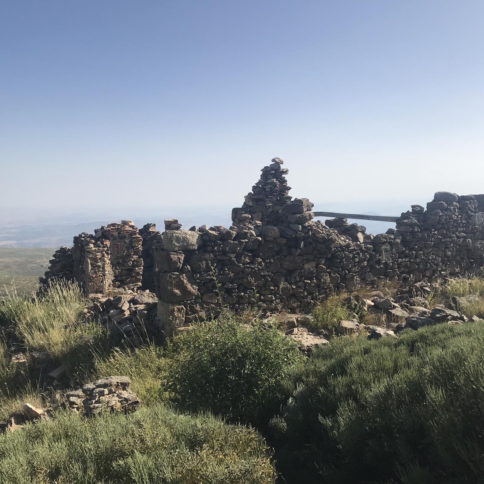
This hermitage receives the visitor as soon as they enter the Villa de Candalario and is called the hermitage of Santo Cristo del Refugio, on a large esplanade presided over by the Terminus Cross. Inside rests the Cristo del Refugio, of great devotion by the residents of the town.
2
0

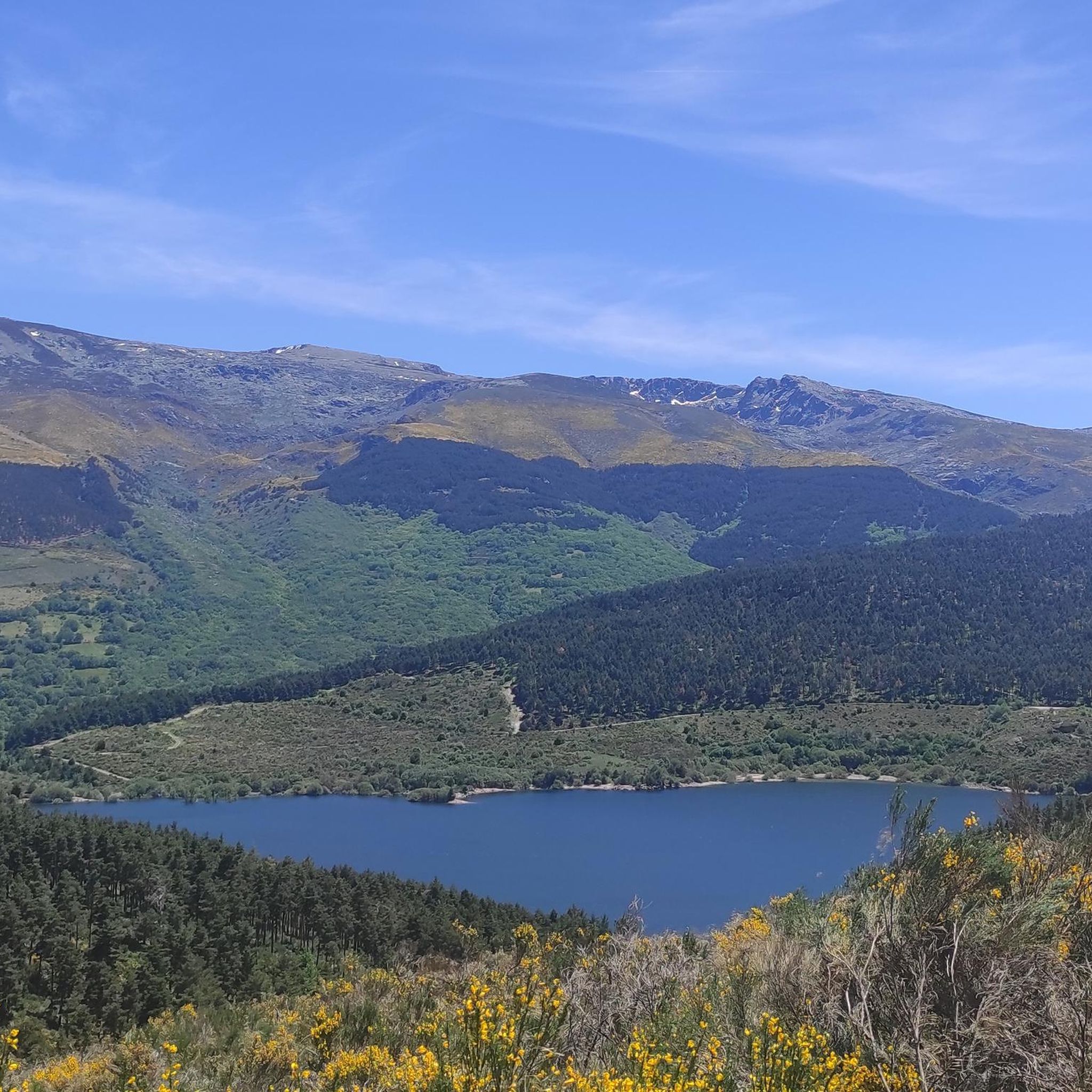
This picturesque section of the Vía de la Plata runs through a beautiful landscape of the Sierra de Béjar and connects the town of Puerto de Béjar with Béjar rolling along a gravel track in perfect condition and without any technical difficulty.
2
1
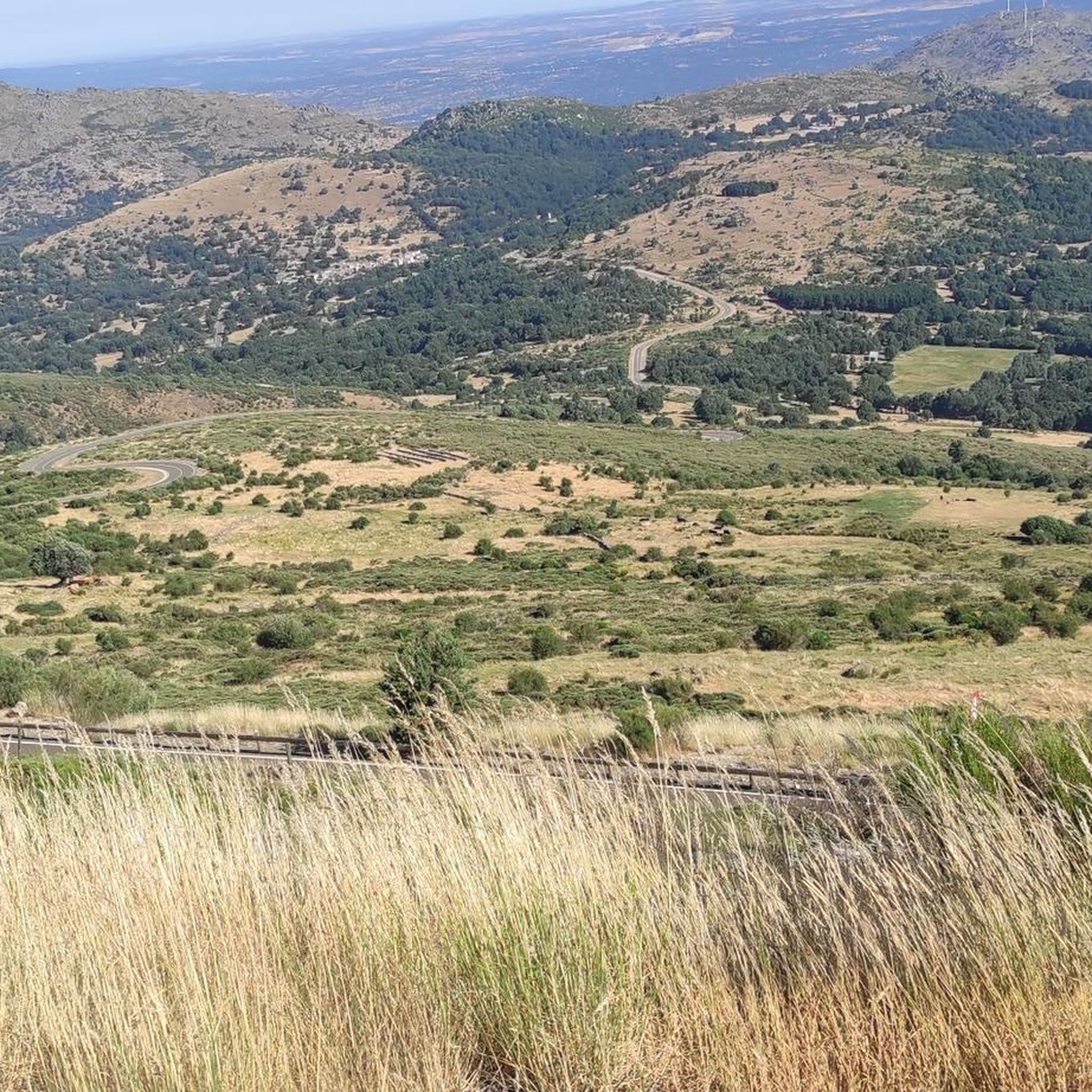
A very popular place in the area and with good reason it is. Next to the cross is the viewpoint that offers beautiful panoramic views of the entire Sierra de Béjar valley and the town below. A few meters away is the refuge and an area with tables to take a break and enjoy this wonderful place.
1
1
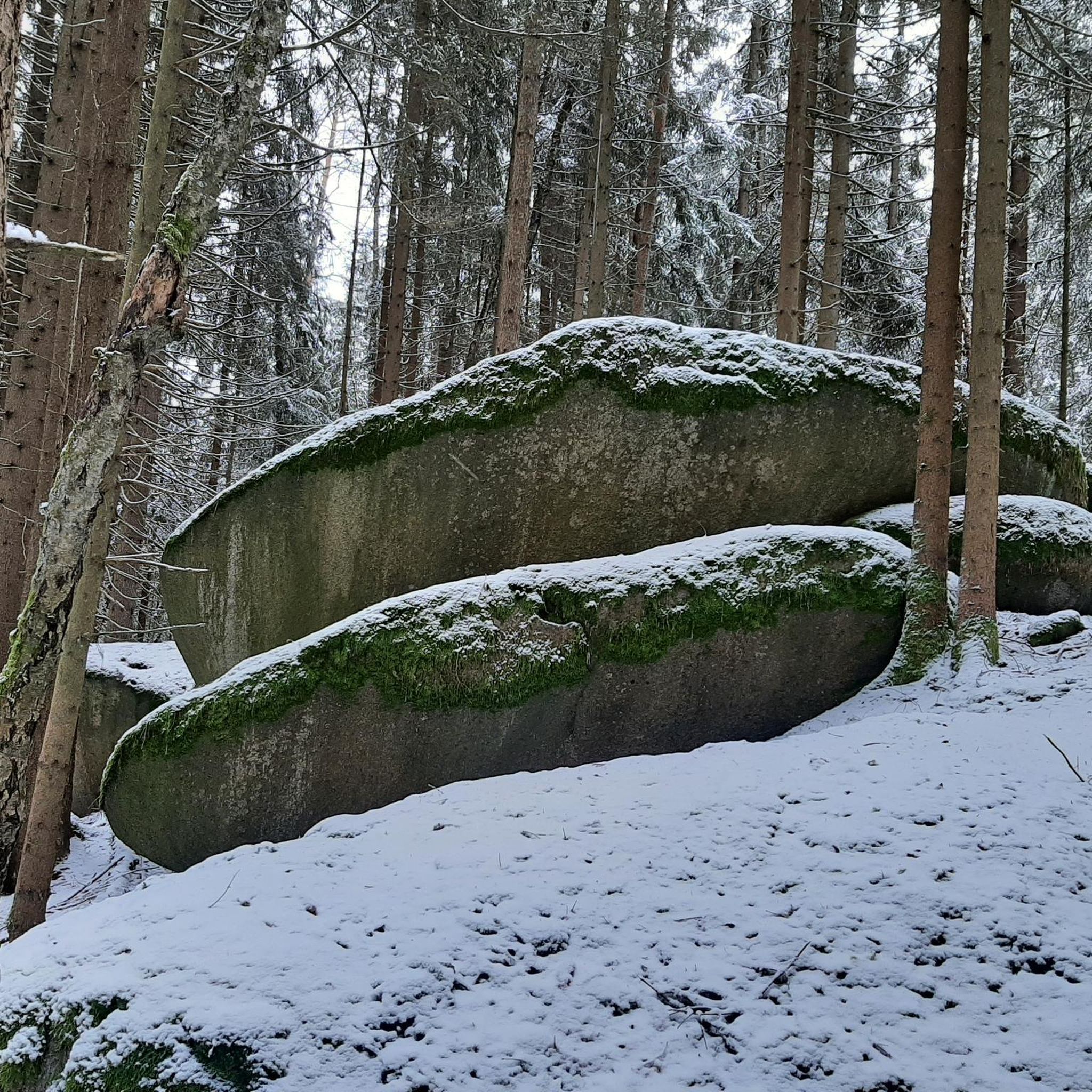
Popularly known as "the roof of Extremadura", the top of the Torreón or Calvitero is located at 2400 meters above sea level and without a doubt the views from there are amazing! An ascent that is demanding but with several alternatives to choose from and all of them with spectacular views.
3
0

The highest point in the province of Cáceres
1
1
Frequently Asked Questions
What types of attractions can I find around La Hoya?
The La Hoya region, located in Spain, offers a diverse range of attractions including historical sites, natural monuments, and scenic trails. You can explore old railway lines converted into cycle paths, impressive viewpoints, and routes suitable for hiking and cycling.
Are there any historical sites to visit near La Hoya?
Yes, the region is rich in history. A notable historical site is the Béjar Station and Vía de la Plata Tunnel, which is part of the old Astorga–Plasencia railway line. Another significant historical and religious site is the Ermita del Humilladero, welcoming visitors to the Villa de Candelario.
What natural features or viewpoints are prominent in the La Hoya area?
The area boasts several impressive natural features and viewpoints. The Torreón (Calvitero Summit), known as "the roof of Extremadura," offers amazing views from 2400 meters above sea level. Another popular spot is Peña de la Cruz and Balanced Boulder, providing panoramic views of the Sierra de Béjar valley.
What outdoor activities can I do near the attractions around La Hoya?
The La Hoya region is excellent for outdoor activities. You can enjoy hiking, mountain biking, and cycling. For specific routes, explore the Hiking around La Hoya, MTB Trails around La Hoya, and Cycling around La Hoya guides.
Are there any family-friendly attractions or activities in La Hoya?
Yes, the Vía Verde de la Plata is a family-friendly cycle way and nature trail, perfect for easy cycling and hiking. The Ermita del Humilladero is also considered family-friendly, offering a pleasant cultural stop.
Where can I find easy hiking or cycling trails in the area?
For easy hiking and cycling, the Vía Verde de la Plata is an excellent choice. This picturesque section runs through the Sierra de Béjar on a well-maintained gravel track with no technical difficulty, making it suitable for all skill levels.
What is the Vía Verde de la Plata and what can I do there?
The Vía Verde de la Plata is a nature trail for hiking and cycling, converted from the old Astorga–Plasencia railway line. It offers a flat, gravel track through the beautiful Sierra de Béjar landscape, connecting towns like Puerto de Béjar and Béjar. You can also find a bar/restaurant in the old station during the tourist season.
What do visitors enjoy most about the attractions around La Hoya?
Visitors particularly appreciate the extensive views from natural monuments like the Torreón (Calvitero Summit) and Peña de la Cruz and Balanced Boulder. The well-maintained gravel track of the Vía Verde de la Plata is also highly rated for its scenic beauty and ease of use for cycling and hiking.
Are there challenging routes for experienced hikers or cyclists?
Yes, for those seeking more challenging adventures, the region offers several demanding routes. For hiking, consider trails like the "Calvitero and Hoya Moros Loop" or "Calvitero and Lagunas del Trampal Loop Trail." For cycling, routes such as "La Garganta and Vía Verde de la Plata Loop" or "Jewish Quarter of Hervás – View of Hervás loop from Béjar" provide a significant challenge. You can find more details in the Hiking around La Hoya and Cycling around La Hoya guides.
What is the "roof of Extremadura" and how can I visit it?
The "roof of Extremadura" refers to the Torreón (Calvitero Summit), located at 2400 meters above sea level. It offers breathtaking views. The ascent is demanding but there are several alternative routes, all providing spectacular vistas. It's a popular spot for experienced hikers.
Can I find places to rest or picnic near the attractions?
Yes, at Peña de la Cruz and Balanced Boulder, there is a large esplanade with picnic areas and fountains, as well as a refuge with tables, perfect for taking a break and enjoying the views.
Is there a specific archaeological site named La Hoya in Spain?
While this guide focuses on the La Hoya region near Béjar, Spain, it's worth noting that there is a significant archaeological site called La Hoya in Álava, Basque Country, Spain. This fortified town dates back to the Bronze and Iron Ages, offering insights into ancient cultures. However, this is a distinct location from the attractions covered in this guide.
Most popular attractions around La Hoya

Get inspired with the komoot mobile app


Explore more
Still not found the Highlight you’re looking for? See guides of the top attractions in other regions:
