The best walks and hikes around Castellanos De Villiquera
4.4
(249)
1,566
hikers
160
hikes
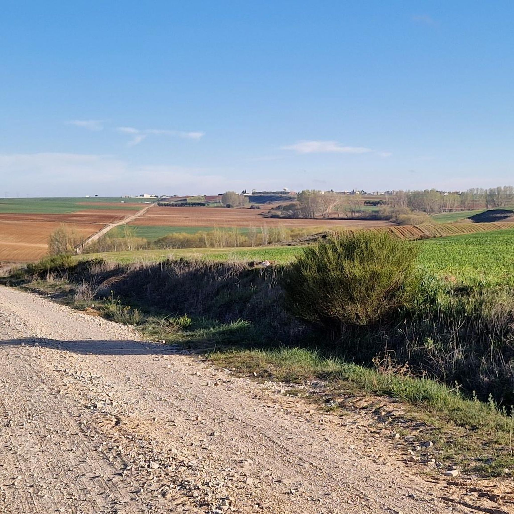
Hiking around Castellanos De Villiquera offers routes through the characteristic agricultural landscapes of the Armuña region. The terrain features expansive cereal fields and undulating ground, with pastures and cultivated lands dominating the scenery. During periods of rain, temporary ponds form, attracting various bird species. The area also includes the "Teso Santo," one of the local elevations.
Best hiking trails around Castellanos De Villiquera
- The most popular hiking route is Los Molinos Trail, a 5.8 miles (9.3 km) trail that takes 1 hour 54 minutes to complete. This easy route features minimal elevation gain.
- Another top favourite among local hikers is Vía de la Plata: Calzada de Valdunciel to Castle of Good Love, a moderate 14.6 miles (23.4 km) path. This route follows a historic path with varied terrain.
- Local hikers also love the Río Tormes Riverside Path – Tormes River loop from Edificio M2 (USAL), a 8.7 miles (14.0 km) trail leading through riverside landscapes, often completed in about 3 hours 40 minutes.
- Hiking around Castellanos De Villiquera is defined by agricultural landscapes, historic routes like the Vía de la Plata, and undulating terrain. The network offers options for different ability levels, from easy walks to moderate hikes.
- The routes in Castellanos De Villiquera are highly rated by the komoot community with an average score of 4.4 stars from over 200 reviews. More than 1,400 hikers have used komoot to explore Castellanos De Villiquera's varied terrain.
Last updated: July 29, 2026
4.7
(6)
20
hikers
9.26km
01:54
40m
40m
Easy hike. Great for any fitness level. Easily-accessible paths. Suitable for all skill levels.
23.4km
04:51
130m
130m
Moderate hike. Good fitness required. Easily-accessible paths. Suitable for all skill levels.

Sign up for free
3.0
(1)
10
hikers
14.0km
03:41
110m
110m
Moderate hike. Good fitness required. Easily-accessible paths. Suitable for all skill levels.
9
hikers
3.99km
01:02
20m
20m
Easy hike. Great for any fitness level. Easily-accessible paths. Suitable for all skill levels.
10
hikers
5.73km
01:33
80m
80m
Easy hike. Great for any fitness level. Easily-accessible paths. Suitable for all skill levels.
Get access to more routes and recommendations from other explorers.
Sign up for free
Already have an account?
Our route recommendations are based on thousands of hikes, rides, and runs completed by other people on komoot.
Start today with a free account
Your next adventure awaits.
Login or Signup




Tips from the Community

take a lovely break by the flowing water
0
0

The Tormes is a river, a tributary of the Duero on its left bank, which runs through the provinces of Ávila, Salamanca and Zamora, in the autonomous community of Castilla y León,
3
0

Bring rugs to sit on because it's very nice
0
0

Always take enough food with you. Travel guides quickly become outdated. It's best to ask in every hostel what is available along the way.
1
0

The route is the goal ...
0
1
The parish church of Santa Elena was built in the 16th century, although the main portal, the portico with its large carved scallop and the transparent alcove of the main chapel were redone around 1728.
3
0

As it passes through Salamanca, the Tormes River offers a very picturesque landscape that can be enjoyed walking the Paseo Fluvial path through the town of Villamayor and even reaching Salamanca following the course of the river.
1
1
This section of the Vía de la Plata runs through the Castilian plateau and is a perfect gravel track with beautiful scenery.
4
0
Frequently Asked Questions
How many hiking trails are available around Castellanos de Villiquera?
There are over 150 hiking routes around Castellanos de Villiquera. These trails offer a variety of experiences, from easy strolls through agricultural landscapes to more moderate paths along historic routes.
What kind of terrain can I expect on hikes in Castellanos de Villiquera?
The terrain around Castellanos de Villiquera is characteristic of the Armuña region, featuring expansive cereal fields and undulating ground. You'll find pastures and cultivated lands, with some local elevations like the "Teso Santo" offering varied views. While extensive tall tree cover is scarce, the landscape changes beautifully with the seasons.
Are there any family-friendly hiking options in the area?
Yes, Castellanos de Villiquera offers several easy routes suitable for families. For instance, the Los Molinos Trail is an easy 5.8-mile (9.3 km) path with minimal elevation gain, perfect for a family outing.
Can I bring my dog on the hiking trails?
Many trails in the Castellanos de Villiquera area are suitable for dogs, especially those traversing the open agricultural landscapes. It's always recommended to keep dogs on a leash, particularly near cultivated fields or areas with livestock, and to respect local wildlife.
What historical or natural landmarks can I see while hiking?
The area is rich in both history and natural features. You can hike along sections of the ancient Vía de la Plata, a historic Roman road. Natural highlights include the "Laguna 'Charca mayor'" in Carbajosa de Armuña, a significant birdwatching spot, and the "Teso Santo" for scenic views. Within Castellanos de Villiquera itself, you can explore the 16th-century Church of San Juan Bautista, the VIART Rural Art Project with its large-format murals, and the restored Old Wash House.
Are there any circular hiking routes available?
Yes, there are several circular routes. An example is the Saint Sylvester Parish loop from Villares de la Reina, which is an easy 2.5-mile (4.0 km) hike. Many other routes in the region are designed as loops, allowing you to start and end at the same point.
What is the best time of year to go hiking in Castellanos de Villiquera?
The landscape around Castellanos de Villiquera offers a dynamic visual experience with colors changing throughout the seasons. Spring and autumn are generally ideal for hiking, offering pleasant temperatures and vibrant scenery. During periods of rain, numerous ponds form, attracting diverse bird species, making it interesting for ornithology enthusiasts.
What do other hikers say about the trails in Castellanos de Villiquera?
The hiking routes in Castellanos de Villiquera are highly rated by the komoot community, with an average score of 4.4 stars from over 200 reviews. Hikers often praise the tranquil agricultural landscapes, the historical significance of routes like the Vía de la Plata, and the variety of options for different ability levels.
Are there any riverside paths for hiking?
Yes, you can find riverside paths in the vicinity. The Río Tormes Riverside Path – Tormes River loop from Edificio M2 (USAL) is a moderate 8.7-mile (14.0 km) trail that leads through scenic riverside landscapes.
What are the typical durations for hikes in this area?
Hikes in Castellanos de Villiquera vary in duration. Easy routes like the Los Molinos Trail can be completed in under two hours, while moderate paths such as the Vía de la Plata: Calzada de Valdunciel to Castle of Good Love can take around five hours or more, depending on your pace.
Are there any nearby attractions or cities worth visiting after a hike?
Absolutely. Just a short distance away, the city of Salamanca offers numerous cultural and historical attractions. You can visit the iconic Plaza Mayor of Salamanca, explore the unique House of Shells, or marvel at the Salamanca Cathedral and the Old Cathedral of Salamanca. The Roman Bridge of Salamanca is also a significant historical landmark.
Are there any easy hikes for beginners around Castellanos de Villiquera?
Yes, many of the routes are classified as easy and are suitable for beginners. For example, the Picnic Table by the River loop from Finca de Valcuevo is an easy 3.5-mile (5.7 km) trail, offering a gentle introduction to hiking in the area.
Most popular routes around Castellanos De Villiquera
Most popular attractions around Castellanos De Villiquera

Get inspired with the komoot mobile app


Explore more
Browse the best Hikes in other regions.
