The best walks and hikes around El Coronil
4.6
(11)
107
hikers
20
hikes
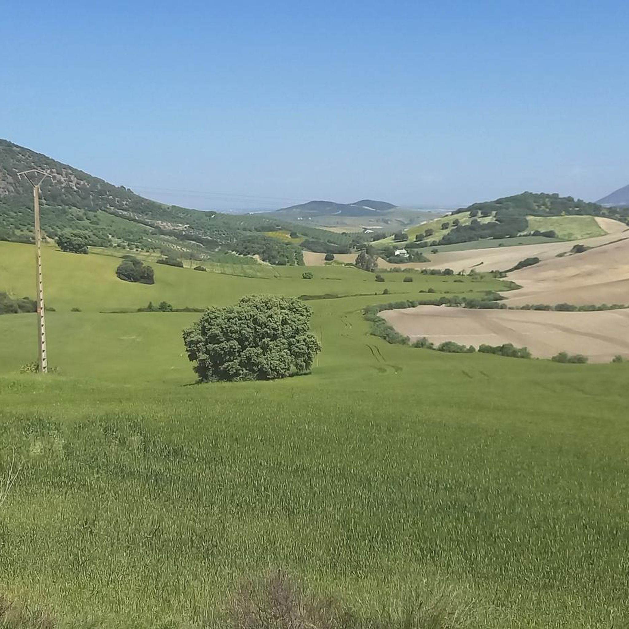
Hiking around El Coronil offers a diverse landscape characterized by rolling agricultural fields, Mediterranean forest ecosystems, and the historic Vía Verde de la Sierra. The region features gentle inclines and descents across its countryside, providing varied terrain for outdoor activities. Cork oaks, wild olive trees, and riverine vegetation are common, alongside distant views of the Sierra Sur of Seville.
Best hiking trails around El Coronil
- The most popular hiking route is Sierra de San Pablo y Montellano — circular from…
Last updated: July 21, 2026
4.0
(1)
16
hikers
Moderate hike. Good fitness required. Mostly accessible paths. Sure-footedness required.
5.0
(1)
9
hikers
8.07km
02:35
330m
330m
Moderate hike. Good fitness required. Mostly accessible paths. Sure-footedness required.

Sign up for free
5.0
(1)
12
hikers
18.2km
04:48
170m
170m
Hike the Vía Verde de la Sierra Trail, a moderate 11.3-mile route through Andalusia's scenic landscapes, featuring tunnels and viaducts.
5.0
(1)
8
hikers
7.25km
02:14
260m
260m
Moderate hike. Good fitness required. Easily-accessible paths. Suitable for all skill levels.
8
hikers
17.2km
05:08
530m
530m
Hard hike. Very good fitness required. Easily-accessible paths. Suitable for all skill levels.
Get access to more routes and recommendations from other explorers.
Sign up for free
Already have an account?
Our route recommendations are based on thousands of hikes, rides, and runs completed by other people on komoot.
Start today with a free account
Your next adventure awaits.
Login or Signup

Tips from the Community

This viewpoint is part of a hiking route that also includes the Mirador de la Cancha and the Castillo de Cote. The complete route is approximately 11.5 km and is circular.
6
0

The Via Verde de la Sierra is a beautiful green route in Andalusia that starts in Puerto Serrano and ends in Olvera. This 36-kilometre route follows an old railway line that was built in the early 20th century between Jerez de la Frontera and Almargen. The route offers a unique combination of beautiful nature and historical sights, including the impressive Sierra de Cádiz and a large colony of Griffon Vultures. The route is ideal for both walking and cycling and passes through several tunnels and viaducts, making it a unique experience. Along the way you will pass through smaller villages and peaceful landscapes, making it perfect for a relaxing adventure in nature.
1
0

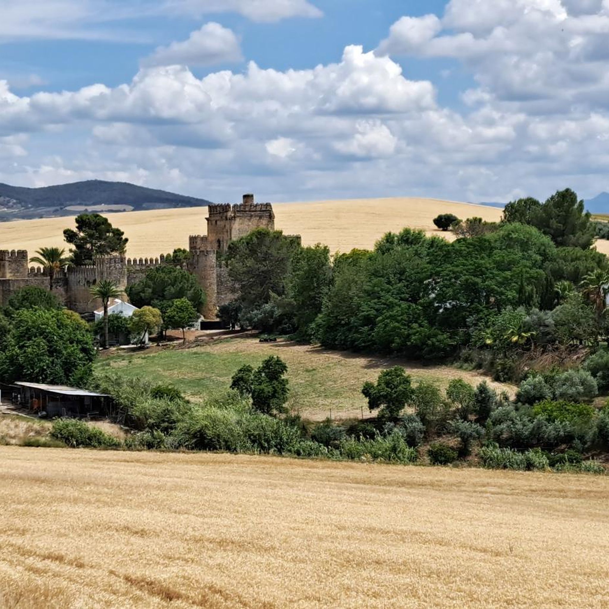
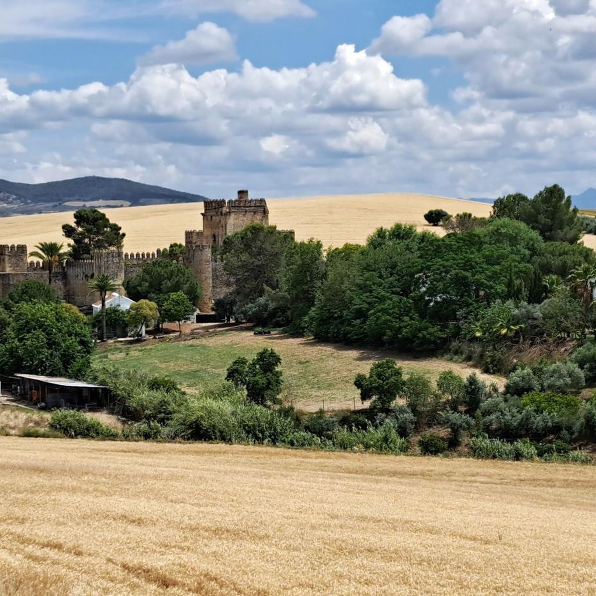
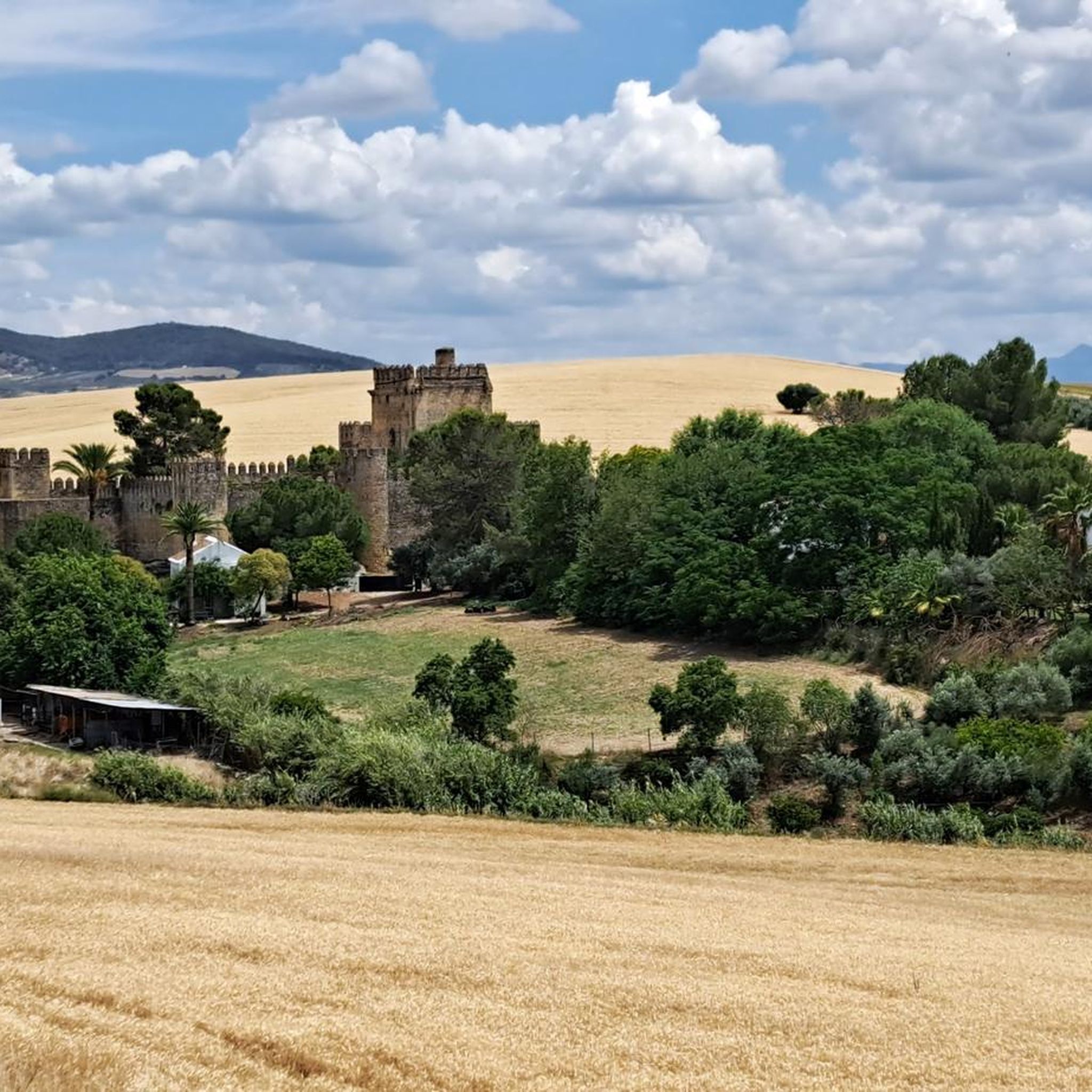
Viewpoint at the top of the Sierra de Montellano from where you can see spectacular views of the Castillo de Coto. All you have to do is turn around and see how the gray tower rises above the hill, in an idyllic picture from a postcard.
0
0
Its location explains its geostrategic relevance, in the place that the Arabs called Mont Aqut. Due to its architectural characteristics, it is considered unique in Spain, and there is a similar one in France and another in England. The Castle is located about 3.5 km. from the Sevillian town of Montellano
0
0
Lookout that offers views from the top of the Sierra de Montellano, at its northwest end. It is mandatory to stop at the viewpoint and observe the panorama that is around!!
0
0
Nice views to the east, highlights the Castillo de Cote, Peñón de Zaframago, Coripe, good access by various paths and trails.
1
0
The Castle of Cote is located about 3.5 km. from the Sevillian town of Montellano. Its location explains its geostrategic relevance, in the place that the Arabs called Mont Aqut. Due to its architectural characteristics, it is considered unique in Spain, and there is a similar one in France and another in England.
1
0
It is an impressive viewpoint to see the northern views of the Sierra de Montellano. Straight road but worth it!
1
0
Frequently Asked Questions
What is the general difficulty of hiking trails around El Coronil?
Hiking trails around El Coronil offer a range of difficulties, primarily focusing on easy to moderate routes. The region's landscape features rolling agricultural fields and gentle inclines, making many paths accessible. Out of the 12 available routes, 2 are considered easy, and 10 are moderate, ensuring options for various fitness levels.
What kind of terrain can I expect on hikes in El Coronil?
You can expect diverse terrain, from the compacted earth and asphalt surfaces of the Vía Verde de la Sierra Trail to paths through Mediterranean forest ecosystems like Dehesa de Pilares. Many routes traverse agricultural lands, including fields of wheat, sunflowers, and olive groves, with gentle inclines and descents characteristic of the rolling hills.
Are there any historical landmarks to see on hikes near El Coronil?
Yes, several hikes offer opportunities to explore historical landmarks. For instance, the 14th-century Moorish Castillo de las Aguzaderas is located about 3 kilometers from El Coronil and can be reached via rural paths. Another route, Subida Castillo de Cote — circular by the Sierra de San Pablo, explores the Sierra de San Pablo, featuring historical points of interest.
Can I find viewpoints with scenic views on trails in El Coronil?
Absolutely. The region offers several scenic viewpoints. For example, the Purto del Acebuche Viewpoint – Puerto del Acebuche Viewpoint loop from Montellano is a route specifically designed to take you to the Puerto del Acebuche Viewpoint. Additionally, the Sierra de San Pablo y Montellano — circular from the population of Montellano trail offers views of the Sierra de San Pablo.
What is the best time of year to go hiking in El Coronil?
The best time to hike in El Coronil is typically during the spring (March to May) and autumn (September to November) months. During these periods, temperatures are milder and more comfortable for outdoor activities, and the natural landscapes are often at their most vibrant. Summers can be very hot, making early mornings or late afternoons preferable if hiking during that season.
Are there family-friendly hiking options in El Coronil?
Yes, El Coronil offers family-friendly hiking options, particularly on the easier routes. The Vía Verde de la Sierra Trail, built on a disused railway line, is known for its accessibility and relatively flat terrain, making it suitable for families. The Dehesa de Pilares also features marked trails and botanical paths, ideal for pleasant walks with children.
Are dogs allowed on hiking trails in El Coronil?
Generally, dogs are welcome on many rural paths and trails in the El Coronil area, especially on the Vía Verde de la Sierra and through agricultural landscapes. However, it's always recommended to keep dogs on a leash, especially in areas with wildlife or livestock, and to clean up after them to preserve the natural environment for everyone.
Are there easy hiking trails suitable for beginners in El Coronil?
Yes, beginners will find suitable options in El Coronil. There are at least 2 easy routes available, which typically feature minimal elevation gain and well-defined paths. These trails provide a gentle introduction to the region's beautiful agricultural landscapes and natural areas without requiring extensive hiking experience.
What do other hikers enjoy the most about hiking in El Coronil?
The area is highly rated by the komoot community, with an average score of 4.5 stars. Reviewers often praise the diverse landscapes, from rolling agricultural fields to Mediterranean forests, and the historical elements like the Vía Verde de la Sierra. The well-maintained paths and opportunities for wildlife observation, such as griffon vultures at Peñón de Zaframagón, are also frequently highlighted.
Are there circular hiking routes available in El Coronil?
Yes, there are several circular hiking routes in the El Coronil area. For example, the Sierra de San Pablo y Montellano — circular from the population of Montellano and the Subida Castillo de Cote — circular by the Sierra de San Pablo are popular options that allow you to start and finish in the same location.
Can I spot any wildlife while hiking in El Coronil?
Yes, the region offers opportunities for wildlife spotting. The Vía Verde de la Sierra passes by the Peñón de Zaframagón, which hosts one of Europe's most populated griffon vulture reserves. The Dehesa de Pilares, a Mediterranean forest, is also home to small animals like rabbits, partridges, and various reptiles and amphibians.
Are there any trails that pass by water features or reservoirs?
Yes, the Torre del Águila Reservoir and Cañada Real Trail is a moderate route that takes you past the Torre del Águila Reservoir, offering scenic views of the water. The Vía Verde de la Sierra also features riverine vegetation along its path.
Most popular routes around El Coronil
Most popular attractions around El Coronil

Get inspired with the komoot mobile app


Explore more
Browse the best Hikes in other regions.
