The best walks and hikes around Valdepeñas De La Sierra
4.6
(444)
2,780
hikers
114
hikes
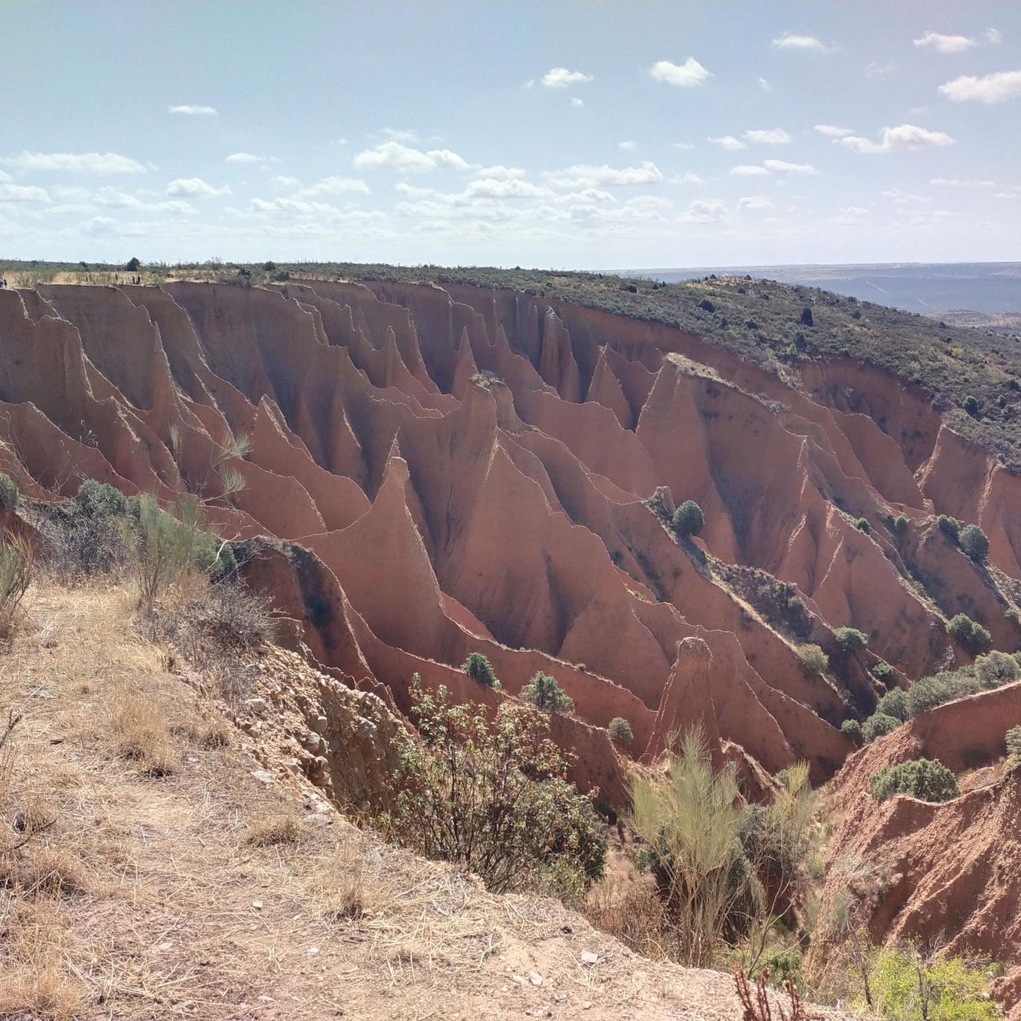
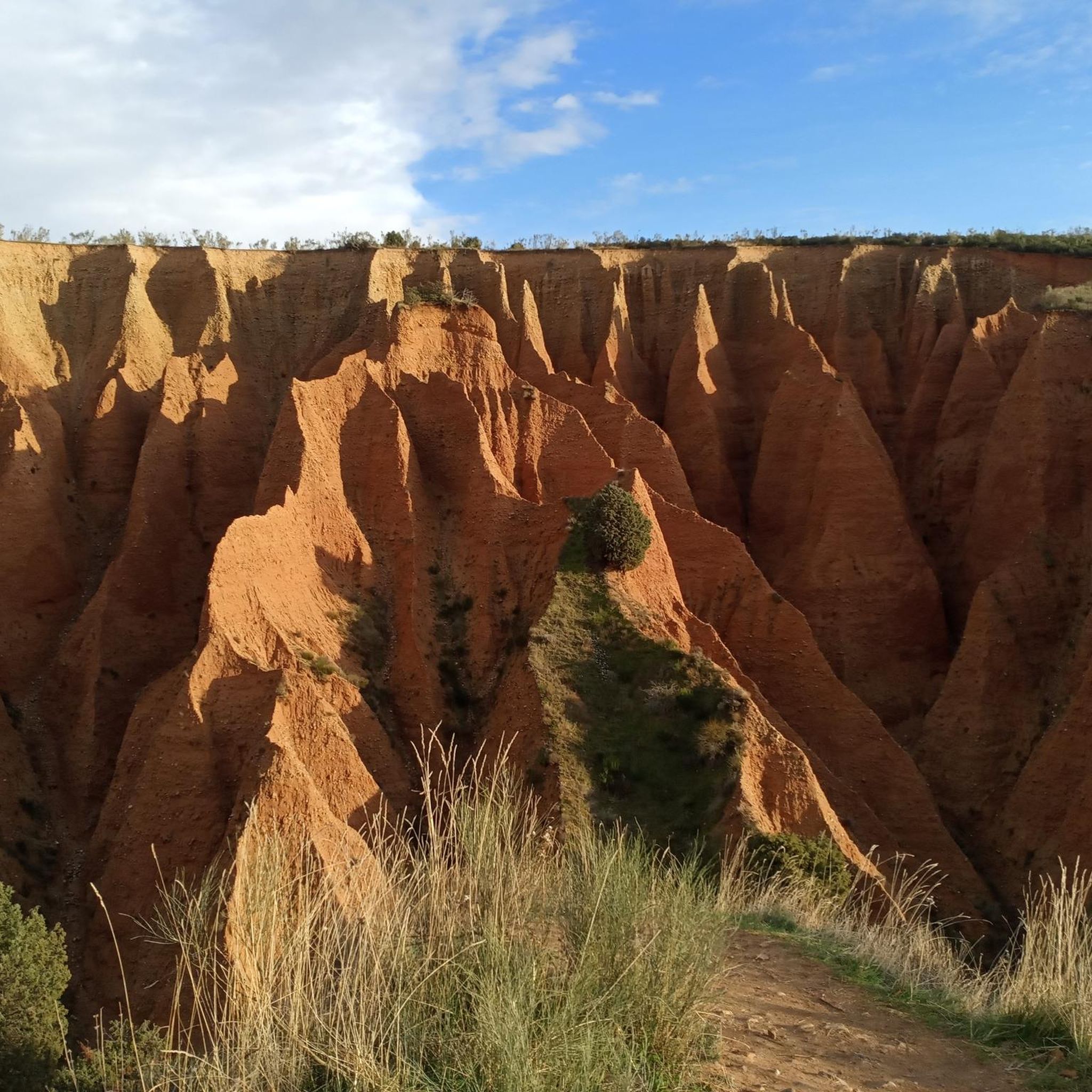
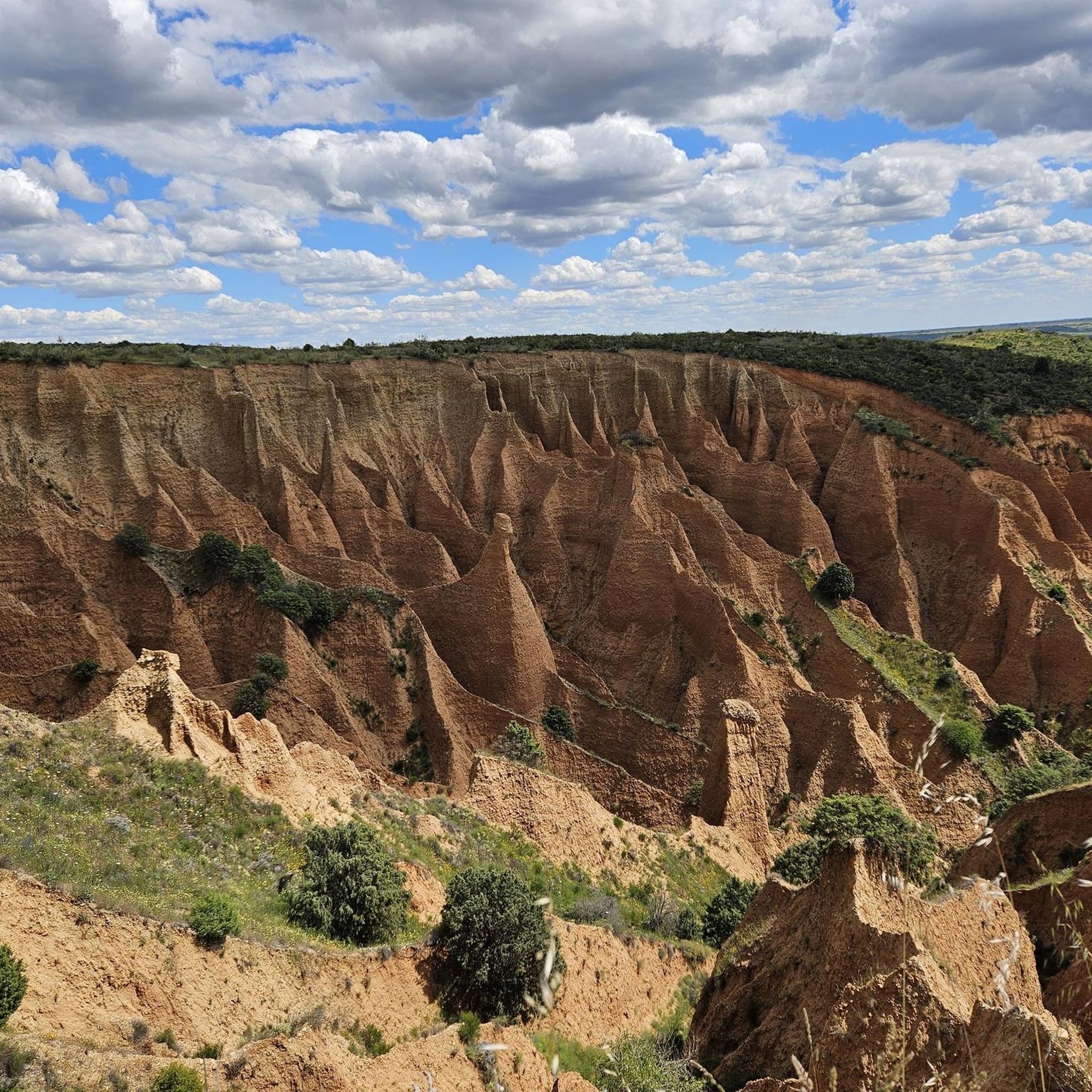
Hiking around Valdepeñas De La Sierra offers diverse terrain within the Sierra Norte Natural Park, characterized by unique geological formations and river canyons. The region features impressive gullies known as Las Cárcavas del Pontón de la Oliva, which present a striking "Martian landscape" due to water erosion on clayey slopes. The Jarama River Canyon provides deep gorges and routes along the river, passing through oak and holm oak forests. This area provides a rugged mountainous environment with varied landscapes for…
Last updated: October 10, 2026
4.2
(20)
80
hikers
14.8km
04:38
570m
570m
Hike the Carcavas del Monte Guadarrama circular route from Ponton de la Oliva, exploring unique geological formations and scenic valley view
5.0
(5)
46
hikers
17.0km
04:49
370m
370m
Hike the moderate 10.6-mile Pontón de la Oliva to La Parra Dam Circular Trail, exploring historic dams and river canyon views.

5.0
(5)
43
hikers
16.3km
04:40
370m
370m
Hike a moderate 10.1-mile (16.3 km) circular route from Pontón de la Oliva to Presa de la Parra, exploring river views and limestone cliffs.
4.8
(18)
172
hikers
Moderate hike. Good fitness required. Easily-accessible paths. Suitable for all skill levels.
4.8
(14)
56
hikers
8.19km
02:30
270m
280m
Moderate hike. Good fitness required. Easily-accessible paths. Suitable for all skill levels.
Get access to more routes and recommendations from other explorers.
Already have an account?
Our route recommendations are based on thousands of hikes, rides, and runs completed by other people on komoot.
Start today with a free account
Your next adventure awaits.

Tips from the Community

These are the ruins of an old but beautiful hermitage.
0
1

start from the dam
1
0
Beautiful place where people go for a walk or to climb.
1
0

The Pontón de la Oliva is a Spanish dam located in the Ayllón mountain range, northeast of the Community of Madrid and northwest of the province of Guadalajara. It was built in 1857 and is currently disused. This dam is the sixth and last in the course of the Lozoya River, and is the oldest of the entire system of dams and canalizations of the Canal de Isabel II. This canal supplies drinking water to Madrid and a large part of the community. The height of the Pontón de la Oliva Dam is approximately 30 meters. If you are interested in exploring the area, there are routes that take you to the Cárcavas de Pontón de la Oliva, a curious geological formation in the Community of Madrid. In addition, you can enjoy a route along the Pontón de la Oliva to the Lozoya River, which offers impressive views. I hope you find this information interesting! 😊
5
0

The La Parra weir is a Spanish reservoir located in the bed of the Lozoya River, in the province of Madrid.
0
0

Built under the reign of Isabel II, it is the oldest dam in Madrid, being the last on the course of the Lozoya River. This dam, 27 meters high, made of limestone, was inaugurated in 1856 as the beginning of the water supply project for Madrid, the new capital of the kingdom of Spain, which was growing considerably in population. Currently disused due to permeability problems caused by the poor choice of its location, today it belongs to the historical heritage of the Sierra de Ayllón, being a place visited by climbing enthusiasts and traveled by hikers and cyclists.
0
0

The Cañada de la Caleriza is a winding path that runs along the banks of the Lozoya River. This section coincides with the beginning of the GR 88, which runs through the provinces of Madrid, Segovia and Guadalajara. The Lozoya is a tributary of the Jarama along whose 91-kilometer route six reservoirs have been built.
2
0

Dam with the aim of controlling the pressure that the Navarejos dam can suffer.
1
1
Frequently Asked Questions
What kind of terrain can I expect when hiking in Valdepeñas De La Sierra?
The region offers diverse terrain within the Sierra Norte Natural Park, characterized by unique geological formations like the impressive gullies known as Las Cárcavas del Pontón de la Oliva, which create a striking "Martian landscape." You'll also find deep river canyons, particularly along the Jarama River, and paths winding through authentic forests of oak and holm oak trees.
Are there hiking routes suitable for beginners or families in Valdepeñas De La Sierra?
Yes, Valdepeñas De La Sierra offers routes for various ability levels. While many trails are moderate, there are approximately 15 easy routes available, making it possible to find suitable options for beginners or families looking for a less strenuous walk.
What are some notable natural features or landmarks to look out for?
A major highlight is Las Cárcavas del Pontón de la Oliva, known for its unique reddish, clay-rich formations. You can also explore the dramatic Jarama River Canyon. Beyond the trails, consider visiting the historic Pontón de la Oliva Dam or the charming village of Patones de Arriba.
Are there any circular hiking routes in the area?
Yes, many routes in Valdepeñas De La Sierra are circular. For example, the Pontón de la Oliva to La Parra Dam Circular Trail is a popular moderate option that explores historic dams and river views. Another is the Jarama Trails Loop, which takes you through the river valley and its surrounding forests.
What do other hikers say about the trails in Valdepeñas De La Sierra?
The trails in Valdepeñas De La Sierra are highly regarded by the komoot community, with an average score of 4.7 stars from over 300 reviews. Hikers often praise the unique geological formations, the serene river canyons, and the diverse forests that define the region's outdoor experience.
How many hiking trails are available in Valdepeñas De La Sierra?
There are over 100 hiking trails in Valdepeñas De La Sierra. This includes a good mix of difficulties, with approximately 15 easy routes, 66 moderate routes, and 20 more challenging options.
Are there any trails that offer views of reservoirs or lakes?
Yes, the region features several reservoirs and viewpoints. You can find trails that offer views of El Atazar Reservoir or Vado Reservoir. Some routes also pass by Lagunas de La Puebla de Beleña.
What is the best time of year to go hiking in Valdepeñas De La Sierra?
The Sierra Norte Natural Park, where Valdepeñas de la Sierra is located, offers diverse landscapes that can be enjoyed across seasons. Spring and autumn generally provide the most pleasant temperatures for hiking, with vibrant flora in spring and beautiful colors in autumn. Summer can be hot, especially in the canyons, while winter offers a different, often quieter, experience.
Are there any shorter, moderate trails for a half-day hike?
Yes, for a moderate half-day hike, consider the Cañada de la Caleriza Trail loop from Pontón de la Oliva. This route is approximately 8.2 km long and can typically be completed in under 2.5 hours, offering a good balance of distance and scenic views.
What kind of wildlife might I encounter on the trails?
As part of the Sierra Norte Natural Park, the area is rich in biodiversity. While specific sightings are never guaranteed, you might encounter various bird species, small mammals, and diverse plant life, particularly in the forested areas along the Jarama River and within the rugged mountainous terrain.
Is it possible to combine hiking with exploring nearby villages or attractions?
Absolutely. Many trails are close to or pass by interesting points. For instance, after a hike, you could explore the historic architecture of Patones de Arriba or visit the El Berrueco Watchtower, which are both within the wider region.
Are there any specific regulations or permits needed for hiking?
Valdepeñas de la Sierra is situated within the Sierra Norte Natural Park, which emphasizes sustainable tourism. While general hiking on marked trails typically doesn't require specific permits, it's always advisable to respect local regulations, stay on marked paths, and practice Leave No Trace principles to preserve the natural environment.
Most popular routes around Valdepeñas De La Sierra
Most popular attractions around Valdepeñas De La Sierra

Get inspired with the komoot mobile app


Explore more
Browse the best Hikes in other regions.
