The best walks and hikes around National Park Chera-Sot Chera
4.7
(745)
4,289
hikers
17
hikes
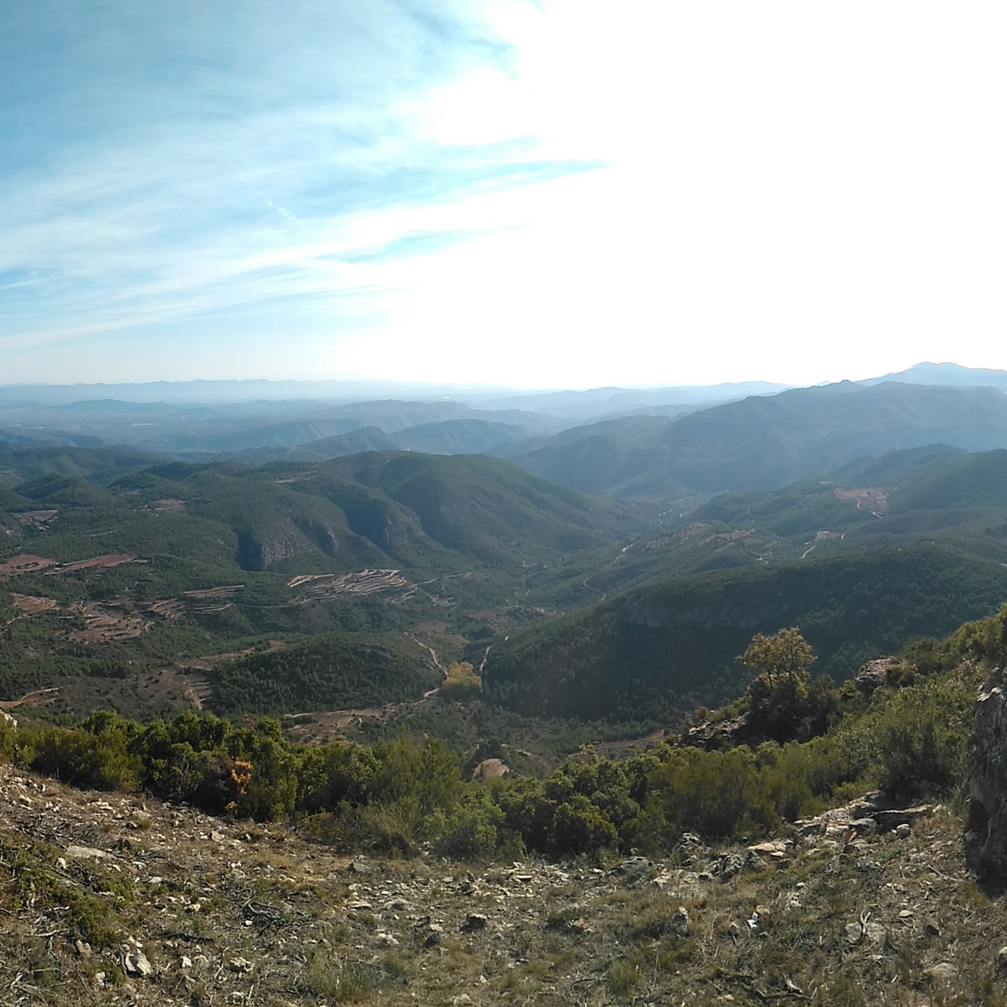
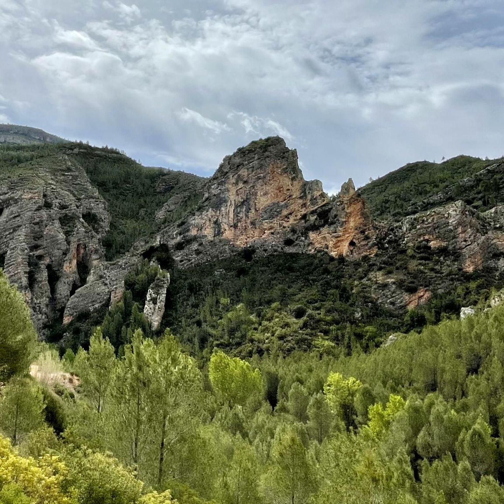
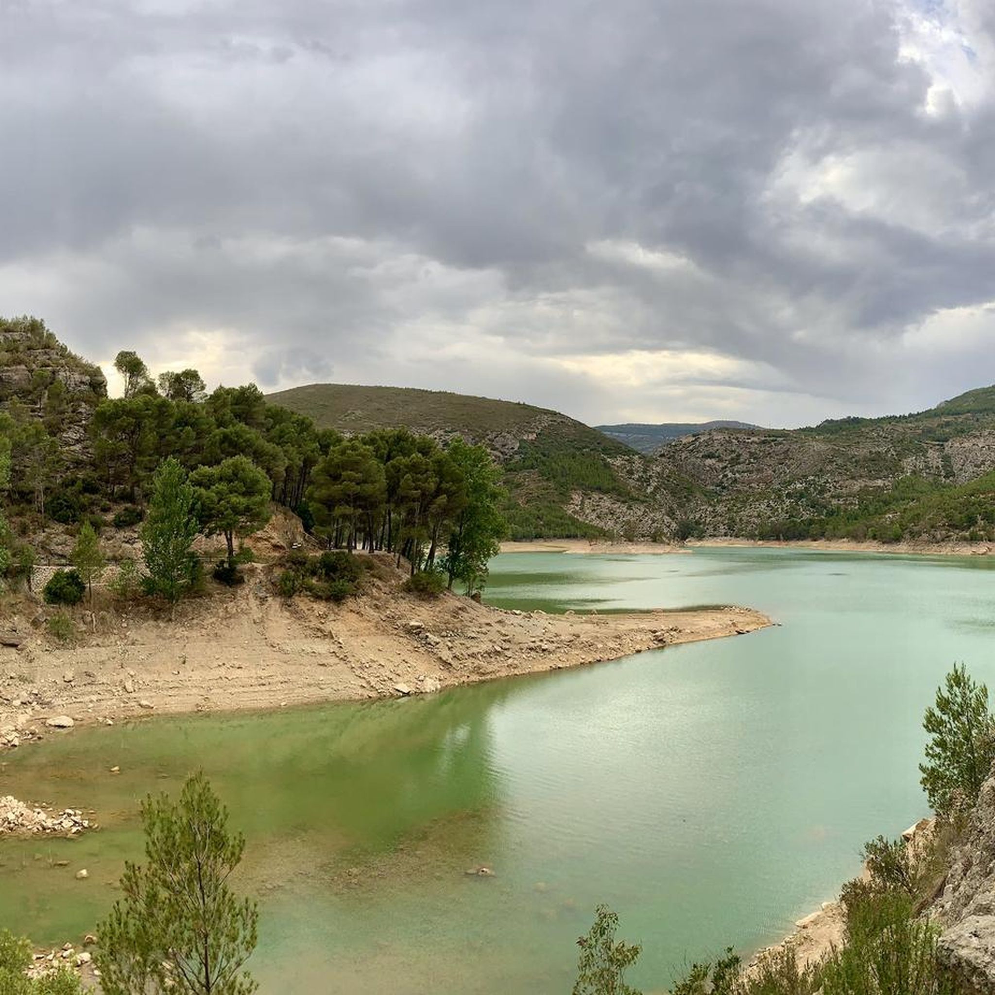
Hiking around National Park Chera-Sot Chera offers diverse landscapes characterized by deep gorges, steep mountains, and fertile valleys. The park spans 6,451.17 hectares and features peaks up to 1,171 meters, such as Cinco Pinos, and 1,136 meters at Pico Ropé. This region is notable for its 75-million-year-old graben and abundant water sources, including the Reatillo River and the Buseo reservoir. Thick forests of pine, poplar, and oak cover much of the terrain.
Best hiking trails around National Park Chera-Sot Chera
…Last updated: October 10, 2026
4.8
(10)
35
hikers
10.1km
03:23
470m
470m
Moderate hike. Good fitness required. Easily-accessible paths. Suitable for all skill levels.
5.0
(1)
6
hikers
14.7km
04:27
470m
480m
Moderate hike. Good fitness required. Easily-accessible paths. Suitable for all skill levels.

5.0
(3)
7
hikers
4.17km
01:08
60m
70m
Easy hike. Great for any fitness level. Easily-accessible paths. Suitable for all skill levels.
4.5
(2)
3
hikers
12.5km
04:06
450m
450m
Moderate hike. Good fitness required. Mostly accessible paths. Sure-footedness required.
5.0
(2)
7
hikers
Moderate hike. Good fitness required. Easily-accessible paths. Suitable for all skill levels.
Get access to more routes and recommendations from other explorers.
Already have an account?
Our route recommendations are based on thousands of hikes, rides, and runs completed by other people on komoot.
Start today with a free account
Your next adventure awaits.

Tips from the Community

The Reatillo River, also known as the Sot River in its final stretch, is a tributary of the Turia River that flows through spectacular natural surroundings in the province of Valencia, particularly in the Chera-Sot de Chera Natural Park. In Sot de Chera, the river forms natural pools or "charcos" (pools), ideal for swimming, especially in summer. One of the best known is Charco Gruñidor, a natural pool of crystal-clear water surrounded by vegetation and rocks.
4
0
The Reatillo River, also known as the Sot River in its final stretch, is a tributary of the Turia River that flows through spectacular natural surroundings in the province of Valencia, particularly in the Chera-Sot de Chera Natural Park. In Sot de Chera, the river forms natural pools or "charcos" (pools), ideal for swimming, especially in summer. One of the best-known is Charco Gruñidor, a natural pool of crystal-clear water surrounded by vegetation and rocks.
4
0

This good viewpoint is just the promising start of the trail. Keep it up and you'll be amazed.
1
0

At the moment, they are undergoing renovations and it is not possible to access.
0
0
Rest area and viewpoint, excellent views, with the front to Morroncillo, to the sides, Sot de Chera (to the NE) and Chera (to the SW).
0
0
The view 360 view when walking on the presa is really amazing : the color of the embalse, the cliffs and rocks on the other side, with colored water as well, makes this place really a must go.
1
0
Thrilling part of trail, very safe as they put cable for people not feeling it but the trail is not that narrow so you can fully enjoy the view.
2
0

Popular bathing spot with small waterfalls and a pool at the end of the canyon.
1
0
Frequently Asked Questions
What types of hiking trails can I find in National Park Chera-Sot Chera?
National Park Chera-Sot Chera offers a diverse range of trails, from easy walks to more strenuous hikes. The terrain is characterized by deep gorges, steep mountains, and fertile valleys, with peaks reaching over 1,100 meters. You'll find a network of approved PR (Pequeño Recorrido) and GR (Gran Recorrido) trails suitable for various fitness levels. Overall, there are 19 hiking routes, including 3 easy, 15 moderate, and 1 difficult option.
Are there any trails that feature waterfalls or natural pools?
Yes, water is a defining element of the park. The Reatillo River, also known as the Sot River, carves through the park, forming natural pools or 'charcos' perfect for swimming, such as Charco Gruñidor. The river also creates narrow ravines with waterfalls, locally known as 'Chorreros'. You can explore these features on trails like The Water Route along the Reatillo River, which leads through beautiful riverine landscapes. Other notable waterfalls include Chorrero de la Castellana and Cascada y Cuevas de la Garita, especially impressive after rainfall.
What are some notable geological features or landmarks to explore?
The park is a geological marvel, situated within a 75-million-year-old graben. Sot de Chera is recognized as the first geological park in the Region of Valencia. You can discover unique formations like the travertine formations "Las Toscas" and "La Garita." "Las Toscas" of Sot de Chera is a priority habitat due to its unique geology. Highlights include Cueva de la Garita and the dramatic landscapes around Pico Ropé.
Are there any circular hiking routes available?
Yes, many trails in National Park Chera-Sot Chera are circular, offering convenient starting and ending points. A popular moderate circular route is Mirador del Morroncillo — Circular from Sot de Chera (PR-CV 223), which provides scenic views. Another well-known option is La Cuesta Larga (PR-CV 414) — Circular to Puntal de Los Vagos.
What kind of wildlife can I expect to see while hiking?
The park is rich in biodiversity and offers opportunities for nature observation. You might spot raptors such as the golden eagle, Bonelli's eagle, peregrine falcon, Eurasian eagle-owl, and griffon vulture. Mammals like wild boars, badgers, civet cats, and wild cats also inhabit the area, making it an appealing destination for wildlife enthusiasts.
What do other hikers enjoy most about the trails in National Park Chera-Sot Chera?
The trails in National Park Chera-Sot Chera are highly rated by the komoot community, with an average score of 4.8 stars from over 400 reviews. Hikers often praise the dramatic and diverse landscapes, the abundance of water features like rivers and natural pools, and the peaceful, isolated experience due to fewer visitors compared to other national parks.
Are there any family-friendly hiking options?
Yes, the park offers trails suitable for families. While specific 'family-friendly' designations aren't always explicit, easy-grade routes like The Water Route along the Reatillo River (2.6 miles, 1 hour 8 minutes) are generally good choices for families with children, offering engaging natural features without excessive difficulty.
Is there parking available near the trailheads?
While specific parking locations aren't detailed for every trailhead, the park is well-equipped for visitors. Given its status as a National Park and the presence of numerous trails originating from towns like Chera and Sot de Chera, you can generally expect designated parking areas near popular access points and villages within or bordering the park.
What is the best time of year to go hiking in this region?
The park's diverse vegetation, including thick forests and abundant water sources, makes it appealing across seasons. Spring and autumn generally offer the most pleasant temperatures for hiking. Summer can be warm, but the natural pools and river areas provide opportunities for cooling down. Winter hikes are also possible, offering a different, quieter experience.
Can I combine hiking with other activities in the park?
Absolutely. Beyond hiking, National Park Chera-Sot Chera supports a range of outdoor activities. You can also enjoy mountain climbing, mountain biking, and camping. The numerous water bodies, including the Buseo reservoir and the Reatillo River, also make it a great spot for enjoying the natural environment.
Are there any trails that lead to viewpoints or panoramic vistas?
Yes, the rugged terrain and steep mountains offer numerous opportunities for panoramic views. The Mirador del Morroncillo — Circular from Sot de Chera (PR-CV 223) is specifically known for its scenic views from the Mirador del Morroncillo. Peaks like Cinco Pinos and Pico Ropé also offer challenging ascents rewarded with extensive vistas.
Where can I learn more about the geology of the area?
Sot de Chera is recognized as the first geological park in the Region of Valencia, attracting scientists for research. You can visit the Geological Park Museum, which displays fossils and provides information panels for outdoor geological itineraries. This is a great way to deepen your understanding of the park's unique 75-million-year-old graben and spectacular rock formations.
Most popular routes around National Park Chera-Sot Chera
Most popular attractions around National Park Chera-Sot Chera

Get inspired with the komoot mobile app


Explore more
Browse the best Hikes in other regions.
