The best road cycling routes around Les Avellanes I Santa Linya
4.7
(24)
2,069
riders
97
rides
Road cycling around Les Avellanes I Santa Linya features a diverse landscape characterized by significant elevation changes, including challenging mountain passes and scenic valleys. The region offers routes that traverse varied terrain, from areas around reservoirs like Sant Llorenç de Montgai to higher mountain roads. Road bike trails Les Avellanes Santa Linya difficulty ranges from easy to difficult, catering to different experience levels.
Best road cycling routes around Les Avellanes I Santa Linya
- The most popular road cycling route is Sant Llorenç de Montgai – Balaguer Bridge loop from Sant Llorenç de Montgai, a 28.9 miles (46.5 km) trail that takes 2 hours 14 minutes to complete. This moderate route offers views of the reservoir and passes over the Balaguer Bridge.
- Another top favourite among local road cyclists is Coll de Montllobar (1080 m) – Coll d'Ares loop from Àger, a difficult 61.4 miles (98.8 km) path. This route includes substantial climbs over two mountain passes, providing a demanding ride with extensive views.
- Local road cyclists also love the Port d'Àger – Coll d'Ares loop from Port d'Àger, a 24.9 miles (40.1 km) trail leading through mountain passes and offering significant elevation gain, often completed in about 2 hours 57 minutes.
- Road cycling around Les Avellanes I Santa Linya is defined by challenging mountain passes, reservoir-side roads, and varied terrain with notable elevation changes. The network offers options for easy, moderate, and difficult routes, accommodating different ability levels.
- The routes in Les Avellanes I Santa Linya are highly rated by the komoot community with an average score of 4.8 stars from over 10 reviews. More than 1,600 road cyclists have used komoot to explore Les Avellanes I Santa Linya's varied terrain.
Last updated: November 6, 2026
4.0
(1)
272
riders
Hard road ride. Very good fitness required. Some segments of this route may be unpaved and difficult to ride.
22
riders
23.7km
01:14
150m
150m
Moderate road ride. Some segments of this route may be unpaved and difficult to ride.

4.0
(1)
37
riders
Moderate road ride. Good fitness required. Some segments of this route may be unpaved and difficult to ride.
5.0
(1)
22
riders
64.6km
03:06
760m
760m
Moderate road ride. Good fitness required. Mostly well-paved surfaces and easy to ride.
9
riders
63.1km
03:30
1,350m
1,350m
Hard road ride. Very good fitness required. Some segments of this route may be unpaved and difficult to ride.
Get access to more routes and recommendations from other explorers.
Already have an account?
Our route recommendations are based on thousands of hikes, rides, and runs completed by other people on komoot.
Start today with a free account
Your next adventure awaits.
Popular around Les Avellanes I Santa Linya



Other adventures around Les Avellanes I Santa Linya

Tips from the Community

Good route.
0
0

Easy hiking trail along the road. You walk directly past the cliffs and the lake. Very impressive
0
0

Fresh drinking water - perfect location to fill your bottles
0
0

Beautiful walk that crosses the dam and continues along its other side.
0
0
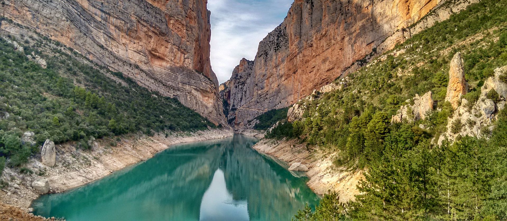
This is an area with a beautiful natural landscape, ideal for relaxing and enjoying nature. It's also an idyllic spot for a multitude of leisure activities. Its cliffs make it an attractive spot for climbing enthusiasts. Along the road that runs alongside it, you'll find several picture-postcard views.
0
0

From the main road you cannot appreciate the rustic beauty of this town on the plain of Lleida. It is worth entering the town and walking through the streets of the historic center.
0
0
Next to the Coll d'Ares, it is the most iconic port in the Montsec mountain range and the Lleida Pre-Pyrenees. The views from above, either towards the Pyrenees and the Isona and Tremp valley, as well as the Plana de Lleida, are magnificent. It is a port with 4 aspects, each one different: - The southern slope, which begins in Artesa de Segre, is almost 24 km long and runs along a road with a lot of traffic, very wide and with long straights. After passing the town of Folquer, you face the hardest section of the climb, now with continuous curves and horseshoes, although with a road that is still very wide. The best are the views of the Lleida plain. It is not a side that I like since it is very stinky. - The southeast slope, the one that begins in Pons, is longer than the previous one, with 29 km. It has 2 rest sections, with some descent, and the road is narrow and twisty. There are good views along the climb. This slope joins the southern slope that comes from Artesa de Segre at the height of Folquer, where the hardest 7 km remain until reaching the top of the pass. - The main northern slope begins in Tremp and is 28.2 km. It is similar to the Artesa de Segre slope, with a similar gradient and a wide, busy road with a progressive slope, although it is true that there are no kilometers that reach 7%. I don't like. - The northwest slope, which also begins in Tremp, takes the old road that goes up through the town of Sant Salvador de Toló. It is a climb without traffic, on an irregular asphalt road, one of the old ones, which is grippy and difficult to roll, but in good condition. If you plan to go up to Comiols on the northern slope, you have to do it here and forget about the slope that runs along the main road.
0
0
Frequently Asked Questions
How many road cycling routes are available in Les Avellanes I Santa Linya?
There are over 80 road cycling routes in the Les Avellanes I Santa Linya region, offering a wide range of options for different skill levels and preferences.
What is the general difficulty level of road cycling routes in this area?
The region features a diverse landscape with significant elevation changes, including challenging mountain passes and scenic valleys. You'll find routes ranging from easy (6 routes) to moderate (49 routes) and difficult (27 routes), catering to various experience levels.
Are there any easy road cycling routes suitable for beginners or families?
Yes, there are 6 easy road cycling routes in the area. A good option for a less strenuous ride is the Bull Rock – Sant Llorenç de Montgai loop from Camarasa, which is about 15.5 miles (25 km) long with moderate elevation gain.
What are some challenging routes for experienced road cyclists?
For experienced cyclists seeking a challenge, routes like the Coll de Montllobar (1080 m) – Coll d'Ares loop from Àger offer substantial climbs over two mountain passes, covering nearly 61.4 miles (98.8 km) with extensive views. Another demanding option is the Port d'Àger – Coll d'Ares loop from Port d'Àger.
Are there circular road cycling routes in Les Avellanes I Santa Linya?
Yes, many routes in the area are circular. For example, the popular Sant Llorenç de Montgai – Balaguer Bridge loop from Sant Llorenç de Montgai offers a moderate 28.9 miles (46.5 km) ride with reservoir views. Another loop option is the Bull Rock – Sant Llorenç de Montgai loop from Sant Llorenç de Montgai.
What kind of natural attractions can I see along the road cycling routes?
The routes often pass by significant natural features. You can encounter highlights such as the Chinese Wall of Finestres, the Cova del Tabac, and the Mas de Melons Wildlife Nature Reserve. Many routes also offer views of reservoirs like the Sant Llorenç de Montgai Reservoir.
Are there any notable viewpoints or scenic spots on the road cycling routes?
Absolutely. The region is known for its extensive views, especially from mountain passes like Coll de Montllobar and Coll d'Ares. Routes around the Sant Llorenç de Montgai reservoir also provide picturesque waterside vistas. The Roca Regina and Barranc del Bosc gorge is another scenic highlight.
What is the best time of year for road cycling in Les Avellanes I Santa Linya?
The diverse terrain means conditions can vary. Generally, spring and autumn offer pleasant temperatures for cycling. Summer can be hot, especially in the valleys, but higher mountain roads might provide cooler conditions. Always check local weather forecasts before heading out.
What do other road cyclists enjoy most about the routes in Les Avellanes I Santa Linya?
The area is highly rated by the komoot community, with an average score of 4.8 stars from over 10 reviews. Cyclists often praise the challenging mountain passes, the scenic reservoir-side roads, and the varied terrain that accommodates different ability levels.
Is parking available near the road cycling trails?
Parking is generally available in the towns and villages that serve as starting points for many routes, such as Sant Llorenç de Montgai, Àger, and Camarasa. Specific parking information can often be found in the route descriptions on komoot.
Are there any cafes or places to stop for refreshments along the routes?
While specific cafes are not listed for every route, the towns and villages within the region, such as Les Avellanes, Santa Linya, Àger, and Balaguer, offer various amenities including cafes and restaurants where you can refuel during your ride.
Most popular routes around Les Avellanes I Santa Linya
Most popular attractions around Les Avellanes I Santa Linya

Get inspired with the komoot mobile app


Explore more
Browse the best Road cycling routes in other regions.
