The best cycling routes around Tamurejo
4
riders
1
ride
Touring cycling around Tamurejo, a municipality in Extremadura, Spain, offers routes through a landscape characterized by mountain architecture and natural surroundings. The area features an elevation of 547 meters above sea level, with prominent natural enclaves like Pinguta del Morro and Peña del Águila. The broader Extremadura region provides varied terrain, including rolling hills and oak forests, suitable for cycling exploration. These routes often include both paved and unpaved surfaces, traversing ancient paths.
Best touring cycling routes around Tamurejo
- The…
Last updated: July 15, 2026
1
riders
28.0km
02:44
410m
410m
Moderate bike ride. Good fitness required. Mostly paved surfaces. Suitable for all skill levels.
1
riders
32.3km
02:02
350m
350m
Moderate bike ride. Good fitness required. Mostly paved surfaces. Suitable for all skill levels.

Sign up for free
2
riders
Hard bike ride. Very good fitness required. Mostly paved surfaces. Suitable for all skill levels.
Our route recommendations are based on thousands of hikes, rides, and runs completed by other people on komoot.
Start today with a free account
Your next adventure awaits.
Login or Signup
Popular around Tamurejo
Tips from the Community

This Almohad-era castle, now devoid of walls and decoration, is built on an octagonal plan atop a high crag south of the town, on a summit difficult to access. It lacks a keep, towers, and external defenses, perhaps due to its reconstruction during the Christian era, which only preserved the wall, omitting any other defensive elements beyond the rugged terrain on which it stands.
2
0
Located south of Castilblanco, this town is surrounded by ferruginous springs. Here we find an Almohad-era castle, now devoid of walls and decoration, built on an octagonal plan atop a high crag south of the town, on a summit that is difficult to access.
2
0
The Herrera del Duque Castle, located in the province of Badajoz (Extremadura), is an impressive 15th-century fortress that dominates the landscape of the La Siberia region from the top of the Sierra Chamorro. It is said that wailing sounds can be heard at night from the "Tower of Sighs," and there are legends about a hidden treasure protected by a curse.
6
0

To the south of Cerro de San Blas we find Baterno, which is a small population center that is part of the commonwealth of La Siberia Extremeña.
2
0
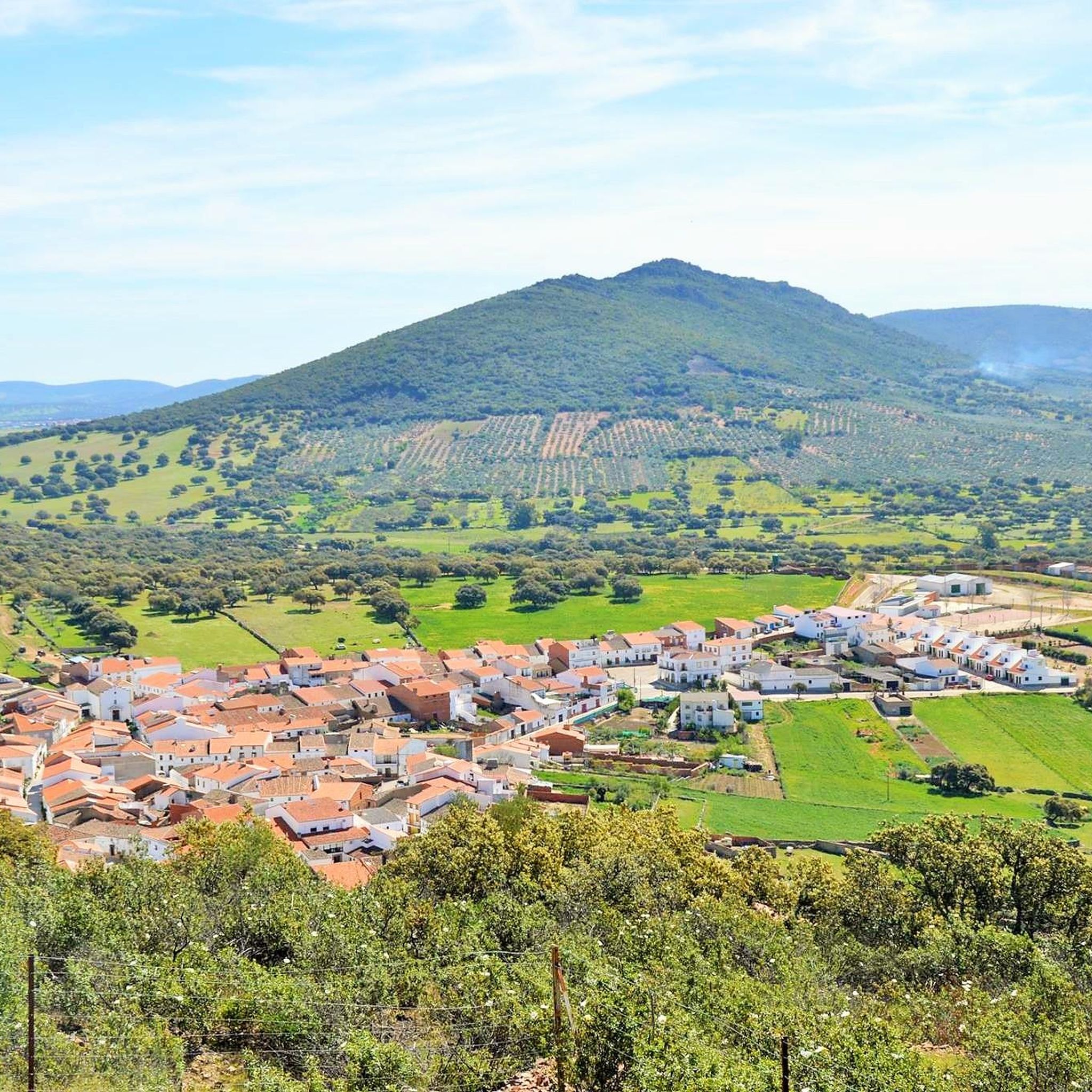
Beautiful town that is located at the foot of a small hill called Pinguta del Morro and that is also located south of the Río Siruela.
1
0
Small town that is located in Valle de Alcudia and that bears the same name as the Río Agudo that runs through the north of the town.
2
0

There is an intense and pronounced climb up to this medieval castle, but from there you can visit the fortress and enjoy the views of the Extremaduran esplanades.
0
1
Castle from the Almohad period, devoid of walls or decoration and built on an octagonal plan on a high rock to the south of the town, on a hill that is difficult to access. This castle does not have a keep, nor does it have cubes or external defenses, perhaps as a result of its reconstruction during the Christian era, which only maintained the wall, ignoring any other defensive element beyond the rugged terrain on which it stands.
11
2
Frequently Asked Questions
What kind of terrain can I expect on touring cycling routes around Tamurejo?
The region around Tamurejo, situated in Extremadura, Spain, offers a diverse landscape for touring cyclists. You'll encounter varied terrain, including rolling hills, mountain architecture, and oak forests. Routes often feature a mix of paved and unpaved surfaces, traversing ancient paths. The area is known for its well-preserved natural conditions, providing a rich natural backdrop for your rides.
Are there any circular touring cycling routes available in Tamurejo?
Yes, several routes around Tamurejo are designed as loops, allowing you to start and finish in the same location. For example, the Puerto de las Navas loop from Fuenlabrada de los Montes is a popular moderate option. Another excellent circular route is the Puerto de Ríofrío – Agudo loop from Tamurejo, which takes you near the Agudo River.
What are the difficulty levels of touring cycling routes in the Tamurejo area?
Touring cycling routes around Tamurejo cater to various ability levels. You'll find moderate paths suitable for many cyclists, as well as more challenging routes with significant ascents and descents. For instance, the Herrera del Duque Castle – Herrera del Duque Town Center loop from Fuenlabrada de los Montes is classified as difficult, offering a more strenuous ride through historic areas and natural surroundings.
Are there any good viewpoints or scenic spots along the cycling routes?
Absolutely. The region is known for its expansive vistas. The 'Pinguta del Morro' is a notable viewpoint offering panoramic views of the surrounding 'vast territories' and 'Siberian landscapes.' While not directly on a specific route listed, the general area's elevation of 547 meters above sea level ensures many opportunities for scenic overlooks as you cycle through the rolling hills and natural enclaves.
What historical or natural attractions can I explore near the cycling routes?
The Tamurejo area is rich in natural beauty and points of interest. You can explore natural enclaves like Aguapero, El Puerto, and El Burro. The 'Peña del Águila,' a prominent rock formation above the Agudo River, is another natural feature. For historical interest, the ruins of 'El Molino,' an old mill, are worth noting. Additionally, you might pass through settlements like Agudo or near the Sierra de la Ubría, offering glimpses into the local character and natural environment.
What is the best time of year to go touring cycling in Tamurejo?
Extremadura generally offers good cycling conditions for much of the year. Spring and autumn are typically ideal, with milder temperatures and pleasant weather for exploring the varied terrain. Summers can be hot, especially in July and August, while winters are generally mild, though some routes might be affected by rain. Checking local weather forecasts before your ride is always recommended.
Are there any long-distance touring cycling options in the Tamurejo region?
While the specific routes highlighted are moderate in length (around 17-20 miles), the broader Extremadura region is recognized for its potential for longer cycling tours. The varied terrain, including mountain ranges and ancient paths, allows for combining routes or planning multi-day trips. The natural conditions and diverse landscapes make it suitable for extended exploration, though you may need to plan your own connections between existing routes.
Can I expect to see wildlife while cycling around Tamurejo?
The well-preserved natural conditions of the Extremadura region, where Tamurejo is located, make it ideal for wildlife observation, particularly birdwatching. As you cycle through oak forests and natural enclaves, you have a good chance of spotting various bird species and other local fauna that thrive in this untouched environment.
Are there any family-friendly touring cycling routes near Tamurejo?
The guide primarily features moderate to difficult routes, which may be challenging for very young children or beginner family cyclists. However, the region's varied terrain includes both paved and unpaved surfaces, and less formally designated paths. Families looking for easier rides might consider shorter sections of these routes or explore the quieter, flatter roads and tracks around local settlements, keeping in mind that some routes involve challenging ascents and descents.
Where can I find parking for my touring bike near the trails in Tamurejo?
Tamurejo is a municipality integrated with its natural surroundings. While specific parking areas for trailheads are not detailed, you can typically find parking within the town of Tamurejo itself or in nearby villages like Fuenlabrada de los Montes, which serve as starting points for several routes. It's advisable to check local signage or inquire locally upon arrival for the most convenient parking options.
What do other touring cyclists enjoy most about cycling in Tamurejo?
Cyclists exploring Tamurejo often praise the region's untouched natural environment and the unique 'Siberian landscapes' that offer expansive views. The blend of mountain architecture, rolling hills, and ancient paths provides a rewarding experience for those seeking a connection with nature. The varied terrain, from paved roads to unpaved tracks, also appeals to cyclists looking for diverse riding conditions.
Are there cafes or places to rest along the touring cycling routes?
The routes often pass through or start from local towns and villages such as Tamurejo, Fuenlabrada de los Montes, or Agudo. These settlements are likely to offer amenities like cafes, shops, or places to rest and refuel. It's always a good idea to carry sufficient water and snacks, especially on longer stretches between villages, as services may not be continuously available along the more remote parts of the trails.
Most popular routes around Tamurejo
Most popular attractions around Tamurejo

Get inspired with the komoot mobile app


Explore more
Browse the best Cycling routes in other regions.
