The best walks and hikes around Villargordo Del Cabriel
4.6
(51)
313
hikers
13
hikes
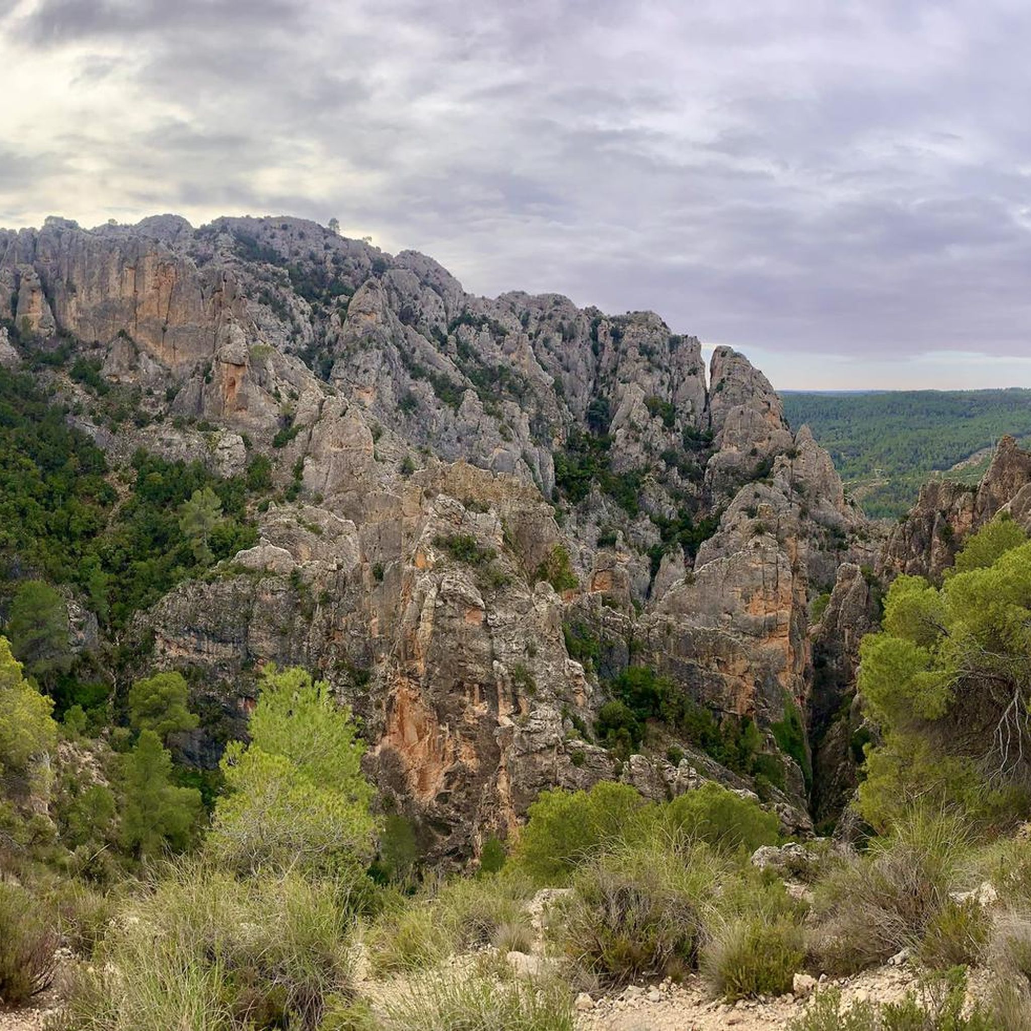
Hiking around Villargordo Del Cabriel offers access to the Hoces del Cabriel Natural Park, a protected landscape defined by the Cabriel River. The terrain features spectacular river meanders, impressive limestone formations like Los Cuchillos, and diverse forests. The region includes valleys, gorges, and ravines, with elevations ranging from riverside paths to hills and peaks.
Best hiking trails around Villargordo Del Cabriel
- The most popular hiking route is Parque Natural de las Hoces del Cabriel — Circular by Los Cuchillos y…
Last updated: May 10, 2026
4.8
(24)
82
hikers
5.99km
01:47
190m
190m
Hike the Parque Natural de las Hoces del Cabriel to see Los Cuchillos and Barranco Moluengo, featuring dramatic geological formations.
4.2
(5)
49
hikers
6.38km
01:42
60m
60m
Hike the easy 4.0-mile Los Cuchillos del Cabriel Trail to see unique knife-like rock formations and river views in Hoces del Cabriel Natural

Sign up for free
2
hikers
Hard hike. Very good fitness required. Easily-accessible paths. Suitable for all skill levels.
4
hikers
29.1km
08:35
870m
870m
Hard hike. Very good fitness required. Easily-accessible paths. Suitable for all skill levels.
5.0
(3)
17
hikers
4.17km
01:19
70m
70m
Moderate hike. Great for any fitness level. Mostly accessible paths. Sure-footedness required.
Get access to more routes and recommendations from other explorers.
Sign up for free
Already have an account?
Our route recommendations are based on thousands of hikes, rides, and runs completed by other people on komoot.
Start today with a free account
Your next adventure awaits.
Login or Signup


Tips from the Community

Hiking: Popular routes, such as the "Engineer's House" trail, offer viewpoints overlooking the reservoir and the Cabriel River gorges. Guided tours: Occasionally, the Hydrographic Confederation and the Villargordo Town Council organize tours and talks in the village of Contreras. Historic roads: The abandoned section of the old N-III highway and the Contreras Hills attract engineering enthusiasts, with their original 20th-century asphalt and signage.
2
0
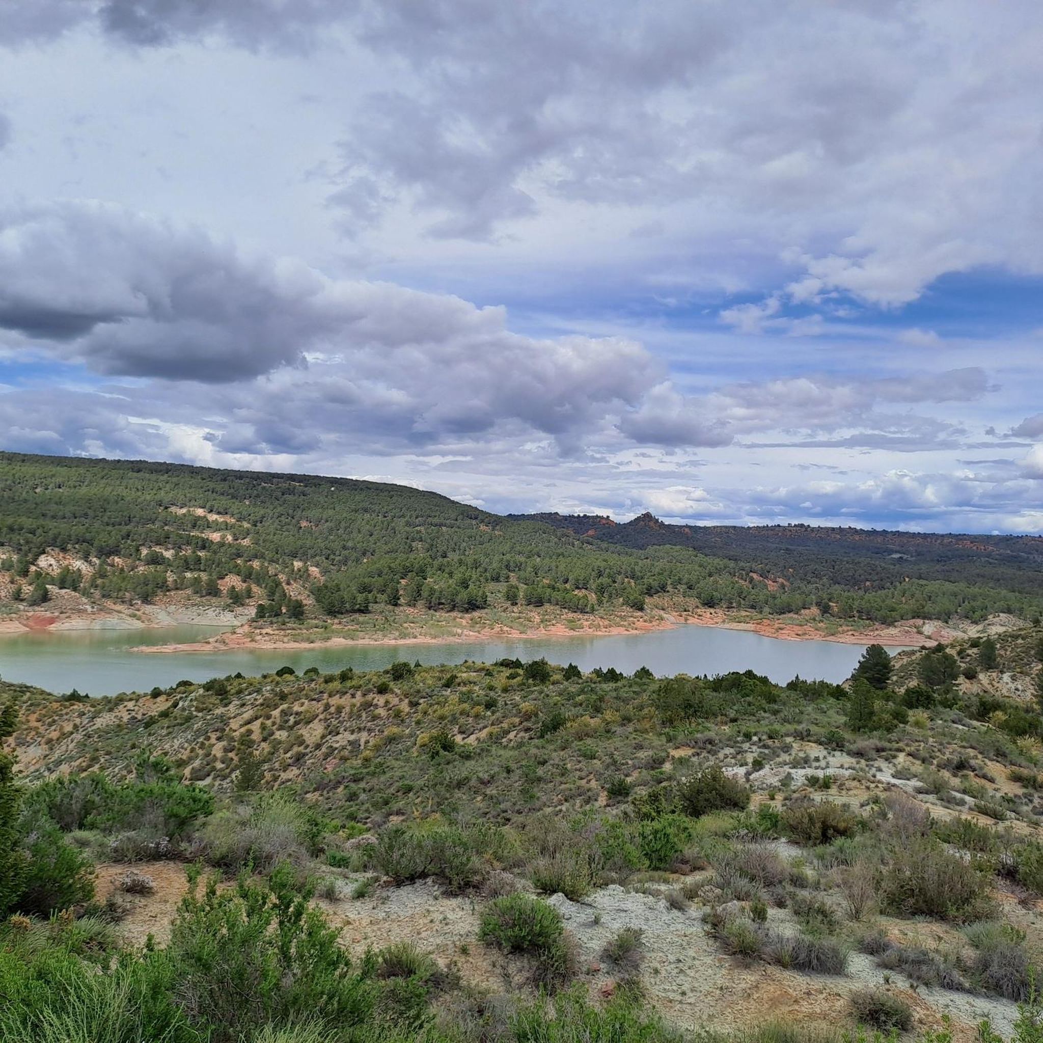
Contreras Dam (Contreras Reservoir), located on the border between Cuenca and Valencia provinces. It lies between Villargordo del Cabriel (Valencia) and the Cuenca municipalities of La Pesquera, Mira, Enguídanos, and Minglanilla, spanning the Cabriel and Guadazaón rivers. Below the dam is the historic Contreras Bridge, built between 1845 and 1851 by Lucio del Valle, part of the old zigzag mountain pass.
2
0

It was built in 1972 at the confluence of the Cabriel and Guadazaón rivers. The dam height is 129 metres. Its purpose is, among other things, to supply water to the city of Valencia. The Contreras Bridge was built between 1845 and 1851 by the engineer Lucio del Valle. To descend the ravine, he had to build a zigzag road that formed the port of Contreras.
1
0

It is a mountain peak located in the vicinity of the Valencian municipality of Villargordo del Cabriel, in the enclave of the Hoces del Cabriel Natural Park, a privileged natural environment that serves as a border with the neighboring region of Castilla – La Mancha. This peak has an altitude of around 1040 m and from its summit it is possible to obtain privileged views of the Sierra del Rubial to which this rocky promontory belongs. The panoramic view offered from this point allows you to see all the towns in the Requena-Utiel region in which this Natural Park is included. Likewise, from the Moluengo peak it is possible to see the depression of the Cabriel River and the neighboring plains of Cuenca. It is possible to go up to the Moluengo peak and cross the privileged natural environment that surrounds it thanks to one of the routes that cross the Hoces del Cabriel Natural Park, known as the yellow route, which starts from the town of Villargordo del Cabriel and leads the traveler to the top of Moluengo. Along this itinerary, which has an extension of 16 km, it is possible to visit places such as the town of Moluengo, the Fonseca viewpoint, the Oliva fountain or the Vadocañas bridge, over the waters of the Cabriel river and which constitutes the point at which the route ends.
0
0
Nice and curious place with a tower and a viewpoint.
0
0

If you go around the Fuente de Oliva counterclockwise (which I recommend), this is the second viewpoint and the first where you can see the Rio Cabriel in the gorges below beautiful cliffs. Continue to the right of the first bench along the cliff, and you will find a second bench and more beautiful views.
1
0
I recommend doing the Fuente de Oliva tour counterclockwise, so the views become more and more beautiful. Here this viewpoint is the first in the series, we see the Rio de Cabriel on the right and the beautiful rocks in the distance on the right. We begin to guess the gorges on the left.
2
0

this trail should be removed from the Komoot base, completely prohibited even for money!
1
0
Frequently Asked Questions
How many hiking trails are available around Villargordo Del Cabriel?
Based on komoot data, there are over 14 hiking routes in the Villargordo Del Cabriel area, catering to various skill levels.
What kind of hiking difficulty levels can I expect in Villargordo Del Cabriel?
The area offers a range of trails, from easy strolls to more challenging routes. You'll find 3 easy, 7 moderate, and 4 difficult trails, ensuring options for different experience levels.
Are there any family-friendly hiking trails in Villargordo Del Cabriel?
Yes, there are several easy routes suitable for families. For instance, the Cuchillares de Contreras – Natural Park of the Hoces del Cabriel is an easy 4.0-mile path offering scenic views within the Natural Park. Another easy option is the Parque Natural de las Hoces del Cabriel — Circular by Los Cuchillos y el Barranco Moluengo, which is 3.7 miles and explores unique geological features.
What natural features or landmarks can I see while hiking in Villargordo Del Cabriel?
The region is rich in natural beauty. You can expect to see the spectacular meanders of the Cabriel River, impressive limestone formations like Los Cuchillos, and diverse forests. Notable landmarks include the historic Vadocañas Bridge and the La Fonseca Viewpoint, offering panoramic views of the gorges.
Are there any circular hiking routes in the area?
Yes, several routes are circular. An excellent example is the Parque Natural de las Hoces del Cabriel — Circular by Los Cuchillos y el Barranco Moluengo, an easy 3.7-mile trail. Another is the Peñas Blancas Path Trench – Peñas Blancas Viewpoint loop from Trinxeras de Contreras, which is also an easy loop.
What is the best time of year to go hiking in Villargordo Del Cabriel?
Villargordo Del Cabriel enjoys a Mediterranean climate with continental influences, resulting in a predominance of sunny days. This makes it an inviting location for enjoying the outdoors year-round. Spring and autumn generally offer the most comfortable temperatures for hiking.
Can I bring my dog on the hiking trails?
While specific dog-friendly regulations can vary by trail and protected area, the Hoces del Cabriel Natural Park generally welcomes responsible dog owners. It's always recommended to keep dogs on a leash and clean up after them to protect the local wildlife and ensure a pleasant experience for all hikers.
Are there any challenging hikes for experienced trekkers?
Yes, for experienced hikers, there are more challenging options. The The Senda Sierra del Rubial (PR-CV 299) — Circular to the summit of El Moluengo is a difficult 12.5-mile trail that leads through varied terrain to a peak. Another difficult route is the Cuchillares de Contreras – La Fonseca Viewpoint loop from Casas Mirasol, covering over 21 km.
What do other hikers enjoy most about hiking in Villargordo Del Cabriel?
The area is highly rated by the komoot community, with an average score of 4.5 stars from over 49 reviews. Reviewers often praise the stunning natural landscapes, the unique geological formations like Los Cuchillos, and the well-preserved environment of the Hoces del Cabriel Natural Park.
Are there opportunities for water activities near the hiking trails?
Yes, the Cabriel River, known as one of Europe's cleanest, is ideal for various water sports. Beyond hiking, you can enjoy kayaking, canoeing, rafting, and canyoning, with options for both calm and whitewater experiences. The Contreras Reservoir also offers serene waters and beautiful views.
What geological features are prominent in the hiking areas?
The region is renowned for its dramatic geological formations. The Cabriel River has carved spectacular meanders, known as 'hoces' or sickles, through the landscape. You'll also encounter impressive pointy crags like Los Cuchillos, which are striking limestone formations, and a rugged terrain of valleys, gorges, and ravines.
Is there public transport available to reach the hiking trailheads?
Information on specific public transport routes directly to all trailheads is limited. It is generally advisable to plan for personal vehicle use to access many of the more remote hiking starting points within the Hoces del Cabriel Natural Park. For broader regional information, you might consult the official Visit Valencia website: visitvalencia.com.
Most popular routes around Villargordo Del Cabriel
Most popular attractions around Villargordo Del Cabriel

Get inspired with the komoot mobile app


Explore more
Browse the best Hikes in other regions.
