The best road cycling routes around Los Altos
4.7
(10)
1,017
riders
57
rides
Road cycling around Los Altos offers diverse terrain, from rolling hills to scenic landscapes, making it a highly regarded destination for outdoor activities. The region is characterized by a semi-rural atmosphere, featuring native oak trees and expansive views towards the Santa Cruz Mountains and Silicon Valley. Cyclists can find well-established routes that traverse varied suburban and natural landscapes, including vineyards and reservoirs. The area provides a mix of challenging climbs and quieter, scenic stretches.
Best road cycling routes around Los…
Last updated: October 2, 2026
37
riders
62.2km
03:04
920m
920m
Hard road ride. Very good fitness required. Mostly well-paved surfaces and easy to ride.
22
riders
Hard road ride. Very good fitness required. Mostly well-paved surfaces and easy to ride.

12
riders
85.4km
04:22
1,220m
1,220m
Hard road ride. Very good fitness required. Mostly well-paved surfaces and easy to ride.
17
riders
90.7km
04:07
890m
890m
Moderate road ride. Good fitness required. Mostly well-paved surfaces and easy to ride.
14
riders
Hard road ride. Very good fitness required. Mostly well-paved surfaces and easy to ride.
Get access to more routes and recommendations from other explorers.
Already have an account?
Our route recommendations are based on thousands of hikes, rides, and runs completed by other people on komoot.
Start today with a free account
Your next adventure awaits.

Other adventures around Los Altos

Tips from the Community

The waterfall looks magically beautiful, widening as it cascades over the limestone basins. From the bridge at the foot of the waterfall, you can look into the large lower basins, where the water has a turquoise-blue color. The scene could also fit well into a fantasy film, at the center of a valley of fairies or elves. Light was very good for taking photos in the late morning. If, however, you arrive only in the early evening, the sun is above the waterfall and is blinding - but then the large basins on the other side of the bridge at the foot of the waterfall are particularly beautiful.
0
0

next to the road
0
0

Spectacular area for hiking routes
0
0

The waterfall springs from the Cueva del Agua from a height of over 20 meters, at the base of the rocky cirque that embraces the village, originating from an aquifer located in the subsoil of the Páramo de Bricia, and it leaps everywhere, dividing the village into two halves, the Villa and the Puebla, and descends among the stone houses, creating a most photogenic scene.
2
0
A spectacular area for hiking trails
0
0

No kitchen, but it has a refrigerator and microwave. Heating. Perfect. Access by reservation: https://espinosa.tarjetasciudadanas.com/
0
0

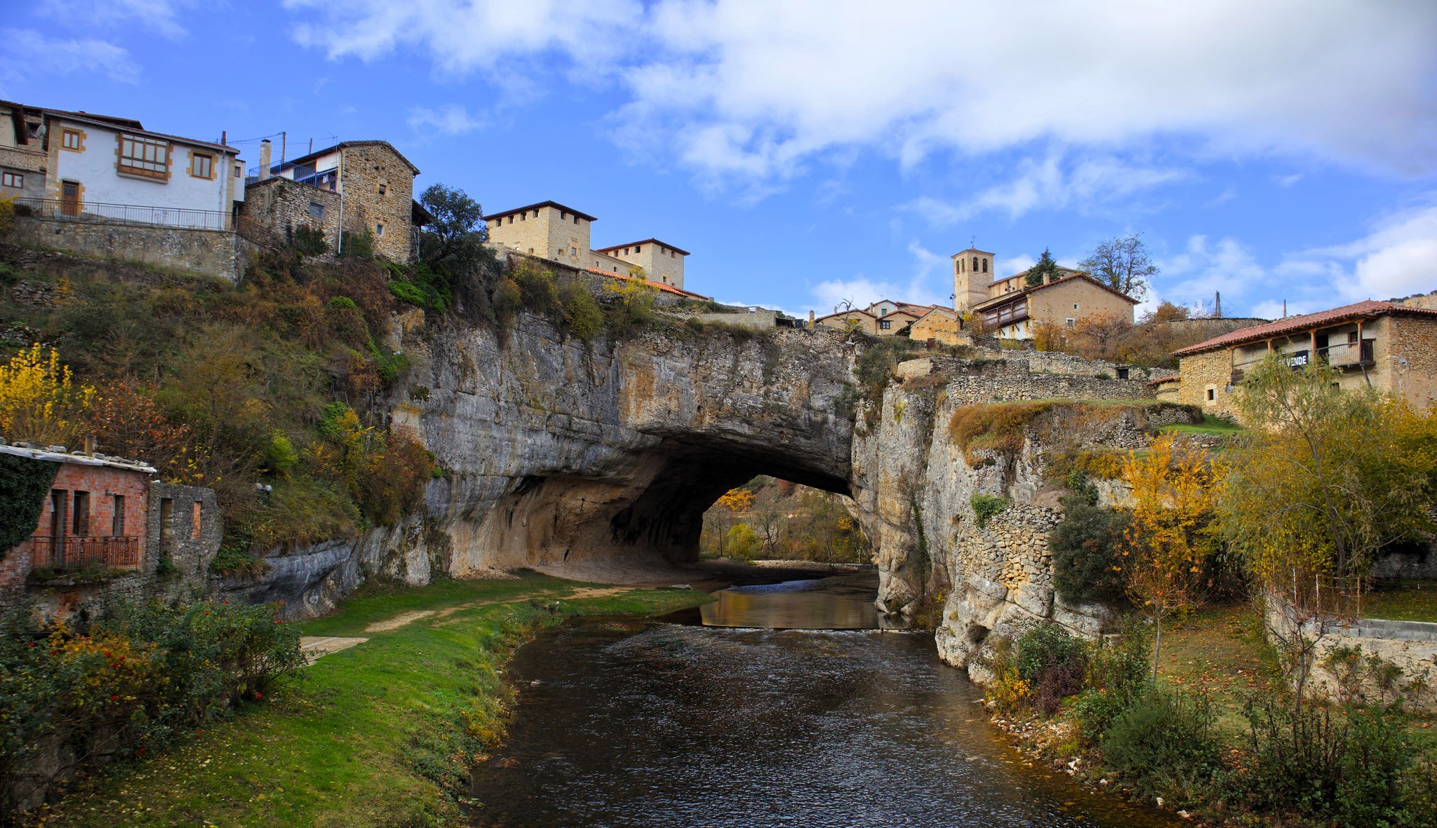
Beautiful and surprising place. It's somewhat hidden if you don't look closely; a very curious cave-like structure opens up in the canyon. Its origin is unclear, but they have plenty of hypotheses! Definitely a must-see if you're passing by this road!
0
0
Caves dug into the road from Trespaderne to Oña. A very cool place whose origin is unclear, whether they were used to shelter nomads or as cells for monks.
0
0
Frequently Asked Questions
How many road cycling routes are available in the Los Altos area?
Los Altos offers a wide selection of road cycling routes, with over 45 tours available. These routes cater to various skill levels, including easy, moderate, and challenging options.
What kind of terrain can I expect on road cycling routes around Los Altos?
The Los Altos region is known for its diverse terrain, featuring rolling hills, lush scenery, and a semi-rural atmosphere. You'll encounter well-paved surfaces, though some segments may be unpaved and more challenging. Routes often provide expansive views towards the Santa Cruz Mountains and Silicon Valley, traversing varied suburban and natural landscapes, including vineyards and reservoirs.
Are there challenging road cycling routes in Los Altos for experienced cyclists?
Yes, Los Altos is an excellent destination for experienced cyclists seeking a challenge. Routes like those around Stevens Creek Reservoir, including the Stevens Creek Reservoir – Black Mountain loop, offer significant elevation gains and require good to very good fitness. Other demanding ascents can be found on roads such as Moody Road, Page Mill Road, and Old La Honda Road.
Are there any easy or beginner-friendly road cycling routes in Los Altos?
While many routes feature elevation changes, Los Altos does offer options suitable for beginners. The region includes routes that traverse varied suburban and natural landscapes, providing a mix of challenging climbs and quieter, scenic stretches. The Palo Alto-Los Altos Bike and Pedestrian Path (Hetch Hetchy Trail) is a well-maintained multi-use route popular for biking and offers scenic views, connecting to parks like Terman Park.
What are some scenic viewpoints or natural features to look out for on Los Altos road cycling routes?
Road cycling in Los Altos offers numerous scenic highlights. You can enjoy picturesque views of vineyards and the Santa Cruz Mountains, especially on routes like the Altamont Road Vineyard – Elena Road Viewpoint loop. Other notable natural features include the Arastradero Preserve with its panoramic bay views, Stevens Creek Reservoir, and the breathtaking vistas from Black Mountain on Monte Bello Ridge.
Can I find loop routes for road cycling in Los Altos?
Yes, many road cycling routes in Los Altos are designed as loops, allowing you to start and end at the same point. Examples include the Junipero Serra Boulevard – Arastradero Lake loop, the Altamont Road Vineyard – Elena Road Viewpoint loop, and various loops around Stevens Creek Reservoir.
What is the best time of year for road cycling in Los Altos?
Los Altos generally offers favorable conditions for road cycling for much of the year due to its mild climate. The region's semi-rural atmosphere and diverse landscapes are enjoyable in spring and fall. While winter conditions are generally mild, some native trails in Los Altos Hills can be more challenging during this season.
Are there any family-friendly road cycling options in Los Altos?
For families, the Palo Alto-Los Altos Bike and Pedestrian Path, also known as the Hetch Hetchy Trail, is a great option. It's a well-maintained multi-use route that is popular for biking and offers scenic views, connecting to parks like Terman Park, providing a more relaxed cycling experience.
Where can I find parking for road biking trails in Los Altos?
Many popular starting points for road cycling routes in Los Altos, such as Rancho San Antonio County Park, offer parking facilities. It's advisable to check specific route descriptions or park websites for detailed parking information before your ride.
What do other road cyclists enjoy most about road cycling in Los Altos?
The Los Altos area is highly rated by the komoot community, with an average score of 4.7 stars. Reviewers often praise the diverse terrain, from rolling hills to scenic landscapes, and the well-established network of routes that cater to various fitness levels. The stunning natural scenery, including vineyards, reservoirs, and mountain views, is frequently highlighted.
Are there any long-distance road cycling routes in Los Altos?
Yes, Los Altos offers several longer road cycling routes for those looking for extended rides. For example, the Junipero Serra Boulevard – Palo Alto-Los Altos Bike Path loop is a 22.6-mile (36.3 km) route, and more challenging options like the Stevens Creek Reservoir – Black Mountain loop extend to 48.2 km (30 miles) with significant elevation.
Can I find routes that pass through Los Altos Hills?
Yes, Los Altos Hills, known for its natural beauty and serene atmosphere, contributes to the overall semi-rural charm of the region. Many cycling routes integrate pathways and roads within Los Altos Hills, offering quiet, scenic stretches and connecting to longer climbs.
Most popular attractions around Los Altos

Get inspired with the komoot mobile app


Explore more
Browse the best Road cycling routes in other regions.
