The best road cycling routes around Mancera De Arriba
53
riders
6
rides
Road cycling around Mancera De Arriba, situated in the northwestern part of Ávila province, offers varied terrain for cyclists. The area is characterized by "tierra llana" or flat land, providing routes suitable for less strenuous rides and long-distance cycling. While the immediate vicinity features gentle plains and scenic valleys, the region's proximity to the Sierra de Gredos Regional Park allows access to demanding mountain passes and significant elevation gains. This combination provides diverse road cycling opportunities, from relaxed spins through…
Last updated: May 21, 2026
8
riders
118km
05:40
1,490m
1,490m
Hard road ride. Very good fitness required. Mostly well-paved surfaces and easy to ride.
14
riders
70.4km
03:05
670m
670m
Moderate road ride. Good fitness required. Mostly well-paved surfaces and easy to ride.

Sign up for free
13
riders
85.7km
03:53
950m
950m
Hard road ride. Very good fitness required. Mostly well-paved surfaces and easy to ride.
8
riders
103km
04:41
1,170m
1,170m
Hard road ride. Very good fitness required. Mostly well-paved surfaces and easy to ride.
6
riders
42.3km
02:03
620m
620m
Moderate road ride. Good fitness required. Mostly well-paved surfaces and easy to ride.
Our route recommendations are based on thousands of hikes, rides, and runs completed by other people on komoot.
Start today with a free account
Your next adventure awaits.
Login or Signup
Popular around Mancera De Arriba

Tips from the Community

The Church of San Miguel in Peñaranda de Bracamonte is a beautiful classicist-style temple, built in quarry stone. Although its interior was severely damaged in 1971, its imposing exterior façade remains a testament to its history. After the fire of 1971, only the main altar chapel was saved, where the main altarpiece was located, a baroque masterpiece made by Sebastián Ducete and Esteban de Rueda. The chapel of San Antonio is also preserved, and in it you can see the Cristo de la Cama, an object of great local devotion. The stone baptismal font is original and was remodeled under the direction of Fernando Pulín, who received the National Restoration Award for his work. If you ever visit Peñaranda de Bracamonte, be sure to admire this architectural gem. 🌟🏰
2
0

This church was dedicated to the Archangel Michael "San MIGUEL". The name (coming from the Hebrew language) means "Who is like God?". He is often depicted - in paintings or as a statue - with a flaming sword, and occasionally a lance. Michael / Miguel is - along with Raphael, Gabriel and Uriel - one of the four archangels who (according to human understanding) occupy the highest rank in the heavenly hierarchy of angelic beings. Their common feast day in the saints' calendar is September 29th.
1
0

Small town that is located at the foot of the northern side of the Sierra de Ávila and that the center is governed by the parish church of San Juan Bautista. It is worth taking a stroll through its streets.
1
0

The history of this town is linked to the fact that it is the head of a region, Tierra de Peñaranda, also known as Campo de Peñaranda. Its churches and streets are very beautiful!
0
0
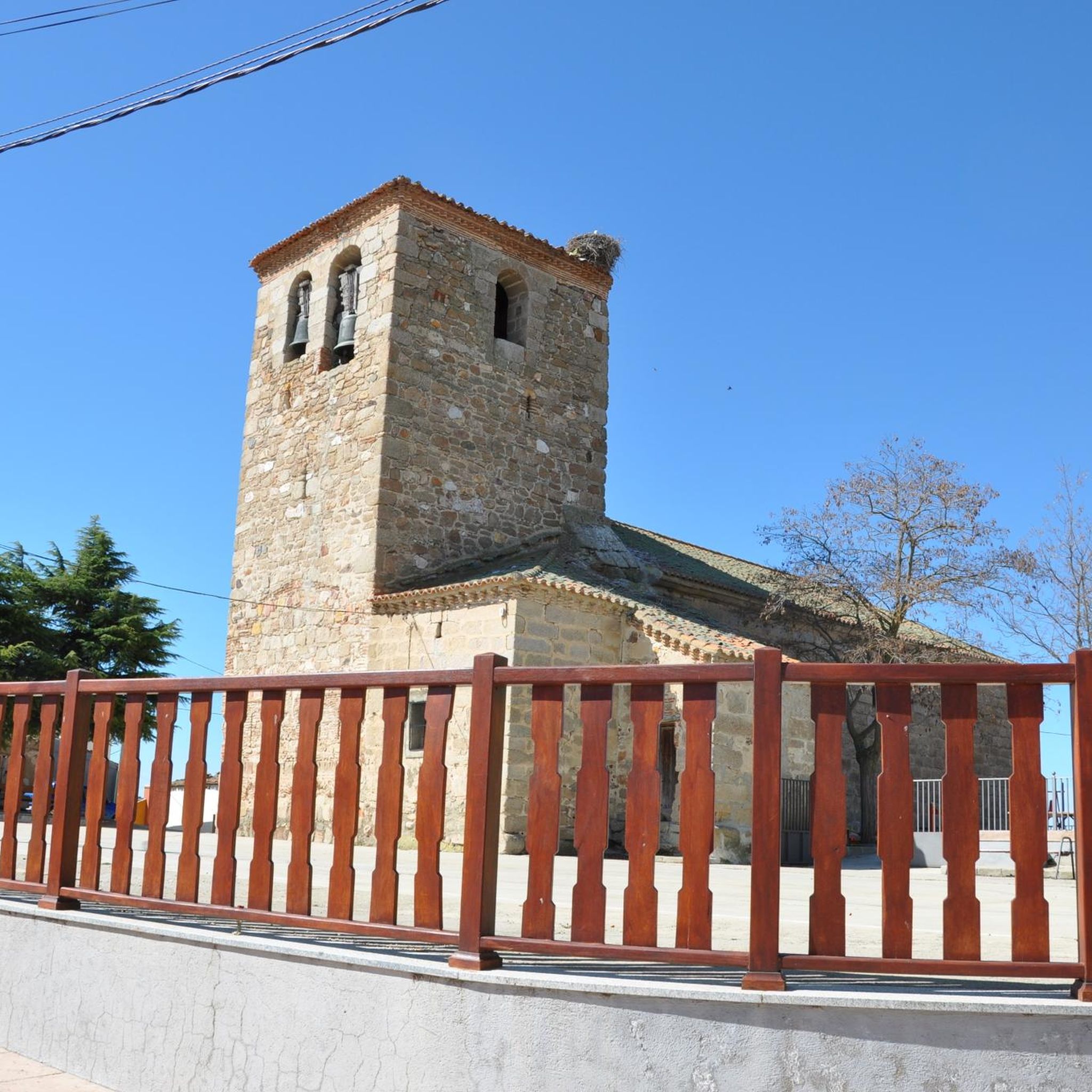
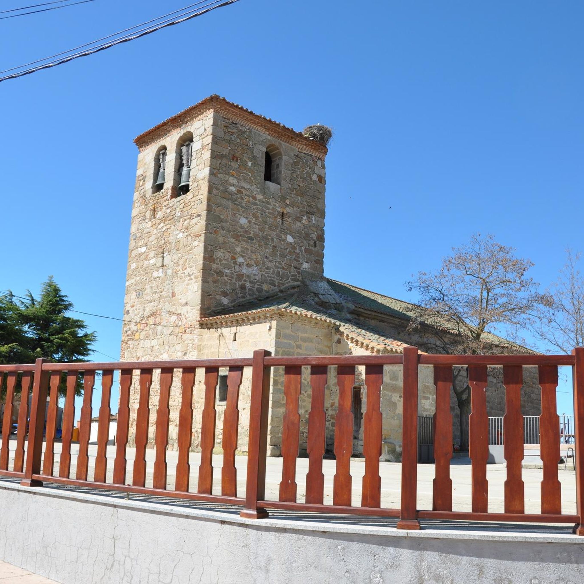
Beautiful church located in the town of Mancera de Arriba. This one, made of stone from the area, has flagged the core since a long time ago.
0
0
The relief of the municipality is formed by two mountainous areas separated by the Amblés valley, through which the Adaja river runs, which is born in the territory. The northern area is called Sierra de Villanueva, a branch of the Sierra de Ávila.
0
0
Mountain pass located in the center of the province of Ávila and which is 1,499 meters above sea level and connects the Amblés valley with San Juan del Olmo and the Muñico valley.
0
0
Frequently Asked Questions
What kind of terrain can I expect when road cycling around Mancera de Arriba?
The region around Mancera de Arriba offers a diverse mix of terrain. You'll find "tierra llana" or flat land, which is ideal for less strenuous rides and long-distance cycling through gentle plains and scenic valleys. However, the proximity to the Sierra de Gredos Regional Park also provides access to demanding mountain passes and significant elevation gains for those seeking more challenging ascents.
Are there routes suitable for beginners or those seeking easier rides?
Yes, the area around Mancera de Arriba includes routes suitable for various ability levels. While many routes feature significant climbs, there are options that traverse rolling terrain through the local countryside, offering a more moderate experience. For example, the Fuente del Oro – Mancera de Arriba loop from Cabezas del Villar is a moderate 43.7-mile path with rolling terrain.
Where can I find challenging road cycling routes near Mancera de Arriba?
For challenging rides, look towards the Sierra de Ávila and the Sierra de Gredos. These areas offer routes with substantial climbs and significant elevation gains. An example is the Ascents to the Sierra de Ávila and Villanueva — circular from Peñaranda de Bracamonte, a difficult 73.1-mile route featuring considerable ascents.
What natural features or landmarks can I see while cycling in the region?
Beyond the varied landscapes of plains and mountains, the region offers historical and natural points of interest. You can explore areas near the Sierra de Gredos Regional Park with its dramatic limestone peaks and diverse flora. Historically, Mancera de Arriba itself has preserved remains of a Roman villa, including in-situ mosaics, at the site of La Claverona, and charming medieval villages dot the wider Ávila landscape.
Is parking available for cyclists in Mancera de Arriba or nearby?
While specific parking facilities for cyclists are not detailed, Mancera de Arriba and surrounding villages like Peñaranda de Bracamonte or Cabezas del Villar typically offer public parking options. It's advisable to check local parking regulations upon arrival, especially in smaller village centers.
When is the best time of year for road cycling around Mancera de Arriba?
The best time for road cycling around Mancera de Arriba is generally during spring (April to June) and autumn (September to October). During these seasons, temperatures are milder and more comfortable for cycling, and the natural scenery is particularly vibrant. Summers can be hot, especially in the plains, while winters can bring colder temperatures and potentially adverse weather conditions in higher elevations like the Sierra de Gredos.
Are there family-friendly road cycling options in the area?
For family-friendly road cycling, focus on the "tierra llana" or flatter areas around Mancera de Arriba. These gentle plains and scenic valleys offer less strenuous routes, which can be more suitable for families or those looking for a relaxed ride. Always consider the distance and elevation gain of a route to ensure it matches your family's comfort level.
Are there any circular road cycling routes available?
Yes, several circular routes are available, allowing you to start and end your ride in the same location. Examples include the Ascents to the Sierra de Ávila and Villanueva — circular from Peñaranda de Bracamonte, the Fuente del Oro – Mancera de Arriba loop from Cabezas del Villar, and the Fuente del Oro – Las Fuentes Pass loop from Peñaranda de Bracamonte.
What is the average elevation gain on road cycling routes in this region?
The elevation gain varies significantly depending on the route's location. Routes in the flatter "tierra llana" areas will have more moderate gains, such as the Fuente del Oro – Mancera de Arriba loop from Cabezas del Villar with over 2,200 feet (670 meters) of ascent. However, routes venturing into the Sierra de Ávila or Sierra de Gredos can feature substantial climbs, with some difficult routes exceeding 4,900 feet (1,490 meters) of elevation gain.
Are there options for long-distance road cycling?
Absolutely. The "tierra llana" around Mancera de Arriba is well-suited for long-distance cycling, offering comfortable settings for extended rides. Many routes, even those with significant climbs, cover distances of 40 to over 70 miles (60 to 110 kilometers), providing ample opportunity for endurance cyclists.
What are the road conditions like for cycling?
The region generally offers well-paved surfaces, especially on main and secondary roads connecting villages. However, as with any rural area, conditions can vary, and some smaller roads might have older asphalt. Cyclists should always be prepared for varying road quality, particularly when venturing into more remote or mountainous areas.
Can I find places to eat or stay overnight near the routes?
Mancera de Arriba and the surrounding towns and villages in Ávila province offer various amenities. You can find cafes, pubs, and accommodation options in these settlements, providing convenient stops for refreshments or overnight stays. It's recommended to plan your route and check for available services in advance, especially in smaller villages.
Most popular routes around Mancera De Arriba

Get inspired with the komoot mobile app


Explore more
Browse the best Road cycling routes in other regions.
