The best running trails around Cogeces Del Monte
48
runners
12
runs
Jogging around Cogeces Del Monte offers diverse natural landscapes, characterized by a network of moors and valleys. The terrain includes pine forests, groves, and numerous springs and streams, providing varied running surfaces and scenic routes. This region, situated between Campo de Peñafiel and Tierra de Pinares de Cuéllar, presents a mix of undulating paths and sheltered valley trails. The natural features create a dynamic environment for runners.
Best jogging routes around Cogeces Del Monte
- The most popular jogging route is…
Last updated: July 25, 2026
Moderate run. Good fitness required. Mostly paved surfaces. Suitable for all skill levels.
Moderate run. Good fitness required. Mostly accessible paths. Some sure footedness required.

Sign up for free
17
runners
10.4km
01:12
70m
70m
Moderate run. Good fitness required. Mostly paved surfaces. Suitable for all skill levels.
17
runners
7.26km
00:47
0m
0m
Moderate run. Good fitness required. Mostly paved surfaces. Suitable for all skill levels.
12
runners
Moderate run. Good fitness required. Mostly paved surfaces. Suitable for all skill levels.
Get access to more routes and recommendations from other explorers.
Sign up for free
Already have an account?
Our route recommendations are based on thousands of hikes, rides, and runs completed by other people on komoot.
Start today with a free account
Your next adventure awaits.
Login or Signup
Tips from the Community

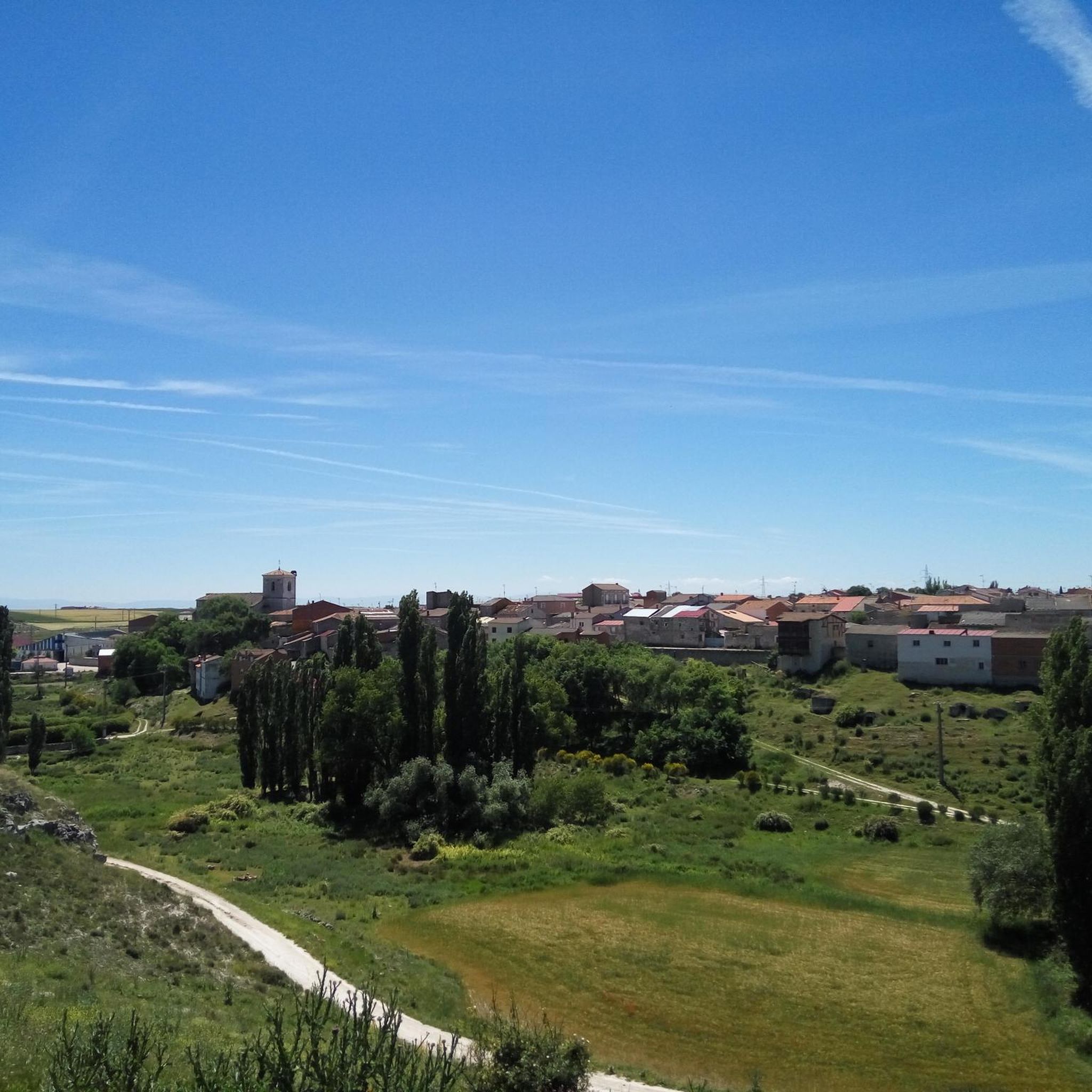
The Mirador de la Atalaya in Traspinedo (Valladolid) is one of the most beautiful spots to enjoy panoramic views of the Duero Valley and the municipality itself. It's part of the Sendero de la Atalaya (PRC-VA 49), a very accessible and well-signposted circular route.
3
0
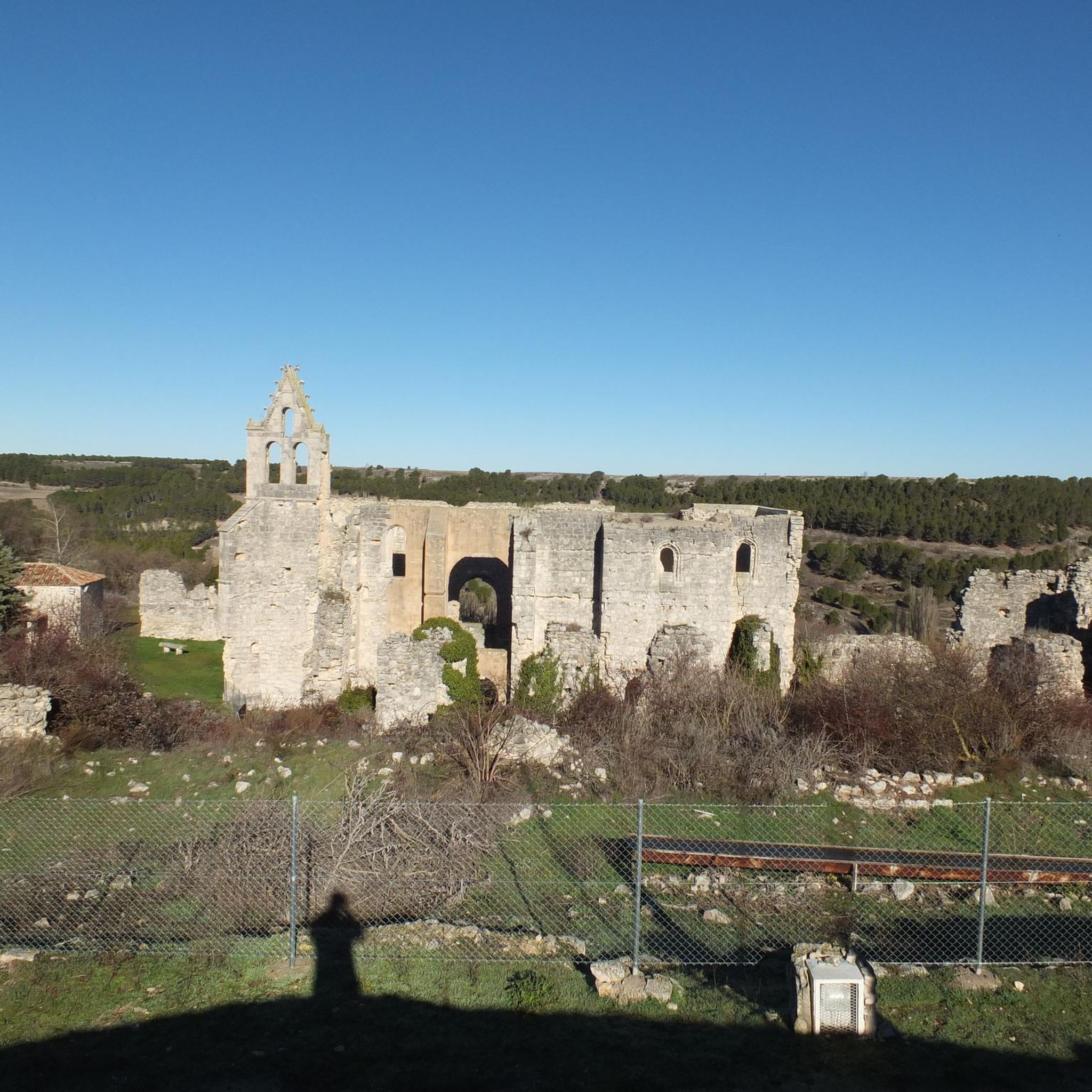
The Old Hermitage of Traspinedo is a favorite place for hiking lovers. Its location on the outskirts of town makes it ideal for a quiet and contemplative walk. If you ever visit Traspinedo, do not hesitate to explore this historical corner and enjoy its charm. 🌿🏰 Despite its current state, the entrance arch and stone cross add a touch of beauty and mystery to the place.
6
0

The church of San Juan de Santibáñez de Valcorva, built between the 12th and 13th centuries, has a brick Mudejar or Romanesque style. It is the oldest church in the region and is protected by the castle or Casa Fuerte de Santibáñez de Valcorba on its north side and by the Valcorba stream on its south side. Over the centuries, it has undergone extensions and modifications, including the construction of a Gothic nave and a fortress bell tower in the 17th century.
1
0
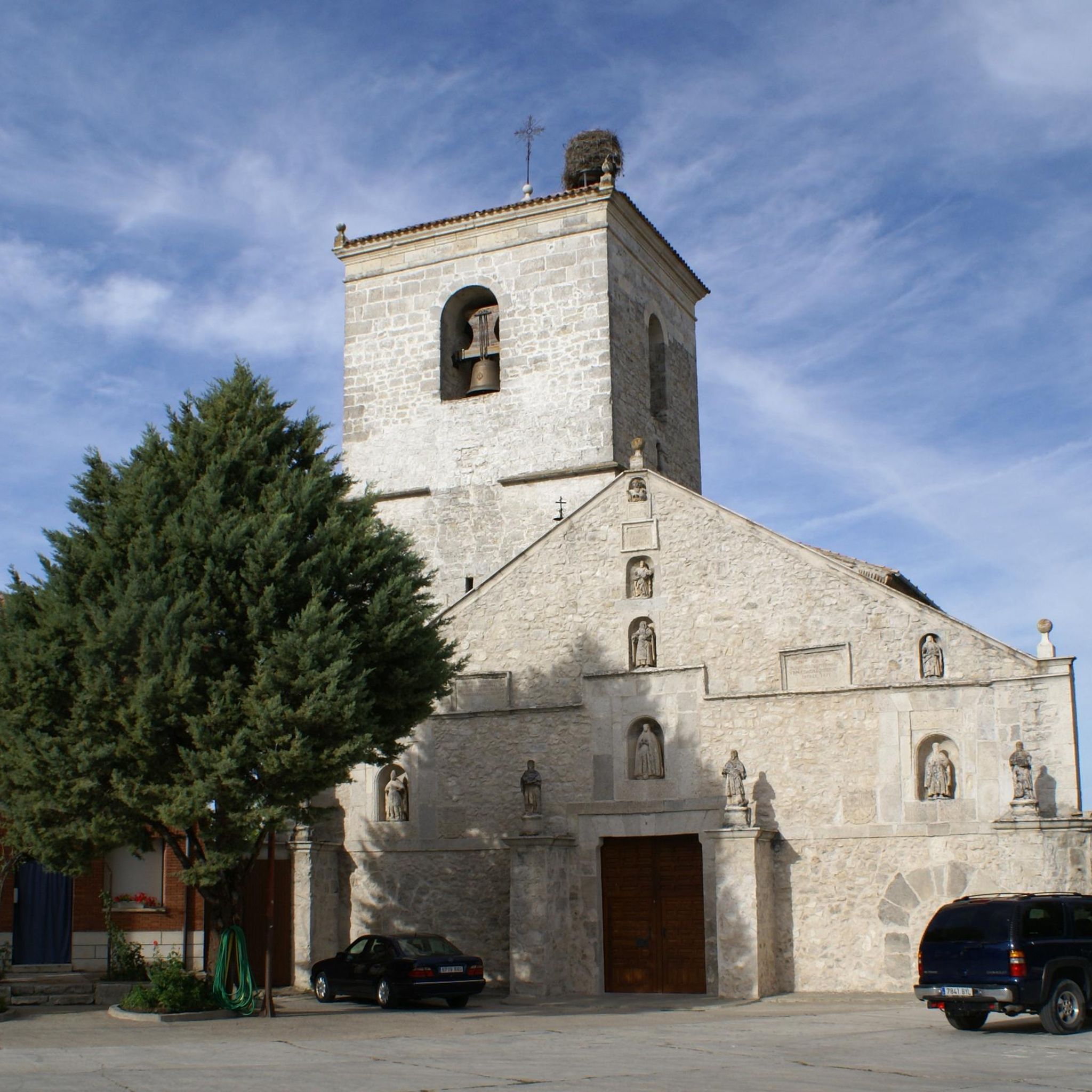
Architectural treasure from the 16th century IN the Gothic style that stands out for its elegant doorway and its spacious interior. Its stone walls keep centuries of history and its main altarpiece is an impressive work of art. The church is a place of devotion and charm, where you can appreciate the beauty of religious art.
1
0

Viewpoint located in the middle of the Valcorba trail with panoramic views of the valley of the same name.
1
0
Religious sanctuary dating from the 13th century in which some remains of Mudejar architecture are preserved. It is the oldest church in the region and one of the oldest in the province
1
1
On this hill south of Traspinedo we find a clariana in the forest known as Mirador de la Atalaya with a bicentennial oak.
1
1
A little outside of the small town of Traspinedo are the ruins of a small hermitage known as "hermitage del Humilladero".
1
1
Frequently Asked Questions
What kind of terrain can I expect on the running routes around Cogeces del Monte?
The region offers a diverse landscape for runners, characterized by a "labyrinth of moors and valleys." You'll find a mix of open moorland, sheltered valley paths, pine forests, groves, and numerous fresh springs and streams. This provides varied running surfaces, from undulating trails to softer, shaded paths, suitable for different preferences.
Are there running routes suitable for beginners or those looking for an easier jog?
While all routes listed in this guide are categorized as moderate, the area's diverse terrain includes gentle, flat stretches, especially along valley paths and through groves. Routes like the Running loop from Campaspero, with minimal elevation gain, offer a relatively smooth experience, making them suitable for those seeking a less strenuous run.
How many jogging routes are available in the Cogeces del Monte area?
There are over 8 dedicated jogging routes around Cogeces del Monte listed on komoot, offering a variety of distances and experiences for runners to explore the local landscape.
What are some natural features or landmarks I might encounter while running?
Many routes will take you through scenic pine forests and groves, past numerous fresh springs, and along streams. You might also pass by historical sites such as the ruins of the 15th-century Armedilla Monastery, which is about 4 kilometers from town, or the unique Duero Route in Sardón del Duero. The region's "páramos y vallejos" (moors and small valleys) also offer dynamic views.
Are there any circular running routes in the area?
Yes, several routes are circular, allowing you to start and finish in the same location. Examples include the popular Sendero de la Atalaya (PRC-VA 49) and the Sendero del Valcorba (PRC®-VA 21), both designed as circular trail runs.
What is the best time of year to go running in Cogeces del Monte?
The presence of many fresh springs ensures a pleasant experience even during warmer months, providing natural hydration points. However, the pine forests and groves offer shade, making spring and autumn particularly enjoyable for running. Winter can also be beautiful, though some paths might be affected by weather conditions.
Are the running trails around Cogeces del Monte dog-friendly?
Many natural trails in the Cogeces del Monte area are suitable for running with dogs. However, it's always recommended to keep your dog on a leash, especially in areas with wildlife or near agricultural land, and to respect local regulations regarding pets in natural spaces.
Are there any family-friendly running options?
The varied terrain includes gentle paths and shaded areas that can be suitable for families. Routes with less elevation gain, such as the Running loop from Campaspero, might be good options for families looking for a more relaxed outdoor activity, though specific pushchair access is not guaranteed on all trails.
Where can I find parking near the running routes?
While specific parking information for each trailhead is not always detailed, many routes start from or pass through villages like Traspinedo or Santibáñez de Valcorba, where you can typically find public parking. For routes starting directly from Cogeces del Monte, parking within the town is usually available.
Are there cafes or restaurants near the running trails in Cogeces del Monte?
Cogeces del Monte and nearby villages offer local cafes and restaurants where you can refuel after your run. Some natural springs, like those in the Valdecascón area, even have small gardens and picnic areas, perfect for a post-run break with your own refreshments.
What is the typical distance and elevation gain for running routes in this area?
The routes vary in distance, generally ranging from approximately 3 to 5 miles (5 to 8 km). Elevation gains are typically moderate, often between 50 and 150 meters, providing a good workout without being overly strenuous for most runners. For example, the Sendero de la Atalaya is 3.2 miles with 127 meters of elevation gain.
Are there any permits required to use the jogging trails?
Generally, no specific permits are required for jogging on the public trails and paths around Cogeces del Monte. However, it's always good practice to respect private property and any posted signs in protected natural areas.
Most popular attractions around Cogeces Del Monte

Get inspired with the komoot mobile app


Explore more
Browse the best Running Trails & Routes in other regions.
