The best MTB trails around Osso De Cinca
16
riders
7
rides
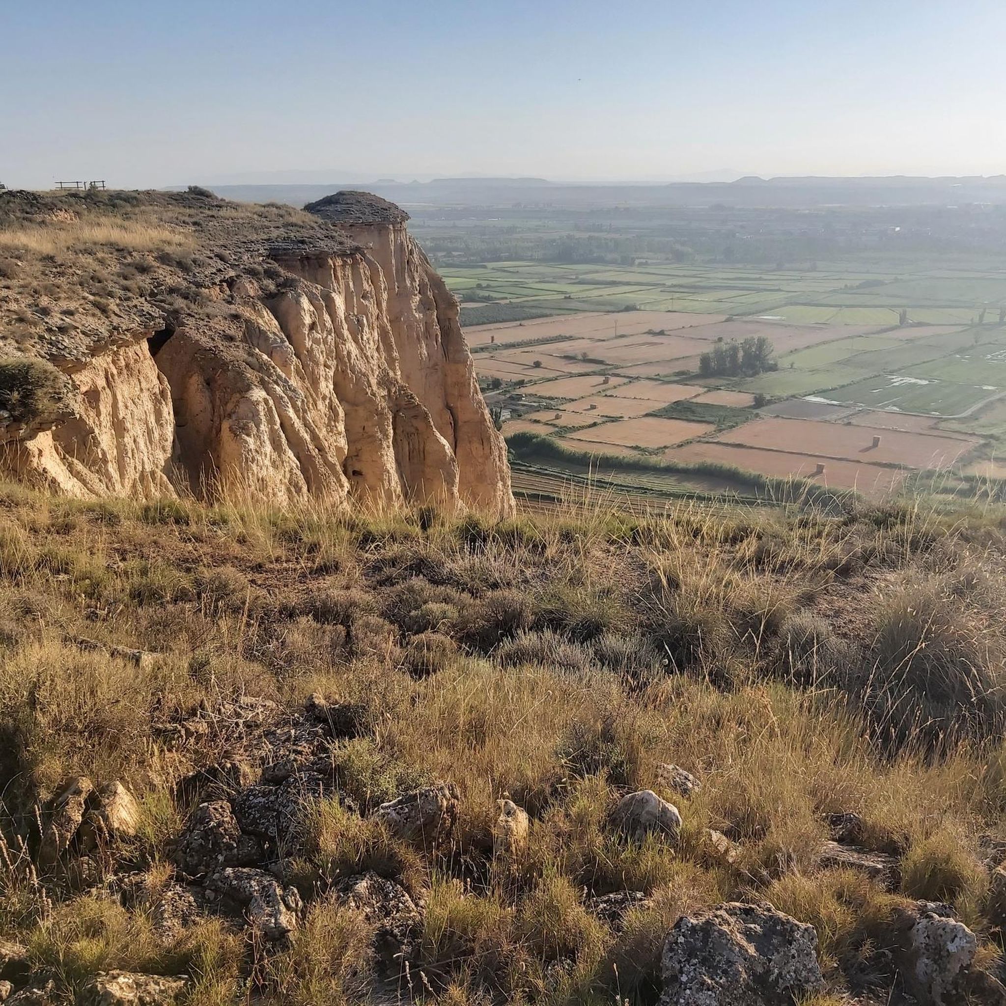
Mountain biking around Osso De Cinca offers diverse landscapes within the Bajo Cinca region of Huesca, Aragon, Spain. The area is characterized by the Cinca River valley, flanked by the Montes de la Encomienda and Calavera, providing lush riparian forests. Contrasting with these verdant areas are the more arid landscapes of Los Monegros, offering varied terrain. Proximity to the Pre-Pyrenean ranges introduces canyons, mountain passes, and valleys, creating a wide array of scenic backdrops for rides.
Best mountain bike trails…
Last updated: August 8, 2026
3
riders
34.2km
02:46
390m
390m
Moderate mountain bike ride. Good fitness required. Suitable for all skill levels.
3
riders
60.5km
04:42
710m
710m
Moderate mountain bike ride. Good fitness required. Suitable for all skill levels.

Sign up for free
2
riders
30.4km
02:21
330m
330m
Moderate mountain bike ride. Good fitness required. Suitable for all skill levels.
1
riders
39.8km
03:26
550m
550m
Moderate mountain bike ride. Good fitness required. Suitable for all skill levels.
2
riders
18.8km
01:34
280m
280m
Easy mountain bike ride. Great for any fitness level. Suitable for all skill levels.
Get access to more routes and recommendations from other explorers.
Sign up for free
Already have an account?
Our route recommendations are based on thousands of hikes, rides, and runs completed by other people on komoot.
Start today with a free account
Your next adventure awaits.
Login or Signup
Popular around Osso De Cinca

Tips from the Community

It's very well set up, the only thing is that it's packed with people and some stop wherever they can without realizing that they're in the middle of the route, hindering those who have no intention of stopping. In my case, in this 2025 edition, I only made a brief stop at the third refreshment station.
1
0

It is a small stone shelter typical of the Monegros region, designed to provide shelter for shepherds or hikers in bad weather.
6
0
It's a small stone monolith that marks one of the highest points of the route, and although it's not very large, everyone who passes by instantly recognizes it. After kilometers of open slopes and wind (sometimes very strong), reaching the Pilón is like a symbol that you've overcome most of your hard work. Many take the opportunity to make a brief stop, take a quick photo, and catch their breath before continuing.
5
0
The climb is steep but steady, traversing a landscape typical of the area: open fields, dusty roads, and very little shade. When the wind blows, as it often does, the effort is multiplied. From the top, the views are wide and spectacular, pure Monegros: endless horizons, ochre tones, and a sense of immensity.
1
0

Spectacular scenery in April
3
0
It's located in a spacious and well-organized area, designed so that the hundreds of bikers could stop, refuel, and continue quickly. Fresh water, isotonic drinks, bananas, bars, and nuts were provided... just the right amount to recharge without losing the pace. The atmosphere was great: riders cheered each other on, mechanics were quick to assist if any basic repairs were needed, and attentive volunteers were available to offer whatever you needed almost before you even asked. Many of us took the opportunity to wipe the dust off our faces, refill our water bottles, and stretch a bit before continuing pedaling toward the second part of the race, where the wind had even more surprises in store for us.
3
0
Ascent to Piedrafita, very beautiful scenery, and then a very fun descent on the track.
0
0

Very interesting and nice for mtb
4
0
Frequently Asked Questions
What kind of terrain can I expect on mountain bike trails around Osso de Cinca?
The region offers a diverse mix of landscapes. You'll find lush riparian forests along the Cinca River, contrasting with more arid, steppe-like areas reminiscent of Los Monegros. Proximity to the Pre-Pyrenean ranges also means you can encounter canyons, mountain passes, and valleys, providing varied scenic backdrops for your rides.
Are there mountain bike trails suitable for beginners or families in Osso de Cinca?
While the guide highlights moderate to difficult routes, the broader Huesca province, where Osso de Cinca is located, is known for trails catering to all skill levels. You can find paths suitable for families and beginners, as well as more technical challenges. It's always recommended to check the specific trail details for difficulty ratings before heading out.
What are some notable natural features or viewpoints I might encounter on the trails?
Many routes offer panoramic views of the diverse landscapes. You'll often ride through the scenic Cinca River valley, with its verdant riparian forests. The region's varied terrain, from riverbanks to pre-Pyrenean foothills, ensures plenty of natural beauty. For specific viewpoints, consider exploring areas around the Santa Cruz Viewpoint (Alcolea Panorama).
Are there any historical routes or landmarks to explore while mountain biking?
Yes, the region boasts trails with historical significance. For instance, some paths follow the ancient aqueduct route of the Cinca hydroelectric scheme, which dates back to the early 20th century. You might also pass by historic churches and settlements like Osso de Cinca or Albalate de Cinca, blending sport with history.
What is the best time of year for mountain biking in Osso de Cinca?
The region's climate, influenced by its proximity to the Mediterranean and the Pre-Pyrenees, generally offers good conditions for outdoor activities. Spring and autumn are often ideal, providing pleasant temperatures and vibrant landscapes. Summers can be hot, especially in the more arid areas, so early morning or late afternoon rides are advisable then. Winters are generally mild, but higher elevations might experience cooler temperatures.
Are there any circular mountain bike routes available?
Yes, several routes in the area are designed as loops. For example, the Velilla de Cinca – Cinca River loop from Velilla de Cinca offers a scenic ride along the river, and the Alto de Piedrafita – Refugio Piedrafita loop from Ballobar takes you through mountainous terrain.
What are some other places of interest near the mountain bike trails?
Beyond the trails, you can explore cultural and historical sites. Notable attractions include the Ermita de Santa María de Chalamera and San Martín Church, Chalamera. The towns of Osso de Cinca and Albalate de Cinca also offer local charm.
How many mountain bike trails are featured in this guide for Osso de Cinca?
This guide features 5 mountain bike trails around Osso de Cinca, ranging from moderate to difficult in intensity. These routes showcase the diverse landscapes of the region.
What is a challenging mountain bike route in the area?
For a more challenging experience, consider the Fraga – Cinca River loop from Fraga. This difficult route spans 60.1 miles (96.7 km) and involves a significant elevation gain, typically taking nearly 7 hours to complete.
Are there any moderate-difficulty mountain bike trails that offer good views?
Yes, the Velilla de Cinca – Cinca River loop from Velilla de Cinca is a moderate 22.1 miles (35.5 km) path that provides a scenic ride along the Cinca River. Another moderate option is the Refugio Piedrafita loop from Ontiñena, which offers varied terrain.
What do other mountain bikers say about the trails in Osso de Cinca?
Over 10 mountain bikers have used komoot to explore Osso de Cinca's varied terrain. They often praise the diverse landscapes, from the Cinca River valley to the Pre-Pyrenean foothills, and the network of trails that cater to different ability levels.
Most popular routes around Osso De Cinca
Most popular attractions around Osso De Cinca

Get inspired with the komoot mobile app


Explore more
Browse the best MTB trails in other regions.
