The best walks and hikes around Karrantza Harana/Valle De Carranza
4.4
(63)
289
hikers
21
hikes
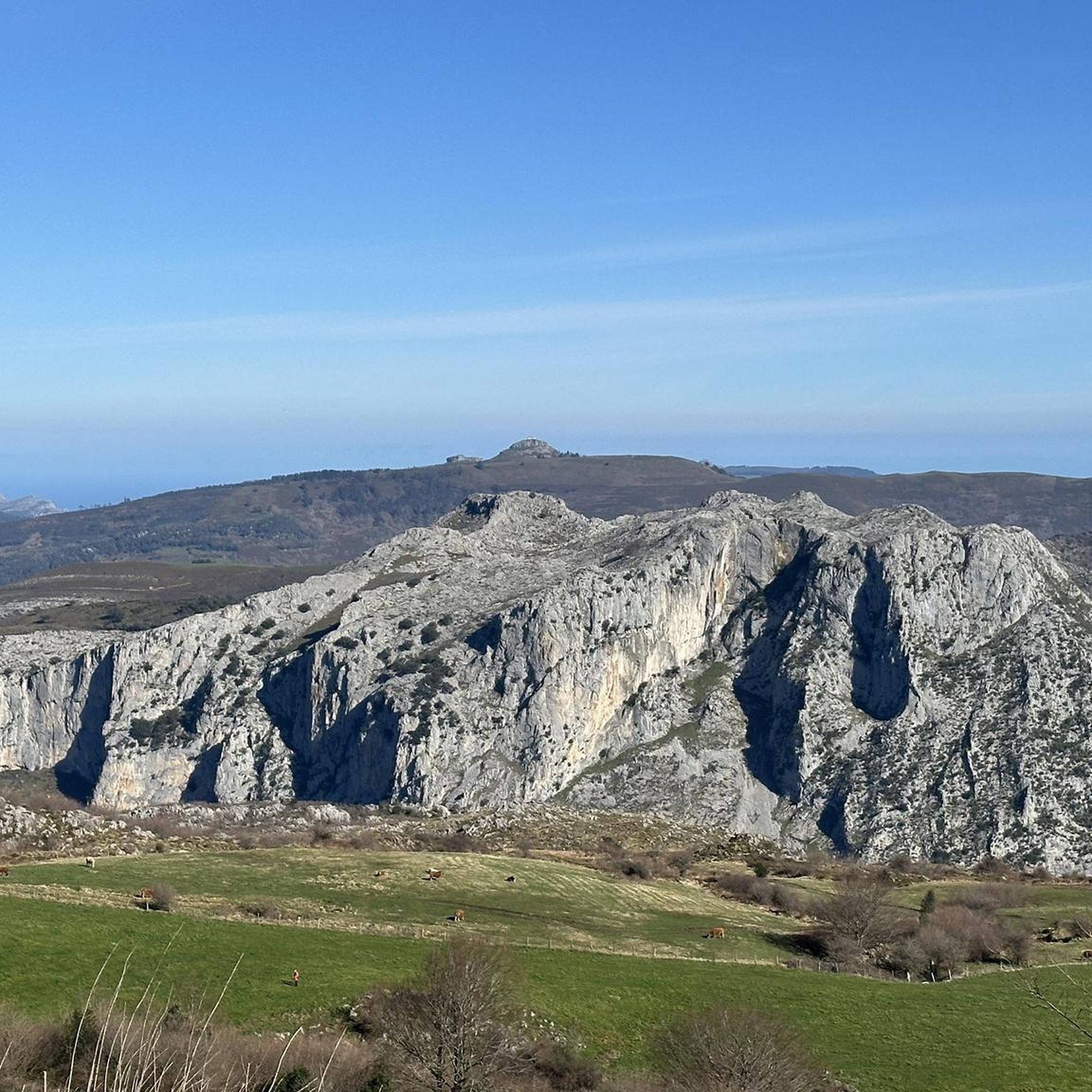
Hiking around Karrantza Harana/Valle De Carranza offers exploration of Bizkaia's largest municipality, characterized by a highly mountainous environment. The region is encircled by rugged chains and high summits, including peaks exceeding 1,000 meters like Zalama (1,335 m) and Mount Grande (1,108 m). The landscape features the Mayor and Calera Rivers flowing through steep gullies, alongside the Armañón Natural Park, known for its numerous caves and sinkholes. This terrain provides diverse hiking opportunities, from easy walks to challenging treks.
Best hiking…
Last updated: October 10, 2026
5.0
(1)
3
hikers
11.8km
03:28
340m
340m
Moderate hike. Good fitness required. Easily-accessible paths. Suitable for all skill levels.
5.0
(4)
23
hikers
14.8km
04:47
630m
630m
Moderate hike. Good fitness required. Easily-accessible paths. Suitable for all skill levels.

3.0
(2)
15
hikers
8.89km
03:06
410m
420m
Hard hike. Good fitness required. Sure-footedness, sturdy shoes and alpine experience required.
4.0
(2)
9
hikers
4.30km
01:22
180m
190m
Easy hike. Great for any fitness level. Easily-accessible paths. Suitable for all skill levels.
11
hikers
13.2km
04:46
800m
800m
Moderate hike. Good fitness required. Easily-accessible paths. Suitable for all skill levels.
Get access to more routes and recommendations from other explorers.
Already have an account?
Our route recommendations are based on thousands of hikes, rides, and runs completed by other people on komoot.
Start today with a free account
Your next adventure awaits.
Popular around Karrantza Harana/Valle De Carranza
Other adventures around Karrantza Harana/Valle De Carranza

Tips from the Community

Karst area and rugged terrain. Few indications of the path to the top. Some milestone of stones and scattered orange signs. It is essential to carry a GPS to navigate.
0
0
Fenced area for cattle use
0
0
Summit markers that mark the dividing line between Cantabria and Vizcaya
0
0
Dolmen on its top a few hundred meters following its crest the Armañon is reached
0
0

The Pozalagua cave is known for housing the largest collection of eccentric stalacticts in the world. Observing this curious phenomenon of nature is well worth a visit to the cave, considered an "underground cathedral". It is necessary to buy tickets and the visit lasts about 50 minutes. Keep in mind that it is quite cold inside the cave.
1
0
La Torca del Carlista is one of several caves found in the Karranza valley. The cavity is located under the Peña Ranero mountain and a large part of it is located on Cantabrian soil. It stands out for its large size, as the main chamber is the fifth largest underground chamber in the world.
0
0
Small waterfall in a beautiful and leafy beech forest near Mount Balgerri.
0
0

Beautiful summit of the Encartaciones that separates the valleys of Karrantza and Turtzioz.
0
0
Frequently Asked Questions
What types of hiking trails can I expect in Karrantza Harana/Valle De Carranza?
Karrantza Harana/Valle De Carranza offers a diverse range of hiking trails, from easy walks to challenging treks. The region is characterized by its mountainous environment, with peaks exceeding 1,000 meters, river valleys, and unique geological features within the Armañón Natural Park. You'll find routes suitable for various fitness levels, including those with significant elevation gain.
Are there any easy hiking trails suitable for beginners or families?
Yes, there are several easy trails. For instance, the Pozalagua Cave loop from Pozalagua-ko kobak is an easy 2.7-mile (4.3 km) route that takes about 1 hour 22 minutes, allowing you to explore the area around the notable Pozalagua Cave. The region has 6 easy routes in total.
What are some notable natural features or landmarks to see while hiking in the area?
The region is rich in natural beauty. A major highlight is the Armañón Natural Park, home to approximately 200 caves and sinkholes. The Cullalvera Cave is a significant attraction. You can also find impressive summits like Zalama Summit and Burgüeno Summit, offering expansive views.
Are there any circular hiking routes in Karrantza Harana/Valle De Carranza?
Yes, many of the trails in Karrantza Harana/Valle De Carranza are circular. Popular options include the Cotobasero and Bernalta Loop from Aldeacueva, and the Sorrondegi Summit (666 m) – Armañón Summit loop from El Suceso, which connects two significant peaks.
What is the best time of year to go hiking in Karrantza Harana/Valle De Carranza?
The best time for hiking generally depends on your preferred conditions. Spring and autumn offer milder temperatures and vibrant landscapes. Summer can be warm, while winter hiking is possible but may require more preparation due to potential snow or colder conditions in the higher mountainous areas.
What do other hikers enjoy most about the trails in Karrantza Harana/Valle De Carranza?
The trails in Karrantza Harana/Valle De Carranza are highly rated by the komoot community, with an average score of 4.3 stars from over 40 reviews. Hikers often praise the diverse mountainous terrain, the scenic river valleys, and the unique geological formations found within the Armañón Natural Park.
Are there any routes that offer views of multiple summits?
Absolutely. The Ordunte Summit (1,105 m) – Bicergi Summit (1160 m) loop from Lanzas Agudas is a great choice, connecting two prominent peaks and providing extensive panoramic views of the surrounding mountainous landscape.
Can I combine hiking with exploring caves in the region?
Yes, you can. The Pozalagua Cave loop from Pozalagua-ko kobak allows you to hike in the vicinity of the renowned Pozalagua Cave, which is famous for its eccentric stalactites. This offers a unique combination of surface hiking and underground exploration.
Are there any historical or cultural points of interest along the hiking trails?
Yes, the region offers a blend of natural and cultural exploration. The megalithic route of Haizko features historical monuments like the Fuentellano dolmen and La Cabaña necropolis, providing insights into the area's ancient past.
What is the overall difficulty level of hiking in Karrantza Harana/Valle De Carranza?
The hiking difficulty varies significantly. Out of 21 total tours, there are 6 easy routes, 10 moderate routes, and 5 difficult routes. This means you can find everything from gentle strolls to challenging ascents requiring good fitness and potentially alpine experience, with some trails featuring over 3,000 feet of elevation gain.
Are there any specific trails that lead to high viewpoints?
Many trails offer excellent viewpoints due to the mountainous nature of the region. For instance, the Bicergi Summit (1160 m) – Ilso de las Estacas Summit loop from Lanzas Agudas provides magnificent views of the surrounding mountains and green valleys from Ilso de las Estacas.
Most popular routes around Karrantza Harana/Valle De Carranza
Most popular attractions around Karrantza Harana/Valle De Carranza

Get inspired with the komoot mobile app


Explore more
Browse the best Hikes in other regions.
