The best running trails around Cristina
4.8
(3)
171
runners
12
runs
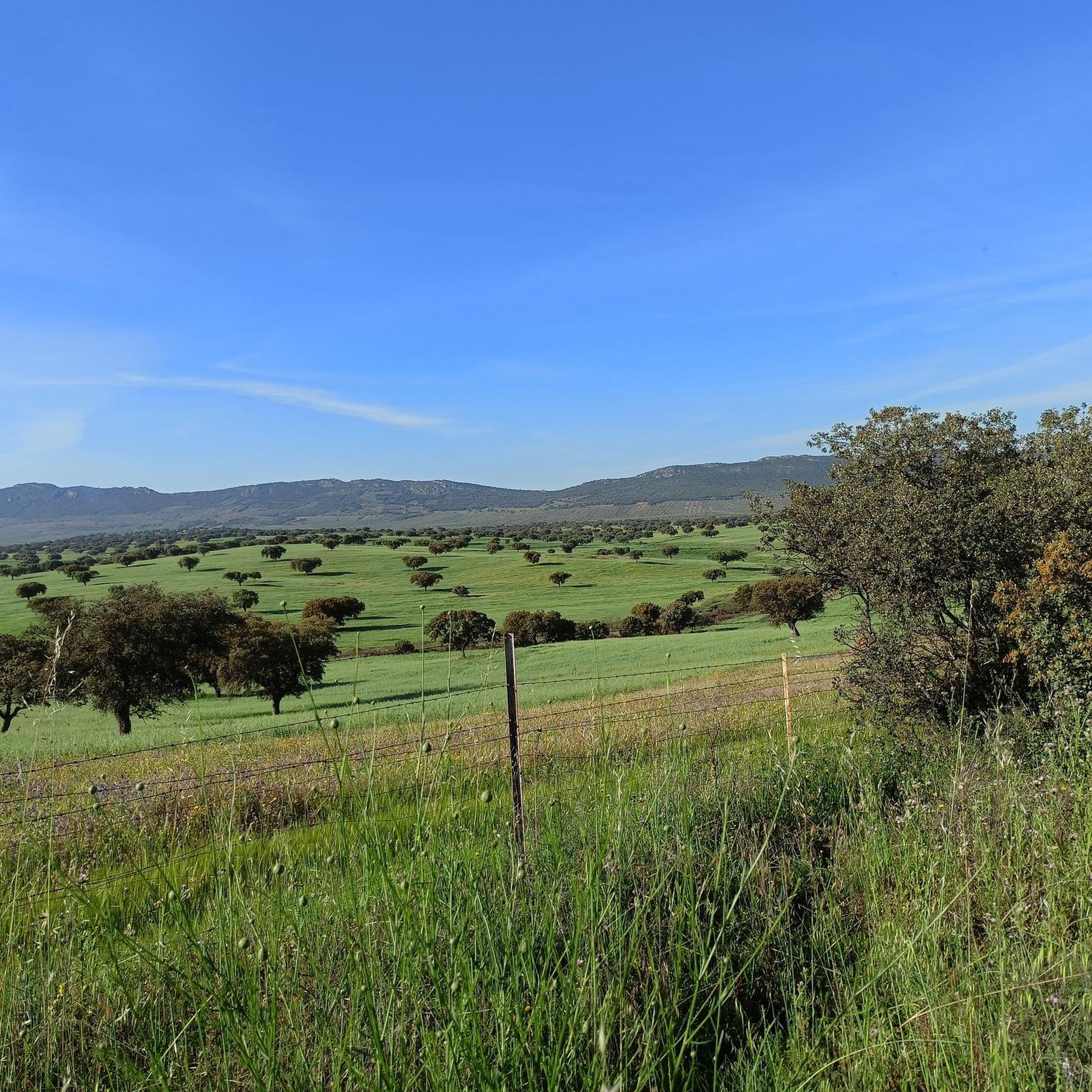
Jogging routes around Cristina traverse a landscape characterized by varied terrain, including hills and areas with notable elevation changes. The region features routes that offer views of natural reservoirs and extend through diverse natural settings. Runners can expect paths that range from moderate climbs to more challenging ascents, providing a comprehensive outdoor experience.
Best jogging routes around Cristina
- The most popular jogging route is Sierra de la Bóveda Trail, a 5.6 miles (9.1 km) trail that takes 1 hour…
Last updated: July 24, 2026
9.09km
01:07
130m
130m
Jogging the Los Balaídos by the Río Chaparral circular from Manchita is a moderate 5.6-mile route with 412 feet of gain, taking just over an
4
runners
11.8km
01:19
60m
60m
Moderate run. Good fitness required. Mostly paved surfaces. Suitable for all skill levels.

Sign up for free
6
runners
19.0km
02:21
310m
310m
Hard run. Very good fitness required. Mostly paved surfaces. Suitable for all skill levels.
3
runners
11.1km
01:20
130m
140m
Moderate run. Good fitness required. Mostly paved surfaces. Suitable for all skill levels.
4
runners
18.7km
01:59
120m
120m
Hard run. Very good fitness required. Mostly paved surfaces. Suitable for all skill levels.
Get access to more routes and recommendations from other explorers.
Sign up for free
Already have an account?
Our route recommendations are based on thousands of hikes, rides, and runs completed by other people on komoot.
Start today with a free account
Your next adventure awaits.
Login or Signup


Tips from the Community

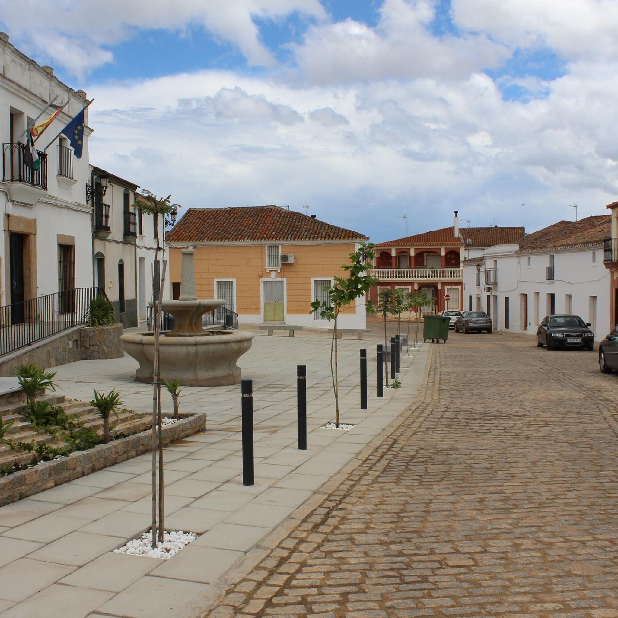
Nucleus that is located to the south of the banks of the Río Garona and close to the small mountains that are near the Embalse de Alange.
2
0
Small town located in the first rounded mountains where mountain ranges such as the Sierra de la Gangosa or Utrera begin, in an area where the Río Chaparral crosses.
0
0
La Zarza is a town located on the plain of the Río Guadiana, in a geographical area dominated by farmland with the Sierra de Juan Bueno and Peñas Blancas in the background.
0
1

Technical stony trails for the most adventurous mountain bikers. Located in the Sierra de Juan Bueno next to the Minas de la Zarza.
1
1
La Zarza is a town located on the plain of the Guadiana River, in a geographical area where agricultural areas predominate with the Sierra de Juan Bueno and Peñas Blancas as background walls.
0
0
Frequently Asked Questions
How many running routes are available around Cristina?
There are 13 dedicated running routes around Cristina, offering a variety of options for different fitness levels. These routes are highly rated by the komoot community, with an average score of 4.5 stars.
What kind of terrain can I expect on the jogging trails in Cristina?
Jogging routes around Cristina are characterized by hilly terrain and diverse natural landscapes. You'll find paths with moderate climbs, such as the Sierra de la Bóveda Trail, as well as more challenging ascents like the Minas de la Zarza loop from La Zarza, which features a significant elevation gain of 1098 feet (335 m).
Are there any easy running routes for beginners in Cristina?
Yes, Cristina offers options suitable for beginners. There is 1 easy route available, and 8 routes are classified as moderate, providing a good range for those starting out or looking for a less strenuous run. The Sierra de la Bóveda Trail is a moderate option that is popular and manageable.
Can I find circular running routes in Cristina?
Absolutely. Many of the running routes in Cristina are designed as loops, allowing you to start and finish in the same location. Examples include the challenging Alange Castle – Views of the Alange Reservoir loop from La Zarza and the Minas de la Zarza loop from La Zarza.
What are the typical distances and durations for running trails in Cristina?
The running trails in Cristina vary in length and duration. For instance, the Sierra de la Bóveda Trail is about 5.6 miles (9.1 km) and takes approximately 1 hour 6 minutes. Longer, more difficult routes like the Minas de la Zarza loop from La Zarza stretch over 13.4 miles (21.6 km) and can take around 2 hours 40 minutes.
What can I see along the running routes in Cristina?
Many running routes in Cristina offer expansive views of the Alange Reservoir and pass by significant landmarks. For example, the Alange Castle – Views of the Alange Reservoir loop from La Zarza provides stunning vistas and takes you past the historic Alange Castle. You can also explore nearby attractions like the Rock Paintings of La Calderita or the Minas de la Zarza.
Are there any family-friendly running options in Cristina?
While specific 'family-friendly' designations aren't provided, the 1 easy route and 8 moderate routes offer suitable options for families looking to jog together. Routes with less elevation gain, such as the Running loop from Villagonzalo, which has only 59 feet (18 m) of elevation gain, might be more appropriate for families.
What is the best time of year to go running in Cristina?
Given the region's characteristics, the best times for running in Cristina are typically during the spring and autumn months. These seasons offer milder temperatures, making for more comfortable conditions than the heat of summer or the cooler, potentially wetter days of winter. Always check local weather forecasts before heading out.
Are the running trails in Cristina suitable for dogs?
Many natural trails in Spain are generally dog-friendly, especially if your dog is well-behaved and kept on a leash. While there are no specific 'dog-friendly' designations in the guide data, the natural landscapes and varied terrain suggest that many routes, particularly those away from urban centers, could be suitable. Always ensure your dog is fit enough for the chosen route and carry water for both of you.
What do other runners enjoy most about jogging in Cristina?
The running routes in Cristina are highly rated by the komoot community, with an average score of 4.5 stars from over 2 reviews. Runners often praise the varied terrain, the beautiful reservoir views, and the immersive natural landscapes that define the area's trails. Over 170 runners have used komoot to explore Cristina's diverse running opportunities.
Are there any hidden gem running routes in Cristina?
While popular routes like the Sierra de la Bóveda Trail are well-loved, the Running loop from Villagonzalo offers a less strenuous, yet scenic, experience with minimal elevation gain, making it a potential hidden gem for those seeking a quieter run through natural surroundings.
Are there opportunities for wildlife spotting on the running trails?
Given the region's natural landscapes and proximity to the Alange Reservoir, there are certainly opportunities to observe local wildlife. The marshlands and natural parks in similar Spanish regions are known for diverse flora and fauna, including various bird species. Running through these natural settings, especially during quieter times of day, increases your chances of spotting local wildlife.
Most popular attractions around Cristina

Get inspired with the komoot mobile app


Explore more
Browse the best Running Trails & Routes in other regions.
