The best walks and hikes around Casavieja
4.6
(100)
584
hikers
64
hikes
Hiking around Casavieja offers access to the varied terrain of the Tiétar Valley in the Sierra de Gredos foothills. The region features river valleys, natural swimming pools, and forested areas, with higher elevations providing views of the surrounding landscape. Trails often follow watercourses and lead through rural settings, characteristic of the Ávila province.
Best hiking trails around Casavieja
- The most popular hiking route is Ruta del Tiétar – circular from Iglesuela del Tiétar (PR-TO 20), a 6.5 miles (10.4…
Last updated: October 11, 2026
5.0
(3)
26
hikers
10.4km
02:49
140m
140m
Moderate hike. Good fitness required. Easily-accessible paths. Suitable for all skill levels.
3.7
(3)
10
hikers
15.7km
04:49
550m
540m
Moderate hike. Good fitness required. Easily-accessible paths. Suitable for all skill levels.

5.0
(3)
23
hikers
15.3km
06:12
900m
900m
Hard hike. Very good fitness required. Mostly accessible paths. Sure-footedness required.
4.0
(2)
11
hikers
Hard hike. Very good fitness required. Mostly accessible paths. Sure-footedness required.
4.8
(5)
9
hikers
4.83km
01:24
130m
120m
Easy hike. Great for any fitness level. Easily-accessible paths. Suitable for all skill levels.
Get access to more routes and recommendations from other explorers.
Already have an account?
Our route recommendations are based on thousands of hikes, rides, and runs completed by other people on komoot.
Start today with a free account
Your next adventure awaits.



Tips from the Community

Gavilanes is a small municipality in Ávila, with only 600 inhabitants. It has a natural pool in the Chorro gorge, located southwest of the town, on Pedro Bernardo Avenue. However, its greatest attraction, which is worth visiting, is the waterfall in the Chorro gorge, two kilometers from the town, near the Machine House. It is the highest waterfall in the community.
1
0
Piedralaves is a charming municipality in the province of Ávila, located on the southern slope of the Gredos mountain range, near the Tiétar river. With a rich historical heritage, the 17th century church of San Antonio de Padua and the emblematic clock tower stand out. It is worth admiring the typical houses with wooden balconies and granite masonry, especially the Casa de los Balcones. Its natural environment, especially the Boyal pasture, provides opportunities for outdoor activities. Another beautiful place in the town is the Charca de la Nieta, a natural pool in the Nuño Cojo gorge.
2
1

The valley of the La Garganta del Niño Cojo goes from the ridge of the Sierra de Gredos to the same town of Piedralaves, they leave the Presa de Piedralves and in other parts, a magnificent view of the area.
1
0
From this point there are good views of the town of Mijares and how the southern slope of the Sierra de Gredos rises to more than two thousand meters in height.
1
0

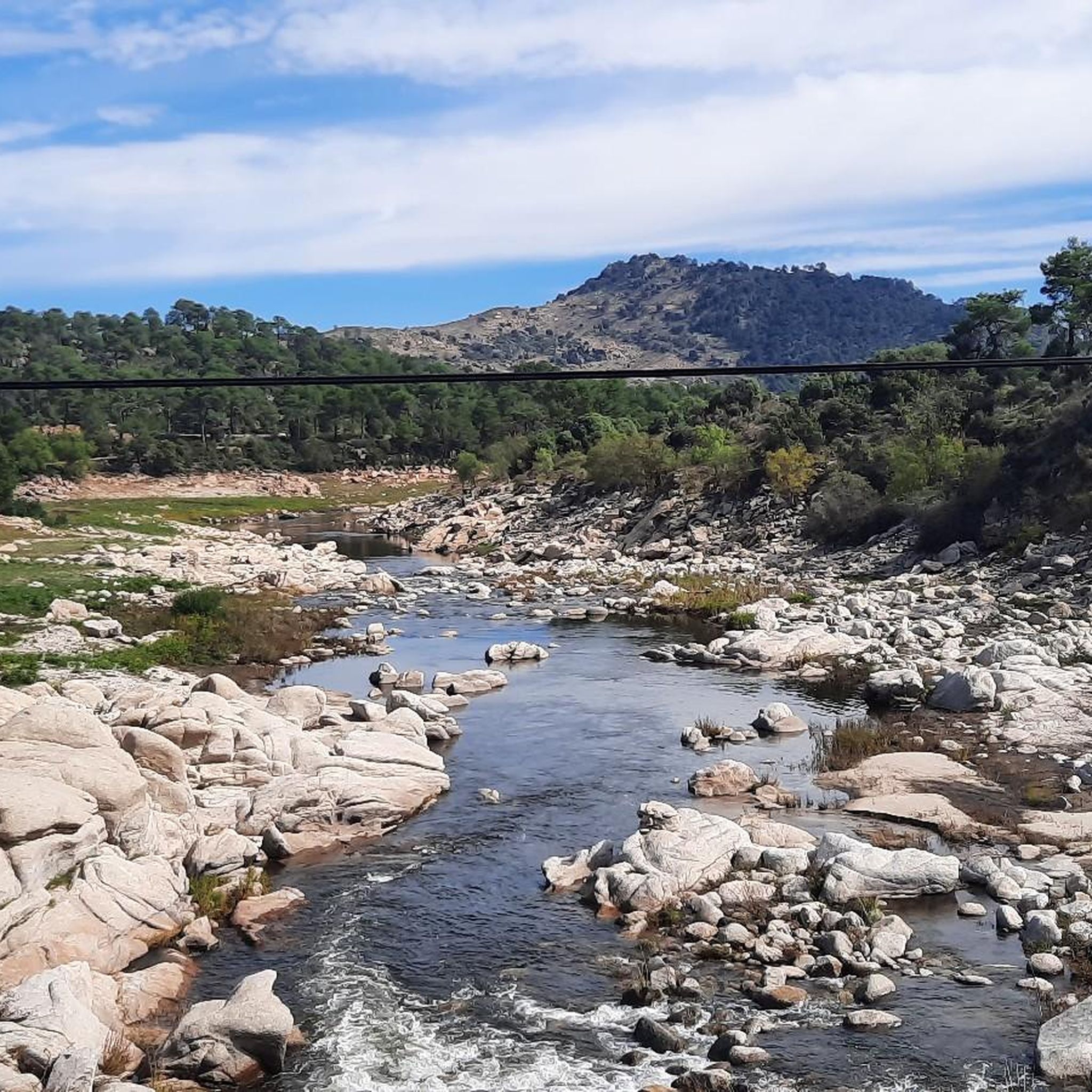
The circular itinerary to the Tiétar river that starts from Iglesuela offers us beautiful views of the town after having traveled the riverbed surrounded by beautiful surroundings.
3
0
The Tiétar River is born in the Sierra de Gredos and flows into the Tagus River after crossing 4 provinces, Madrid, Ávila, Toledo and Cáceres. One of the places to enjoy its waters and the landscape it offers is in its passage through the area of the Iglesuela del Tiétar when going along the path marked out as PR-TO 20.
2
0

A must visit if anyone walks through the area. Spectacular view and place that exudes peace and tranquility.
1
0
Frequently Asked Questions
How many hiking trails are available around Casavieja?
There are over 60 hiking trails around Casavieja, offering a wide range of options from easy strolls to more challenging routes. The area features 18 easy, 42 moderate, and 4 difficult trails.
Are there easy or beginner-friendly hiking routes in Casavieja?
Yes, Casavieja offers 18 easy hiking routes suitable for beginners. An excellent option is the Gavilanes – Natural swimming pool loop from Gavilanes, which is 3.0 miles (4.8 km) long and leads through rural landscapes to a natural swimming pool.
What is the best time of year to hike in Casavieja?
The best time to hike in Casavieja, located in the Sierra de Gredos foothills, is typically during spring (April-June) and autumn (September-November). During these seasons, the weather is mild and pleasant, and the natural scenery is at its most vibrant. Summer can be very hot, especially in the Tiétar Valley, while winter can bring colder temperatures and occasional snow at higher elevations.
Are there any circular walks available around Casavieja?
Yes, many routes in the Casavieja area are circular, allowing you to start and end at the same point. A popular moderate circular option is the Cascada de El Chorro — circular desde Mijares, which is 9.8 miles (15.7 km) long and leads to a beautiful waterfall.
Can I find trails with waterfalls or natural swimming pools in Casavieja?
Absolutely. The region is known for its water features. You can hike to the impressive El Chorro Waterfall. Additionally, routes like the Gavilanes – Natural swimming pool loop from Gavilanes lead directly to refreshing natural swimming spots.
Are the hiking trails in Casavieja suitable for families?
Yes, Casavieja offers several family-friendly hiking options. The region's easy trails, often leading to natural swimming pools or through gentle rural landscapes, are ideal for families. The Gavilanes – Natural swimming pool loop from Gavilanes is specifically highlighted as a family-friendly choice.
What kind of natural attractions or landmarks can I see while hiking near Casavieja?
While hiking near Casavieja, you can encounter various natural attractions and landmarks. These include the scenic Puerto de Mijares mountain pass, the impressive El Chorro Waterfall, and the serene Mijares natural pool. You might also cross historic structures like Puente Mosquea.
Is Casavieja a dog-friendly hiking destination?
Generally, the natural areas around Casavieja are welcoming to dogs, making it a good destination for hiking with your canine companion. However, it's always advisable to keep your dog on a leash, especially near livestock or in protected areas, and to check for any specific local regulations or signage on individual trails.
What do other hikers enjoy most about hiking in Casavieja?
The hiking experience in Casavieja is highly rated by the komoot community, with an average score of 4.6 stars from over 70 reviews. Hikers frequently praise the varied terrain, including river valleys, natural pools, and forested hills, as well as the well-maintained paths that offer options for different ability levels.
Are there parking facilities available near the trailheads in Casavieja?
Parking availability varies by trailhead. In Casavieja and surrounding villages like Gavilanes or Mijares, you can often find public parking areas close to the start of popular routes. It's recommended to check specific route details or local signage for the most convenient parking options.
Is it possible to reach hiking trails in Casavieja using public transport?
Public transport options to reach specific trailheads directly in Casavieja and the surrounding rural areas can be limited. While there are bus services connecting Casavieja to larger towns, accessing the more remote starting points of hiking trails might require a car or a local taxi service. It's best to research specific bus routes and schedules if relying on public transport.
Are there any challenging or difficult hikes around Casavieja?
Yes, for experienced hikers seeking a challenge, Casavieja offers 4 difficult routes. An example is the La Rubiera (2,002 m) – Lanchamala (1,994 m) loop from Embalse de Piedralaves, which is 8.7 miles (14.0 km) long and involves significant elevation gain, offering panoramic views from higher peaks.
Most popular attractions around Casavieja

Get inspired with the komoot mobile app


Explore more
Browse the best Hikes in other regions.
