The best walks and hikes around Valtorres
4.1
(12)
82
hikers
10
hikes
Hiking around Valtorres offers diverse landscapes within the Comarca de Calatayud, characterized by a blend of traditional agricultural scenery and varied natural features. The region features picturesque Ribota Valleys, limestone formations, and fertile river valleys, including those along the Jalón and Jiloca rivers. Hikers can explore areas with fruit orchards and dramatic geological formations, providing a tranquil and scenic backdrop for outdoor activities. The terrain includes both gentle paths through cultivated lands and more rugged trails leading to viewpoints.
Best…
Last updated: August 11, 2026
3.7
(3)
4
hikers
13.1km
03:48
330m
330m
Moderate hike. Good fitness required. Easily-accessible paths. Suitable for all skill levels.
4.3
(3)
19
hikers
10.5km
03:10
310m
310m
Moderate hike. Good fitness required. Easily-accessible paths. Suitable for all skill levels.

Sign up for free
7
hikers
5.44km
01:37
150m
160m
Easy hike. Great for any fitness level. Easily-accessible paths. Suitable for all skill levels.
4.5
(2)
6
hikers
10.9km
03:00
190m
190m
Moderate hike. Good fitness required. Easily-accessible paths. Suitable for all skill levels.
5
hikers
12.0km
03:16
180m
180m
Moderate hike. Good fitness required. Easily-accessible paths. Suitable for all skill levels.
Get access to more routes and recommendations from other explorers.
Sign up for free
Already have an account?
Our route recommendations are based on thousands of hikes, rides, and runs completed by other people on komoot.
Start today with a free account
Your next adventure awaits.
Login or Signup


Tips from the Community

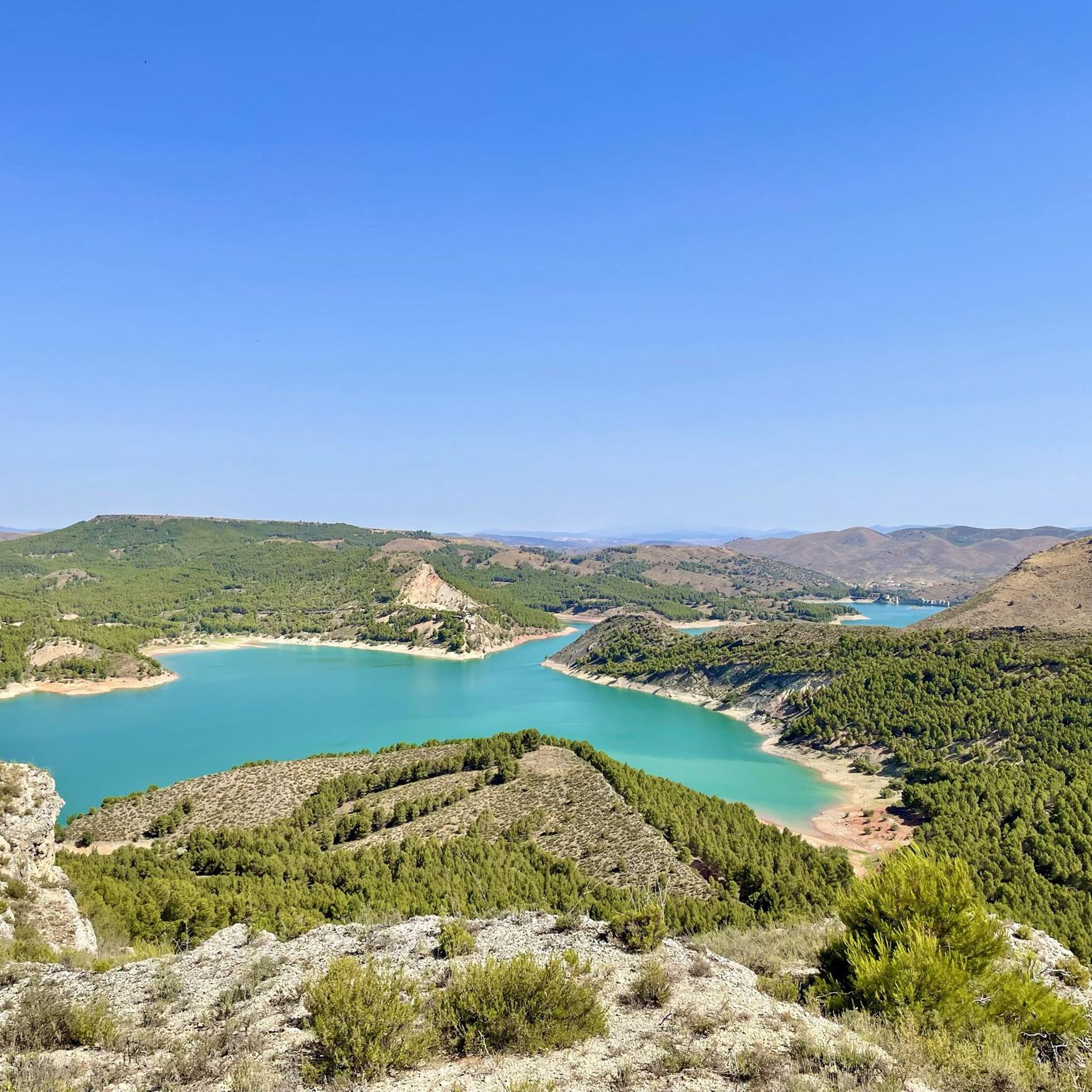
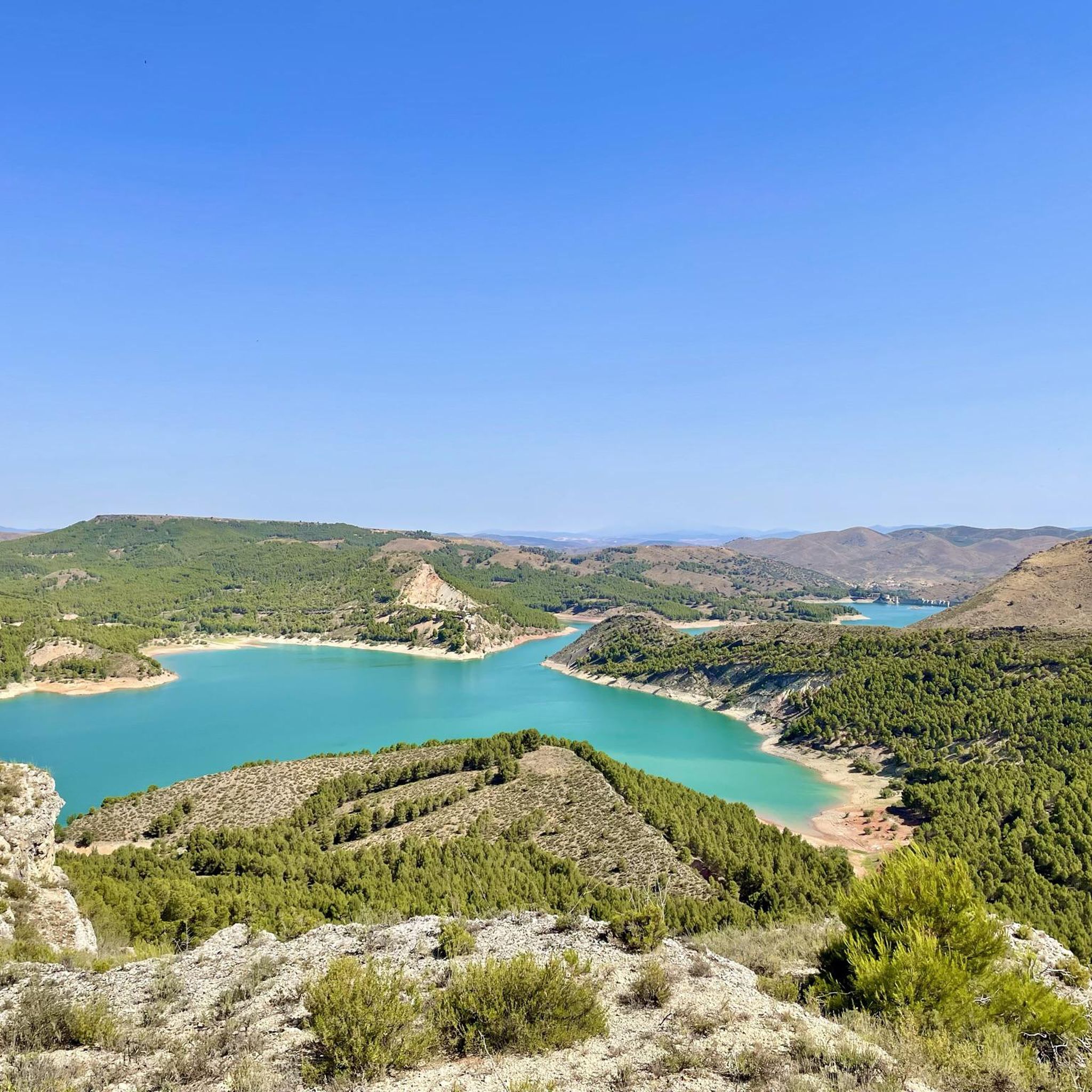
The La Tranquera Reservoir in Nuévalos is a spectacular place to enjoy nature and panoramic views. Inaugurated in 1959, the reservoir was designed to regulate the flow of the Piedra River and ensure the water supply in the region.
2
0

The La Paradera waterfall, in the municipality of Ibdes, is one of the several natural spectacles that the Mesa River gives us as it passes through these lands.
1
0

Beautiful views of the Tranquera reservoir, from the town of Nuévalos, with the imposing Torre del Castillo behind us. If we are lucky enough to go with the reserves of the reservoir well charged with water, we will see the spectacular emerald blue color that it has. We will find fishermen, people bathing and a lot of fauna.
1
0
Beautiful waterfall located in the town of Ibdes. A very cozy corner without coverage to enjoy nature to the fullest like the sound of falling water. We will find a picnic area Waterfall integrated into the Ibdes water route.
1
0
We are in the Sierra de Armantes, in a place shaped by wind and water. We would not say that we are in Zaragoza! What a beautiful print and what contrasts of colors, apart from some impressive views. It will remind us of the Far West, what's more, in Zaragoza they call it the Bilbilitano Far West.
4
1
Located at an altitude of 817 meters, we find beautiful views of the Tranquera reservoir from Cerro de Somé. The path to here is not marked, but it is clearly visible. Not long ago, this area was burned but it is already growing and returning to normal.
1
0
Beautiful views of the Tranquera reservoir, from the town of Nuévalos, with the imposing Torre del Castillo behind us. If we are lucky enough to go with the reservoir's reserves fully loaded with water, we will see its spectacular emerald blue color. We will find fishermen, people bathing and a lot of fauna.
1
0
On our arrival at Cruz de Armantes, we will be surrounded by a beautiful landscape of the Ribota valleys. A picture that will surely force us to take out our cameras to photograph.
2
1
Frequently Asked Questions
What kind of landscapes can I expect to see while hiking around Valtorres?
Hiking around Valtorres offers a diverse blend of traditional agricultural scenery, including fruit orchards with pear and peach trees, and varied natural features. You'll encounter picturesque Ribota Valleys, striking limestone formations, and fertile river valleys, such as those along the Jalón and Jiloca rivers. The area provides a tranquil and scenic backdrop, with both gentle paths through cultivated lands and more rugged trails leading to panoramic viewpoints like those around Cruz de Armantes.
Are there any trails suitable for beginners or those looking for an easier walk?
Yes, there are options for various ability levels. For an easier walk, consider The Castles – Cruz de Armantes loop from Los Llanos de Muñoz. This trail is 6.2 km long and typically takes about 1 hour 48 minutes to complete, leading through the scenic Cruz de Armantes area.
Are there any hiking routes that feature waterfalls near Valtorres?
Absolutely! The La Caprichosa Waterfall – Iris Waterfall loop from Ibdes is a moderate 13.0 km path that explores river valleys and features two notable waterfalls, La Caprichosa and Iris, making it a popular choice for those seeking scenic water features.
What do other hikers enjoy most about the trails in Valtorres?
The hiking routes in Valtorres are highly rated by the komoot community, with an average score of 4.4 stars from over 14 reviews. Hikers often praise the varied terrain, from river valleys to scenic viewpoints, and the tranquil rural setting. Many appreciate the blend of natural beauty and traditional agricultural landscapes.
Can I find any circular hiking routes in the Valtorres area?
Yes, several routes are designed as loops, allowing you to start and end in the same location. Examples include the easy The Castles – Cruz de Armantes loop from Los Llanos de Muñoz and the moderate La Caprichosa Waterfall – Iris Waterfall loop from Ibdes. Another option is the La Paradera Waterfall loop from Nuévalos.
Are there any historical or cultural points of interest to explore while hiking?
While hiking, you can integrate visits to nearby historical and cultural sites. The broader region features Mudejar architectural styles, a UNESCO World Heritage site in Calatayud, and ancient forts. The historic Camino del Cid also passes through Valtorres, adding a cultural dimension to the hiking experience. You can also find highlights like Castillo de Alcocer.
What are some notable natural landmarks or viewpoints to look out for?
The area is rich in natural landmarks and viewpoints. You can find stunning views of the Ribota valleys from areas like Cruz de Armantes and the Castillejos Viewpoint (Sierra de Armantes). The Far West Bilbilitano Rock Formations are also a unique natural monument to explore.
Are there any lakes or reservoirs that can be seen from the hiking trails?
Yes, several trails offer views of the beautiful Embalse de la Tranquera (Tranquera Reservoir). You can find viewpoints such as View of Embalse de la Tranquera, View of the Tranquera Reservoir from Cerro de Somé, and View of Nuévalos and Tranquera Reservoir. The reservoir itself features interesting structures like the La Tranquera Reservoir: Bridge and Tunnels and the La Tranquera Reservoir Dam.
What is the typical duration for a moderate hike in Valtorres?
Moderate hikes in Valtorres typically range from around 3 to 4 hours. For example, the Cerro Somé Trail is 13.1 km and takes approximately 3 hours 47 minutes, while the La Caprichosa Waterfall – Iris Waterfall loop from Ibdes is 13.0 km and takes about 3 hours 40 minutes.
What is the best time of year to go hiking in Valtorres?
Valtorres offers pleasant hiking conditions for much of the year. The traditional agricultural scenery, with its fruit orchards, is particularly beautiful in spring when trees are in blossom or in late summer/early autumn during harvest. The region's diverse natural beauty makes it enjoyable across seasons, but spring and autumn generally offer milder temperatures ideal for longer walks.
Are there any longer, more challenging routes for experienced hikers?
While the guide primarily features moderate routes, the longer trails like the Cerro Somé Trail (13.1 km with 330m elevation gain) and the La Caprichosa Waterfall – Iris Waterfall loop from Ibdes (13.0 km with 267m elevation gain) provide a good challenge for experienced hikers looking for longer distances and varied terrain.
Most popular routes around Valtorres
Most popular attractions around Valtorres

Get inspired with the komoot mobile app


Explore more
Browse the best Hikes in other regions.
