The best road cycling routes around Peñamellera Alta
4.7
(68)
3,725
riders
67
rides
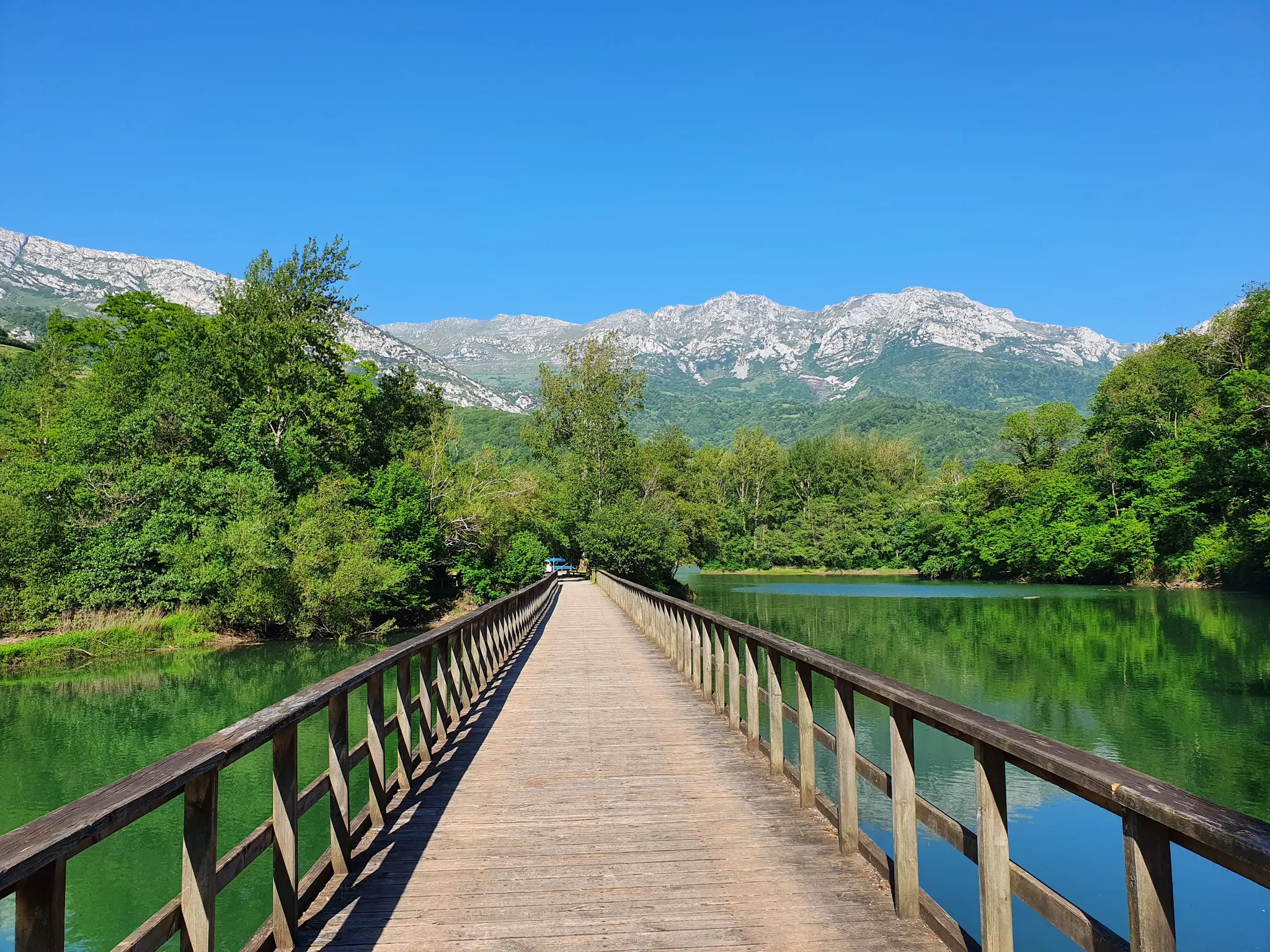
Road cycling routes around Peñamellera Alta traverse a landscape defined by the Picos de Europa and Sierra del Cuera mountain ranges, with the Cares River carving a prominent gorge. The region features significant elevation changes, dense forests, and open meadows, providing varied terrain for road cyclists. Roads often follow river valleys or ascend mountain passes, offering a range of challenging climbs and scenic sections.
Best road cycling routes around Peñamellera Alta
- The most popular road cycling route is Jitu de…
Last updated: November 1, 2026
5.0
(3)
148
riders
41.9km
02:50
1,410m
1,410m
Hard road ride. Very good fitness required. Mostly well-paved surfaces and easy to ride.
5.0
(3)
138
riders
61.3km
03:51
1,710m
1,710m
Hard road ride. Very good fitness required. Mostly well-paved surfaces and easy to ride.

82
riders
95.8km
05:08
1,820m
1,820m
Hard road ride. Very good fitness required. Some segments of this route may be unpaved and difficult to ride.
4.0
(1)
46
riders
101km
05:07
1,660m
1,660m
Hard road ride. Very good fitness required. Mostly well-paved surfaces and easy to ride.
5.0
(1)
35
riders
43.4km
02:30
1,010m
1,010m
Hard road ride. Very good fitness required. Mostly well-paved surfaces and easy to ride.
Get access to more routes and recommendations from other explorers.
Already have an account?
Our route recommendations are based on thousands of hikes, rides, and runs completed by other people on komoot.
Start today with a free account
Your next adventure awaits.
Popular around Peñamellera Alta




Other adventures around Peñamellera Alta

Tips from the Community

Beautiful village between mountains
0
0

Poncebos is one of the main epicenters of nature and hiking tourism in the Picos de Europa National Park, located in the municipality of Cabrales, Asturias. This small mountain settlement serves as the gateway to some of the most iconic landscapes and routes in the entire Cantabrian Cornice. Although its residential area is small, its hospitality and transport infrastructure welcomes thousands of visitors each year. Main Attractions and Routes Ruta del Cares: Poncebos is the Asturian starting (or ending) point of this famous 12-kilometer gorge that connects with Caín, in León. The gorge offers impressive vertical rock scenery. Bulnes Funicular: An underground rack railway that crosses the entrails of Peña Maín. It overcomes an elevation difference of 400 meters to connect Poncebos with the isolated alpine village of Bulnes in just 7 minutes. Canal del Tejo: The traditional mountain path that linked Poncebos with Bulnes before the arrival of the funicular in 2001. It is a winding and demanding route, ideal for experienced hikers. Camarmeña and its Viewpoint: A small hamlet located just above Poncebos, from whose viewpoint you can get privileged views of the iconic Pico Urriellu (Naranjo de Bulnes).
0
0
Spectacular climb with the river alongside
0
0
The fastest way to reach the Cabrales locality of Bulnes is by taking the funicular, operational since 2001, which covers a distance of 2,227 km.
0
0
Spectacular view with explanation
0
0
At the roundabout you can go towards Benia de Onís, the area of Cangas and the Lakes of Covadonga, towards Arenas de Cabrales, the area of Sotres, Bulnes, Colombres..., or towards Posada de Llanes.
0
0

Wonderful spot on earth. Only parking on weekends is critical.
0
0

A town with a lively and very pleasant atmosphere, where you can feel both peace and adventure.
0
0
Frequently Asked Questions
How many road cycling routes are available in Peñamellera Alta?
There are over 60 road cycling routes around Peñamellera Alta, offering a wide range of options for different skill levels. You'll find everything from moderate ascents to challenging climbs through the mountainous terrain.
What is the general difficulty level for road cycling in Peñamellera Alta?
Road cycling in Peñamellera Alta is characterized by significant elevation changes due to its location within the Picos de Europa and Sierra del Cuera. While there are some moderate routes, a substantial number, around 28, are classified as difficult, featuring demanding climbs. About 34 routes are moderate, and a few are easier, catering to various experience levels.
What kind of landscapes can I expect to see while road cycling in Peñamellera Alta?
You can expect dramatic and varied landscapes. Routes often wind through the deep gorges carved by the Cares River, ascend into the rugged Picos de Europa, or traverse the Sierra del Cuera. You'll encounter dense forests of chestnuts, oaks, and beeches, open meadows, and imposing rock faces, all contributing to a stunning backdrop for your ride.
When is the best time of year for road cycling in Peñamellera Alta?
The best time for road cycling in Peñamellera Alta is generally from spring through autumn. During these seasons, the weather is more stable, and temperatures are pleasant for tackling the region's climbs. Summer offers longer daylight hours, but spring and autumn provide cooler temperatures and vibrant natural scenery.
Are there any road cycling routes with significant climbs in Peñamellera Alta?
Yes, Peñamellera Alta is known for its challenging climbs. For a route with substantial elevation gain, consider the Views of the Zapedo marsh – San Antolín de Bedón Beach loop from Vidiago. This difficult route covers over 155 km and features nearly 1900 meters of ascent, offering a demanding experience through varied landscapes.
Can I find any moderate road cycling routes in the area?
Absolutely. While many routes are challenging, there are also moderate options. For example, the Valle Oscuro Scenic Road – Villa Delfina loop from Vidiago is a moderate 50 km route with around 650 meters of elevation gain, providing a scenic ride without the most extreme climbs.
Are there circular road cycling routes available in Peñamellera Alta?
Yes, many routes in the region are designed as loops or round trips, allowing you to start and finish in the same location. Examples include the Views of the Zapedo marsh – San Antolín de Bedón Beach loop from Vidiago and the Valle Oscuro Scenic Road – Villa Delfina loop from Vidiago, both offering comprehensive tours of their respective areas.
What interesting landmarks or natural features can I see along the road cycling routes?
Road cycling routes in Peñamellera Alta offer access to stunning natural features. You'll ride alongside the dramatic Cares River gorge and through areas bordering the Picos de Europa National Park. While cycling, you might also pass by unique geological formations. For specific points of interest, you can explore nearby caves like Cueva del Dragón or the Cabrales Cheese Cave Museum, which are highlights in the broader area.
Is there parking available for cyclists in Peñamellera Alta?
Yes, parking is generally available in the villages and towns throughout Peñamellera Alta, such as Panes or Alles, which serve as common starting points for routes. It's advisable to check local signage for specific parking regulations and designated areas, especially during peak seasons.
What public transport options are available for cyclists in Peñamellera Alta?
Public transport in Peñamellera Alta primarily consists of bus services connecting the main villages. While some buses may accommodate bikes, it's highly recommended to check with the specific bus operator in advance regarding their bike carriage policies, especially for larger groups or during busy periods, as space can be limited.
Are there cafes, pubs, or accommodation options along the road cycling routes?
Yes, the villages and towns within Peñamellera Alta and its surroundings offer various amenities. You'll find cafes and small restaurants for refreshments, as well as rural guesthouses and hotels for accommodation. These spots are often strategically located, making them convenient stops during or after your ride.
What do other road cyclists enjoy the most about road cycling in Peñamellera Alta?
The road cycling experience in Peñamellera Alta is highly rated by the komoot community, with an average score of 4.8 stars from over 50 reviews. Cyclists frequently praise the region's challenging climbs, the breathtaking views of the Picos de Europa and the Cares River, and the diverse, unspoiled natural landscapes that make every ride memorable.
Most popular routes around Peñamellera Alta
Most popular attractions around Peñamellera Alta

Get inspired with the komoot mobile app


Explore more
Browse the best Road cycling routes in other regions.
