The best walks and hikes around Trijueque
5.0
(5)
33
hikers
12
hikes
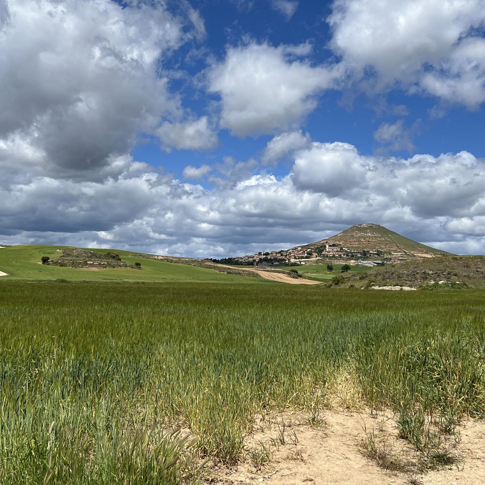
Hiking around Trijueque offers expansive panoramic views of the Alcarria region, the Henares Valley, and the distant Central System mountains. The municipality is situated on the edge of a plain that descends into the Badiel valley, contributing to its designation as the "Balcón de la Alcarria." The landscape features cultivated fields, gentle hills, and varied topography, providing diverse opportunities for exploration on foot.
Best hiking trails around Trijueque
- The most popular hiking route is Jardín de La Alcarria — circular…
Last updated: October 1, 2026
5.0
(1)
5
hikers
12.0km
03:15
160m
160m
Moderate hike. Good fitness required. Easily-accessible paths. Suitable for all skill levels.
5.0
(1)
5
hikers
10.1km
02:48
180m
180m
Moderate hike. Good fitness required. Easily-accessible paths. Suitable for all skill levels.

5.0
(1)
5
hikers
2.30km
00:46
110m
120m
Easy hike. Great for any fitness level. Easily-accessible paths. Suitable for all skill levels.
5
hikers
3.41km
00:57
60m
70m
Easy hike. Great for any fitness level. Easily-accessible paths. Suitable for all skill levels.
1
hikers
6.26km
01:50
170m
170m
Easy hike. Great for any fitness level. Easily-accessible paths. Suitable for all skill levels.
Get access to more routes and recommendations from other explorers.
Already have an account?
Our route recommendations are based on thousands of hikes, rides, and runs completed by other people on komoot.
Start today with a free account
Your next adventure awaits.

Tips from the Community

Hita is a beautiful town full of history. The castle, the walls, its houses and churches, and the Archpriest of Hita bear witness to this.
0
0
A place with a lot of history. Only the ruins remain.
0
0

Brihuega, known as the “Garden of Alcarria”, is a charming destination in the province of Guadalajara, Castilla-La Mancha. In addition, Brihuega is famous for its bull runs, which are among the oldest in Spain.
5
0
Beautiful village of La Alcarria. With spectacular Lavender Fields. Its Romanesque church has elements of this art. There are remains, a tower and a doorway of an ancient Jerónimo Monastery built in 1076 by Alfonso VI. Its Rollo or Pillory, its Plaza, its fountain and its wash house are also jewels that must be seen.
0
1
This monument to the Brihuega running of the bulls is located in the middle of a Muslim Castle, near several churches, some of them Romanesque, and next to a very special Bullring, La Muralla de Brhuiega.
0
0

Very pretty town with many attractions!
0
0
Beauty concentrated in the color purple.
0
0
On the right bank of the Ungría River, there is an ancient grove with the thickest trees I have ever seen.
0
0
Frequently Asked Questions
What kind of landscape can I expect when hiking around Trijueque?
Hiking around Trijueque offers expansive panoramic views of the Alcarria region, the Henares Valley, and the distant Central System mountains. The area is known as the 'Balcón de la Alcarria' due to its position on the edge of a plain descending into the Badiel valley. You'll encounter a diverse landscape of cultivated fields, gentle hills, and varied topography, providing a rich natural tapestry for exploration.
Are there easy hiking trails suitable for beginners or families in Trijueque?
Yes, Trijueque offers several easy routes. For instance, the Río Ungría Grove loop from Fuentes de la Alcarria is an easy 6.3 km trail that takes about 1 hour 50 minutes to complete, leading you through a pleasant grove. Another easy option is the Brihuega – Fountain of the Twelve Spouts loop from Brihuega, which is 5.4 km long.
What are the typical distances and durations for hikes in the Trijueque area?
The hiking trails around Trijueque vary in length and duration. You can find routes ranging from shorter, easy walks like the 5.4 km Brihuega – Fountain of the Twelve Spouts loop, which takes around 1 hour 30 minutes, to moderate trails such as the Jardín de La Alcarria — circular through the lavender fields of Brihuega, which covers 12.0 km and typically takes about 3 hours 14 minutes.
Are there any circular hiking routes available?
Yes, many of the trails around Trijueque are circular, offering convenient starting and ending points. Popular circular options include the Jardín de La Alcarria — circular through the lavender fields of Brihuega, the Hiking loop from Brihuega, and the Río Ungría Grove loop from Fuentes de la Alcarria.
What interesting landmarks or attractions can I see near the hiking trails?
The region around Trijueque is rich in history and natural beauty. While hiking, you can explore charming settlements like Brihuega and Hita. Notable historical sites include the Castillo de Torija and the Medieval Walls and Church of Brihuega. Nature lovers will appreciate the famous Lavender Fields and Arab Caves of Brihuega, and the unique Fountain of the Twelve Spouts.
What is the best time of year to go hiking in Trijueque?
The Alcarria region, where Trijueque is located, generally offers pleasant hiking conditions during spring and autumn. Spring brings blooming wildflowers, including the famous lavender fields around Brihuega, while autumn showcases beautiful fall foliage. Summers can be hot, making early mornings or late afternoons preferable, and winters are generally mild but can be chilly.
Are there any dog-friendly hiking trails in the area?
Many trails in the Trijueque region are suitable for hiking with dogs, provided they are kept under control and local regulations are followed. The natural, open landscapes and varied terrain offer plenty of opportunities for you and your canine companion to explore. Always ensure you carry enough water for both yourself and your dog, especially during warmer months.
What do other hikers say about the trails in Trijueque?
The hiking experience in Trijueque is highly rated by the komoot community, with an average score of 5.0 stars from 4 reviews. Hikers often praise the expansive panoramic views, the diverse landscape of cultivated fields and gentle hills, and the peaceful atmosphere of the Alcarria region.
What is the difficulty level of the hikes around Trijueque?
The trails around Trijueque cater to various fitness levels. You'll find a good mix of easy and moderate routes. Out of the 10 available tours, 4 are classified as easy, and 6 are moderate. There are no difficult trails, making the area accessible for most hikers looking for enjoyable walks with scenic views.
Are there any specific trails that feature the famous lavender fields?
Yes, the Jardín de La Alcarria — circular through the lavender fields of Brihuega is a popular moderate route specifically designed to take you through these scenic fields. This 12.0 km trail is particularly stunning when the lavender is in bloom, typically in late June and July.
Where can I find accommodation or places to eat near the hiking areas?
Trijueque and nearby towns like Brihuega offer various options for accommodation, cafes, and restaurants. You can find rural guesthouses, small hotels, and local eateries serving traditional Castilian cuisine. It's advisable to check in advance, especially during peak seasons, for availability and opening hours.
Is public transport available to reach the trailheads around Trijueque?
While Trijueque is a small municipality, public transport options to specific trailheads might be limited. It's generally recommended to have a car for flexibility when exploring the wider Alcarria region and accessing various starting points for hikes. However, local bus services might connect Trijueque to larger towns like Guadalajara, from where further local transport or taxis could be arranged.
Are there any challenging hikes for experienced hikers?
The current selection of routes around Trijueque primarily features easy and moderate trails. While there are no routes classified as 'difficult' in this guide, the varied topography of the Alcarria region allows for longer, more strenuous walks if you combine multiple sections or explore off the main paths. The moderate trails, such as the Hiking loop from Brihuega, offer good distances and elevation changes for a satisfying outing.
Most popular attractions around Trijueque

Get inspired with the komoot mobile app


Explore more
Browse the best Hikes in other regions.
